Brownsville is a city in and the county seat of Haywood County, Tennessee, United States, located in the western Tennessee Delta. Its population as of the 2010 census was 10,292, with a decrease to 9,788 at the 2020 census. The city is named after General Jacob Jennings Brown, an American officer of the War of 1812.
| Name: | Brownsville city |
|---|---|
| LSAD Code: | 25 |
| LSAD Description: | city (suffix) |
| State: | Tennessee |
| County: | Haywood County |
| Elevation: | 390 ft (119 m) |
| Total Area: | 9.86 sq mi (25.54 km²) |
| Land Area: | 9.86 sq mi (25.54 km²) |
| Water Area: | 0.00 sq mi (0.00 km²) |
| Total Population: | 9,788 |
| Population Density: | 992.80/sq mi (383.30/km²) |
| ZIP code: | 38012 |
| Area code: | 731 |
| FIPS code: | 4708920 |
| GNISfeature ID: | 1278634 |
| Website: | brownsvilletn.gov |
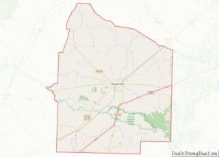
Online Interactive Map
Click on ![]() to view map in "full screen" mode.
to view map in "full screen" mode.
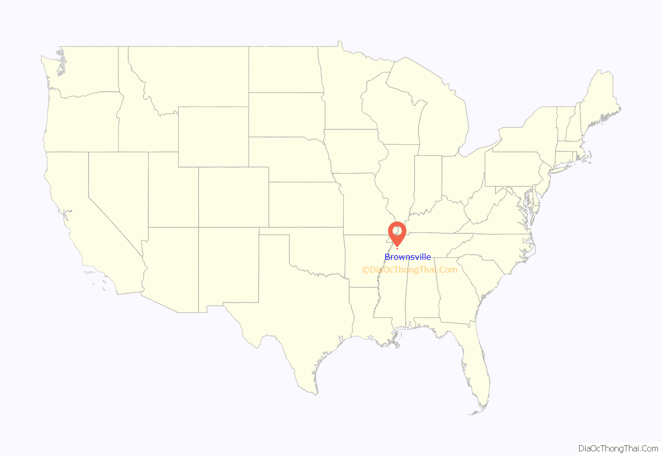
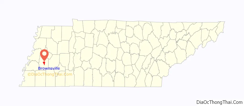
Brownsville location map. Where is Brownsville city?
History
Brownsville was a trading center that developed in association with cotton plantations and commodity agriculture in the lowlying Delta of the Mississippi River around Memphis, Tennessee and West Tennessee. It is located north of the Hatchie River, a tributary of the Mississippi, which originally served as the main transportation routes to markets for cotton. The land was developed by planters for cotton plantations, and worked by large numbers of enslaved persons now called African Americans, who made up a majority of the town and county population.
The town is notable for its many well-preserved homes owned by wealthy planters before the Civil War, and multi-generational family-owned farms.
The Tabernacle Campground was founded in 1826 by the Rev. Howell Taylor, soon after Brownsville was founded. In the 21st century, it serves as the site of an annual “camp-meeting” for descendants of Taylor.
In the mid to late 19th century, German Jewish immigrants also settled in Brownsville. They founded a congregation in the 1860s, and built Temple Adas Israel in 1882. It is listed on the National Register of Historic Places. The building is believed to be the oldest synagogue in Tennessee, and is a rare example of a synagogue built in the Gothic Revival style.
Through the late 19th century, whites worked to re-establish supremacy after Reconstruction and impose Jim Crow and second-class status on African Americans. Tennessee effectively disenfranchised most blacks in the state after the turn of the 20th century, excluding them from the political system and destroying what had been a competitive system. The state’s congressional delegation and elected officials became predominantly white Democrats. The exception was East Tennessee, where white Republicans formed the majority. The region of yeomen farmers had been mostly Unionist-leaning during the Civil War.
Among the city’s contemporary attractions is the West Tennessee Delta Heritage Center, which interprets the delta region.
Lynchings for control
From the late 19th into the early 20th century, whites lynched three African-American men in Brownsville, two in the 20th century.
In the late 1930s, with Haywood County’s black majority disenfranchised, in 1939 a number of blacks in Brownsville founded a local NAACP chapter. They worked to assert their right to register and vote in the presidential election of 1940. In June 1940 threats were made against the group, and Elisha Davis was kidnapped by a large white mob. They demanded the names of NAACP members and their plans. He fled town, followed by his family, losing his successful service station and all their property.
On June 20, 1940, Elbert Williams, secretary of the NAACP chapter, and Elisha’s brother Thomas Davis were questioned by police. Thomas Davis was released, but Williams was never seen alive again. His body was found in the Hatchie River a few days later, with bullet holes in his chest. He is considered to be the first NAACP member to have been lynched for civil rights activities; he is the last recorded lynching victim in the state. Several other NAACP members were run out of town by police, fearing for their lives.
Thurgood Marshall of the NAACP conducted an investigation of Williams’ murder and appealed to the Department of Justice to prosecute the case, providing affidavits of witnesses. FBI agents were sent to the town in September to protect blacks wanting to register to vote, but the local people were fearful because there had been no prosecution of Williams’ killers. In October 1940, The Crisis, the magazine of the NAACP, reported that no blacks registered to vote. Thomas Davis and his family moved North and resettled in Niles, Michigan. The DOJ closed the Williams case in 1942.
A retired white Tennessee lawyer, Jim Emison, has joined the family and other supporters in working in the 21st century to bring justice to Williams. Since 2012 he has been working on the case, based on contemporary Department of Justice files and his own research. He turned over his materials to DOJ in 2015, asking them to re-open the case.
In 2015, the Tennessee Historical Commission approved an official historical marker honoring Elbert Williams. It was dedicated in Brownsville on June 20, 2015, at a memorial service marking the seventy-fifth anniversary of Williams’ murder. The featured speaker was NAACP President Cornell W. Brooks.
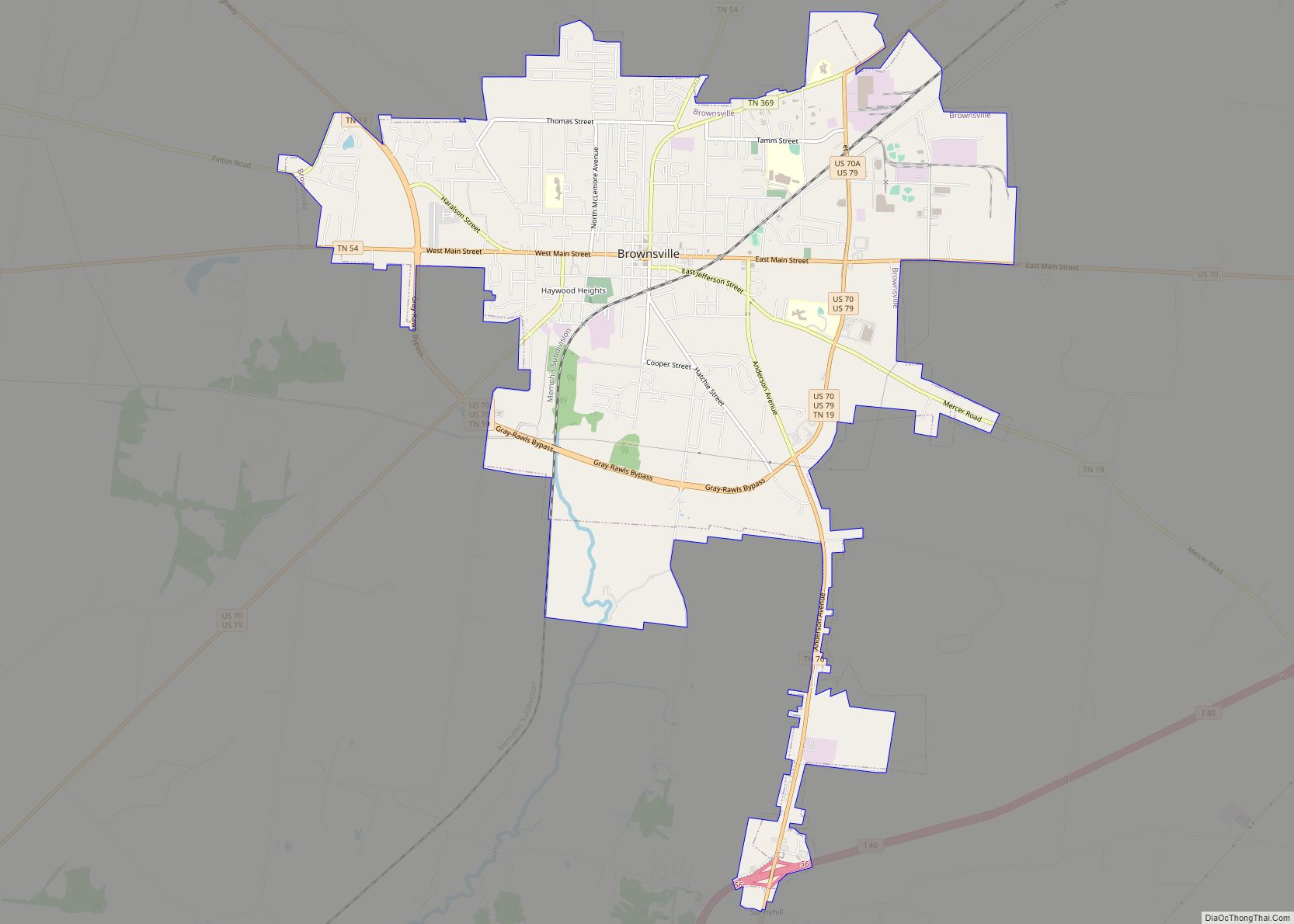
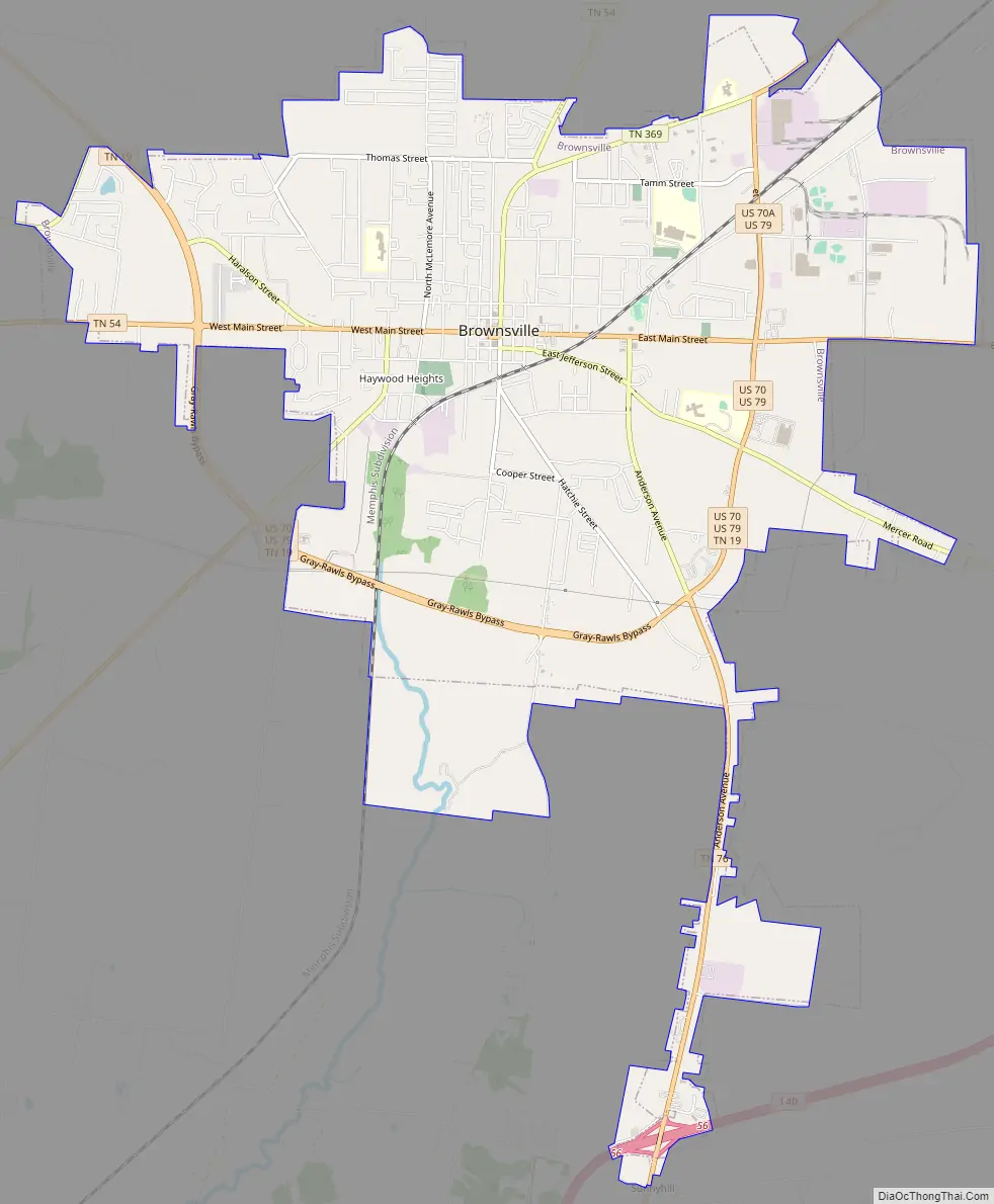
Brownsville Road Map
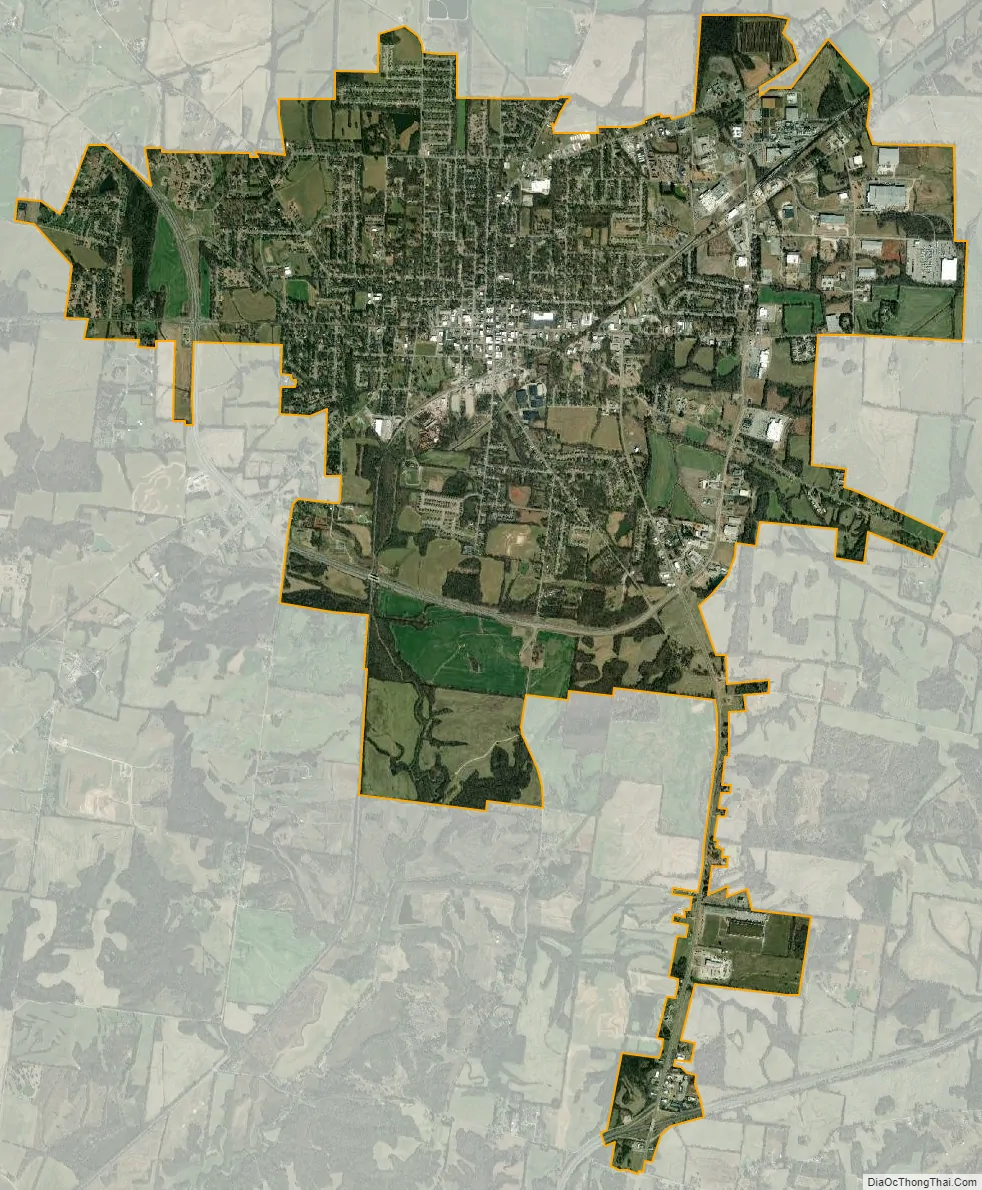
Brownsville city Satellite Map
Geography
Brownsville is located in central Haywood County. According to the United States Census Bureau, the city has a total area of 10.2 square miles (26.4 km), all land. U.S. Routes 70 and 79 form a bypass around the southern and eastern sides of the city. US 79 leads northeast 25 miles (40 km) to Humboldt, while US 70 leads east 26 miles (42 km) to Jackson. The two highways together leads southwest 57 miles (92 km) to Memphis. Interstate 40 passes south of Brownsville, coming closest at exits 56 and 60, where it is 4 miles (6 km) south of downtown.
Brownsville is situated on the southeastern edge of the New Madrid Seismic Zone, an area with a high earthquake risk.
The Hatchie River passes south of Brownsville. It is the longest free-flowing tributary of the lower Mississippi, and contains the largest forested floodplain in Tennessee. The river is home to hundreds of species of fish, including 11 species of catfish, and the alligator snapping turtle. The Hatchie River was named by the Nature Conservancy as one of the “great places” to save. The Hatchie is designated as a “scenic river” under the Tennessee Wild and Scenic Rivers Act.
Climate
The climate in this area is characterized by hot, humid summers and generally mild to cool winters. According to the Köppen Climate Classification system, Brownsville has a humid subtropical climate, abbreviated “Cfa” on climate maps.
See also
Map of Tennessee State and its subdivision:- Anderson
- Bedford
- Benton
- Bledsoe
- Blount
- Bradley
- Campbell
- Cannon
- Carroll
- Carter
- Cheatham
- Chester
- Claiborne
- Clay
- Cocke
- Coffee
- Crockett
- Cumberland
- Davidson
- Decatur
- DeKalb
- Dickson
- Dyer
- Fayette
- Fentress
- Franklin
- Gibson
- Giles
- Grainger
- Greene
- Grundy
- Hamblen
- Hamilton
- Hancock
- Hardeman
- Hardin
- Hawkins
- Haywood
- Henderson
- Henry
- Hickman
- Houston
- Humphreys
- Jackson
- Jefferson
- Johnson
- Knox
- Lake
- Lauderdale
- Lawrence
- Lewis
- Lincoln
- Loudon
- Macon
- Madison
- Marion
- Marshall
- Maury
- McMinn
- McNairy
- Meigs
- Monroe
- Montgomery
- Moore
- Morgan
- Obion
- Overton
- Perry
- Pickett
- Polk
- Putnam
- Rhea
- Roane
- Robertson
- Rutherford
- Scott
- Sequatchie
- Sevier
- Shelby
- Smith
- Stewart
- Sullivan
- Sumner
- Tipton
- Trousdale
- Unicoi
- Union
- Van Buren
- Warren
- Washington
- Wayne
- Weakley
- White
- Williamson
- Wilson
- Alabama
- Alaska
- Arizona
- Arkansas
- California
- Colorado
- Connecticut
- Delaware
- District of Columbia
- Florida
- Georgia
- Hawaii
- Idaho
- Illinois
- Indiana
- Iowa
- Kansas
- Kentucky
- Louisiana
- Maine
- Maryland
- Massachusetts
- Michigan
- Minnesota
- Mississippi
- Missouri
- Montana
- Nebraska
- Nevada
- New Hampshire
- New Jersey
- New Mexico
- New York
- North Carolina
- North Dakota
- Ohio
- Oklahoma
- Oregon
- Pennsylvania
- Rhode Island
- South Carolina
- South Dakota
- Tennessee
- Texas
- Utah
- Vermont
- Virginia
- Washington
- West Virginia
- Wisconsin
- Wyoming