Kewaunee is a city in Kewaunee County, Wisconsin, United States. The population was 2,837 at the 2020 census. Located on the northwestern shore of Lake Michigan, the city is the county seat of Kewaunee County. Its Menominee name is Kewāneh, an archaic name for a species of duck.
Kewaunee is part of the Green Bay Metropolitan Statistical Area.
| Name: | Kewaunee city |
|---|---|
| LSAD Code: | 25 |
| LSAD Description: | city (suffix) |
| State: | Wisconsin |
| County: | Kewaunee County |
| Elevation: | 610 ft (186 m) |
| Total Area: | 3.73 sq mi (9.66 km²) |
| Land Area: | 3.53 sq mi (9.15 km²) |
| Water Area: | 0.20 sq mi (0.52 km²) |
| Total Population: | 2,837 |
| Population Density: | 803.5/sq mi (310.2/km²) |
| ZIP code: | 54216 |
| Area code: | 920 |
| FIPS code: | 5539350 |
| GNISfeature ID: | 1567445 |
| Website: | cityofkewaunee.org |
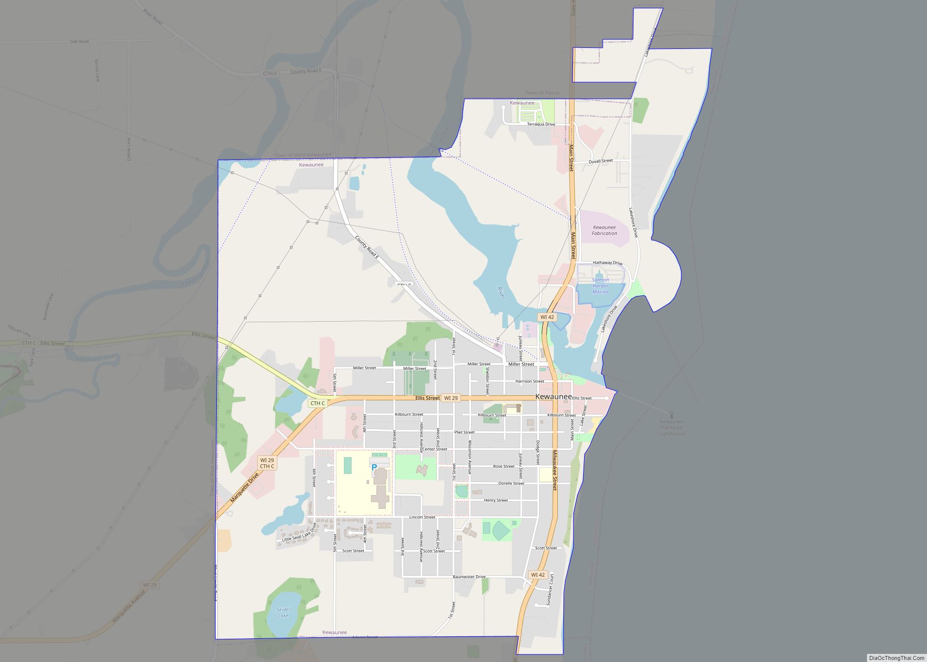
Online Interactive Map
Click on ![]() to view map in "full screen" mode.
to view map in "full screen" mode.
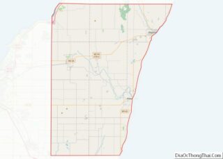
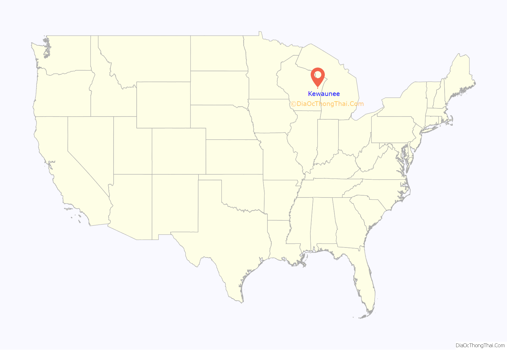
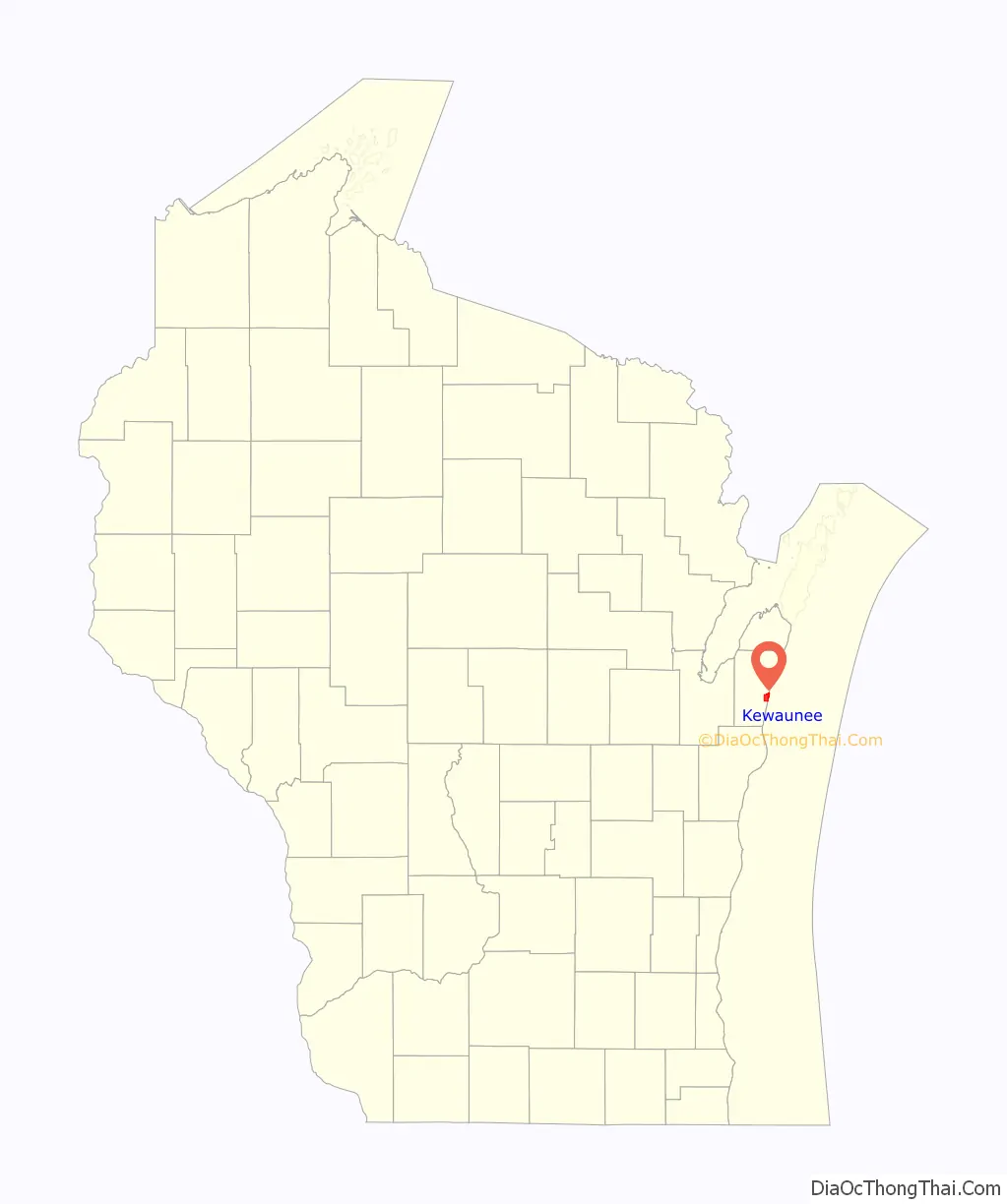
Kewaunee location map. Where is Kewaunee city?
History
Kewaunee was the site of a Potawatomi village at the time of European contact in the seventeenth century. French Jesuit missionary Jacques Marquette celebrated All Saints Day at the Potawatomi village in 1674. Later, French explorer René-Robert Cavelier, Sieur de La Salle visited the village in 1679, and Canadian Jesuit Jean-François Buisson de Saint-Cosme stopped in September 1698. The Potawatomis moved south and east along Lake Michigan in the eighteenth century, and the area was reclaimed by Menominee people. Trader Jacques Vieau established a short lived trading post for the North West Company in the area of Kewaunee in 1795. The United States acquired the land from the Menominee nation in the 1831 Treaty of Washington.
The current settlement at Kewaunee began in 1836, when false rumors of gold deposits in the Kewaunee River triggered a minor gold rush of Yankee settlers. Land speculator Joshua Hathaway surveyed and platted the settlement. When no gold was found, the settlers who remained established a sawmill and developed the local harbor for the lumber industry. Kewaunee became the county seat of Kewaunee County at the time of the county’s formation in 1852. In the late nineteenth century, the community attracted many Czech and German immigrants.
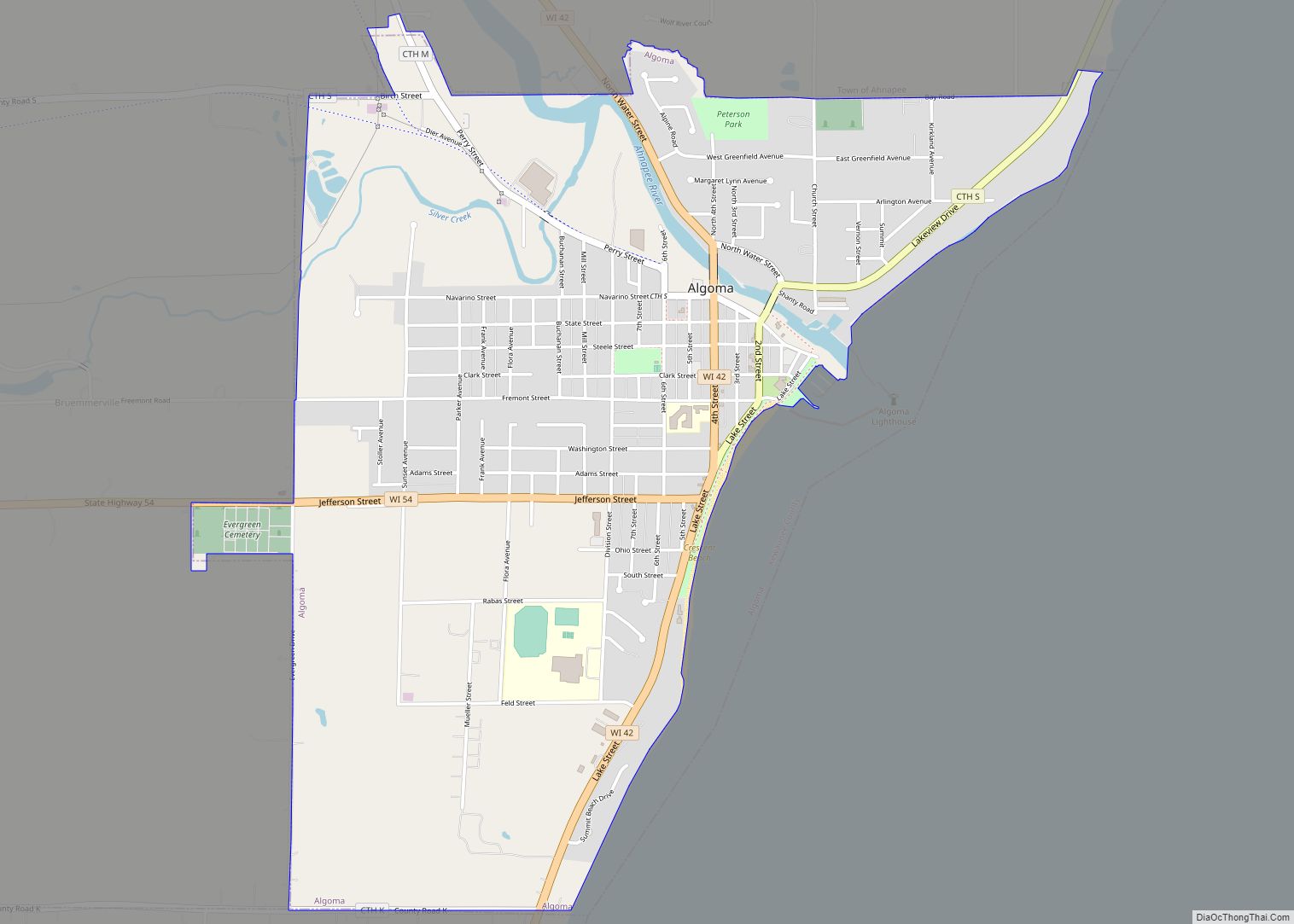
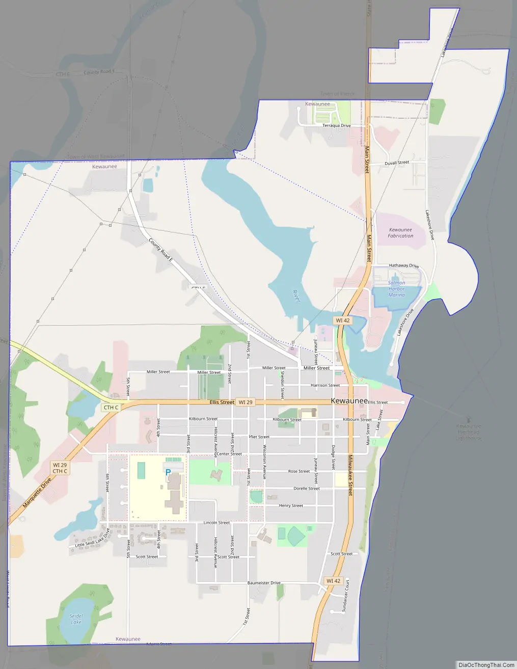
Kewaunee Road Map
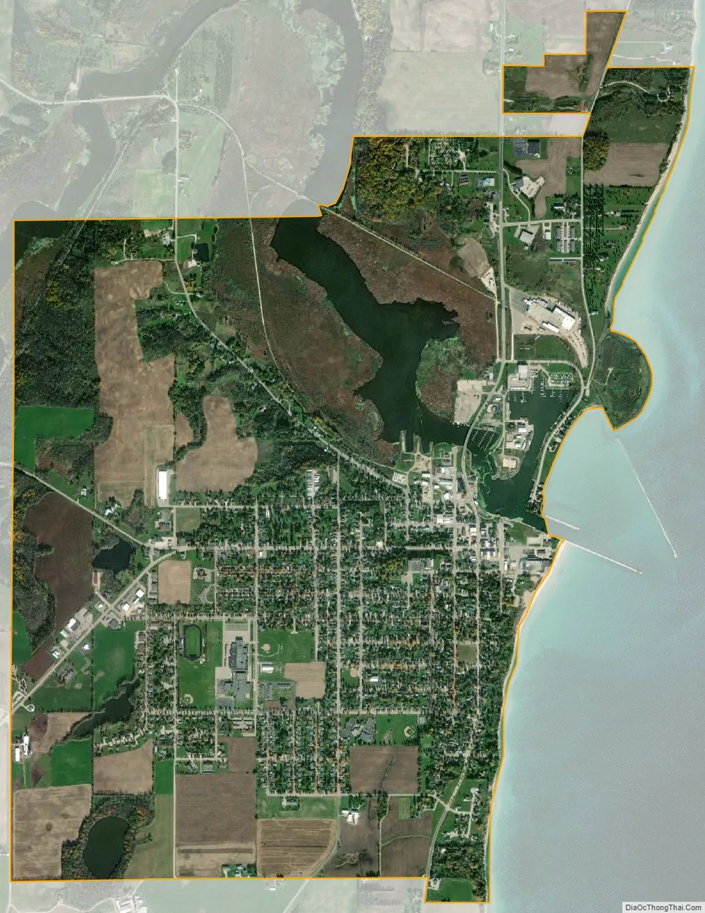
Kewaunee city Satellite Map
Geography
Kewaunee is located at 44°27′32″N 87°30′34″W / 44.45889°N 87.50944°W / 44.45889; -87.50944 (44.458758, -87.509496).
According to the United States Census Bureau, the city has a total area of 3.73 square miles (9.66 km), of which, 3.53 square miles (9.14 km) is land and 0.2 square miles (0.52 km) is water.
Highways
- WIS 42 Northbound travels to Algoma, Wisconsin. South it continues into Two Rivers and Manitowoc, Wisconsin.
- WIS 29 connects with Green Bay, Wisconsin westbound.
See also
Map of Wisconsin State and its subdivision:- Adams
- Ashland
- Barron
- Bayfield
- Brown
- Buffalo
- Burnett
- Calumet
- Chippewa
- Clark
- Columbia
- Crawford
- Dane
- Dodge
- Door
- Douglas
- Dunn
- Eau Claire
- Florence
- Fond du Lac
- Forest
- Grant
- Green
- Green Lake
- Iowa
- Iron
- Jackson
- Jefferson
- Juneau
- Kenosha
- Kewaunee
- La Crosse
- Lafayette
- Lake Michigan
- Lake Superior
- Langlade
- Lincoln
- Manitowoc
- Marathon
- Marinette
- Marquette
- Menominee
- Milwaukee
- Monroe
- Oconto
- Oneida
- Outagamie
- Ozaukee
- Pepin
- Pierce
- Polk
- Portage
- Price
- Racine
- Richland
- Rock
- Rusk
- Saint Croix
- Sauk
- Sawyer
- Shawano
- Sheboygan
- Taylor
- Trempealeau
- Vernon
- Vilas
- Walworth
- Washburn
- Washington
- Waukesha
- Waupaca
- Waushara
- Winnebago
- Wood
- Alabama
- Alaska
- Arizona
- Arkansas
- California
- Colorado
- Connecticut
- Delaware
- District of Columbia
- Florida
- Georgia
- Hawaii
- Idaho
- Illinois
- Indiana
- Iowa
- Kansas
- Kentucky
- Louisiana
- Maine
- Maryland
- Massachusetts
- Michigan
- Minnesota
- Mississippi
- Missouri
- Montana
- Nebraska
- Nevada
- New Hampshire
- New Jersey
- New Mexico
- New York
- North Carolina
- North Dakota
- Ohio
- Oklahoma
- Oregon
- Pennsylvania
- Rhode Island
- South Carolina
- South Dakota
- Tennessee
- Texas
- Utah
- Vermont
- Virginia
- Washington
- West Virginia
- Wisconsin
- Wyoming