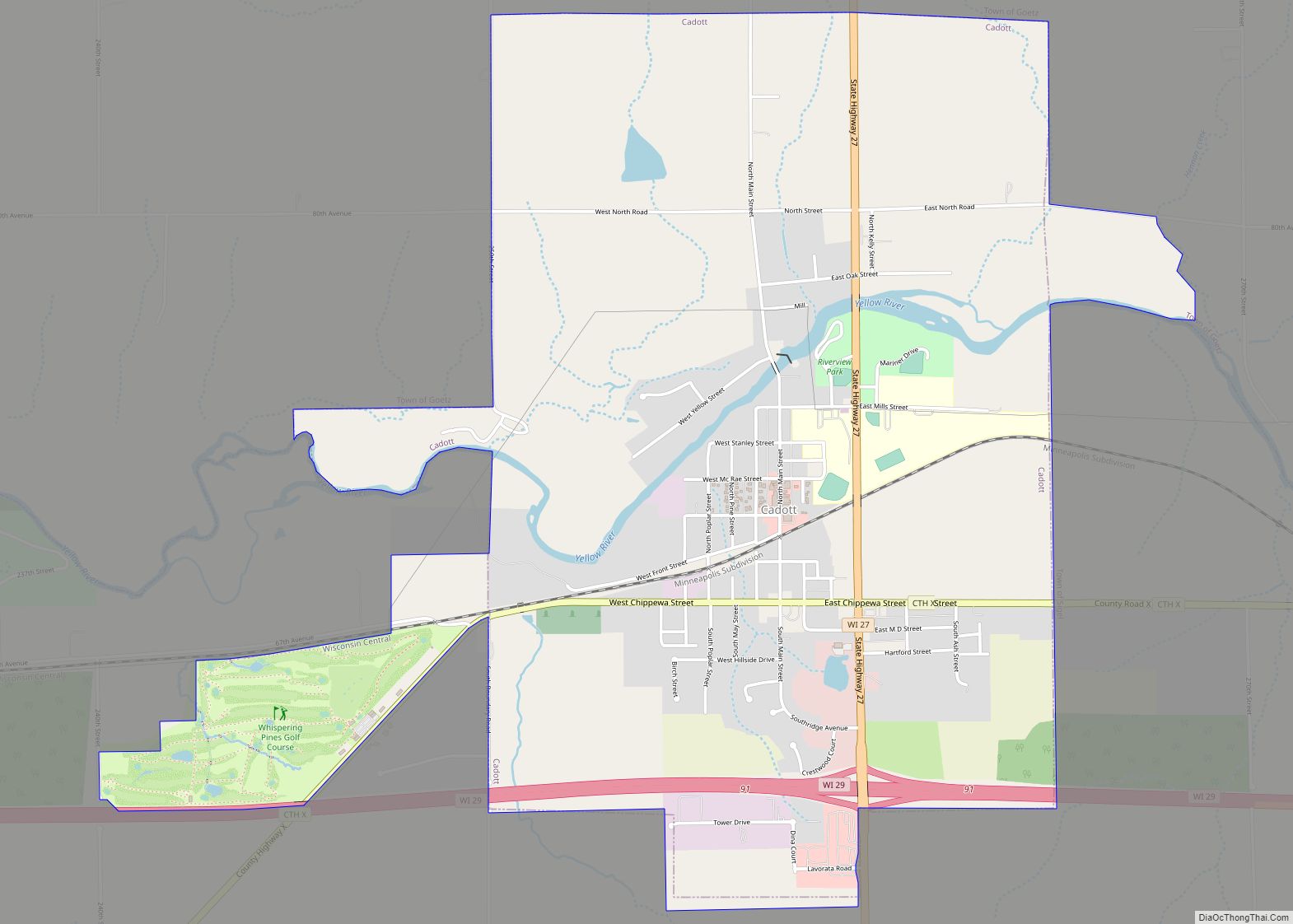
Cadott is a village in Chippewa County in the U.S. state of Wisconsin. The population was 1,437 at the 2010 census.
| Name: | Cadott village |
|---|---|
| LSAD Code: | 47 |
| LSAD Description: | village (suffix) |
| State: | Wisconsin |
| County: | Chippewa County |
| Elevation: | 984 ft (300 m) |
| Total Area: | 3.48 sq mi (9.01 km²) |
| Land Area: | 3.40 sq mi (8.81 km²) |
| Water Area: | 0.07 sq mi (0.19 km²) |
| Total Population: | 1,437 |
| Population Density: | 418.45/sq mi (161.58/km²) |
| Area code: | 715 & 534 |
| FIPS code: | 5511750 |
| GNISfeature ID: | 1562502 |
| Website: | villageofcadott.com |
Online Interactive Map
Click on ![]() to view map in "full screen" mode.
to view map in "full screen" mode.
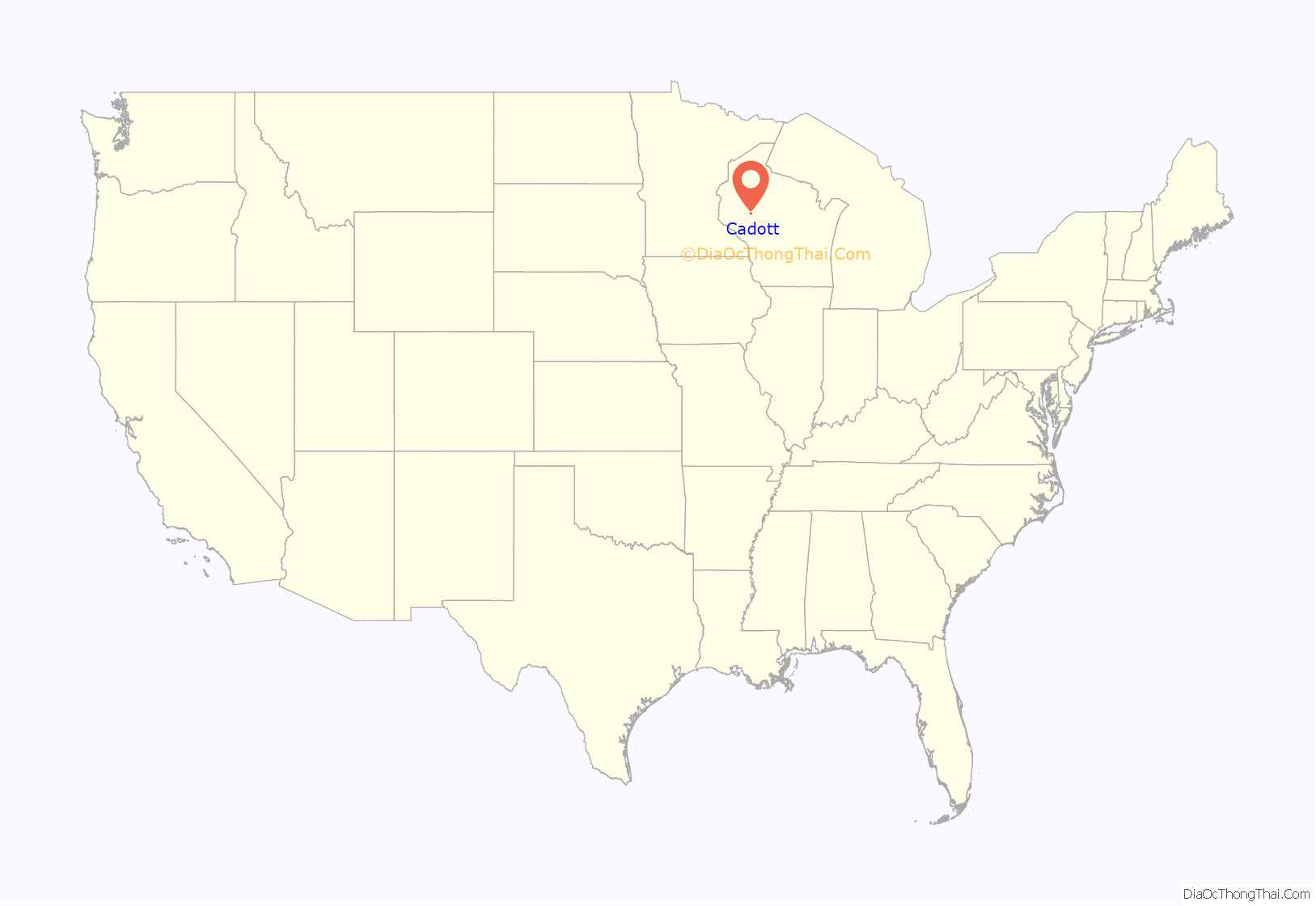
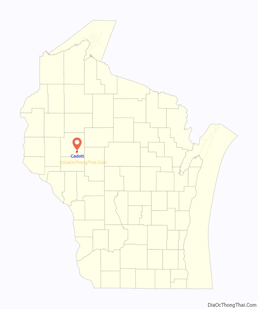
Cadott location map. Where is Cadott village?
History
In the late 1700s or early 1800s Jean Baptiste Cadotte, son of French Canadian fur trader Michel Cadotte of the Madeline Island area, established a trading post on the Yellow River near modern Cadott.
In 1865 the village at the current site was founded by Robert Marriner, who built a dam and sawmill on the river and platted the town. Marriner named it “Cadotte Falls” after the earlier trading post.
On July 21, 2020, a tornado hit the north side of the village. It damaged structures, but did not injure anybody.
Cadott Road Map
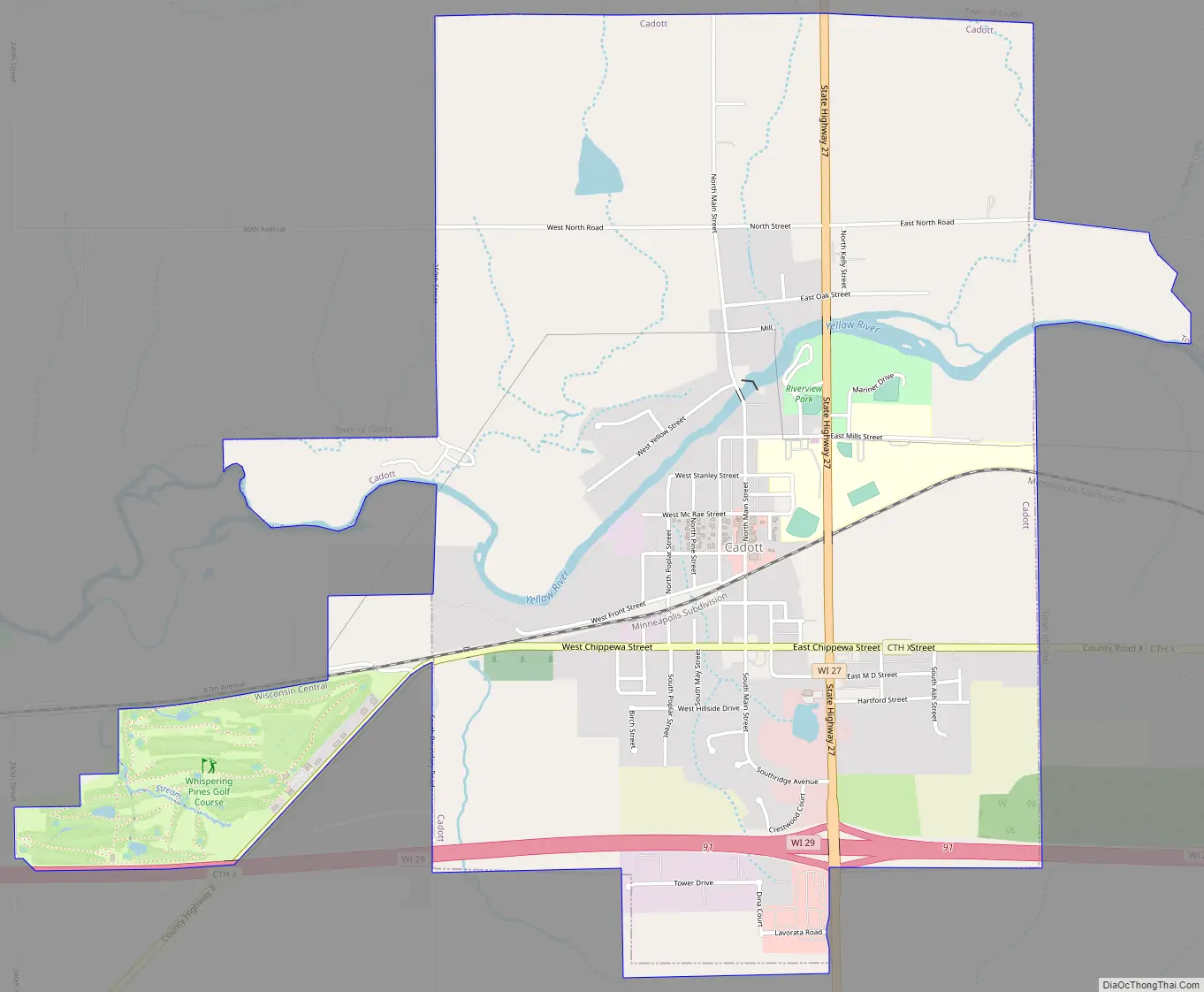
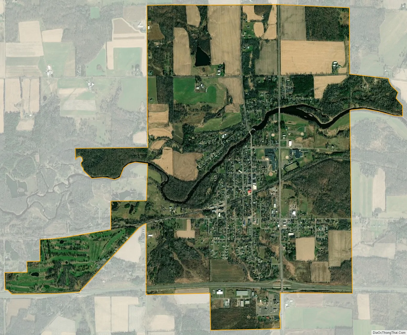
Cadott city Satellite Map
Geography
Cadott is located at 44°56′55″N 91°9′5″W / 44.94861°N 91.15139°W / 44.94861; -91.15139 (44.948515, -91.151304).
According to the United States Census Bureau, the village has an area of 3.38 square miles (8.75 km), of which 3.31 square miles (8.57 km) is land and 0.07 square miles (0.18 km) is water.
Cadott has the distinction of being equidistant from the Equator and North Pole. Billboards on Hwy. 27 between Cadott and Cornell offer tourists the opportunity to be photographed by the unusual signs.
See also
Map of Wisconsin State and its subdivision:- Adams
- Ashland
- Barron
- Bayfield
- Brown
- Buffalo
- Burnett
- Calumet
- Chippewa
- Clark
- Columbia
- Crawford
- Dane
- Dodge
- Door
- Douglas
- Dunn
- Eau Claire
- Florence
- Fond du Lac
- Forest
- Grant
- Green
- Green Lake
- Iowa
- Iron
- Jackson
- Jefferson
- Juneau
- Kenosha
- Kewaunee
- La Crosse
- Lafayette
- Lake Michigan
- Lake Superior
- Langlade
- Lincoln
- Manitowoc
- Marathon
- Marinette
- Marquette
- Menominee
- Milwaukee
- Monroe
- Oconto
- Oneida
- Outagamie
- Ozaukee
- Pepin
- Pierce
- Polk
- Portage
- Price
- Racine
- Richland
- Rock
- Rusk
- Saint Croix
- Sauk
- Sawyer
- Shawano
- Sheboygan
- Taylor
- Trempealeau
- Vernon
- Vilas
- Walworth
- Washburn
- Washington
- Waukesha
- Waupaca
- Waushara
- Winnebago
- Wood
- Alabama
- Alaska
- Arizona
- Arkansas
- California
- Colorado
- Connecticut
- Delaware
- District of Columbia
- Florida
- Georgia
- Hawaii
- Idaho
- Illinois
- Indiana
- Iowa
- Kansas
- Kentucky
- Louisiana
- Maine
- Maryland
- Massachusetts
- Michigan
- Minnesota
- Mississippi
- Missouri
- Montana
- Nebraska
- Nevada
- New Hampshire
- New Jersey
- New Mexico
- New York
- North Carolina
- North Dakota
- Ohio
- Oklahoma
- Oregon
- Pennsylvania
- Rhode Island
- South Carolina
- South Dakota
- Tennessee
- Texas
- Utah
- Vermont
- Virginia
- Washington
- West Virginia
- Wisconsin
- Wyoming