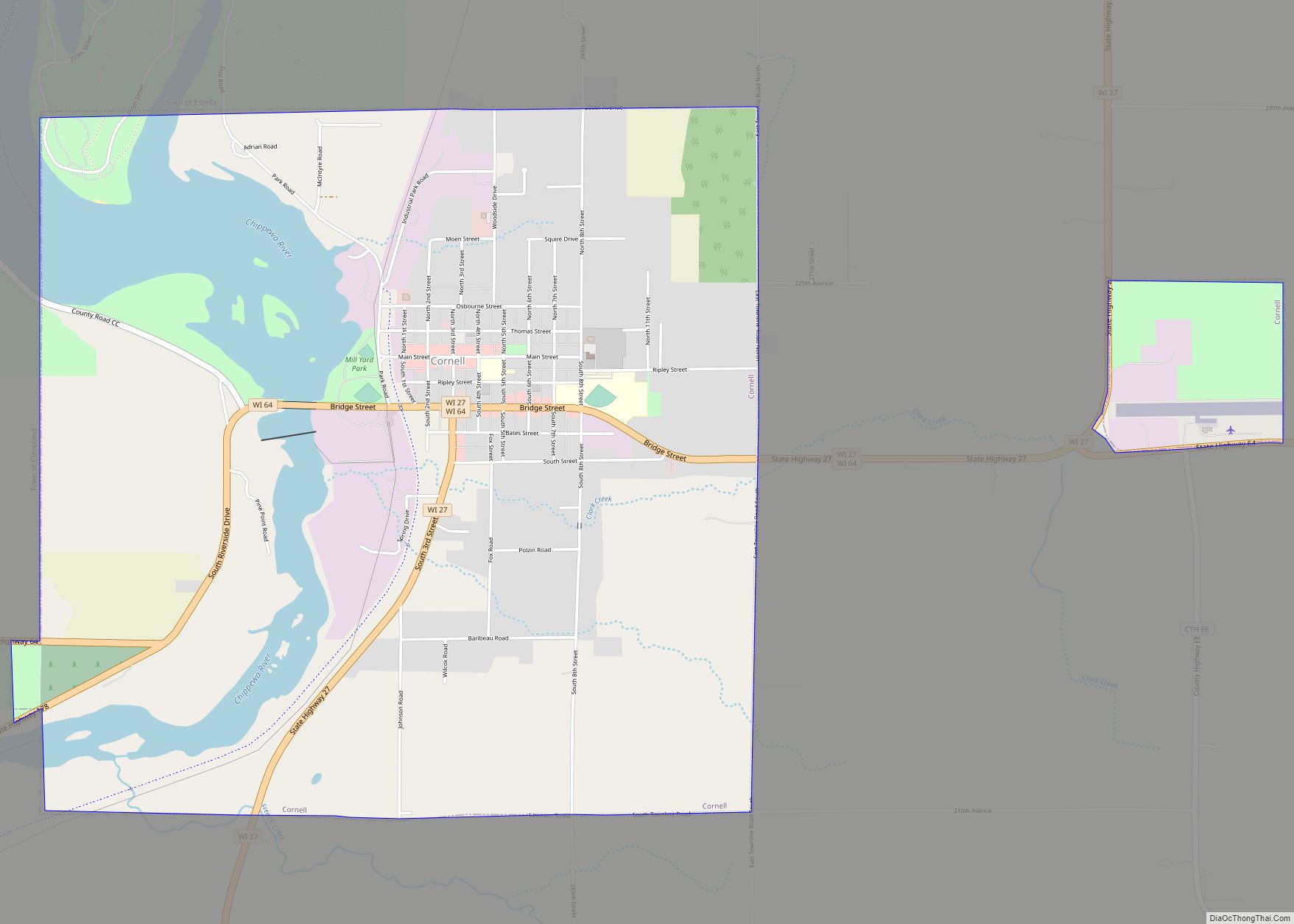
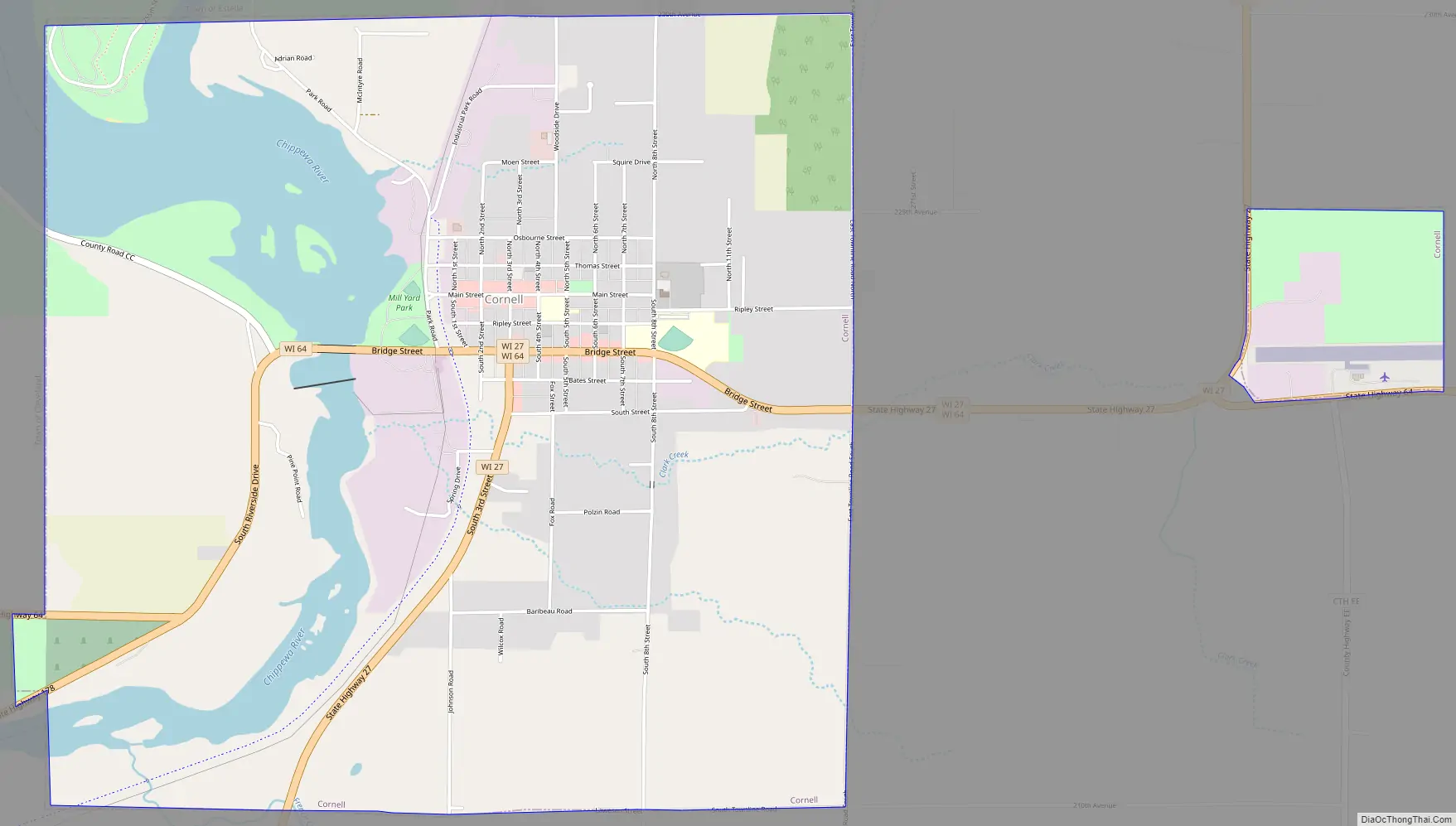
Cornell is a city in Chippewa County, Wisconsin, United States. The population was 1,467 at the 2010 census. It is located on the Chippewa River, upstream from Lake Wissota and Chippewa Falls, where Highway 64 crosses the river and Highway 27.
| Name: | Cornell city |
|---|---|
| LSAD Code: | 25 |
| LSAD Description: | city (suffix) |
| State: | Wisconsin |
| County: | Chippewa County |
| Elevation: | 1,083 ft (330 m) |
| Total Area: | 4.32 sq mi (11.19 km²) |
| Land Area: | 3.79 sq mi (9.81 km²) |
| Water Area: | 0.54 sq mi (1.38 km²) |
| Total Population: | 1,467 |
| Population Density: | 371.53/sq mi (143.46/km²) |
| Area code: | 715 & 534 |
| FIPS code: | 5517100 |
| GNISfeature ID: | 1563404 |
| Website: | cityofcornell.com |
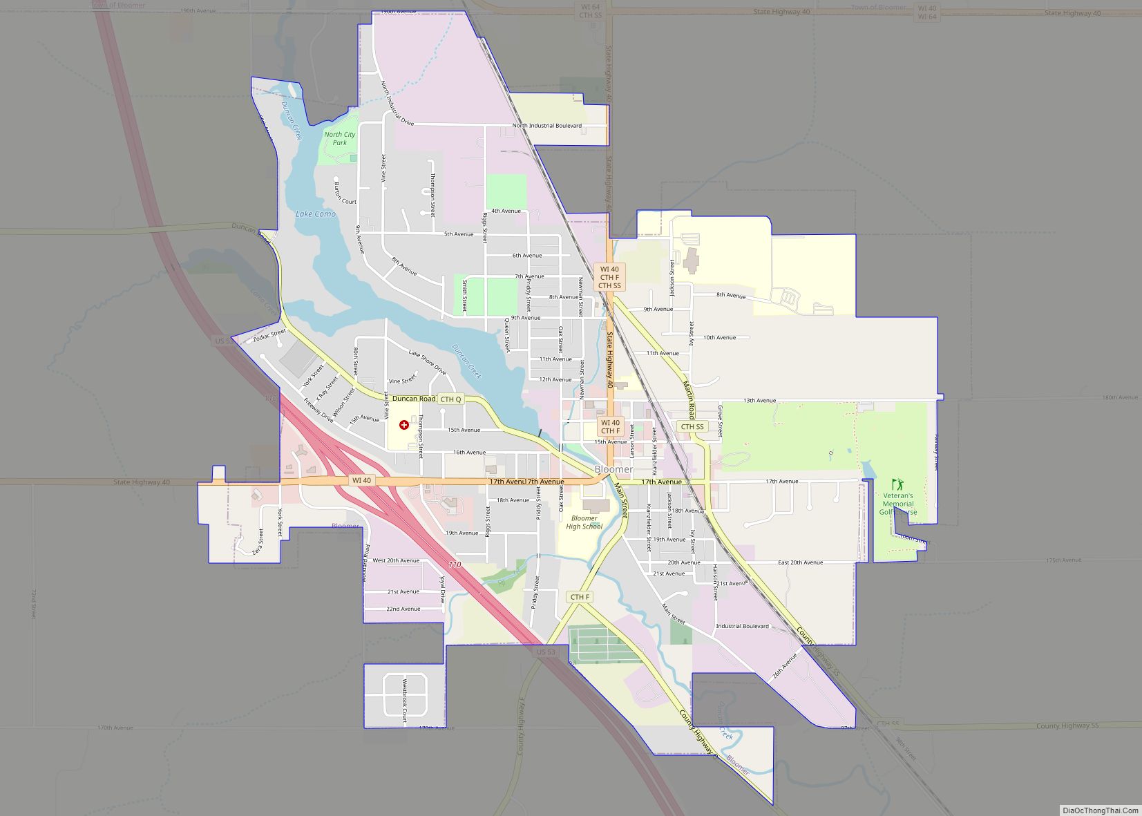
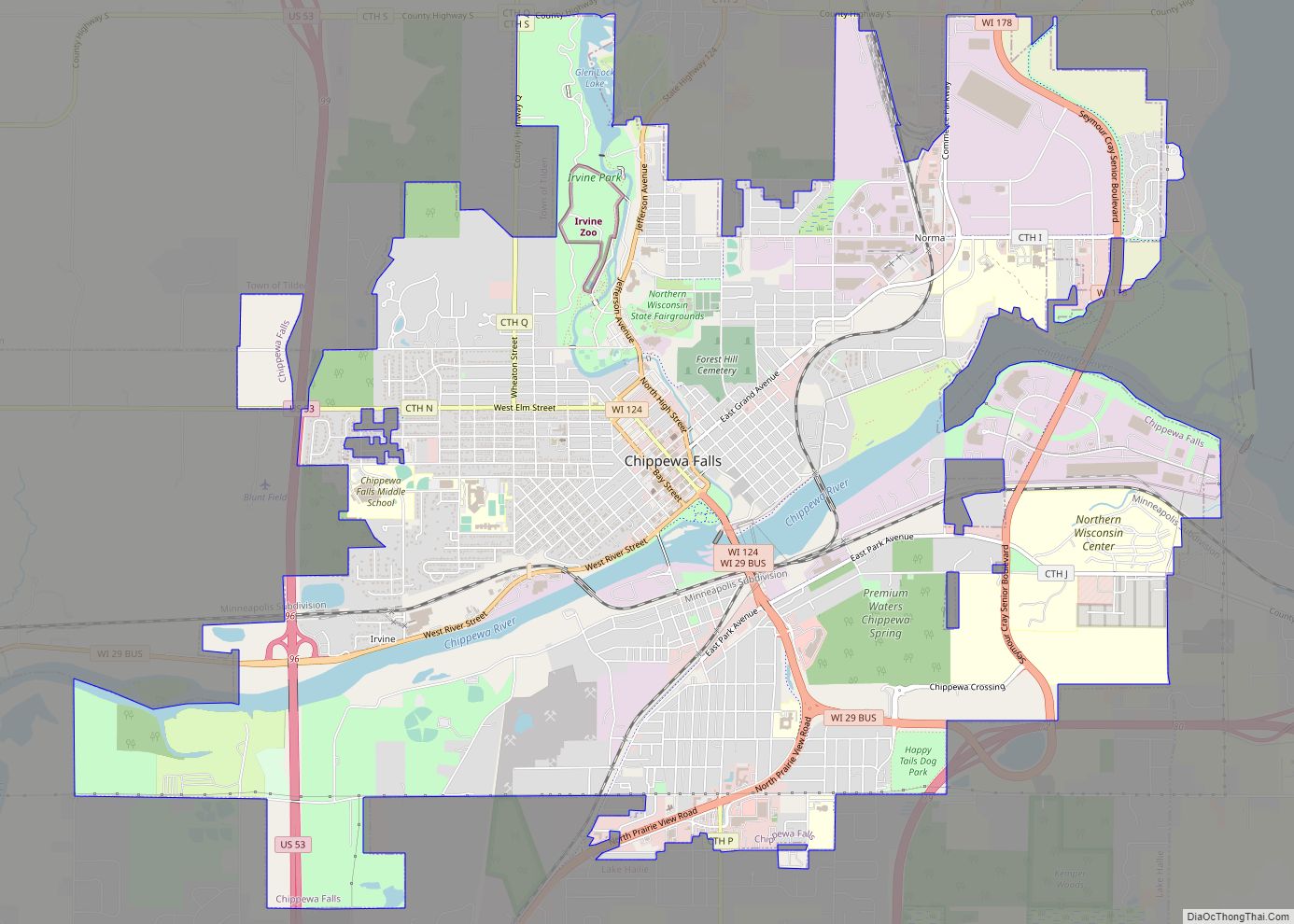
Online Interactive Map
Click on ![]() to view map in "full screen" mode.
to view map in "full screen" mode.
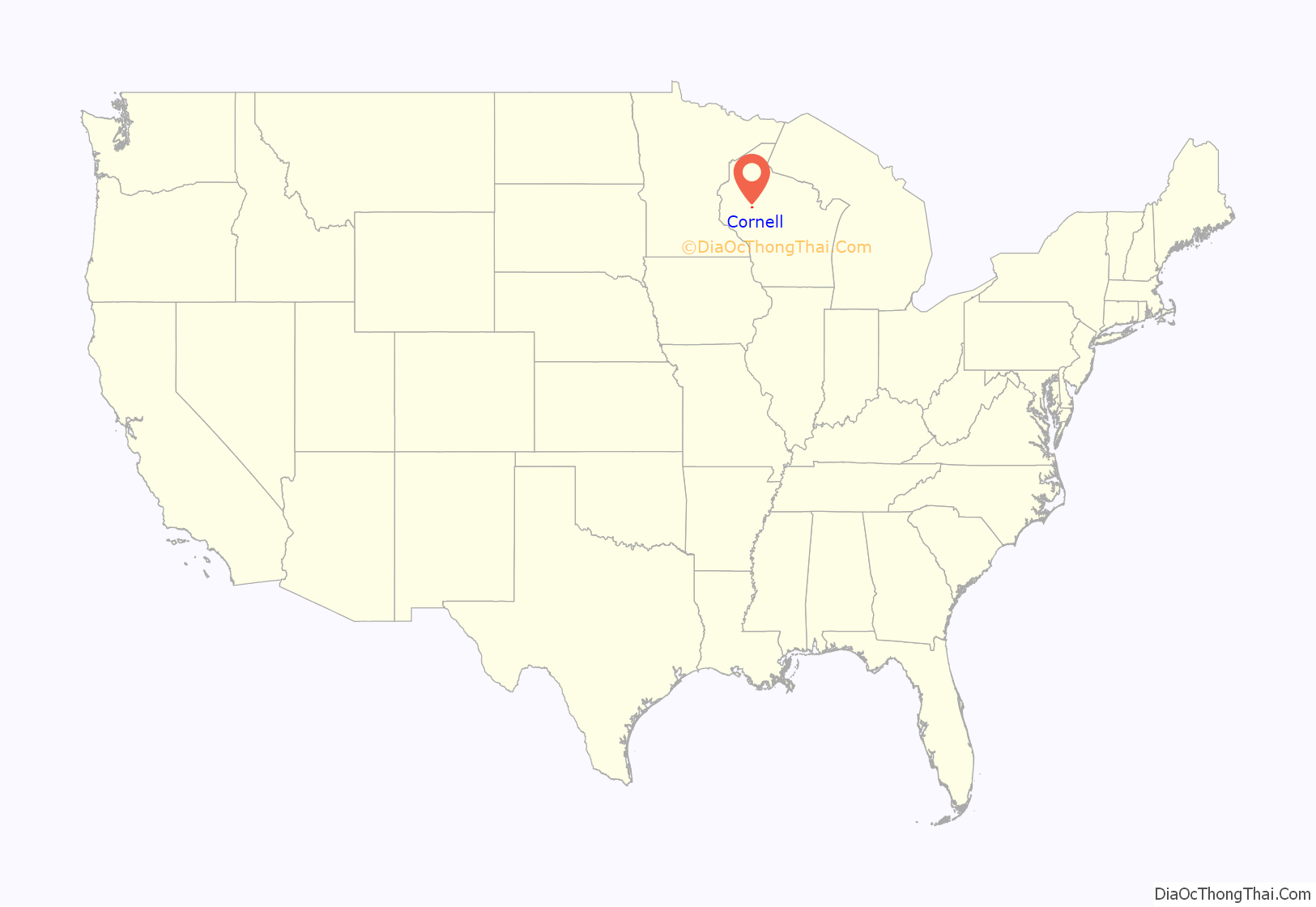
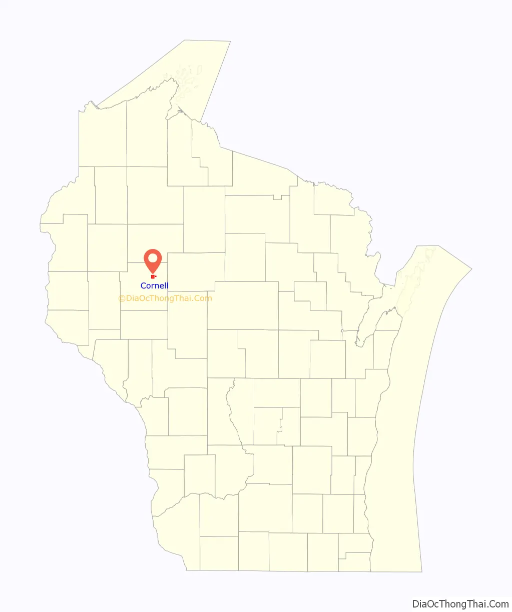
Cornell location map. Where is Cornell city?
History
The Cornell area was long visited by Sioux and Chippewa people passing up and down the Chippewa River.
The early white settlement was called Brunet Falls, named for Jean Brunet, who opened a trading post in the area in 1843. Brunet was a French-born American who served in the U.S. Army and led the building in 1836 of the first dam and sawmill in the then-wilderness at Chippewa Falls. After that he moved up the river another 30 miles and built a log cabin a mile below what would become Cornell on the west bank of the river. From his log cabin he ran a trading post that initially served Indians, and later grew into a stopping place (inn) for loggers and traders heading upriver.
The city was named for Ezra Cornell, one of the founders of Western Union, who owned a very large amount of timber land in the area. Upon his death in 1874, this land became a part of the endowment for the Ivy League university that bears his name.
Cornell Road Map
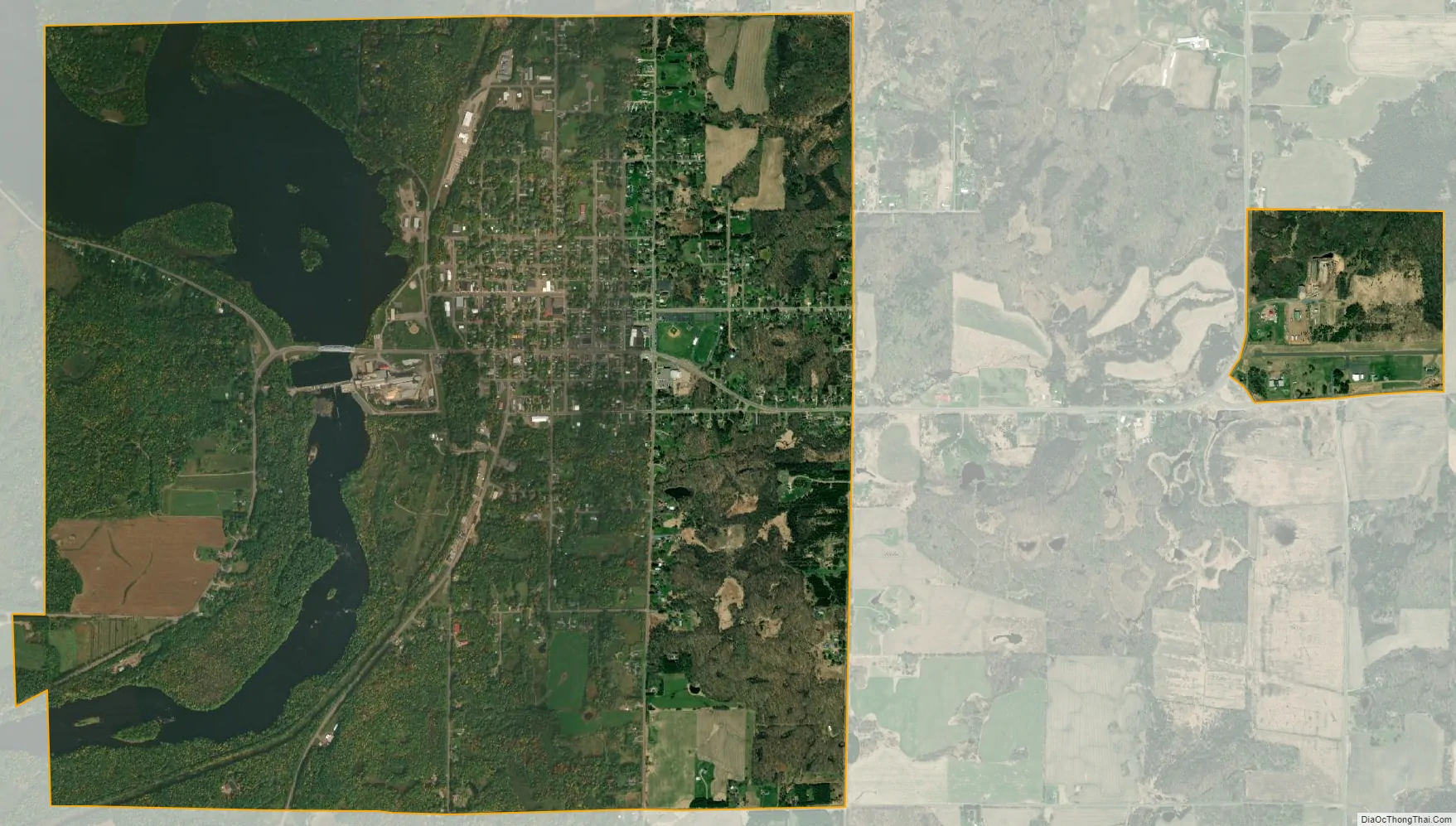
Cornell city Satellite Map
Geography
Cornell is located at 45°09′55″N 91°08′57″W / 45.165328°N 91.149044°W / 45.165328; -91.149044 (45.165328, -91.149044).
According to the United States Census Bureau, the city has a total area of 4.37 square miles (11.32 km), of which 3.84 square miles (9.95 km) is land and 0.53 square miles (1.37 km) is water.
See also
Map of Wisconsin State and its subdivision:- Adams
- Ashland
- Barron
- Bayfield
- Brown
- Buffalo
- Burnett
- Calumet
- Chippewa
- Clark
- Columbia
- Crawford
- Dane
- Dodge
- Door
- Douglas
- Dunn
- Eau Claire
- Florence
- Fond du Lac
- Forest
- Grant
- Green
- Green Lake
- Iowa
- Iron
- Jackson
- Jefferson
- Juneau
- Kenosha
- Kewaunee
- La Crosse
- Lafayette
- Lake Michigan
- Lake Superior
- Langlade
- Lincoln
- Manitowoc
- Marathon
- Marinette
- Marquette
- Menominee
- Milwaukee
- Monroe
- Oconto
- Oneida
- Outagamie
- Ozaukee
- Pepin
- Pierce
- Polk
- Portage
- Price
- Racine
- Richland
- Rock
- Rusk
- Saint Croix
- Sauk
- Sawyer
- Shawano
- Sheboygan
- Taylor
- Trempealeau
- Vernon
- Vilas
- Walworth
- Washburn
- Washington
- Waukesha
- Waupaca
- Waushara
- Winnebago
- Wood
- Alabama
- Alaska
- Arizona
- Arkansas
- California
- Colorado
- Connecticut
- Delaware
- District of Columbia
- Florida
- Georgia
- Hawaii
- Idaho
- Illinois
- Indiana
- Iowa
- Kansas
- Kentucky
- Louisiana
- Maine
- Maryland
- Massachusetts
- Michigan
- Minnesota
- Mississippi
- Missouri
- Montana
- Nebraska
- Nevada
- New Hampshire
- New Jersey
- New Mexico
- New York
- North Carolina
- North Dakota
- Ohio
- Oklahoma
- Oregon
- Pennsylvania
- Rhode Island
- South Carolina
- South Dakota
- Tennessee
- Texas
- Utah
- Vermont
- Virginia
- Washington
- West Virginia
- Wisconsin
- Wyoming