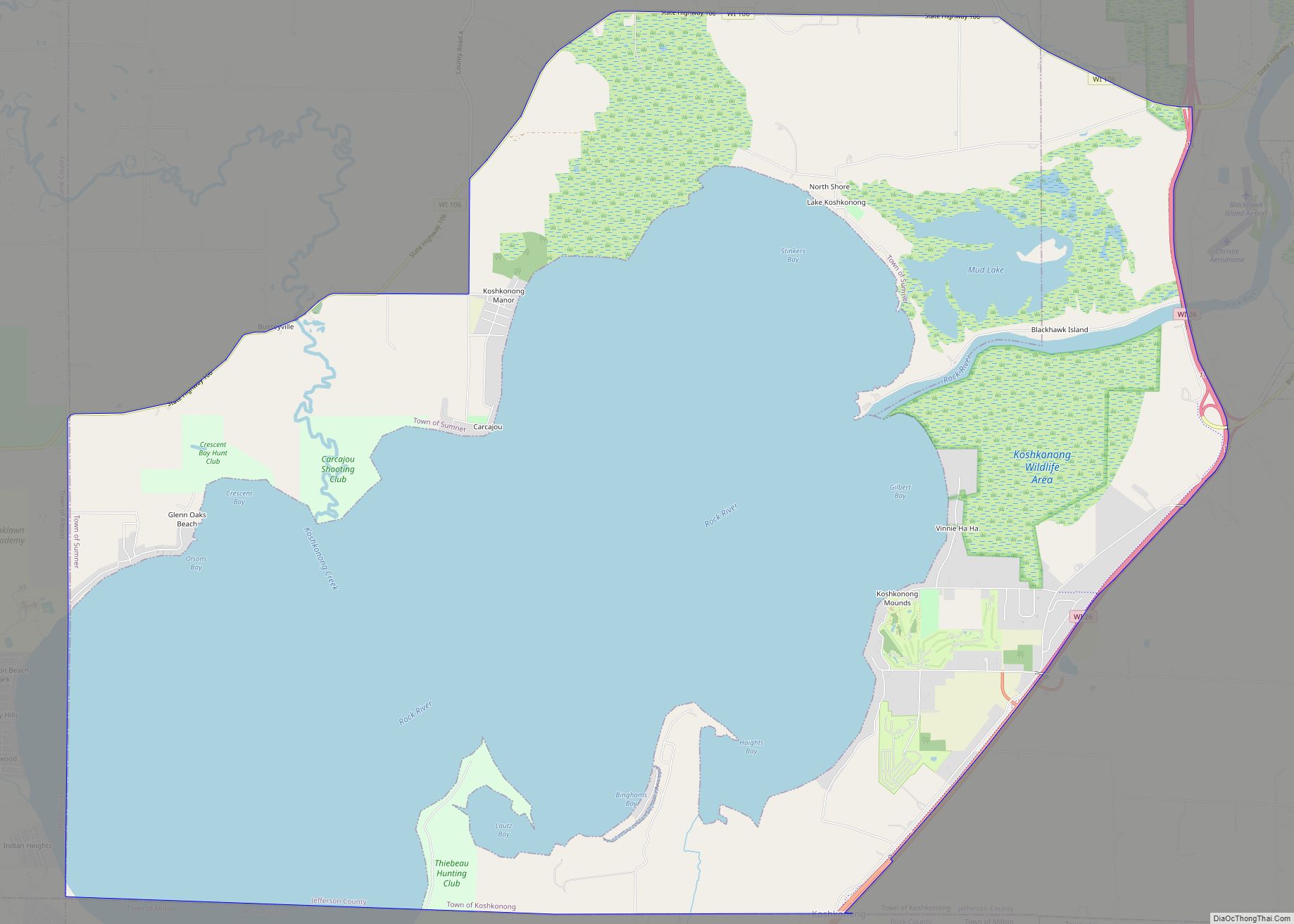
Fort Atkinson is a city in Jefferson County, Wisconsin, United States. It is on the Rock River, a few miles upstream from Lake Koshkonong. The population was 12,579 at the 2020 census. Fort Atkinson is the largest city located entirely in Jefferson County, as Watertown is split between Jefferson and Dodge counties. Fort Atkinson is a principal city of the Fort Atkinson-Watertown micropolitan statistical area which is in turn a sub-market of the larger Milwaukee-Waukesha-Racine CSA.
| Name: | Fort Atkinson city |
|---|---|
| LSAD Code: | 25 |
| LSAD Description: | city (suffix) |
| State: | Wisconsin |
| County: | Jefferson County |
| Elevation: | 787 ft (240 m) |
| Total Area: | 5.80 sq mi (15.03 km²) |
| Land Area: | 5.66 sq mi (14.66 km²) |
| Water Area: | 0.14 sq mi (0.37 km²) |
| Total Population: | 12,579 |
| Population Density: | 2,222.4/sq mi (858.2/km²) |
| Area code: | 920 |
| FIPS code: | 5526675 |
| GNISfeature ID: | 1565151 |
| Website: | www.fortatkinsonwi.net |
Online Interactive Map
Click on ![]() to view map in "full screen" mode.
to view map in "full screen" mode.
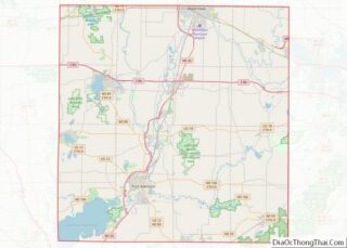
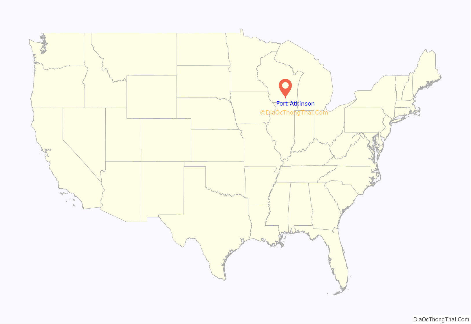
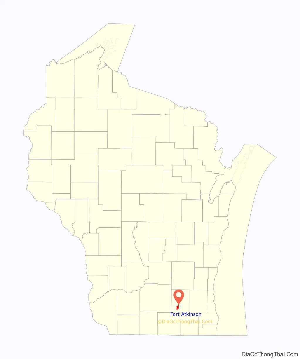
Fort Atkinson location map. Where is Fort Atkinson city?
History
Fort Atkinson was named after General Henry Atkinson, the commander of U.S. forces in the area during the Black Hawk War (1832) against a mixed band of Sauk, Meskwaki and Kickapoo peoples. The city developed at the site of Fort Koshkonong, which was used during that war. A replica of the original 1832 stockade has been built just outside town, although not at the original site. The fort was located to control the confluence of the Rock and Bark rivers.
The settlement grew rapidly in the mid-19th century, after the migration of pioneers from the east, especially New York State and the northern tier. They were among the many migrants carrying New England Yankee culture west across the northern tier of states.
The history and natural history of Fort Atkinson and the surrounding area are presented at the Hoard Historical Museum and National Dairy Shrine Museum. William Dempster Hoard founded the nationally distributed dairy farm magazine Hoard’s Dairyman in Fort Atkinson in 1885. The museums include the Frank and Luella Hoard House, the Dwight and Almira Foster House, and the Knox Research Library and Archive. The Dairy Shrine portion of the complex portrays the past, present, and future of the dairy industry.
The oldest manmade features near Fort Atkinson are a cluster of prehistoric earthworks indigenous mounds just south of town. Early European settlers named them the General Atkinson Mound Group. The mounds are a remnant of the Woodland Period in present-day Wisconsin. They are effigy and geometric mounds, different from the platform mounds at nearby Aztalan State Park, built by peoples of the Mississippian culture, which reached its peak around 1300. They had settlements throughout the Mississippi Valley and its tributaries, extending from central Illinois northward to the Great Lakes and also to the Southeastern United States. Materials were traded within the culture from the Great Lakes to the Gulf of Mexico. A 125-foot (38 m) long panther intaglio, the Panther Intaglio Effigy Mound, appears on a mound west of town, the last remaining intaglio in the state.
Fort Atkinson’s 19th- and early 20th-century building history is preserved in the Main Street and Merchants Avenue historic districts. Other Registered Historic Places include the Fort Atkinson Water Tower, David W. and Jane Curtis House, Hoard’s Dairyman Farm, and Jones Dairy Farm.
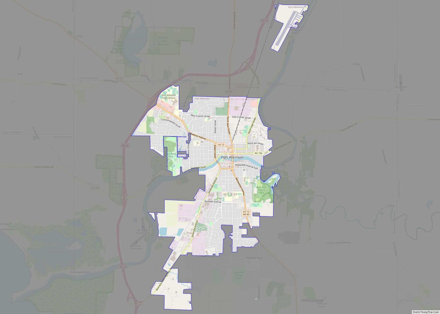
Fort Atkinson Road Map
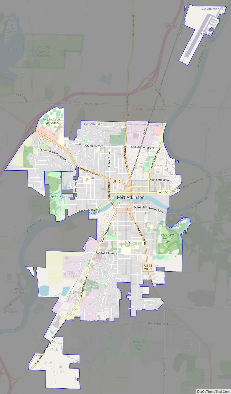
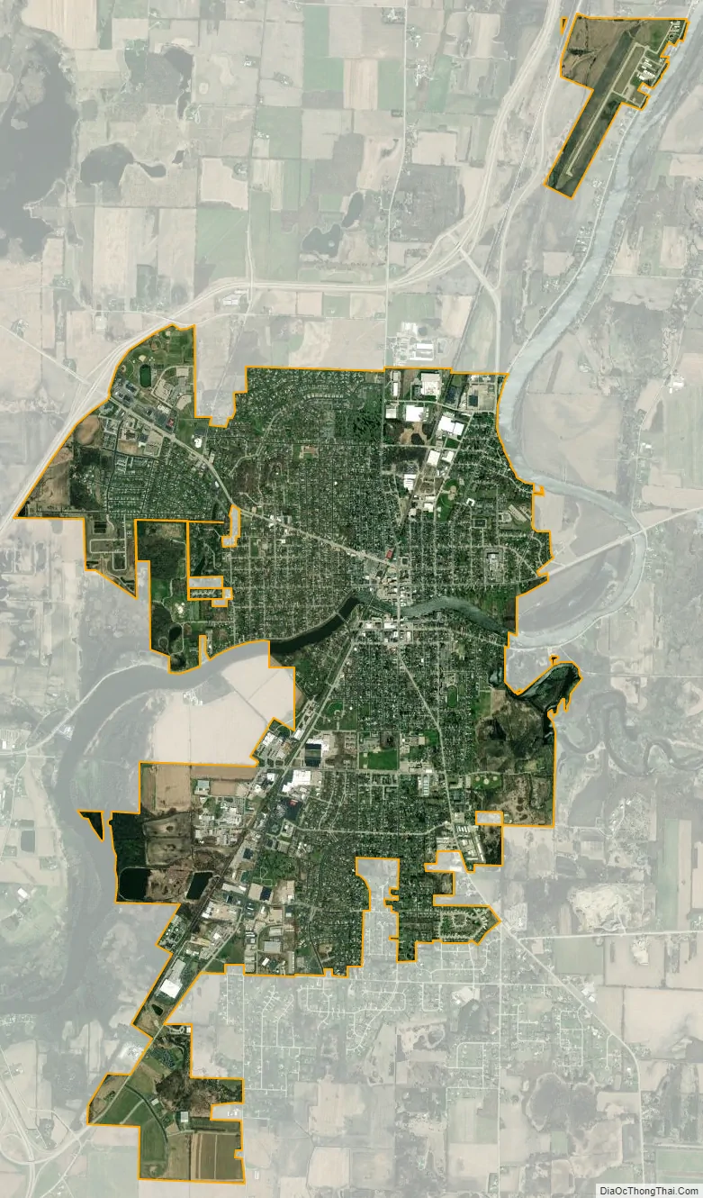
Fort Atkinson city Satellite Map
Geography
Fort Atkinson is located at 42°55′38″N 88°50′26″W / 42.92722°N 88.84056°W / 42.92722; -88.84056 (42.927091, −88.840446).
According to the United States Census Bureau, the city has a total area of 5.80 square miles (15.02 km), of which 5.66 square miles (14.66 km) is land and 0.14 square miles (0.36 km) is water.
The city developed along the river, which provided the earliest transportation pathways for trade and travel. Occasionally the downtown area is flooded when the Rock River exceeds its banks. Just east of the city, the Bark River enters the Rock and can add considerable volume in certain seasons. The Rock River is a tributary of the Mississippi River, which it joins at Rock Island, Illinois.
See also
Map of Wisconsin State and its subdivision:- Adams
- Ashland
- Barron
- Bayfield
- Brown
- Buffalo
- Burnett
- Calumet
- Chippewa
- Clark
- Columbia
- Crawford
- Dane
- Dodge
- Door
- Douglas
- Dunn
- Eau Claire
- Florence
- Fond du Lac
- Forest
- Grant
- Green
- Green Lake
- Iowa
- Iron
- Jackson
- Jefferson
- Juneau
- Kenosha
- Kewaunee
- La Crosse
- Lafayette
- Lake Michigan
- Lake Superior
- Langlade
- Lincoln
- Manitowoc
- Marathon
- Marinette
- Marquette
- Menominee
- Milwaukee
- Monroe
- Oconto
- Oneida
- Outagamie
- Ozaukee
- Pepin
- Pierce
- Polk
- Portage
- Price
- Racine
- Richland
- Rock
- Rusk
- Saint Croix
- Sauk
- Sawyer
- Shawano
- Sheboygan
- Taylor
- Trempealeau
- Vernon
- Vilas
- Walworth
- Washburn
- Washington
- Waukesha
- Waupaca
- Waushara
- Winnebago
- Wood
- Alabama
- Alaska
- Arizona
- Arkansas
- California
- Colorado
- Connecticut
- Delaware
- District of Columbia
- Florida
- Georgia
- Hawaii
- Idaho
- Illinois
- Indiana
- Iowa
- Kansas
- Kentucky
- Louisiana
- Maine
- Maryland
- Massachusetts
- Michigan
- Minnesota
- Mississippi
- Missouri
- Montana
- Nebraska
- Nevada
- New Hampshire
- New Jersey
- New Mexico
- New York
- North Carolina
- North Dakota
- Ohio
- Oklahoma
- Oregon
- Pennsylvania
- Rhode Island
- South Carolina
- South Dakota
- Tennessee
- Texas
- Utah
- Vermont
- Virginia
- Washington
- West Virginia
- Wisconsin
- Wyoming