Rock Island is a city in and the county seat of Rock Island County, Illinois, United States. The original Rock Island, from which the city name is derived, is now called Arsenal Island. The population was 37,108 at the 2020 census. Located on the Mississippi River, it is one of the Quad Cities, along with neighboring Moline, East Moline, and the Iowa cities of Davenport and Bettendorf. The Quad Cities has a population of about 380,000. The city is home to Rock Island Arsenal, the largest government-owned weapons manufacturing arsenal in the US, which employs 6,000 people.
The Rock Island–Milan School District, Rockridge School District (southwest portion of city) along with private schools, serve the city. The District (Downtown Rock Island) has art galleries and theaters, nightclubs and coffee shops, and restaurants of all flavors. Golf courses, parks, a casino, botanical center, marina, historic tours, bike paths, and festivals offer entertainment opportunities.
| Name: | Rock Island city |
|---|---|
| LSAD Code: | 25 |
| LSAD Description: | city (suffix) |
| State: | Illinois |
| County: | Rock Island County |
| Incorporated: | 1841 |
| Land Area: | 16.87 sq mi (43.70 km²) |
| Water Area: | 0.20 sq mi (0.53 km²) |
| Population Density: | 2,199.51/sq mi (849.23/km²) |
| Area code: | 309 |
| FIPS code: | 1765078 |
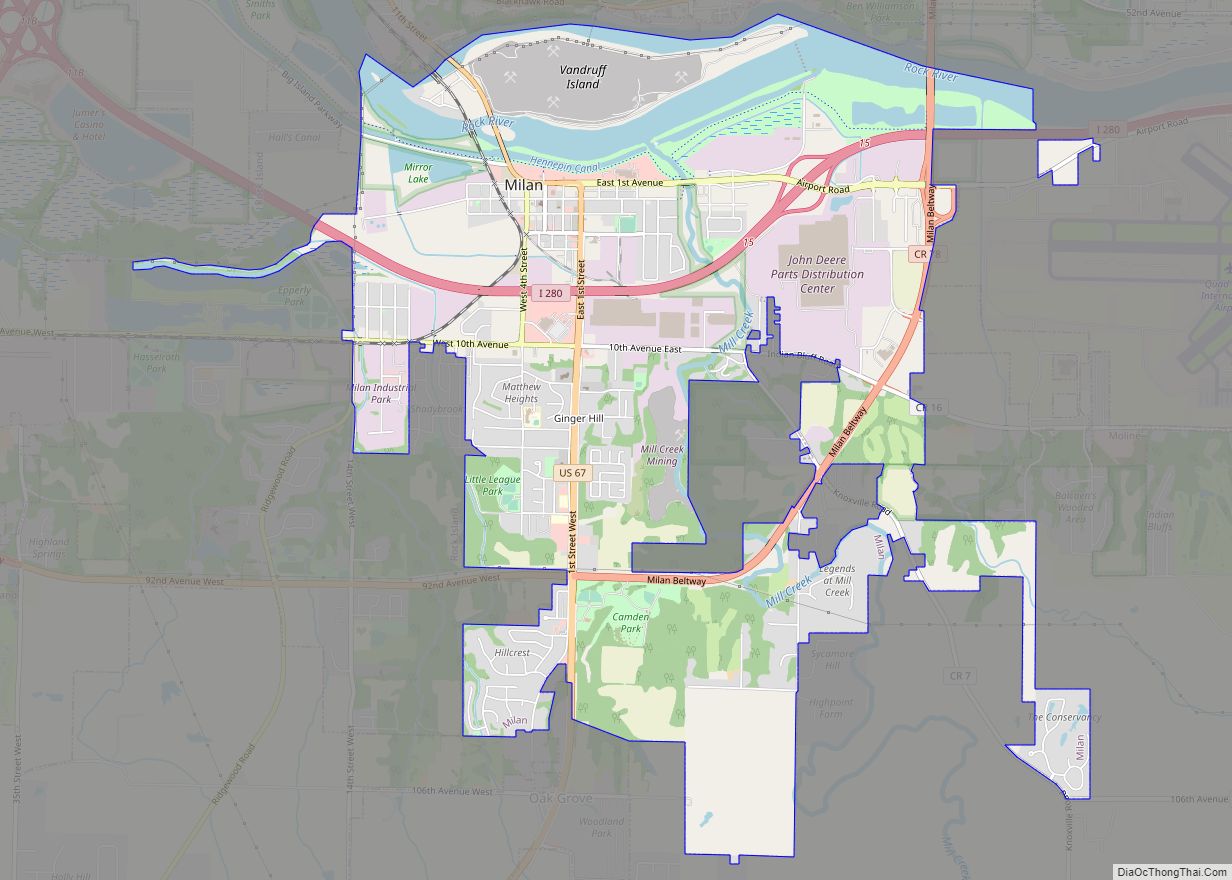
Online Interactive Map
Click on ![]() to view map in "full screen" mode.
to view map in "full screen" mode.
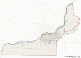
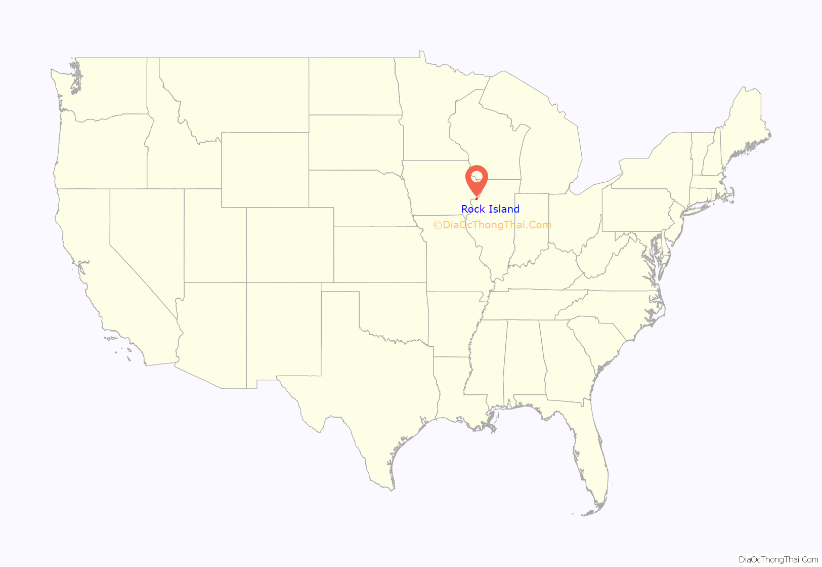
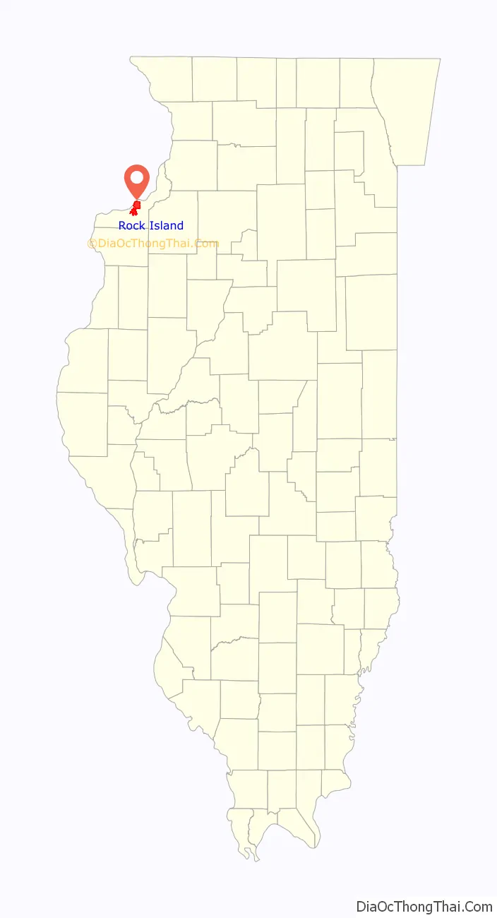
Rock Island location map. Where is Rock Island city?
History
European-American Settlement
The original portion of what is now known as Rock Island was called Farnhamsburg – after the original two homes were built by Colonel George Davenport and Russell Farnham in 1826. Davenport and Farnham were business partners, trading with the local Native Americans. The original city plat was filed on July 10, 1835, and was named Stephenson. It was renamed Rock Island in March 1841.
This area has been a fortuitous place first for settlement and then for steamboat traffic, bridges, and railroads.
Railroads and development
The Chicago, Rock Island & Pacific Railroad (RI) was founded here in 1851, known informally as the Rock Island Line; over the next century, the railroad grew to serve fourteen states but ended in bankruptcy in 1980. As part of later nineteenth-century development, two first-class hotels: the Harper House (built by Ben Harper and opened in February 1871) and the Rock Island House were built in town. The Rock Island Arsenal has manufactured military equipment and ordnance for the U.S. Army since the 1880s.
The Rock Island Southern Railway was an interurban line that ran from Rock Island to Monmouth, Illinois, then onward to Galesburg, Illinois. It was built between 1906 and 1910. A portion of the trackage, from Rock Island to Preemption, Illinois, was shared with the CRI&P line that served the coal mines in Cable, Illinois, and Sherrard, Illinois. The line finally folded in 1952.
Bridges
Due to its geography, Rock Island has a rich history of bridge building, including the first railroad bridge across the Mississippi (now gone), an unusual two-track railroad bridge, and the largest roller dam in the world.
The first railroad bridge across the Mississippi River was built between Arsenal Island and Davenport in 1856. Many steamboat pilots felt that the bridge had been intentionally positioned to make it hard for them to navigate, and this conflict reflected a larger rivalry: St. Louis and its steamboats against Chicago and its railroads. Two weeks after the bridge opened, the steamboat Effie Afton collided with the bridge, caught fire, and damaged the bridge. The owner of the Effie Afton sued the bridge company for damages, and Abraham Lincoln was one of the lawyers who defended the railroad. This test case was appealed to the United States Supreme Court, which ruled in favor of the railroad in 1872. Although the original bridge is long gone, a monument exists on Arsenal Island marking the Illinois side. On the Iowa side, the bridge was located near where 4th and Federal streets intersect with River Drive.
The Lock and Dam No. 15 and the Government Bridge are located just southwest of the site of the first bridge. The Government Bridge, completed in 1896, is notable for having two sets of railroad tracks above the car lanes. There are only two bridges in the world with this feature. Three other bridges span the river between Rock Island and Davenport. The Crescent Rail Bridge is a railroad-only bridge, completed in 1899. The Centennial Bridge was completed in 1940 for autos only. The newest bridge is the Interstate 280 bridge, completed in 1973. Lock and Dam No. 15, completed in 1934 as a federal Works Progress Administration (WPA) project during the Great Depression, is the largest roller dam in the world. The dam is designed for navigation, not flood control. During flood season, the rollers are raised, unleashing the full flow of the water.
On the south side of the city, overlooked by the Black Hawk State Historic Site, are auto and railroad crossings of the Rock River to Milan, Illinois. This set of bridges also crosses the historic Hennepin Canal and Sears Dam (this was named after the entrepreneur David B. Sears, who previously built the Sears Dam between Arsenal Island and Moline.) In 2007 a new bridge was completed between 3rd Street Moline/southeast Rock Island and Milan. It expedites the trip to Milan, the airport, and points south on U.S. Route 67.
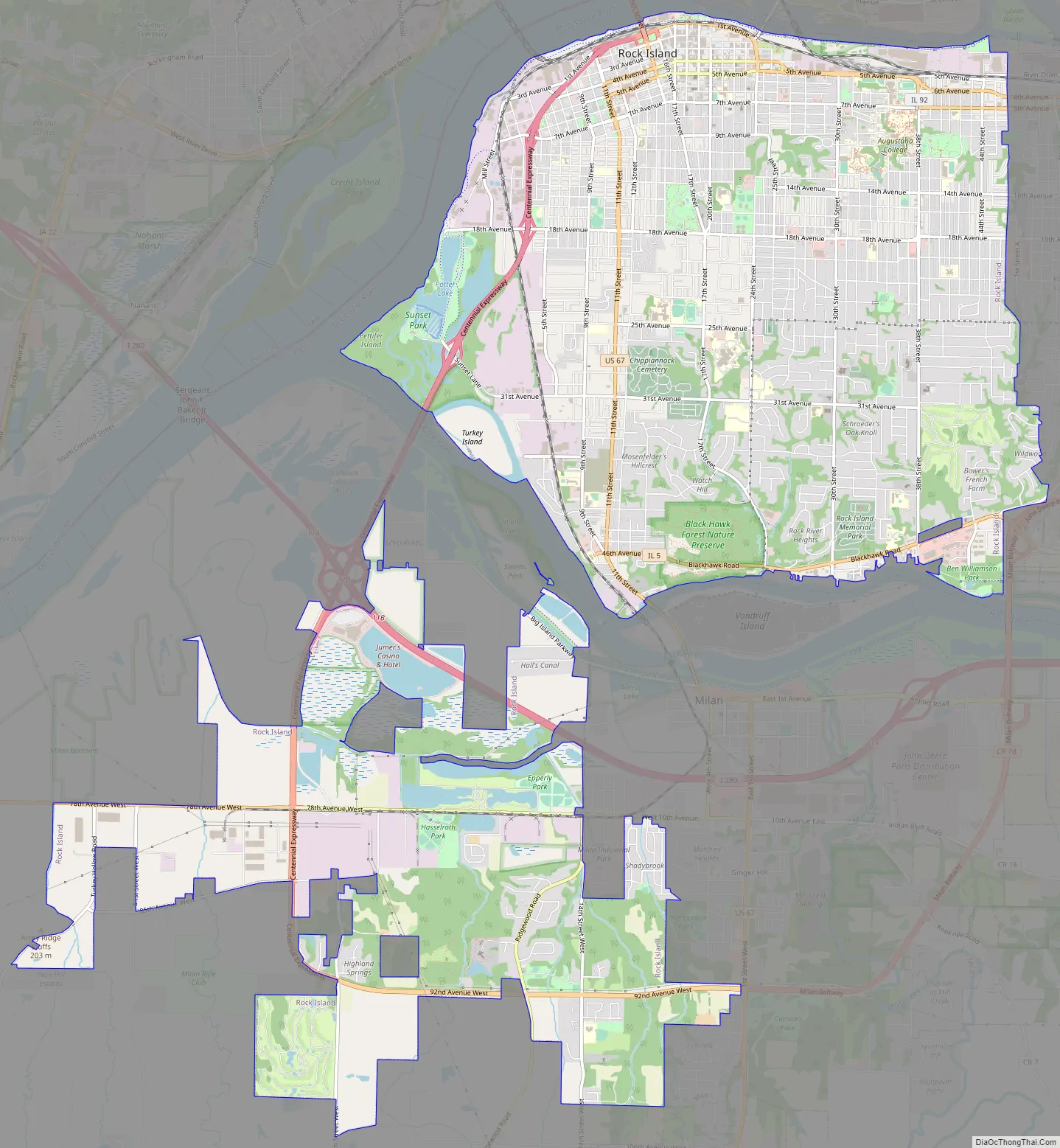
Rock Island Road Map
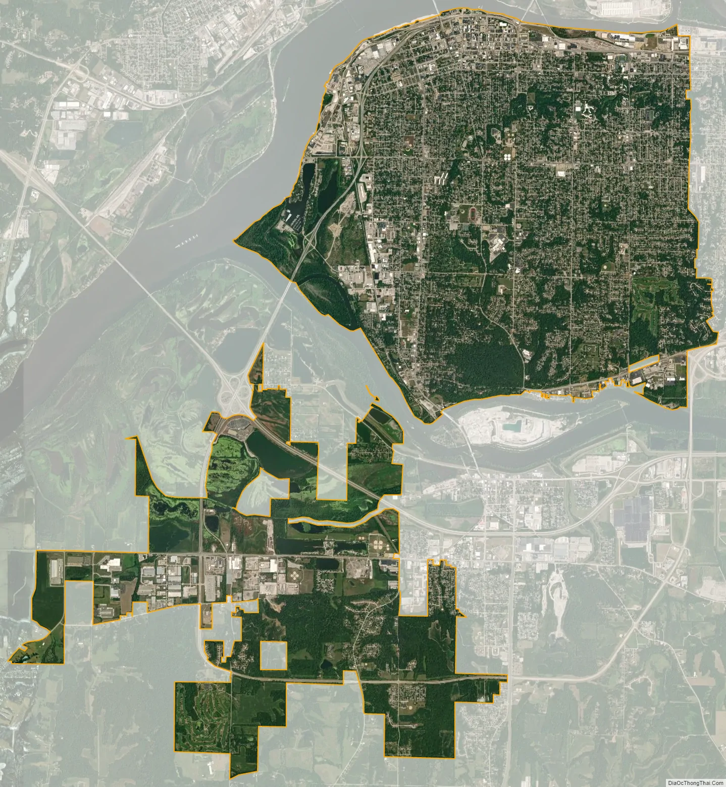
Rock Island city Satellite Map
Geography
Rock Island is located at 41°29′21″N 90°34′23″W / 41.48917°N 90.57306°W / 41.48917; -90.57306 (41.489083, -90.573154).
According to the 2010 census, Rock Island has a total area of 17.872 square miles (46.29 km), of which 16.85 square miles (43.64 km) (or 94.28%) is land and 1.022 square miles (2.65 km) (5.72%) is water.
See also
Map of Illinois State and its subdivision:- Adams
- Alexander
- Bond
- Boone
- Brown
- Bureau
- Calhoun
- Carroll
- Cass
- Champaign
- Christian
- Clark
- Clay
- Clinton
- Coles
- Cook
- Crawford
- Cumberland
- De Kalb
- De Witt
- Douglas
- Dupage
- Edgar
- Edwards
- Effingham
- Fayette
- Ford
- Franklin
- Fulton
- Gallatin
- Greene
- Grundy
- Hamilton
- Hancock
- Hardin
- Henderson
- Henry
- Iroquois
- Jackson
- Jasper
- Jefferson
- Jersey
- Jo Daviess
- Johnson
- Kane
- Kankakee
- Kendall
- Knox
- La Salle
- Lake
- Lake Michigan
- Lawrence
- Lee
- Livingston
- Logan
- Macon
- Macoupin
- Madison
- Marion
- Marshall
- Mason
- Massac
- McDonough
- McHenry
- McLean
- Menard
- Mercer
- Monroe
- Montgomery
- Morgan
- Moultrie
- Ogle
- Peoria
- Perry
- Piatt
- Pike
- Pope
- Pulaski
- Putnam
- Randolph
- Richland
- Rock Island
- Saint Clair
- Saline
- Sangamon
- Schuyler
- Scott
- Shelby
- Stark
- Stephenson
- Tazewell
- Union
- Vermilion
- Wabash
- Warren
- Washington
- Wayne
- White
- Whiteside
- Will
- Williamson
- Winnebago
- Woodford
- Alabama
- Alaska
- Arizona
- Arkansas
- California
- Colorado
- Connecticut
- Delaware
- District of Columbia
- Florida
- Georgia
- Hawaii
- Idaho
- Illinois
- Indiana
- Iowa
- Kansas
- Kentucky
- Louisiana
- Maine
- Maryland
- Massachusetts
- Michigan
- Minnesota
- Mississippi
- Missouri
- Montana
- Nebraska
- Nevada
- New Hampshire
- New Jersey
- New Mexico
- New York
- North Carolina
- North Dakota
- Ohio
- Oklahoma
- Oregon
- Pennsylvania
- Rhode Island
- South Carolina
- South Dakota
- Tennessee
- Texas
- Utah
- Vermont
- Virginia
- Washington
- West Virginia
- Wisconsin
- Wyoming