Lake Hallie is a village in Chippewa County, Wisconsin, United States. It was incorporated from part of the Town of Hallie on February 18, 2003. The 2010 census put the village’s population at 6,448.
| Name: | Lake Hallie village |
|---|---|
| LSAD Code: | 47 |
| LSAD Description: | village (suffix) |
| State: | Wisconsin |
| County: | Chippewa County |
| Elevation: | 909 ft (277 m) |
| Total Area: | 14.59 sq mi (37.77 km²) |
| Land Area: | 14.14 sq mi (36.63 km²) |
| Water Area: | 0.44 sq mi (1.14 km²) |
| Total Population: | 6,448 |
| Population Density: | 477.06/sq mi (184.19/km²) |
| Area code: | 715 & 534 |
| FIPS code: | 5541525 |
| GNISfeature ID: | 2013447 |
| Website: | http://www.lakehallie.us/ |
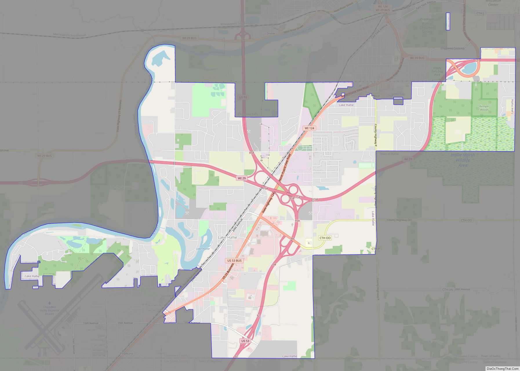
Online Interactive Map
Click on ![]() to view map in "full screen" mode.
to view map in "full screen" mode.
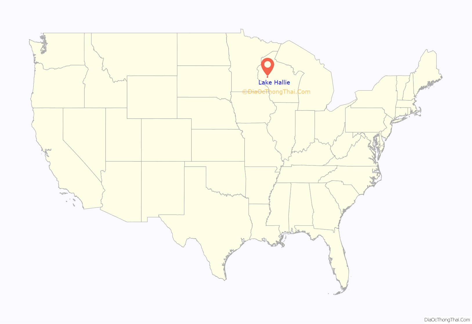
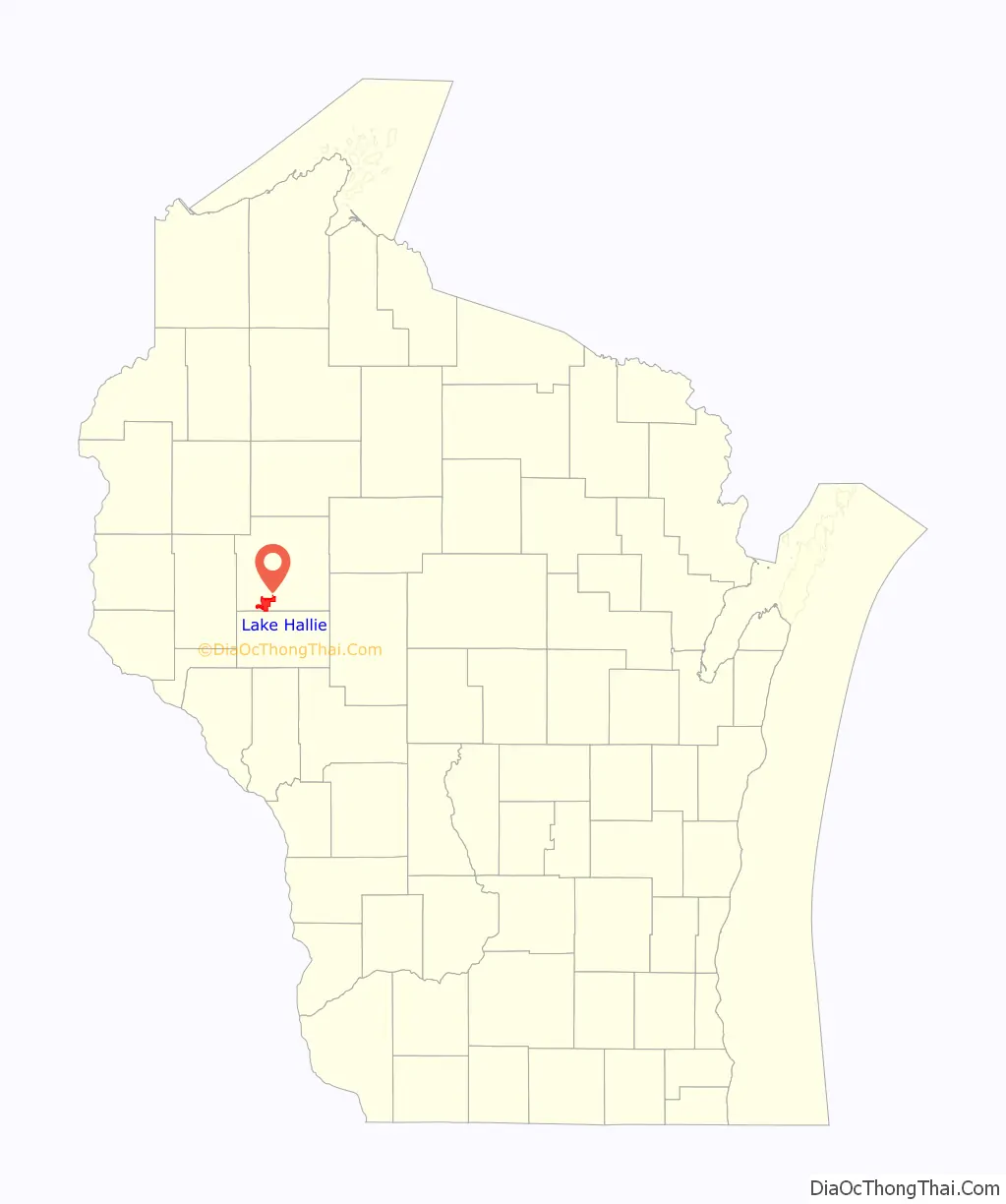
Lake Hallie location map. Where is Lake Hallie village?
History
The lake, from which the village derives its name, is an oxbow lake near the Chippewa River between Eau Claire and Chippewa Falls. Here, in 1843, the McCann brothers joined with Jeremiah C. Thomas to build the Blue Mill, which used the lake as a holding pond for logs. Later, after several changes of ownership and many improvements, this mill was acquired by the Badger State Lumber Company and became known as Badger Mills. Its operations were discontinued in the 1890s due to a shortage of logs.
In an open effort to prevent further annexation and utility encroachment by the cities of Chippewa Falls from the northeast and Eau Claire from the southwest, the village was incorporated by referendum from a large portion of the Town of Hallie on February 28, 2003. Over 95% of the Town of Hallie’s residents in 2000 lived within the new village. The village has experienced substantial growth since its incorporation; its 2010 population was 6,448, a 37.1% increase over the Town of Hallie’s 2000 population of 4,703.
Lake Hallie Road Map
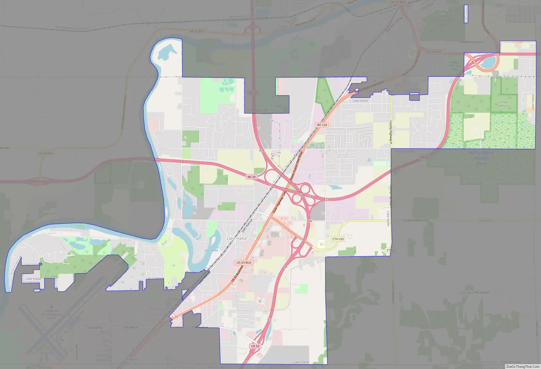
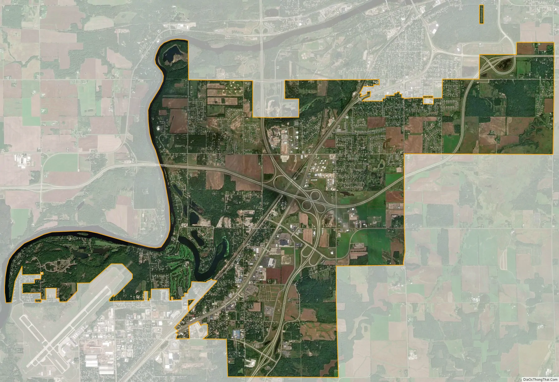
Lake Hallie city Satellite Map
Geography
Lake Hallie is bordered on the north by Chippewa Falls, the south by Eau Claire and the Town of Seymour, west by the Chippewa River, on the southeast by the Town of Hallie, and on the east by the Town of Lafayette.
According to the United States Census Bureau, the village has a total area of 14.57 square miles (37.74 km), of which 14.09 square miles (36.49 km) is land and 0.48 square miles (1.24 km) is water.
See also
Map of Wisconsin State and its subdivision:- Adams
- Ashland
- Barron
- Bayfield
- Brown
- Buffalo
- Burnett
- Calumet
- Chippewa
- Clark
- Columbia
- Crawford
- Dane
- Dodge
- Door
- Douglas
- Dunn
- Eau Claire
- Florence
- Fond du Lac
- Forest
- Grant
- Green
- Green Lake
- Iowa
- Iron
- Jackson
- Jefferson
- Juneau
- Kenosha
- Kewaunee
- La Crosse
- Lafayette
- Lake Michigan
- Lake Superior
- Langlade
- Lincoln
- Manitowoc
- Marathon
- Marinette
- Marquette
- Menominee
- Milwaukee
- Monroe
- Oconto
- Oneida
- Outagamie
- Ozaukee
- Pepin
- Pierce
- Polk
- Portage
- Price
- Racine
- Richland
- Rock
- Rusk
- Saint Croix
- Sauk
- Sawyer
- Shawano
- Sheboygan
- Taylor
- Trempealeau
- Vernon
- Vilas
- Walworth
- Washburn
- Washington
- Waukesha
- Waupaca
- Waushara
- Winnebago
- Wood
- Alabama
- Alaska
- Arizona
- Arkansas
- California
- Colorado
- Connecticut
- Delaware
- District of Columbia
- Florida
- Georgia
- Hawaii
- Idaho
- Illinois
- Indiana
- Iowa
- Kansas
- Kentucky
- Louisiana
- Maine
- Maryland
- Massachusetts
- Michigan
- Minnesota
- Mississippi
- Missouri
- Montana
- Nebraska
- Nevada
- New Hampshire
- New Jersey
- New Mexico
- New York
- North Carolina
- North Dakota
- Ohio
- Oklahoma
- Oregon
- Pennsylvania
- Rhode Island
- South Carolina
- South Dakota
- Tennessee
- Texas
- Utah
- Vermont
- Virginia
- Washington
- West Virginia
- Wisconsin
- Wyoming