Muskego (/mʌsˈkiɡoʊ/) is a city in Waukesha County, Wisconsin, United States. As of the 2020 census, the city had a population of 25,032. Muskego is the fifth largest community in Waukesha County, Wisconsin. Muskego has a large Norwegian population. The name Muskego is derived from the Potawatomi Indian name for the area, “Mus-kee-Guaac”, meaning sunfish. The Potawatomi were the original inhabitants of Muskego. There are three lakes within the city’s boundaries.
| Name: | Muskego city |
|---|---|
| LSAD Code: | 25 |
| LSAD Description: | city (suffix) |
| State: | Wisconsin |
| County: | Waukesha County |
| Incorporated: | 1964 |
| Elevation: | 815.90 ft (244 m) |
| Land Area: | 31.60 sq mi (81.85 km²) |
| Water Area: | 4.37 sq mi (11.32 km²) |
| Population Density: | 795.13/sq mi (307.00/km²) |
| ZIP code: | 53150 |
| Area code: | 414, 262 |
| FIPS code: | 5555275 |
| GNISfeature ID: | 1570056 |
| Website: | http://www.cityofmuskego.org |
Online Interactive Map
Click on ![]() to view map in "full screen" mode.
to view map in "full screen" mode.
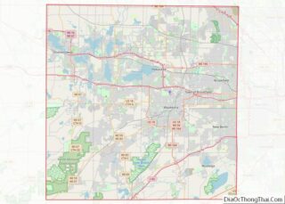
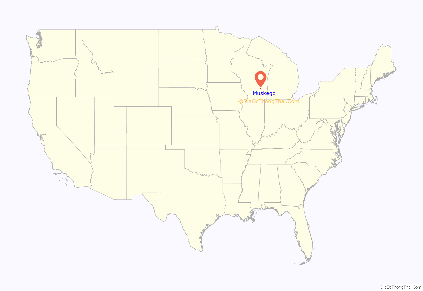
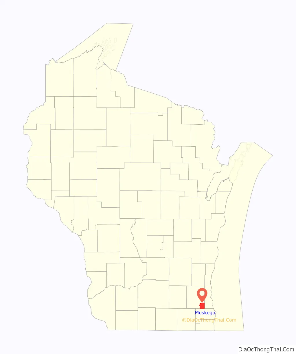
Muskego location map. Where is Muskego city?
History
The history of Muskego started originally as the home of the Potawatomi, who named it “Mus-kee-Guaac”, which means “sunfish”. The first European came in 1827 and a few years later (1833), the Potawatomi tribe ceded their lands in Wisconsin to the United States government. The first permanent settlers, coming from New Hampshire, were the Luther Parker family.
Once an agricultural area, Muskego was incorporated as a city in 1964. When it became a city it included the unincorporated communities of Durham Hill and Tess Corners. With an increase in housing developments in the city, it has become a bedroom community for Milwaukee.
Muskego Beach Amusement Park
Muskego Beach Amusement Park (1861–1967), later known as DandiLion Park (1968–1977), was a popular amusement park located on the southern bank of Little Muskego Lake. It was at some point home of the world’s fastest roller coaster.
Charles Rose, operator of Wisconsin State Fair Park purchased Muskego Beach Amusement Park from Mrs. William Boszhardt in 1944. After World War II, he reopened it. The park included rides, games of chance, and was a venue for musical bands. Charles Rose died in 1963 and five years later, Willard Masterson purchased the park. He renamed it “DandiLion Park” and added more amusement rides, including the Tailspin roller coaster. In 1974, an eleven-year-old boy fell from the Ferris wheel and died.
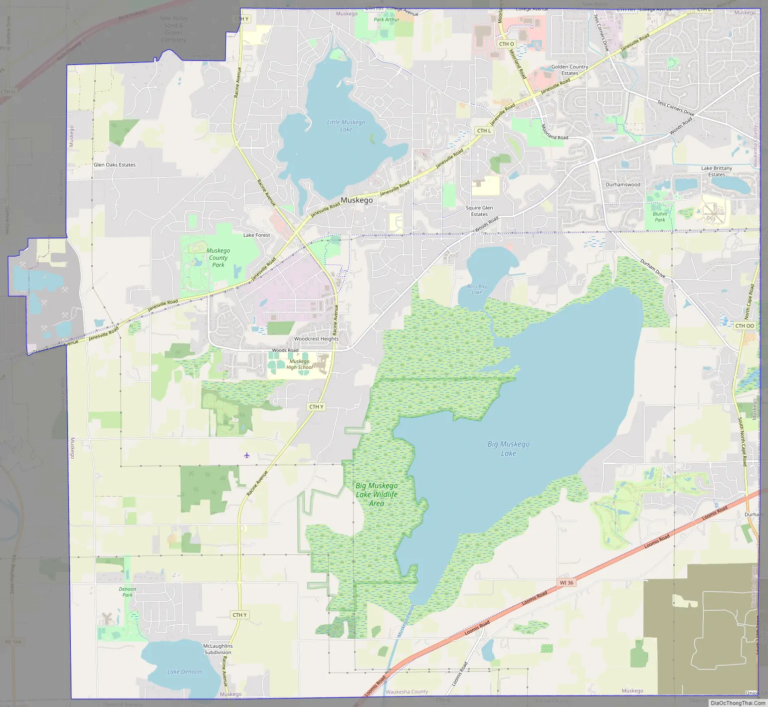
Muskego Road Map
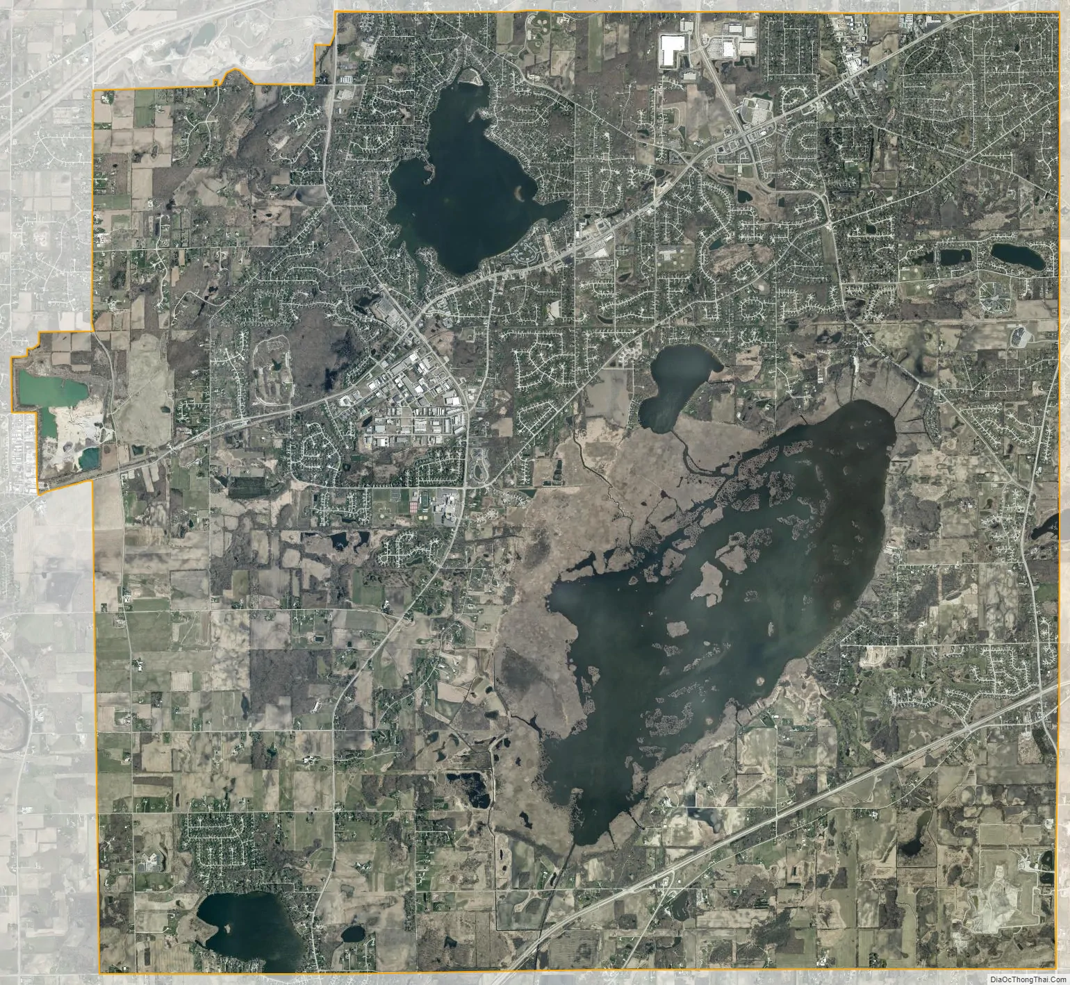
Muskego city Satellite Map
Geography
According to the United States Census Bureau, the city has a total area of 35.98 square miles (93.19 km), of which, 31.60 square miles (81.84 km) is land and 4.38 square miles (11.34 km) is water.
Muskego contains three lakes within its borders: Big Muskego Lake, Little Muskego Lake, and Lake Denoon.
Big Muskego Lake is a shallow 2,260-acre (9.1 km) flow-through lake in south-central Muskego. Most of the lake is less than four feet deep with a generally organic or muck bottom. Big Muskego Lake is fringed with cattail-dominated wetlands and encompasses numerous islands of cattail marsh. Bass Bay is a 110-acre (0.45 km) connected embayment of Big Muskego Lake that has a deeper basin typical of other glacially formed kettle lakes in the region. Bass Bay has a maximum depth of 23 feet (7.0 m) and has a bottom substrate of predominantly muck with some isolated sandy shoreline areas.
Little Muskego Lake is a 506-acre (2.05 km) flow-through lake with extensive shallow margins and a single deep basin. Located in the northwestern quadrant of the city, the lake has a maximum depth of 65 feet (20 m) and averages 14 feet (4.3 m) deep. The bottom substrate predominantly consists of silt or muck. Residents and visitors to Little Muskego Lake enjoy a variety of lake-related recreational activities, including boating, skiing, sailing, and fishing. The Muskego Waterbugs perform a water ski show in front of Idle Isle Park each Wednesday evening throughout the summer. The lake contains many fish species including: largemouth bass, northern pike, walleye, and several panfish species. Most of the shores of Little Muskego Lake are developed with residential housing.
Lake Denoon is a 162-acre (0.66 km) lake in the southwestern portion of the city and is also partially located in the Town of Norway, Wisconsin. The lake has a glacially formed kettle basin that reaches a maximum depth of 55 feet (17 m) with bottom substrates varying from sands and gravel to muck. An outlet stream on the south end drains to Ke-Nong-Go-Mong (Long) Lake in Racine County. A cattail island and an extent of cattail shoreline are found on the lake’s west end. The remaining lakeshore is mostly developed with residential housing.
A plan to drain the lakes, which were described as a stagnant nuisance, was proposed in 1854.
See also
Map of Wisconsin State and its subdivision:- Adams
- Ashland
- Barron
- Bayfield
- Brown
- Buffalo
- Burnett
- Calumet
- Chippewa
- Clark
- Columbia
- Crawford
- Dane
- Dodge
- Door
- Douglas
- Dunn
- Eau Claire
- Florence
- Fond du Lac
- Forest
- Grant
- Green
- Green Lake
- Iowa
- Iron
- Jackson
- Jefferson
- Juneau
- Kenosha
- Kewaunee
- La Crosse
- Lafayette
- Lake Michigan
- Lake Superior
- Langlade
- Lincoln
- Manitowoc
- Marathon
- Marinette
- Marquette
- Menominee
- Milwaukee
- Monroe
- Oconto
- Oneida
- Outagamie
- Ozaukee
- Pepin
- Pierce
- Polk
- Portage
- Price
- Racine
- Richland
- Rock
- Rusk
- Saint Croix
- Sauk
- Sawyer
- Shawano
- Sheboygan
- Taylor
- Trempealeau
- Vernon
- Vilas
- Walworth
- Washburn
- Washington
- Waukesha
- Waupaca
- Waushara
- Winnebago
- Wood
- Alabama
- Alaska
- Arizona
- Arkansas
- California
- Colorado
- Connecticut
- Delaware
- District of Columbia
- Florida
- Georgia
- Hawaii
- Idaho
- Illinois
- Indiana
- Iowa
- Kansas
- Kentucky
- Louisiana
- Maine
- Maryland
- Massachusetts
- Michigan
- Minnesota
- Mississippi
- Missouri
- Montana
- Nebraska
- Nevada
- New Hampshire
- New Jersey
- New Mexico
- New York
- North Carolina
- North Dakota
- Ohio
- Oklahoma
- Oregon
- Pennsylvania
- Rhode Island
- South Carolina
- South Dakota
- Tennessee
- Texas
- Utah
- Vermont
- Virginia
- Washington
- West Virginia
- Wisconsin
- Wyoming