New Berlin (/nuːˈbɜːrlɪn/) is a city located in eastern Waukesha County in the U.S. state of Wisconsin. The population was 40,451 at the 2020 census, making it the third-largest community in Waukesha County after the cities of Waukesha and Brookfield.
| Name: | New Berlin city |
|---|---|
| LSAD Code: | 25 |
| LSAD Description: | city (suffix) |
| State: | Wisconsin |
| County: | Waukesha County |
| Founded: | January 13, 1840 |
| Incorporated: | 1959 |
| Elevation: | 922 ft (281 m) |
| Total Area: | 36.88 sq mi (95.51 km²) |
| Land Area: | 36.44 sq mi (94.38 km²) |
| Water Area: | 0.43 sq mi (1.13 km²) 1.17% |
| Total Population: | 40,451 |
| Population Density: | 1,089.22/sq mi (420.55/km²) |
| Area code: | 262 |
| FIPS code: | 5556375 |
| GNISfeature ID: | 1570202 |
| Website: | www.newberlin.org |
Online Interactive Map
Click on ![]() to view map in "full screen" mode.
to view map in "full screen" mode.
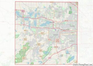
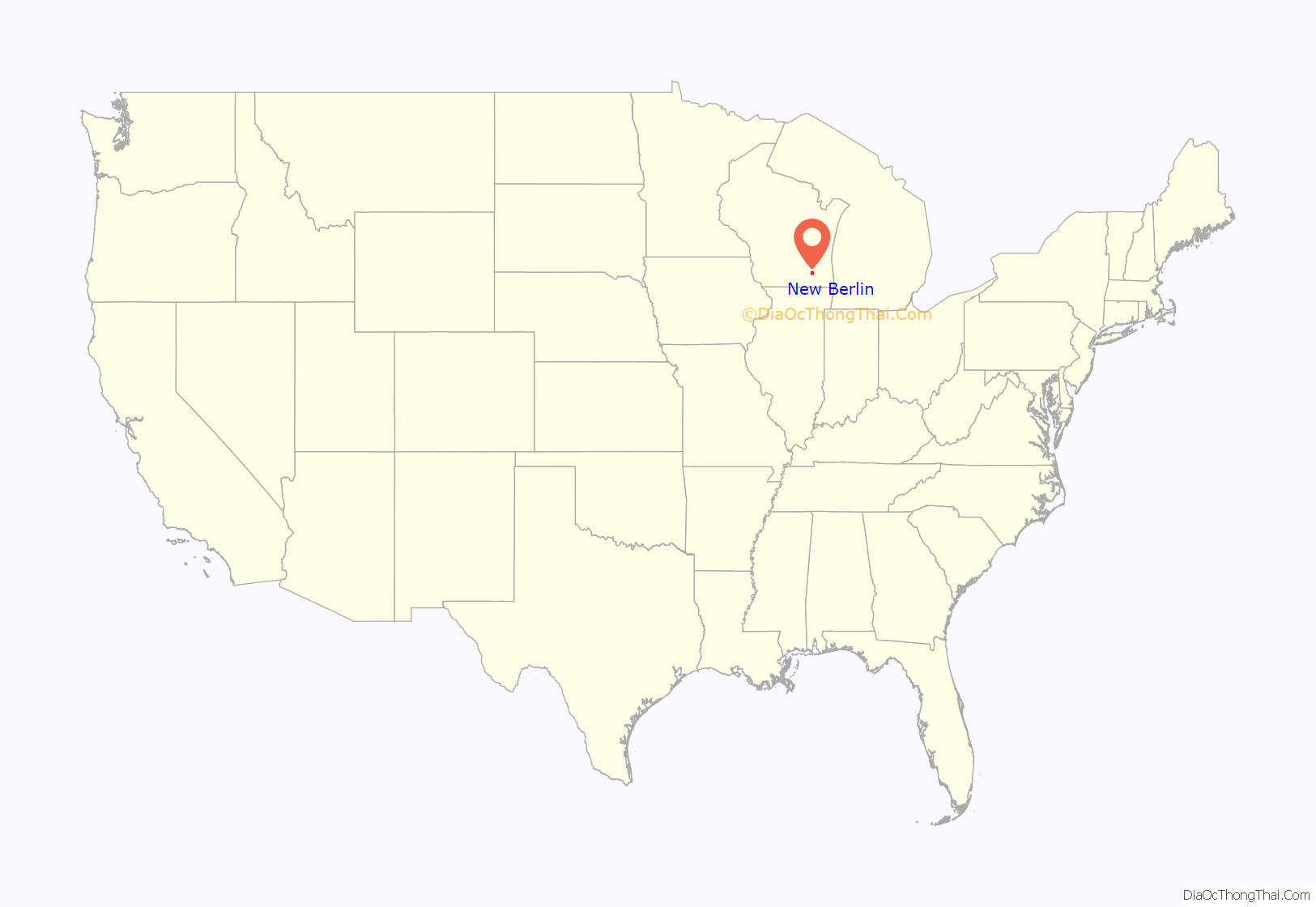
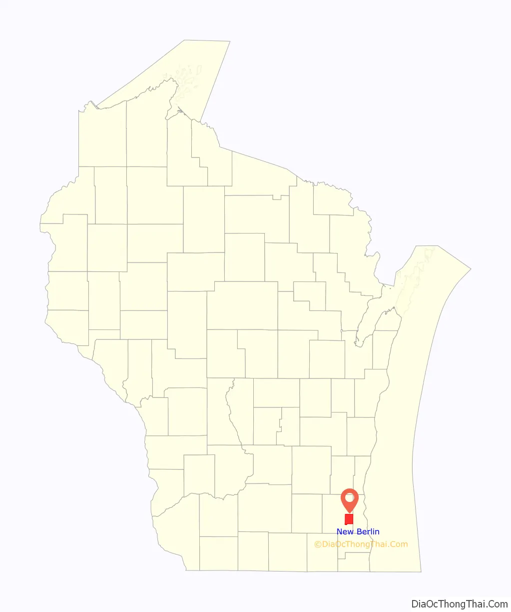
New Berlin location map. Where is New Berlin city?
History
The first settlers, Sidney Evans and P.G. Harrington, arrived in the northeastern part of what is now New Berlin in 1836. The area first came under local government in 1838 as part of the Town of Muskego, which at the time was composed of New Berlin and Muskego. The area that is now New Berlin was separated from Muskego in 1839 and named the Town of Mentor.
On January 13, 1840, Mentor became New Berlin. It was named by Evans after his hometown, New Berlin, New York. The town remained a rural and agricultural area until the 1940s, when the westward migration to the suburbs from Milwaukee began. Between 1850 and 1950, New Berlin’s population went from 1,293 to 5,334. Ten years later, in 1960, the population had nearly tripled to 15,788. The Town of New Berlin became the City of New Berlin with its incorporation in 1959.
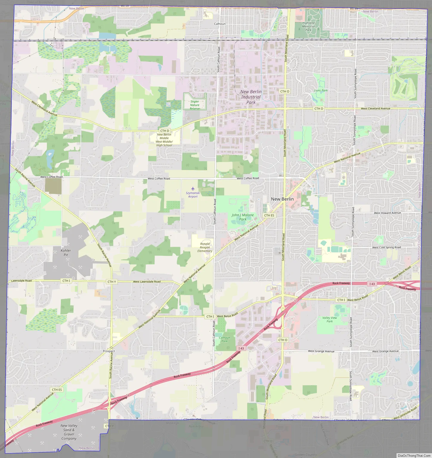
Large-scale growth occurred in the 1960s and 1970s, mainly as a result of the construction of the New Berlin Industrial Park, which began in 1964. The park comprises three separate business parks encompassing 1,126 acres (4.6 km), including Moorland Road Industrial Park, New Berlin Industrial Park and MSI/Lincoln Avenue Industrial Park.
Interstate 43 was expanded at the Moorland Road exit to accommodate a growing number of commuters. The new interchange has a two-lane roundabout that has been the center of a great deal of controversy because of the high number of accidents and traffic backups on 43.
New Berlin Road Map
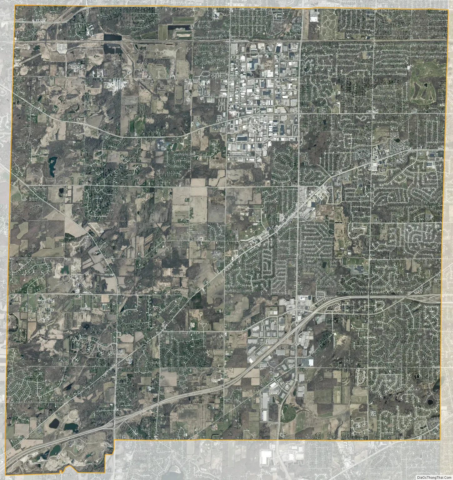
New Berlin city Satellite Map
Geography
New Berlin is located at 42°58′45″N 88°6′33″W / 42.97917°N 88.10917°W / 42.97917; -88.10917 (42.979063, −88.109188). It straddles the Sub-Continental Divide, which runs north–south through the eastern part of the city. Nearly 27 square miles (70 km) in the western part of the city, or about 73% of the city’s total land area, is west of the Sub-Continental Divide in the Fox River watershed, which is part of the Mississippi River watershed. The remaining area is within the Great Lakes/St. Lawrence River drainage basin.
According to the United States Census Bureau, the city has a total area of 36.87 square miles (95.49 km), of which 36.44 square miles (94.38 km) is land and 0.43 square miles (1.11 km) is water.
Michael Joseph Gross of GQ said that “On the map, New Berlin forms a neat six-by-six-mile square in the southeast corner of Waukesha County”.
Calhoun and Prospect are populated places within the city of New Berlin.
See also
Map of Wisconsin State and its subdivision:- Adams
- Ashland
- Barron
- Bayfield
- Brown
- Buffalo
- Burnett
- Calumet
- Chippewa
- Clark
- Columbia
- Crawford
- Dane
- Dodge
- Door
- Douglas
- Dunn
- Eau Claire
- Florence
- Fond du Lac
- Forest
- Grant
- Green
- Green Lake
- Iowa
- Iron
- Jackson
- Jefferson
- Juneau
- Kenosha
- Kewaunee
- La Crosse
- Lafayette
- Lake Michigan
- Lake Superior
- Langlade
- Lincoln
- Manitowoc
- Marathon
- Marinette
- Marquette
- Menominee
- Milwaukee
- Monroe
- Oconto
- Oneida
- Outagamie
- Ozaukee
- Pepin
- Pierce
- Polk
- Portage
- Price
- Racine
- Richland
- Rock
- Rusk
- Saint Croix
- Sauk
- Sawyer
- Shawano
- Sheboygan
- Taylor
- Trempealeau
- Vernon
- Vilas
- Walworth
- Washburn
- Washington
- Waukesha
- Waupaca
- Waushara
- Winnebago
- Wood
- Alabama
- Alaska
- Arizona
- Arkansas
- California
- Colorado
- Connecticut
- Delaware
- District of Columbia
- Florida
- Georgia
- Hawaii
- Idaho
- Illinois
- Indiana
- Iowa
- Kansas
- Kentucky
- Louisiana
- Maine
- Maryland
- Massachusetts
- Michigan
- Minnesota
- Mississippi
- Missouri
- Montana
- Nebraska
- Nevada
- New Hampshire
- New Jersey
- New Mexico
- New York
- North Carolina
- North Dakota
- Ohio
- Oklahoma
- Oregon
- Pennsylvania
- Rhode Island
- South Carolina
- South Dakota
- Tennessee
- Texas
- Utah
- Vermont
- Virginia
- Washington
- West Virginia
- Wisconsin
- Wyoming