Suamico is a village in Brown County in the U.S. state of Wisconsin. The population was 11,346 at the time of the 2010 census. Suamico is part of the Green Bay Metropolitan Statistical Area, and contains the neighborhood community of Flintville.
| Name: | Suamico village |
|---|---|
| LSAD Code: | 47 |
| LSAD Description: | village (suffix) |
| State: | Wisconsin |
| County: | Brown County |
| Elevation: | 591 ft (180 m) |
| Total Area: | 59.40 sq mi (153.85 km²) |
| Land Area: | 36.34 sq mi (94.12 km²) |
| Water Area: | 23.06 sq mi (59.73 km²) |
| Total Population: | 11,346 |
| Population Density: | 359.18/sq mi (138.68/km²) |
| ZIP code: | 54173 |
| Area code: | 920 |
| FIPS code: | 5577975 |
| GNISfeature ID: | 1584242 |
| Website: | suamico.org |
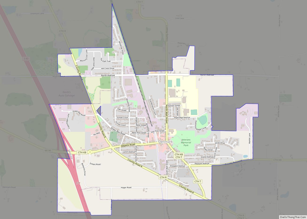
Online Interactive Map
Click on ![]() to view map in "full screen" mode.
to view map in "full screen" mode.
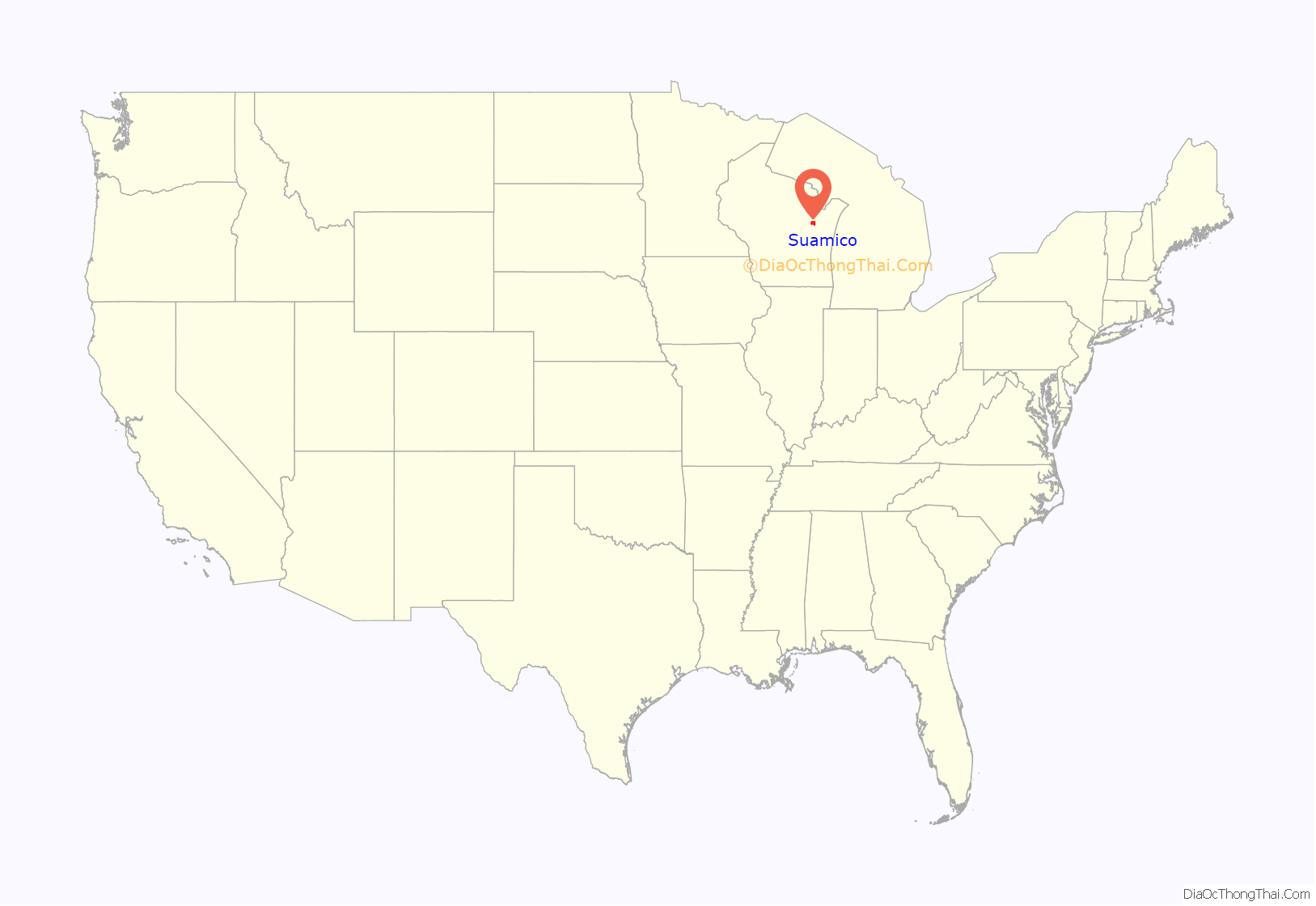
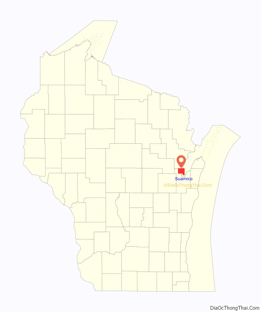
Suamico location map. Where is Suamico village?
History
“The Indian name Oussuamigong, now spelled Suamico, has several disputed meanings. Father Chrysostom Verwyst explains the meaning as ‘place of the yellow beaver.’ Father Jones translates it as ‘at the beaver’s tale.’ Rev. E.P. Wheeler of Ashland, whose study of the Wisconsin Indians has made him an authority, says it means ‘yellow residence place.’ It has also been accepted that it means ‘point or tail of land,’ or ‘the beaver’s tail,’ which suits us best.” It is believed the name comes from an Indian word meaning small or little beaver, although this has not been determined with certainty. The original settlement of Suamico was a small fishing community on Green Bay. Little evidence of it, apart from some small housing plots, remains.
Suamico is pronounced (swam ĭ kō). The name Suamico is believed to have come from the Menominee Indians which means: Mäte Sue’mako Tusi’niniu, “Great Sand Bar People,” on the sand dunes at what is now called Big Suamico, on Green Bay. Other sources also indicate that the name stands for: beaver tail, yellow beaver, or swan.
Big Suamico was the unofficial name for the river, township, and village called Suamico. It was used to distinguish themselves from the Little Suamico River and Township immediately north in Oconto County. The Suamico and Fort Howard Road was the first declared county road in Brown County laid out between Big Suamico and Fort Howard in 1849–1850. It followed a former Indian trail. The Suamico River flows generally eastward through Pittsfield and Suamico Townships into Green Bay.
Suamico was first established by Legislature on August 2, 1848, from Howard. It was apparently dropped when Oconto County was established on February 6, 1851. It was then re-established to its current size by the County Board on March 16, 1858. Suamico was an excellent farming country and raising stock was profitable. Industry of the 1850s and 1860s was milling and there were large sawmills along the Suamico River. The Suamico Post Office was established on July 20, 1857, with John Bruce as Postmaster. It was platted by John Bruce in 1873.
In a referendum in September 2003, the Town of Suamico voted to become incorporated, becoming the village of Suamico. The village is a bedroom community mostly developed since 1980.
Suamico Road Map
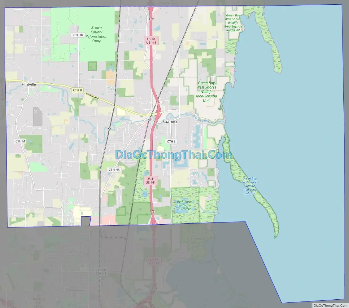
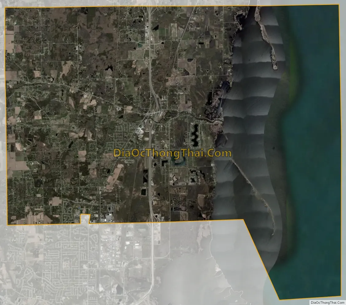
Suamico city Satellite Map
Geography
According to the United States Census Bureau, the village has a total area of 59.42 square miles (153.90 km), of which, 36.36 square miles (94.17 km) of it is land and 23.06 square miles (59.73 km) is water. Suamico is the largest “village” in the United States when both land area and water area are considered, since about 38.8 percent of its area is officially water area, but it drops down to fifth place when only land area is considered (following Kronenwetter, Wisconsin; Caledonia, Wisconsin; Wellington, Florida; and Speculator, New York).
Flintville
Flintville, a residential community in the village of Suamico, was named after Richard Flint, an early settler.
See also
Map of Wisconsin State and its subdivision:- Adams
- Ashland
- Barron
- Bayfield
- Brown
- Buffalo
- Burnett
- Calumet
- Chippewa
- Clark
- Columbia
- Crawford
- Dane
- Dodge
- Door
- Douglas
- Dunn
- Eau Claire
- Florence
- Fond du Lac
- Forest
- Grant
- Green
- Green Lake
- Iowa
- Iron
- Jackson
- Jefferson
- Juneau
- Kenosha
- Kewaunee
- La Crosse
- Lafayette
- Lake Michigan
- Lake Superior
- Langlade
- Lincoln
- Manitowoc
- Marathon
- Marinette
- Marquette
- Menominee
- Milwaukee
- Monroe
- Oconto
- Oneida
- Outagamie
- Ozaukee
- Pepin
- Pierce
- Polk
- Portage
- Price
- Racine
- Richland
- Rock
- Rusk
- Saint Croix
- Sauk
- Sawyer
- Shawano
- Sheboygan
- Taylor
- Trempealeau
- Vernon
- Vilas
- Walworth
- Washburn
- Washington
- Waukesha
- Waupaca
- Waushara
- Winnebago
- Wood
- Alabama
- Alaska
- Arizona
- Arkansas
- California
- Colorado
- Connecticut
- Delaware
- District of Columbia
- Florida
- Georgia
- Hawaii
- Idaho
- Illinois
- Indiana
- Iowa
- Kansas
- Kentucky
- Louisiana
- Maine
- Maryland
- Massachusetts
- Michigan
- Minnesota
- Mississippi
- Missouri
- Montana
- Nebraska
- Nevada
- New Hampshire
- New Jersey
- New Mexico
- New York
- North Carolina
- North Dakota
- Ohio
- Oklahoma
- Oregon
- Pennsylvania
- Rhode Island
- South Carolina
- South Dakota
- Tennessee
- Texas
- Utah
- Vermont
- Virginia
- Washington
- West Virginia
- Wisconsin
- Wyoming