Kronenwetter is a village in Marathon County, Wisconsin, United States. It is the largest village by land area (although Suamico is larger when its water area is added) in the state of Wisconsin, as well as in the entire United States, and the third-largest community by population in Marathon County. It is part of the Wausau, Wisconsin Metropolitan Statistical Area. As of the 2020 census, the population of Kronenwetter was 8,353.
The residential community of Evergreen is located in the village. Evergreen was a former census-designated place. The former unincorporated community of Peplin was also located in the town of Kronenwetter before its incorporation into a village.
| Name: | Kronenwetter village |
|---|---|
| LSAD Code: | 47 |
| LSAD Description: | village (suffix) |
| State: | Wisconsin |
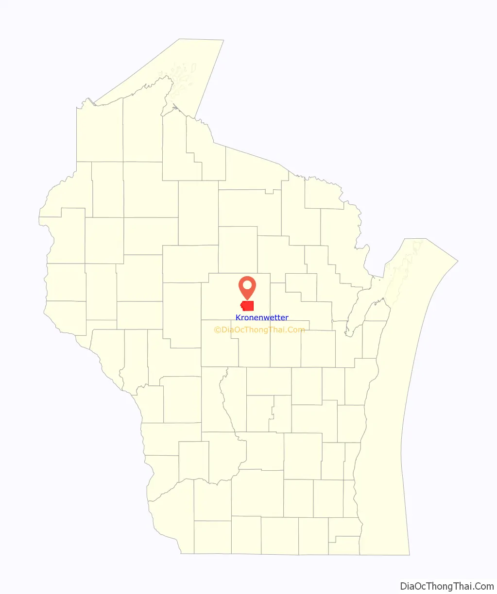
| County: | Marathon County |
| Elevation: | 1,198 ft (365 m) |
| Total Area: | 51.97 sq mi (134.61 km²) |
| Land Area: | 51.61 sq mi (133.66 km²) |
| Water Area: | 0.36 sq mi (0.95 km²) |
| Total Population: | 8,353 |
| Population Density: | 156.55/sq mi (60.44/km²) |
| ZIP code: | 54455 |
| Area code: | 715 & 534 |
| FIPS code: | 5540550 |
| GNISfeature ID: | 1583496 |
| Website: | www.kronenwetter.org |
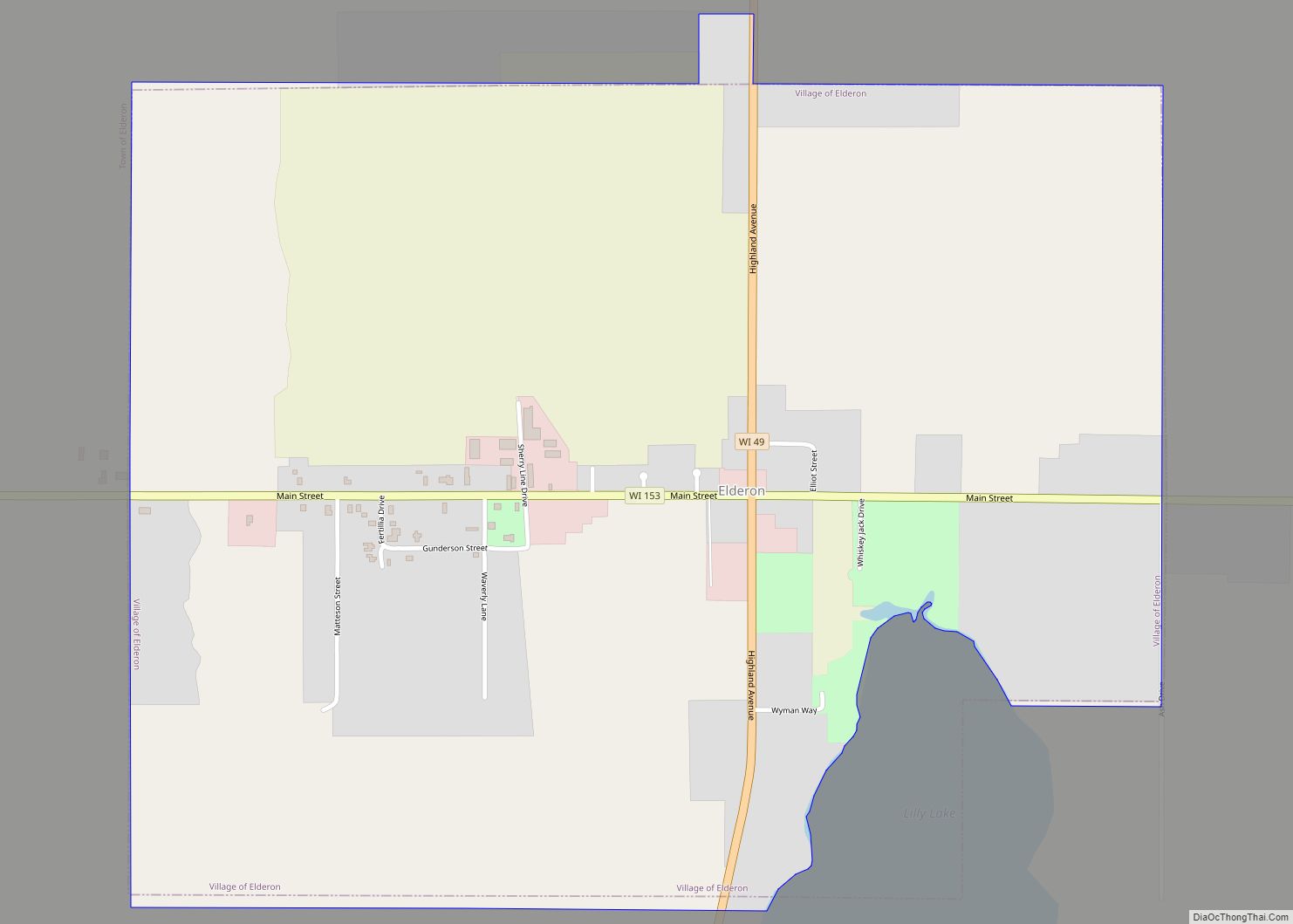
Online Interactive Map
Click on ![]() to view map in "full screen" mode.
to view map in "full screen" mode.
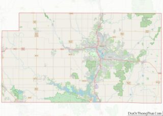
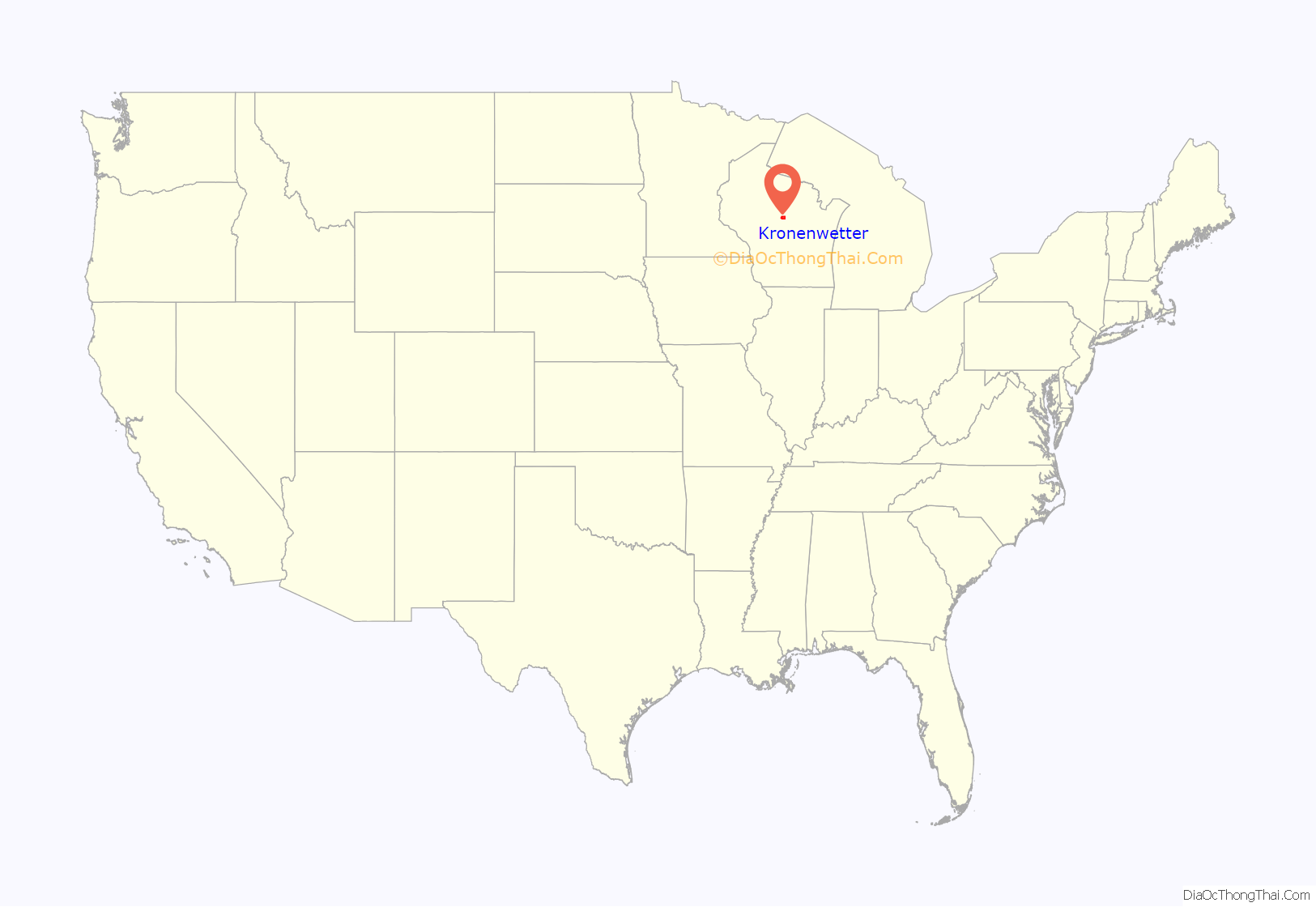
Kronenwetter location map. Where is Kronenwetter village?
History
Prior to the formation of the town of Kronenwetter, the area was composed of several small settlements. Around 1855, a Native American named Keeler dug a canal, rerouting the Bull Jr. Creek over a drop to power a small sawmill he built. Other buildings were built, and the area became known as Keelerville. In 1857, Sebastian Kronenwetter moved to the area and purchased the Keelerville sawmill, making it quite successful. In the years to follow, Kronenwetter continued his success, owning a hotel and building a sawmill in what is now the city of Mosinee. In 1885, he was elected to the Wisconsin State Assembly.
On November 11, 1886, the eastern section of the town of Mosinee was formed into a new town known as Kronenwetter. In 1902, Sebastian Kronenwetter died and was buried in the Mosinee cemetery.
Kronenwetter expanded around 1910 when the Worzella brothers purchased 26,000 acres (110 km) of land and built the Polish community of Peplin near the intersection of County Highway X and East State Highway 153. The brothers constructed a sawmill, store, office, blacksmith shop, and living quarters for the workers. To advertise their new community, the brothers printed brochures describing the area in Polish and sent them to major cities in the United States. They also put advertisements in Polish-language newspapers in those cities. To entice the Polish people to come, the brochures included pictures of beautiful farms, including buildings and livestock. Among the first to arrive were Vince Ruzga, Albert Wonsil and Alex Dyda. The Worzella brothers built homes for the settlers starting from $350 for a three-room house and $450 for a five-room house. The sawmill eventually was shut down, but others were built in the area and were supported by the community, as the lumber was needed for homes. The sawmills ceased operation in 1930. During those years, schools were built throughout the town and population expanded.
In the election of November 5, 2002, the residents chose by a referendum to create the Village of Kronenwetter from most of the town; this became effective on November 20. The first village board of trustees was sworn into office on January 13, 2003. On February 24, 2003, the village annexed the remainder of the town, dissolving the town as a legal entity.
Residents of Kronenwetter use the postal zip code of 54455 for the nearby city of Mosinee, though Kronenwetter has a larger population than Mosinee. In the spring of 2010, residents were surveyed by the US Postal Service to see whether residents would like to be able to use “Kronenwetter, WI 54455” as a valid address, and a majority of residents voted yes. The joint 54455 zip code went into effect in mid-2010.
Kronenwetter Road Map
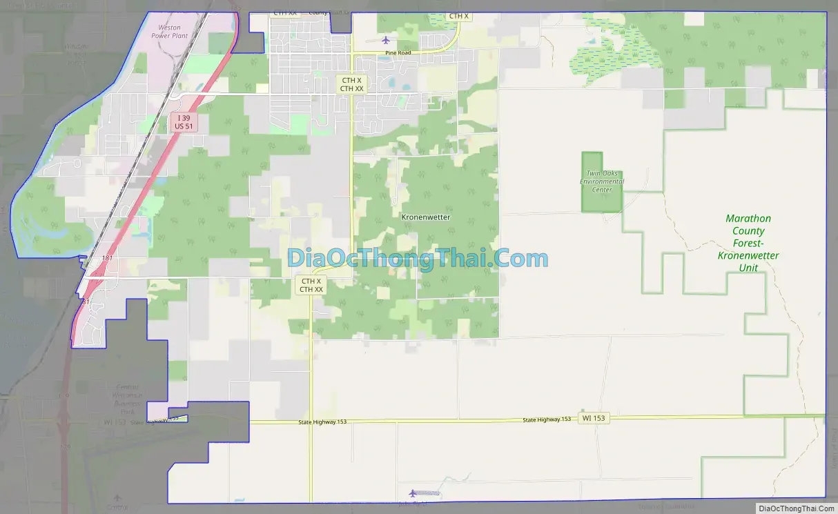
Kronenwetter city Satellite Map

Geography
According to the United States Census Bureau, the village has a total area of 52.06 square miles (134.83 km), of which, 51.70 square miles (133.90 km) of it is land and 0.36 square miles (0.93 km) is water. This makes the village of Kronenwetter the largest village in Wisconsin.
Major highways
- U.S. Highway 51
- Interstate 39
- Highway 153 (Wisconsin)
See also
Map of Wisconsin State and its subdivision:- Adams
- Ashland
- Barron
- Bayfield
- Brown
- Buffalo
- Burnett
- Calumet
- Chippewa
- Clark
- Columbia
- Crawford
- Dane
- Dodge
- Door
- Douglas
- Dunn
- Eau Claire
- Florence
- Fond du Lac
- Forest
- Grant
- Green
- Green Lake
- Iowa
- Iron
- Jackson
- Jefferson
- Juneau
- Kenosha
- Kewaunee
- La Crosse
- Lafayette
- Lake Michigan
- Lake Superior
- Langlade
- Lincoln
- Manitowoc
- Marathon
- Marinette
- Marquette
- Menominee
- Milwaukee
- Monroe
- Oconto
- Oneida
- Outagamie
- Ozaukee
- Pepin
- Pierce
- Polk
- Portage
- Price
- Racine
- Richland
- Rock
- Rusk
- Saint Croix
- Sauk
- Sawyer
- Shawano
- Sheboygan
- Taylor
- Trempealeau
- Vernon
- Vilas
- Walworth
- Washburn
- Washington
- Waukesha
- Waupaca
- Waushara
- Winnebago
- Wood
- Alabama
- Alaska
- Arizona
- Arkansas
- California
- Colorado
- Connecticut
- Delaware
- District of Columbia
- Florida
- Georgia
- Hawaii
- Idaho
- Illinois
- Indiana
- Iowa
- Kansas
- Kentucky
- Louisiana
- Maine
- Maryland
- Massachusetts
- Michigan
- Minnesota
- Mississippi
- Missouri
- Montana
- Nebraska
- Nevada
- New Hampshire
- New Jersey
- New Mexico
- New York
- North Carolina
- North Dakota
- Ohio
- Oklahoma
- Oregon
- Pennsylvania
- Rhode Island
- South Carolina
- South Dakota
- Tennessee
- Texas
- Utah
- Vermont
- Virginia
- Washington
- West Virginia
- Wisconsin
- Wyoming