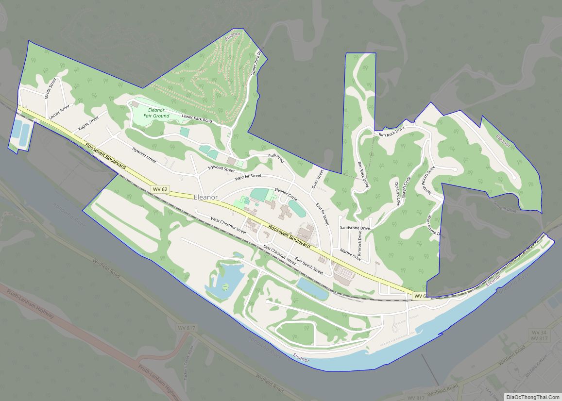
Eleanor is a town in Putnam County, West Virginia, United States, along the Kanawha River. Its population was 1,548 at the 2020 census. It is part of the Huntington–Ashland metropolitan area. The town, named for Eleanor Roosevelt, was established as a New Deal project in the 1930s like other Franklin D. Roosevelt towns around the nation (e.g. Greenbelt, Greenhills, Greendale, Hanford, or Norris).
| Name: | Eleanor town |
|---|---|
| LSAD Code: | 43 |
| LSAD Description: | town (suffix) |
| State: | West Virginia |
| County: | Putnam County |
| Elevation: | 604 ft (184 m) |
| Total Area: | 2.13 sq mi (5.51 km²) |
| Land Area: | 2.12 sq mi (5.50 km²) |
| Water Area: | 0.01 sq mi (0.01 km²) |
| Total Population: | 1,548 |
| Population Density: | 747.88/sq mi (288.78/km²) |
| ZIP code: | 25070 |
| Area code: | 304 |
| FIPS code: | 5424292 |
| GNISfeature ID: | 1538590 |
| Website: | eleanorwv.com |
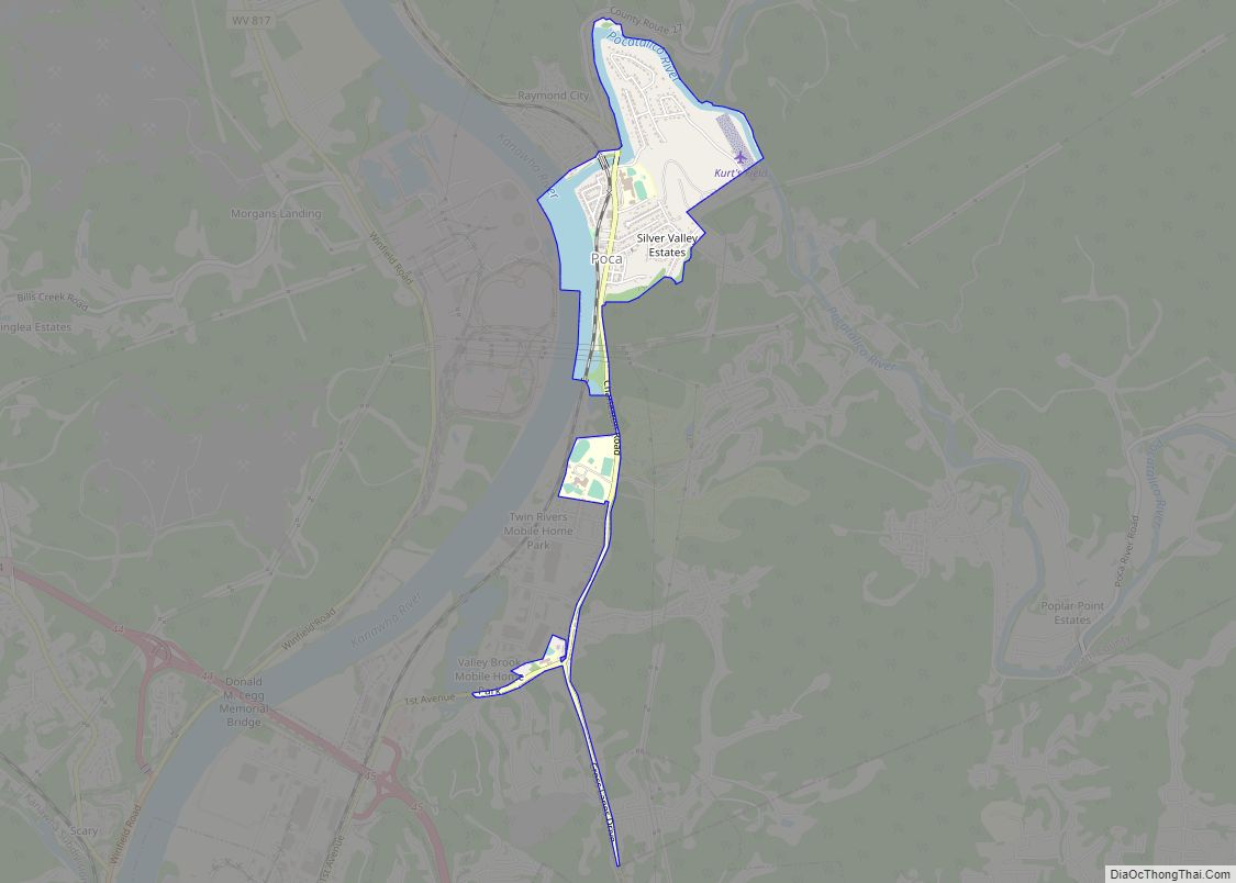
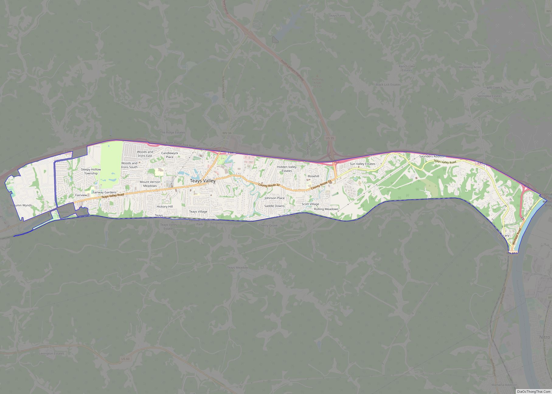
Online Interactive Map
Click on ![]() to view map in "full screen" mode.
to view map in "full screen" mode.
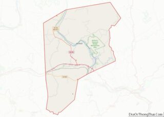
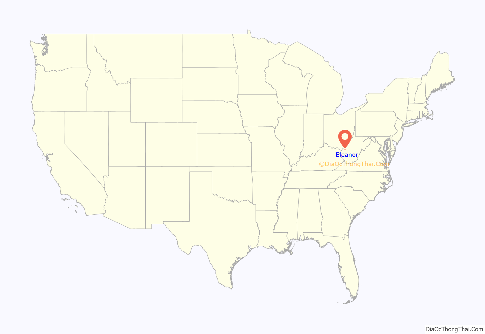
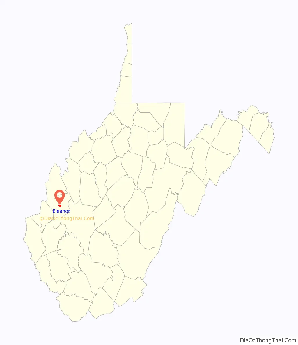
Eleanor location map. Where is Eleanor town?
History
Eleanor was established in 1934, when President Franklin D. Roosevelt and First Lady Eleanor visited the county and developed it as a test site for families. It was one of three resettlement communities in West Virginia, the others being Arthurdale and Tygart Valley. When the town was developed, the houses were built to look very similar to one another and are now referred to as old Eleanor houses. There are three schools in Eleanor: George Washington Elementary School, George Washington Middle School and the Putnam County Career and Technical Center.
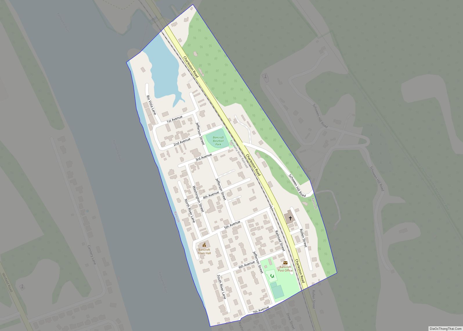
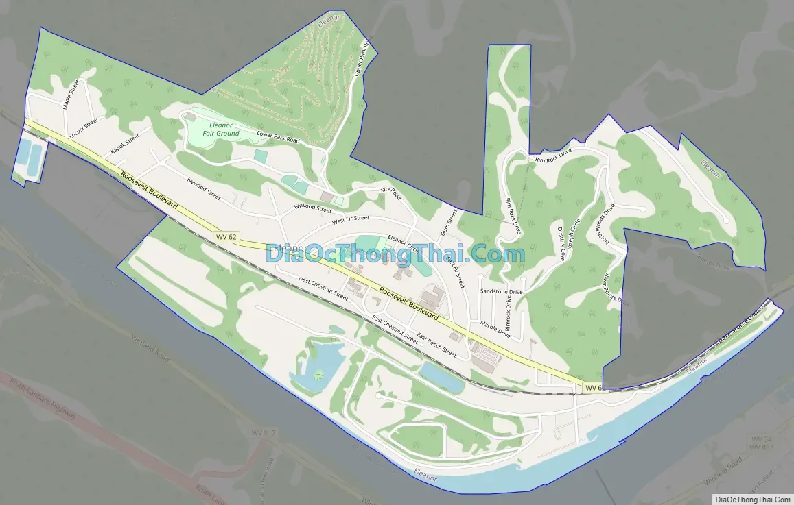
Eleanor Road Map
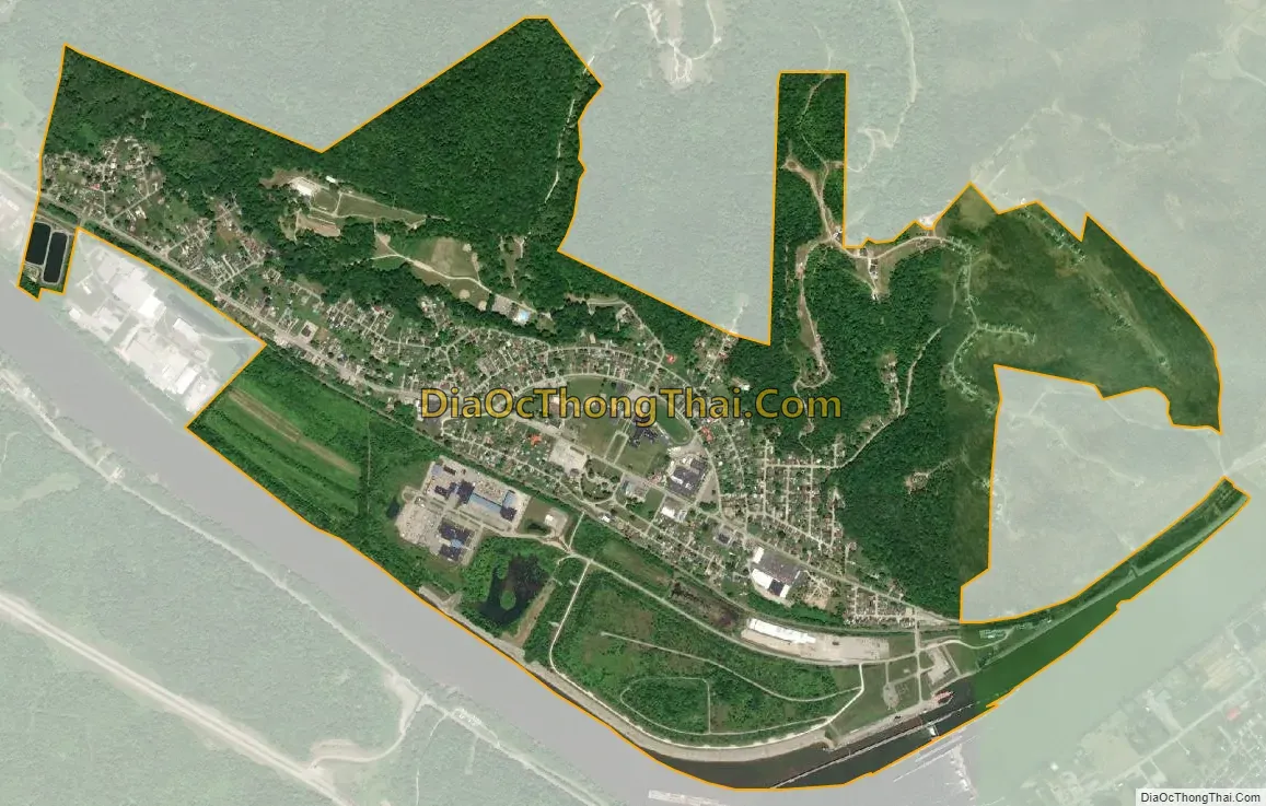
Eleanor city Satellite Map
Geography
Eleanor is located at 38°32′21″N 81°55′52″W / 38.53917°N 81.93111°W / 38.53917; -81.93111 (38.539037, -81.931046).
According to the United States Census Bureau, the town has a total area of 2.13 square miles (5.52 km), of which 2.12 square miles (5.49 km) is land and 0.01 square miles (0.03 km) is water.
Climate
The climate in this area is characterized by relatively high temperatures and evenly distributed precipitation throughout the year. According to the Köppen Climate Classification system, Eleanor has a Humid subtropical climate, abbreviated “Cfa” on climate maps.
See also
Map of West Virginia State and its subdivision:- Barbour
- Berkeley
- Boone
- Braxton
- Brooke
- Cabell
- Calhoun
- Clay
- Doddridge
- Fayette
- Gilmer
- Grant
- Greenbrier
- Hampshire
- Hancock
- Hardy
- Harrison
- Jackson
- Jefferson
- Kanawha
- Lewis
- Lincoln
- Logan
- Marion
- Marshall
- Mason
- McDowell
- Mercer
- Mineral
- Mingo
- Monongalia
- Monroe
- Morgan
- Nicholas
- Ohio
- Pendleton
- Pleasants
- Pocahontas
- Preston
- Putnam
- Raleigh
- Randolph
- Ritchie
- Roane
- Summers
- Taylor
- Tucker
- Tyler
- Upshur
- Wayne
- Webster
- Wetzel
- Wirt
- Wood
- Wyoming
- Alabama
- Alaska
- Arizona
- Arkansas
- California
- Colorado
- Connecticut
- Delaware
- District of Columbia
- Florida
- Georgia
- Hawaii
- Idaho
- Illinois
- Indiana
- Iowa
- Kansas
- Kentucky
- Louisiana
- Maine
- Maryland
- Massachusetts
- Michigan
- Minnesota
- Mississippi
- Missouri
- Montana
- Nebraska
- Nevada
- New Hampshire
- New Jersey
- New Mexico
- New York
- North Carolina
- North Dakota
- Ohio
- Oklahoma
- Oregon
- Pennsylvania
- Rhode Island
- South Carolina
- South Dakota
- Tennessee
- Texas
- Utah
- Vermont
- Virginia
- Washington
- West Virginia
- Wisconsin
- Wyoming