Florida is a state in the Southeastern region of the United States, bordered to the west by the Gulf of Mexico; Alabama to the northwest; Georgia to the north; the Bahamas and Atlantic Ocean to the east; and the Straits of Florida and Cuba to the south. It is the only state that borders both the Gulf of Mexico and the Atlantic Ocean. With a population exceeding 21 million, it is the third-most populous state in the nation as of 2020. It spans 65,758 square miles (170,310 km), ranking 22nd in area among the 50 states. The Miami metropolitan area, anchored by the cities of Miami, Fort Lauderdale, and West Palm Beach, is the state’s largest metropolitan area with a population of 6.138 million, and the state’s most-populous city is Jacksonville with a population of 949,611. Florida’s other major population centers include Tampa Bay, Orlando, Cape Coral, and the state capital of Tallahassee.
Various Native American groups have inhabited Florida for at least 14,000 years. In 1513, Spanish explorer Juan Ponce de León became the first known European to make landfall, calling the region La Florida ([la floˈɾiða] for its lush greenery and the Easter season (Pascua Florida in Spanish). Florida subsequently became the first area in the continental U.S. to be permanently settled by Europeans, with the Spanish colony of St. Augustine, founded in 1565, being the oldest continuously inhabited city. Florida was repeatedly contested by Spain and Great Britain before being ceded to the U.S. in 1819; it was admitted as the 27th state on March 3, 1845. Florida was the principal location of the Seminole Wars (1816–1858), the longest and most extensive of the Indian Wars in U.S. history. The state seceded from the Union on January 10, 1861, becoming one of the seven original Confederate States, and was readmitted to the Union after the Civil War on June 25, 1868.
Since the mid-20th century, Florida has experienced rapid demographic and economic growth. Its economy, with a gross state product (GSP) of $1.4 trillion, is the fourth-largest of any U.S. state and the 16th-largest in the world; the main sectors are tourism, hospitality, agriculture, real estate, and transportation. Florida is world-renowned for its beach resorts, amusement parks, warm and sunny climate, and nautical recreation; attractions such as Walt Disney World, the Kennedy Space Center, and Miami Beach draw tens of millions of visitors annually. Florida is a popular destination for retirees, seasonal vacationers, and both domestic and international migrants; it hosts nine out of the ten fastest-growing communities in the U.S. The state’s close proximity to the ocean has shaped its culture, identity, and daily life; its colonial history and successive waves of migration are reflected in African, European, Indigenous, Latino, and Asian influences. Florida has attracted or inspired some of the most prominent American writers, including Ernest Hemingway, Marjorie Kinnan Rawlings, and Tennessee Williams, and continues to attract celebrities and athletes, particularly in golf, tennis, auto racing, and water sports. Florida has been considered a battleground state in American presidential elections, particularly those in 2000, 2016, and 2020.
About two-thirds of Florida occupies a peninsula between the Gulf of Mexico and the Atlantic Ocean. It has the longest coastline in the contiguous United States, spanning approximately 1,350 miles (2,170 km), not including its many barrier islands. Florida has 4,510 islands that are ten acres (4.0 hectares) or larger in area, the second-largest of any state after Alaska. Much of Florida is at or near sea level, and is characterized by sedimentary soil. Florida is the flattest state in the country, with the lowest high point of any U.S. state, at just 345 feet (105 meters). Florida’s largest freshwater lake, Lake Okeechobee, is the second-largest located entirely within the contiguous 48 states and often referred to as an inland sea. Several beaches in Florida have turquoise and emerald-colored coastal waters.
Florida’s climate varies from subtropical in the north to tropical in the south. It is the only state besides Hawaii to have a tropical climate, and is the only continental state with both a tropical climate, located at the southern portion of the state, and a coral reef. Florida has several unique ecosystems, including Everglades National Park, the largest tropical wilderness in the U.S. and among the largest in the Americas. Unique wildlife include the American alligator, American crocodile, American flamingo, Roseate spoonbill, Florida panther, bottlenose dolphin, and manatee. The Florida Reef is the only living coral barrier reef in the continental United States, and the third-largest coral barrier reef system in the world after the Great Barrier Reef, and Belize Barrier Reef.
| Before statehood: | Florida Territory |
|---|---|
| Admitted to the Union: | March 3, 1845; 178 years ago (1845-03-03) (27th) |
| Capital: | Tallahassee |
| Largest city: | Jacksonville |
| Largest metro and urban areas: | Miami |
| Elevation: | 100 ft (30 m) |
| Total Area: | 65,758 sq mi (170,312 km) |
| Area Rank: | 22nd |
| Total Population: | 22,244,823 |
| Population Rank: | 3rd |
| Population Density: | 414.8/sq mi (160/km) |
| Population Density Rank: | 8th |
| Median Household Income: | $57,700 |
| Income Rank: | 34th |
| Demonym(s): | Floridian, Floridan |
| USPS abbreviation: | FL |
| ISO 3166 code: | US-FL |
| Website: | myflorida.com |
Online Interactive Map
Click on ![]() to view map in "full screen" mode.
to view map in "full screen" mode.
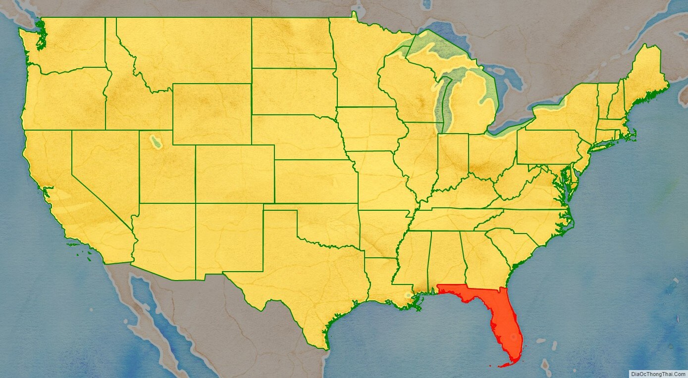
Florida location map. Where is Florida state?
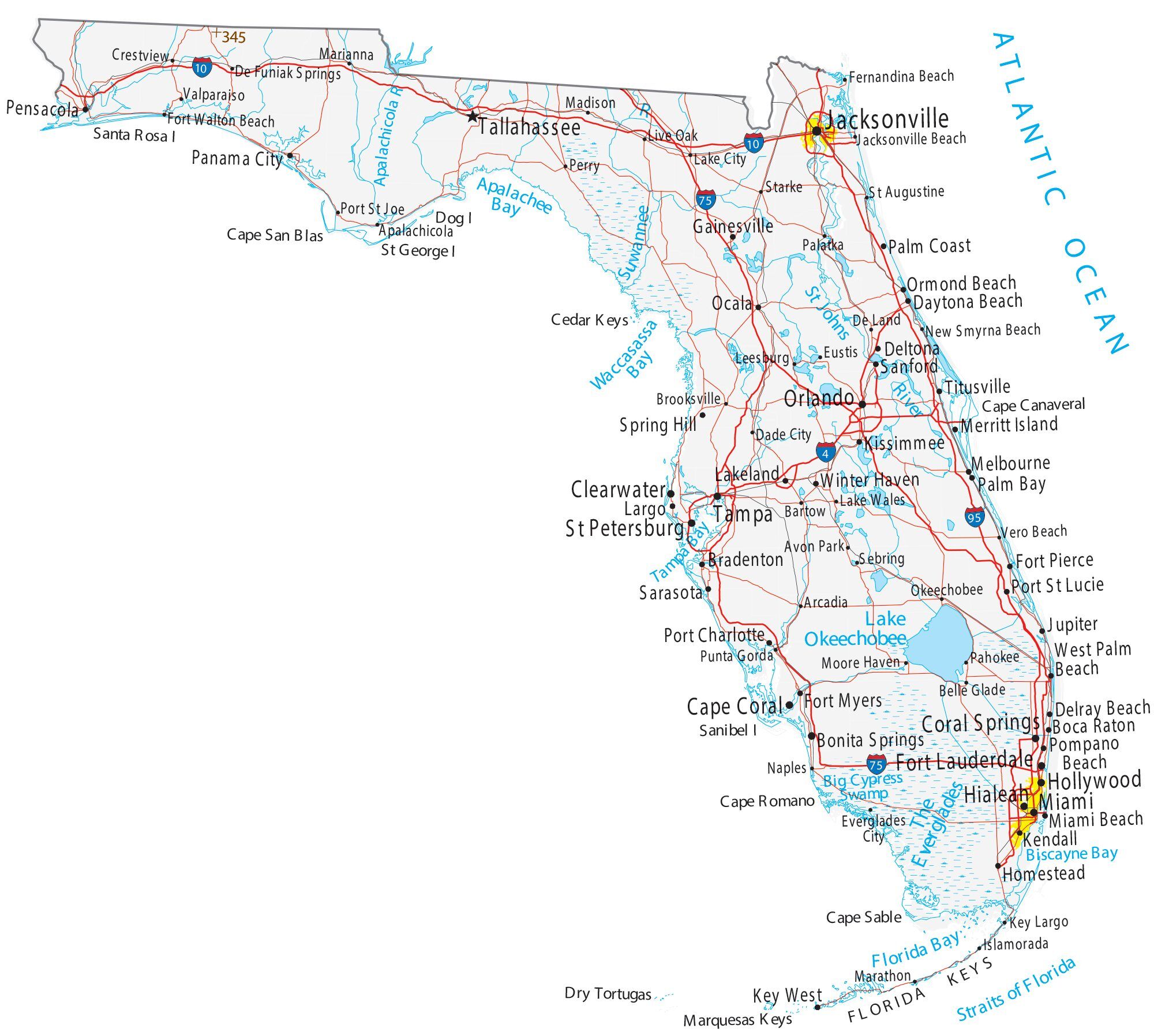
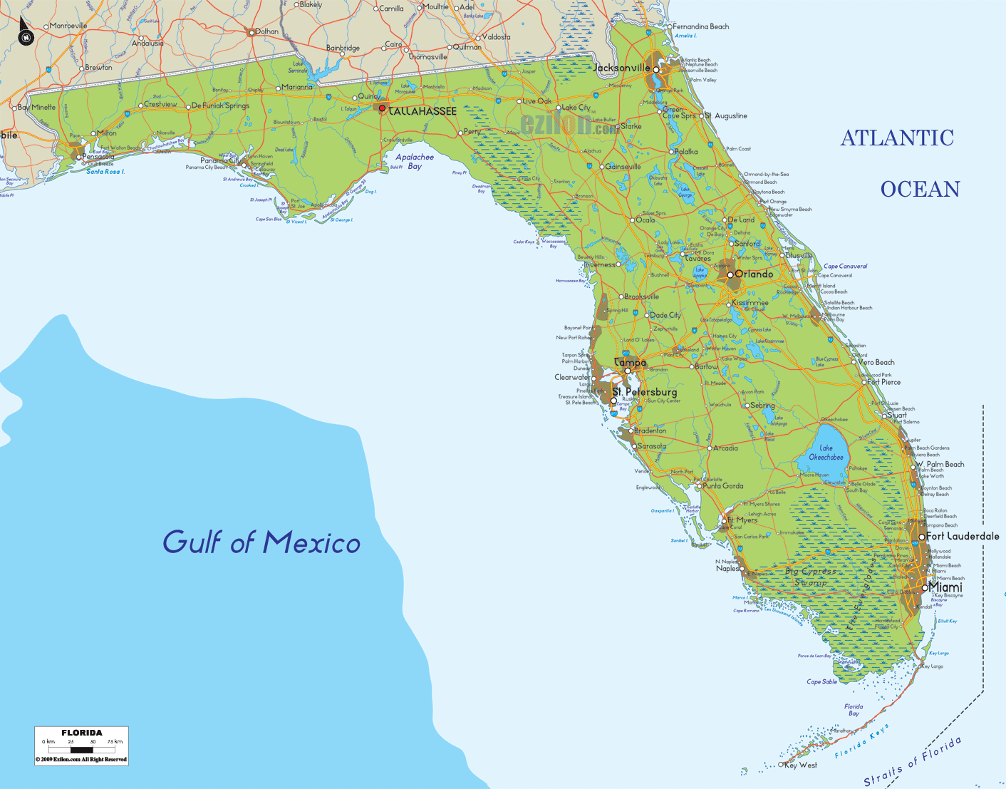
Florida Road Map
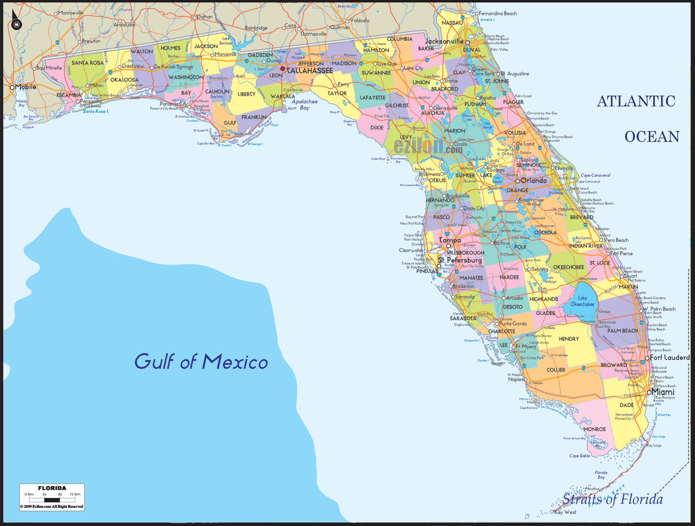
Florida Map – Roads & Cities
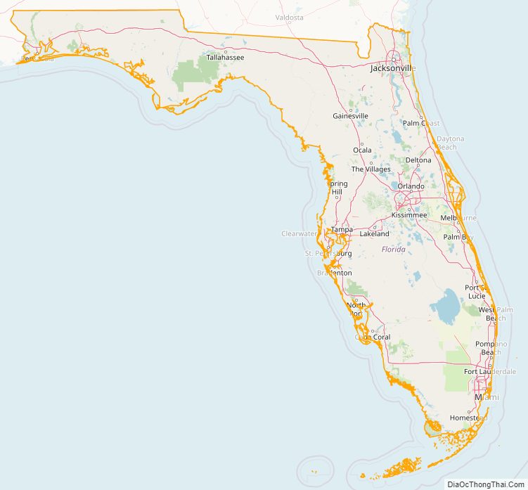
Florida Street Map
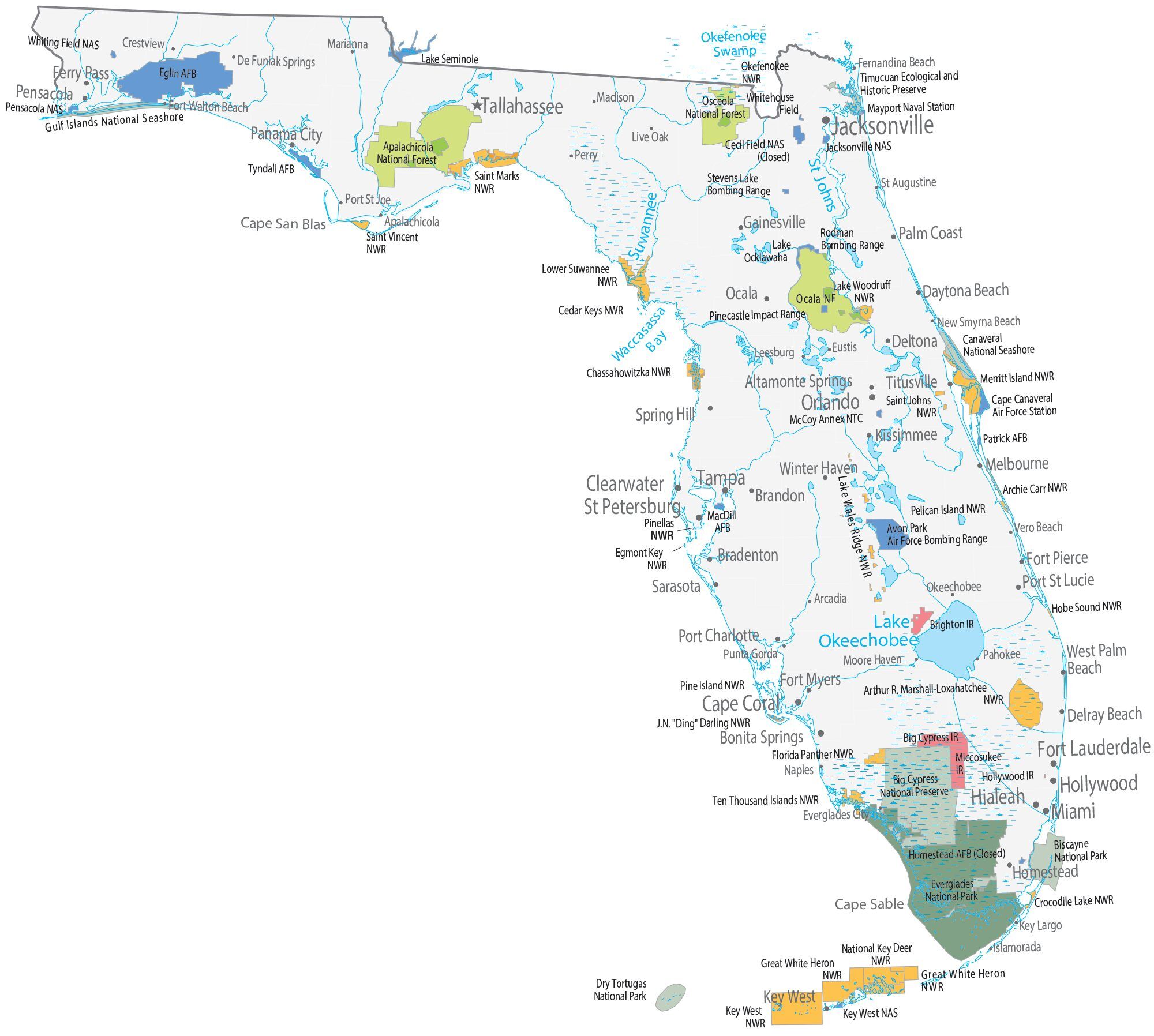
Florida State Map – Places and Landmarks
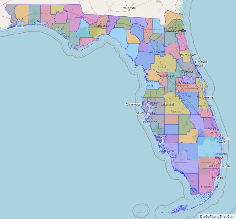
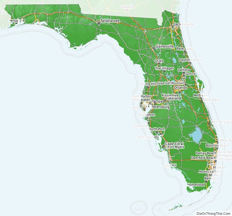
Florida Political Map
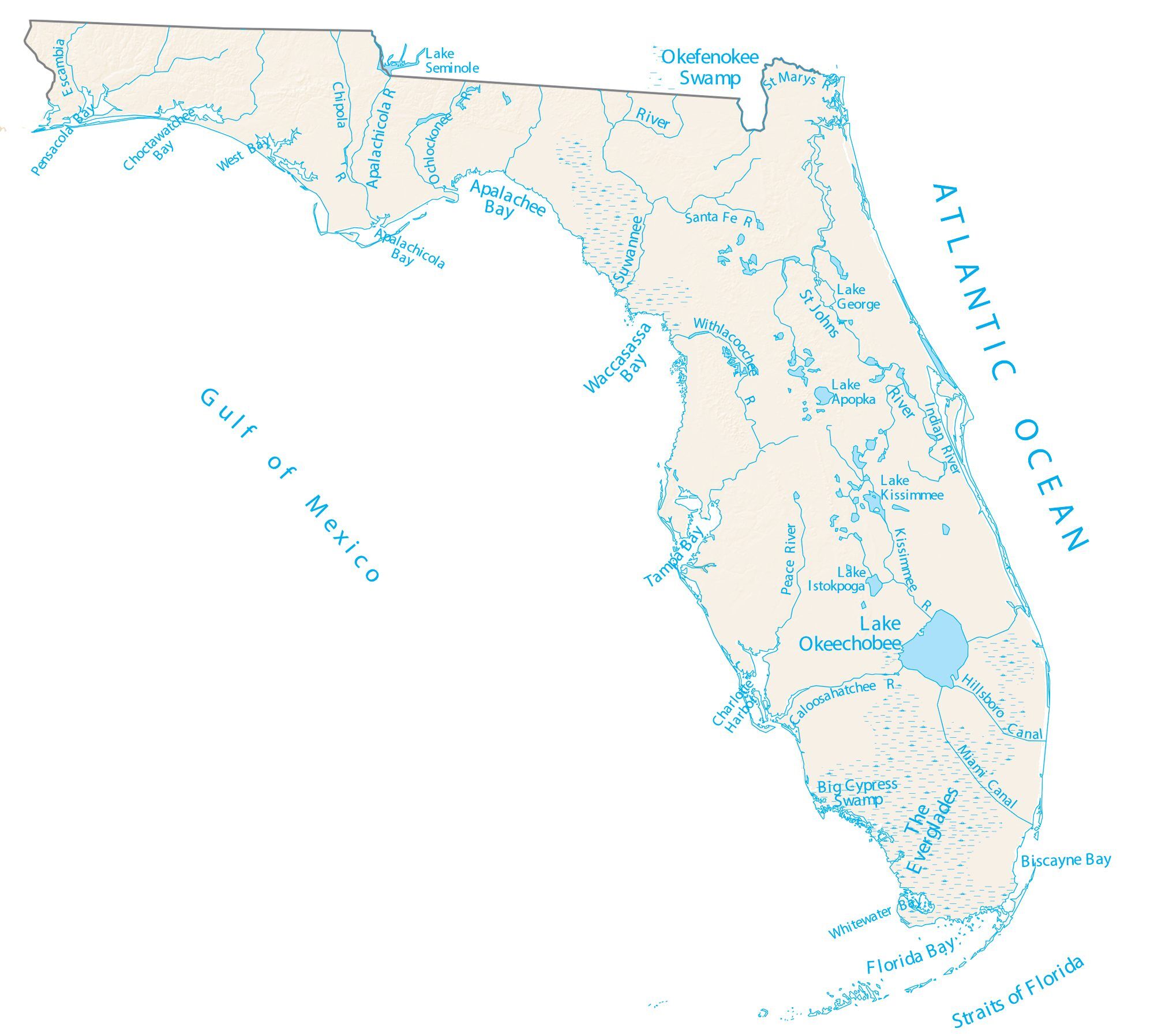
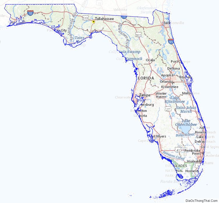
Florida Lakes and Rivers Map
Florida Physical Map
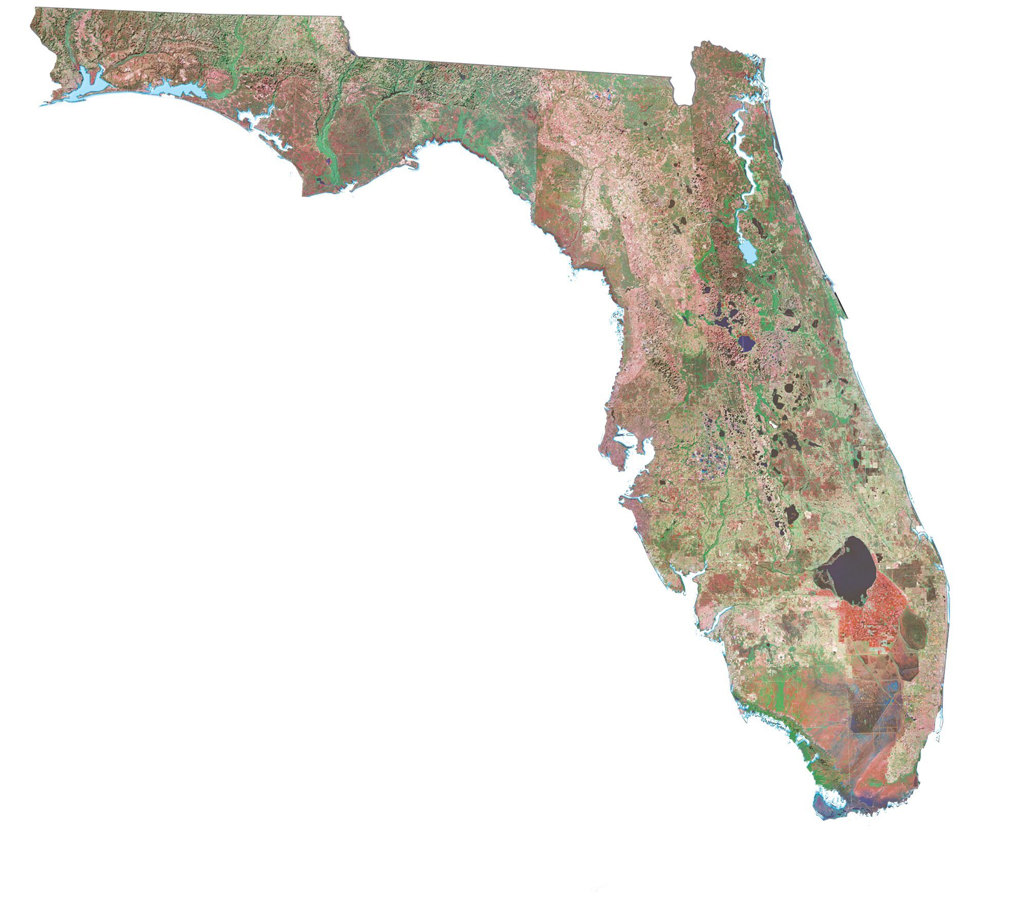
Florida Topographic Map
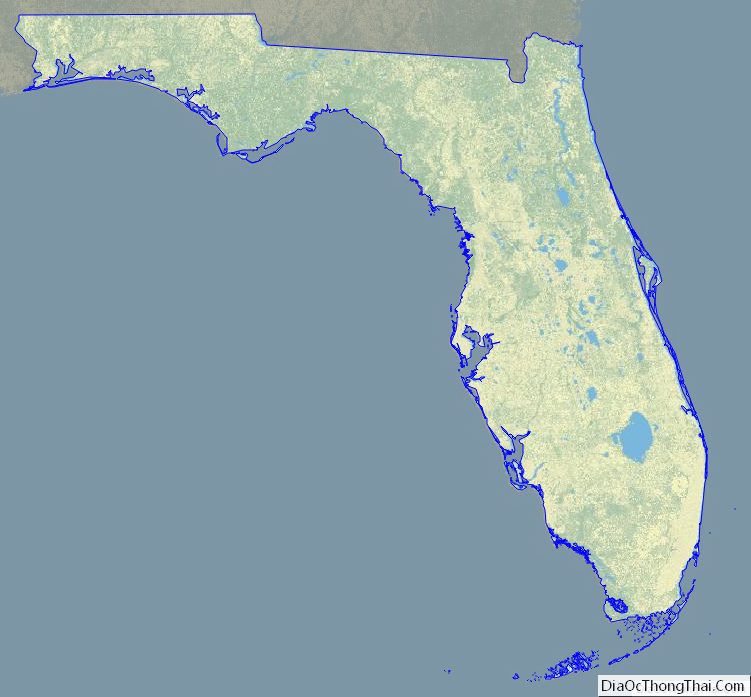
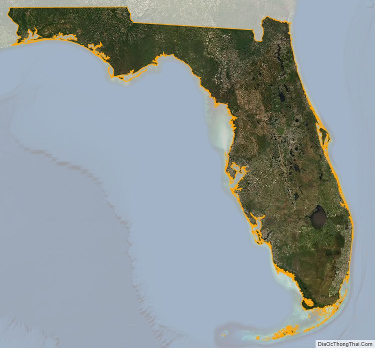
Florida Satellite Map
Others printable maps
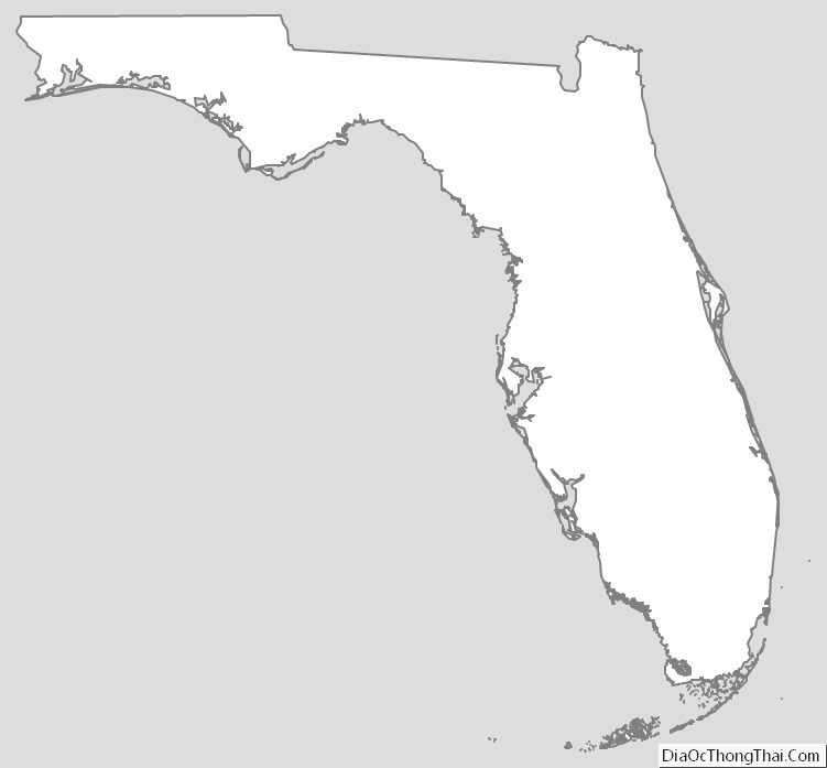
Florida Outline Map
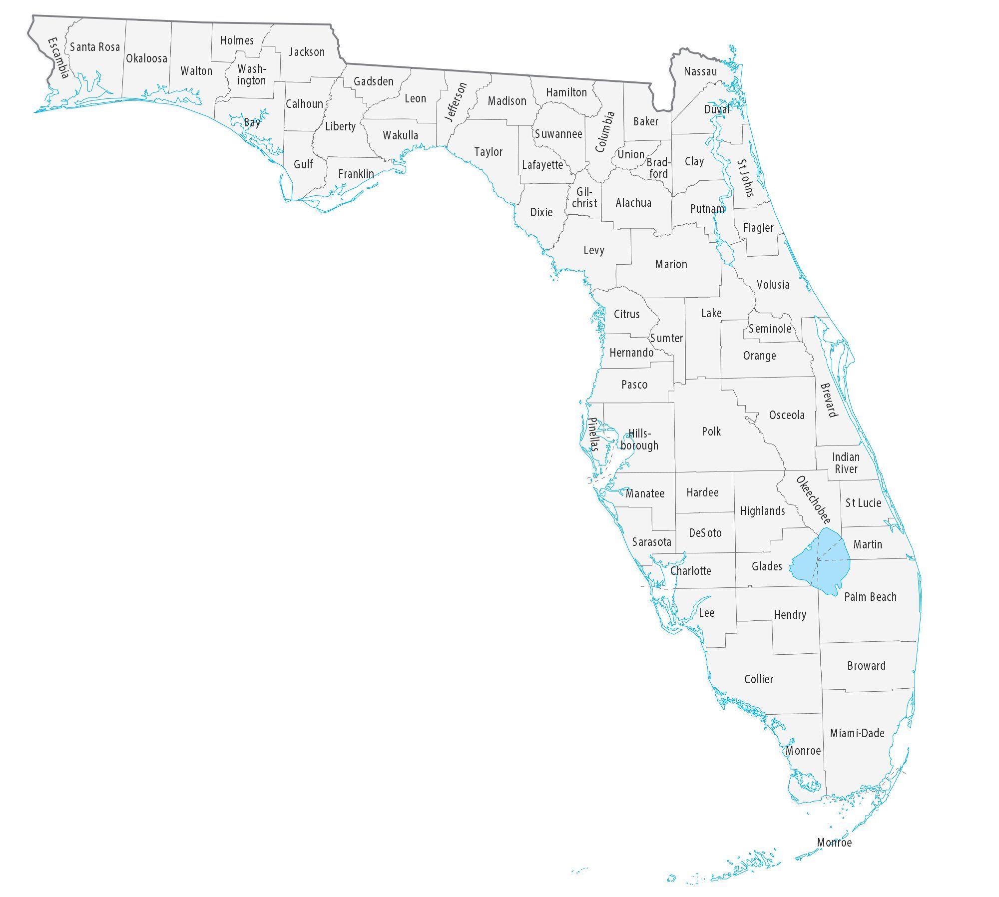
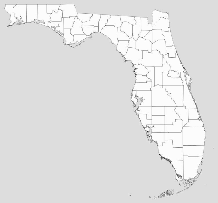
Blank Florida County Map
See also
Map of Florida State and its subdivision:- Alachua
- Baker
- Bay
- Bradford
- Brevard
- Broward
- Calhoun
- Charlotte
- Citrus
- Clay
- Collier
- Columbia
- Desoto
- Dixie
- Duval
- Escambia
- Flagler
- Franklin
- Gadsden
- Gilchrist
- Glades
- Gulf
- Hamilton
- Hardee
- Hendry
- Hernando
- Highlands
- Hillsborough
- Holmes
- Indian River
- Jackson
- Jefferson
- Lafayette
- Lake
- Lee
- Leon
- Levy
- Liberty
- Madison
- Manatee
- Marion
- Martin
- Miami-Dade
- Monroe
- Nassau
- Okaloosa
- Okeechobee
- Orange
- Osceola
- Palm Beach
- Pasco
- Pinellas
- Polk
- Putnam
- Saint Johns
- Saint Lucie
- Santa Rosa
- Sarasota
- Seminole
- Sumter
- Suwannee
- Taylor
- Union
- Volusia
- Wakulla
- Walton
- Washington
- Alabama
- Alaska
- Arizona
- Arkansas
- California
- Colorado
- Connecticut
- Delaware
- District of Columbia
- Florida
- Georgia
- Hawaii
- Idaho
- Illinois
- Indiana
- Iowa
- Kansas
- Kentucky
- Louisiana
- Maine
- Maryland
- Massachusetts
- Michigan
- Minnesota
- Mississippi
- Missouri
- Montana
- Nebraska
- Nevada
- New Hampshire
- New Jersey
- New Mexico
- New York
- North Carolina
- North Dakota
- Ohio
- Oklahoma
- Oregon
- Pennsylvania
- Rhode Island
- South Carolina
- South Dakota
- Tennessee
- Texas
- Utah
- Vermont
- Virginia
- Washington
- West Virginia
- Wisconsin
- Wyoming


