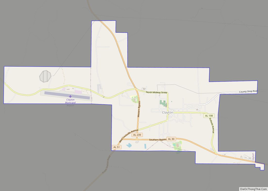
Clayton is a town in and the county seat of Barbour County, Alabama, United States. The population was 3,008 at the 2010 census, up from 1,475 in 2000.
| Name: | Clayton town |
|---|---|
| LSAD Code: | 43 |
| LSAD Description: | town (suffix) |
| State: | Alabama |
| County: | Barbour County |
| Elevation: | 591 ft (180 m) |
| Total Area: | 6.78 sq mi (17.55 km²) |
| Land Area: | 6.78 sq mi (17.55 km²) |
| Water Area: | 0.00 sq mi (0.00 km²) |
| Total Population: | 2,265 |
| Population Density: | 334.27/sq mi (129.06/km²) |
| ZIP code: | 36016 |
| Area code: | 334 |
| FIPS code: | 0115376 |
| GNISfeature ID: | 0116206 |
Online Interactive Map
Click on ![]() to view map in "full screen" mode.
to view map in "full screen" mode.
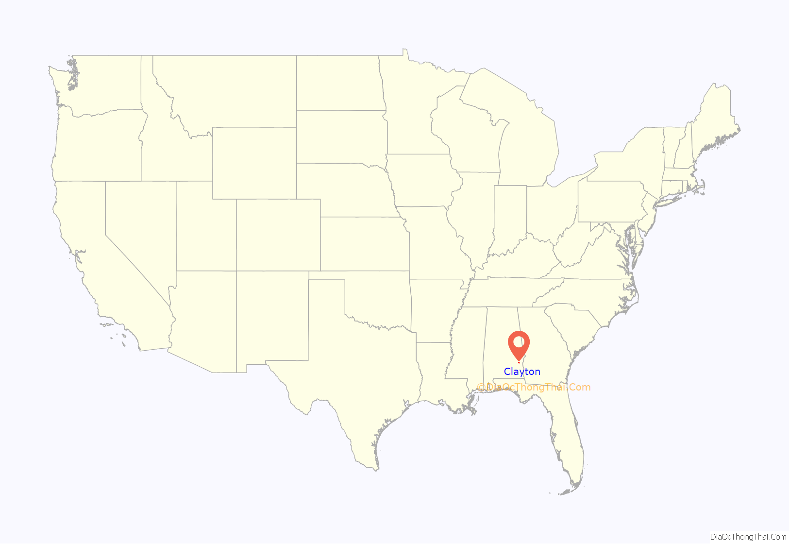
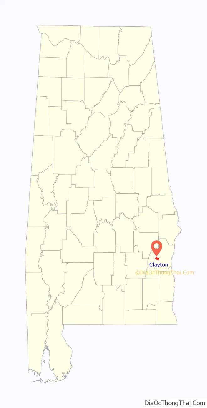
Clayton location map. Where is Clayton town?
History
Clayton has been the county seat since 1834, two years after the creation of Barbour County. Clayton is located geographically in the center of the county. The town was located at the headwaters of the Pea and Choctawhatchee rivers on the historic road from Hobdy’s Bridge over the Pea River to Eufaula on the Chattahoochee River. By 1818, there were a few settlers in the area around Clayton, but settlement began in earnest around 1823. The town was named for Augustine S. Clayton, a Georgia jurist and congressman. Clayton became the county seat of Barbour County in 1833 and was laid out on a central courthouse square plan. The first Circuit Court was held in Clayton on September 23, 1833. The Clayton post office was established in September 1835 with John F. Keener as postmaster. Clayton, with a population of 200, was incorporated on December 21, 1841, by the Alabama Legislature. Its first mayor, after incorporation, was John Jackson.
Clayton has a rich heritage with four properties listed on the National Register of Historic Places. It is also known for its Whiskey Bottle Tombstone, which was featured in Ripley’s Believe It or Not!.
Governor George Wallace was born in nearby Clio and began his legal and political career in Clayton. In March 1956, Wallace attended at the Clayton football stadium the first public meeting of the Barbour County White Citizens’ Council, with an estimated 4,500 persons attending the white supremacist rally, “the largest rally in the history of the county seat.”
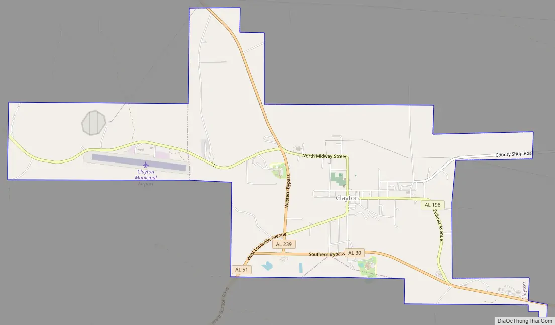
Clayton Road Map
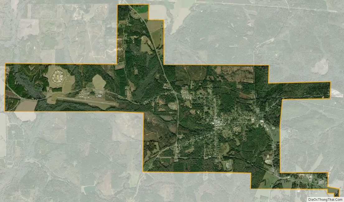
Clayton city Satellite Map
Geography
Clayton is located at 31°52’39.014″ North, 85°26’56.486″ West (31.877504, -85.449024).
According to the U.S. Census Bureau, the town has a total area of 6.7 square miles (17.3 km), all land.
See also
Map of Alabama State and its subdivision:- Autauga
- Baldwin
- Barbour
- Bibb
- Blount
- Bullock
- Butler
- Calhoun
- Chambers
- Cherokee
- Chilton
- Choctaw
- Clarke
- Clay
- Cleburne
- Coffee
- Colbert
- Conecuh
- Coosa
- Covington
- Crenshaw
- Cullman
- Dale
- Dallas
- De Kalb
- Elmore
- Escambia
- Etowah
- Fayette
- Franklin
- Geneva
- Greene
- Hale
- Henry
- Houston
- Jackson
- Jefferson
- Lamar
- Lauderdale
- Lawrence
- Lee
- Limestone
- Lowndes
- Macon
- Madison
- Marengo
- Marion
- Marshall
- Mobile
- Monroe
- Montgomery
- Morgan
- Perry
- Pickens
- Pike
- Randolph
- Russell
- Saint Clair
- Shelby
- Sumter
- Talladega
- Tallapoosa
- Tuscaloosa
- Walker
- Washington
- Wilcox
- Winston
- Alabama
- Alaska
- Arizona
- Arkansas
- California
- Colorado
- Connecticut
- Delaware
- District of Columbia
- Florida
- Georgia
- Hawaii
- Idaho
- Illinois
- Indiana
- Iowa
- Kansas
- Kentucky
- Louisiana
- Maine
- Maryland
- Massachusetts
- Michigan
- Minnesota
- Mississippi
- Missouri
- Montana
- Nebraska
- Nevada
- New Hampshire
- New Jersey
- New Mexico
- New York
- North Carolina
- North Dakota
- Ohio
- Oklahoma
- Oregon
- Pennsylvania
- Rhode Island
- South Carolina
- South Dakota
- Tennessee
- Texas
- Utah
- Vermont
- Virginia
- Washington
- West Virginia
- Wisconsin
- Wyoming