Five Points is a town in Chambers County, Alabama, United States. At the 2020 census, the population was 114.
| Name: | Five Points town |
|---|---|
| LSAD Code: | 43 |
| LSAD Description: | town (suffix) |
| State: | Alabama |
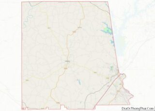
| County: | Chambers County |
| Elevation: | 869 ft (265 m) |
| Total Area: | 1.03 sq mi (2.67 km²) |
| Land Area: | 1.03 sq mi (2.67 km²) |
| Water Area: | 0.00 sq mi (0.00 km²) |
| Total Population: | 114 |
| Population Density: | 110.68/sq mi (42.74/km²) |
| ZIP code: | 36855 |
| Area code: | 334 |
| FIPS code: | 0126200 |
| GNISfeature ID: | 0118333 |
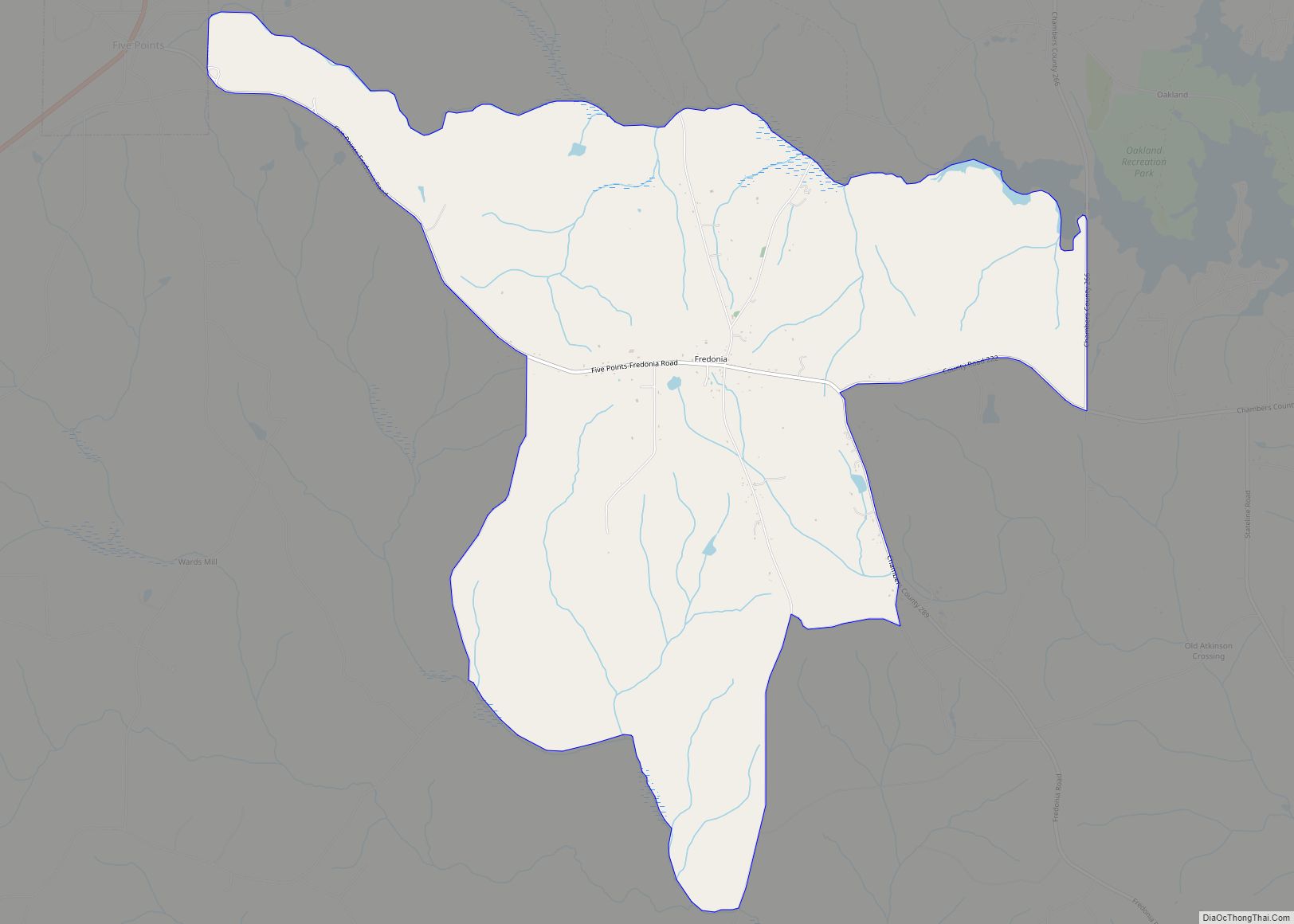
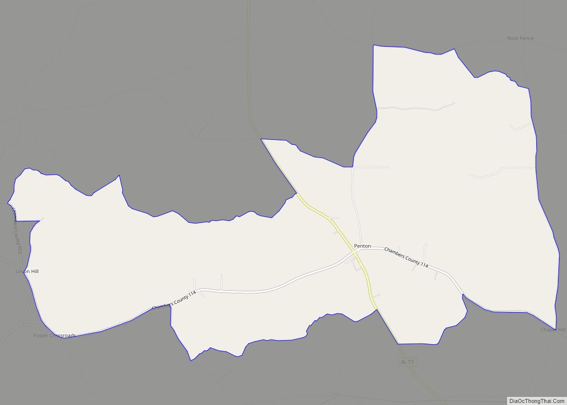
Online Interactive Map
Click on ![]() to view map in "full screen" mode.
to view map in "full screen" mode.
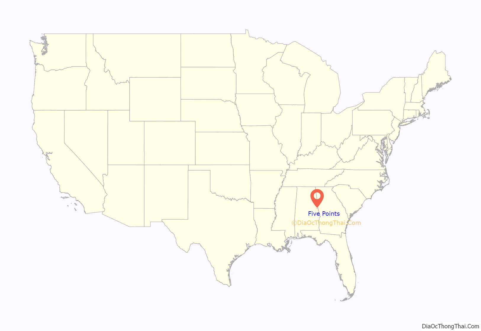
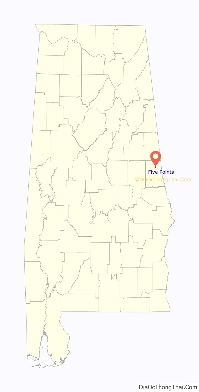
Five Points location map. Where is Five Points town?
History
In 1885, Five Points was named because of the five roads converging at a single point. Before this, the post office was known as “Lystra”. The town was incorporated in 1915, making it Chambers County’s oldest incorporated town. The Baptist Church was the first to take the name of “Five Points” on its building in 1929.
Five Points holds the distinction of being the first town of its size to receive electricity from Alabama Power in 1925. In order to receive power, citizens were required to erect their own poles from Stroud to White Plains.
Five Points is home to the first consolidated high school in Alabama. The original Five Points High School was an imposing brick building which had two floors above a full basement and a large auditorium that seated 400 people. Erected in 1916, it stood amidst an 18-acre (7.3 ha) campus, the only rural school in the state with its own electric and steam-generating plant and water works. The school building was replaced by a one-story building in 1939. In 1974 a fire destroyed that structure which was replaced by the present building.
The town elected its first African-American mayor, Geneva Bledsoe, in 1992. The current mayor is Derrick L. Wright Sr. who won the election by a vote of 50–32 in August 2012.
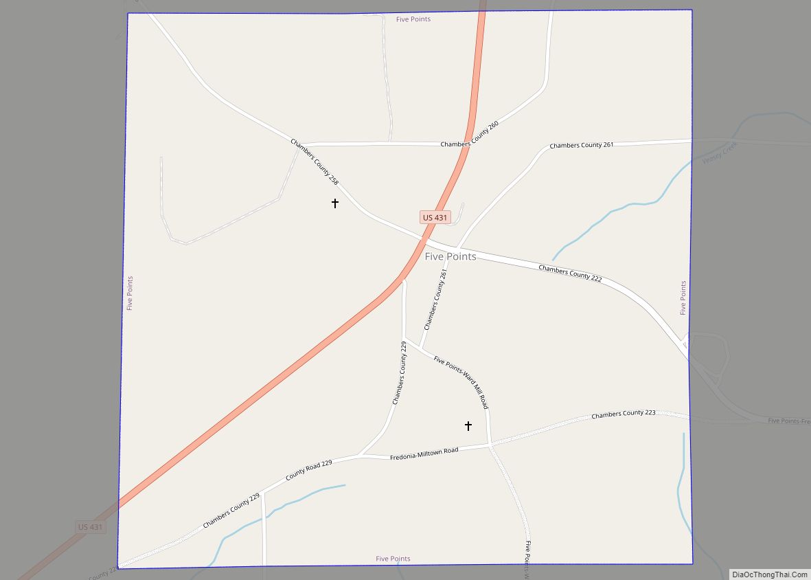
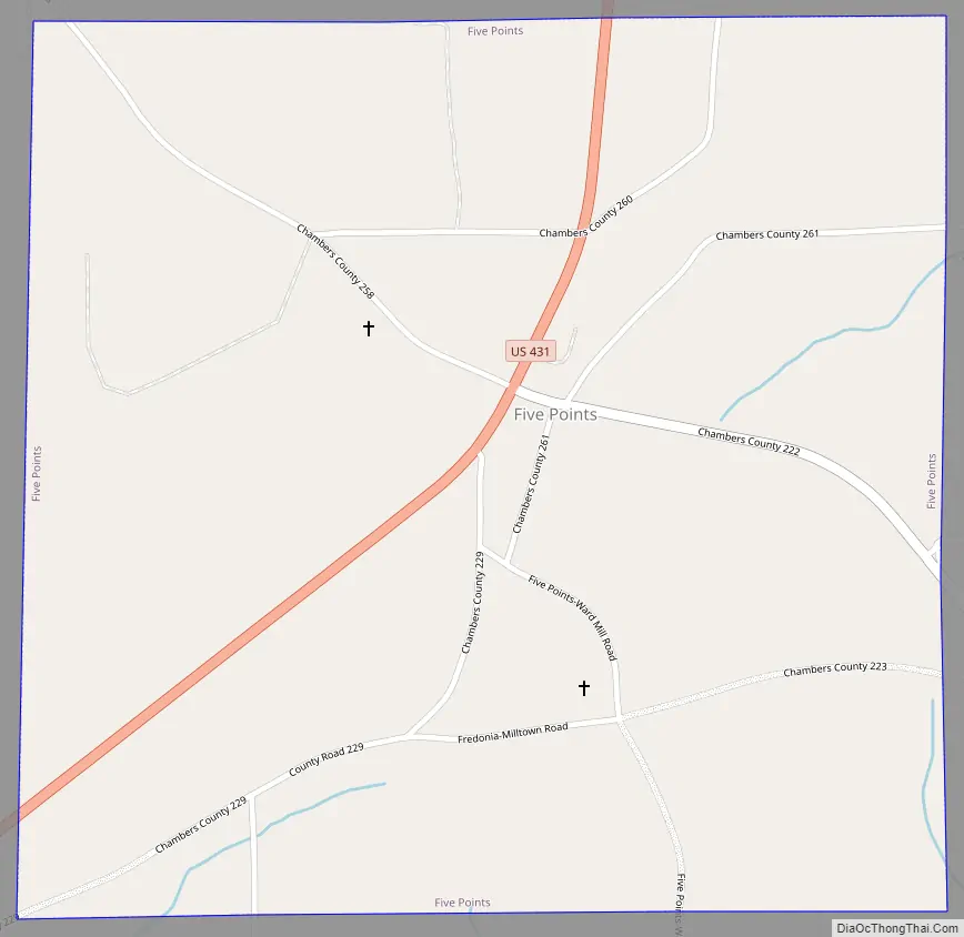
Five Points Road Map
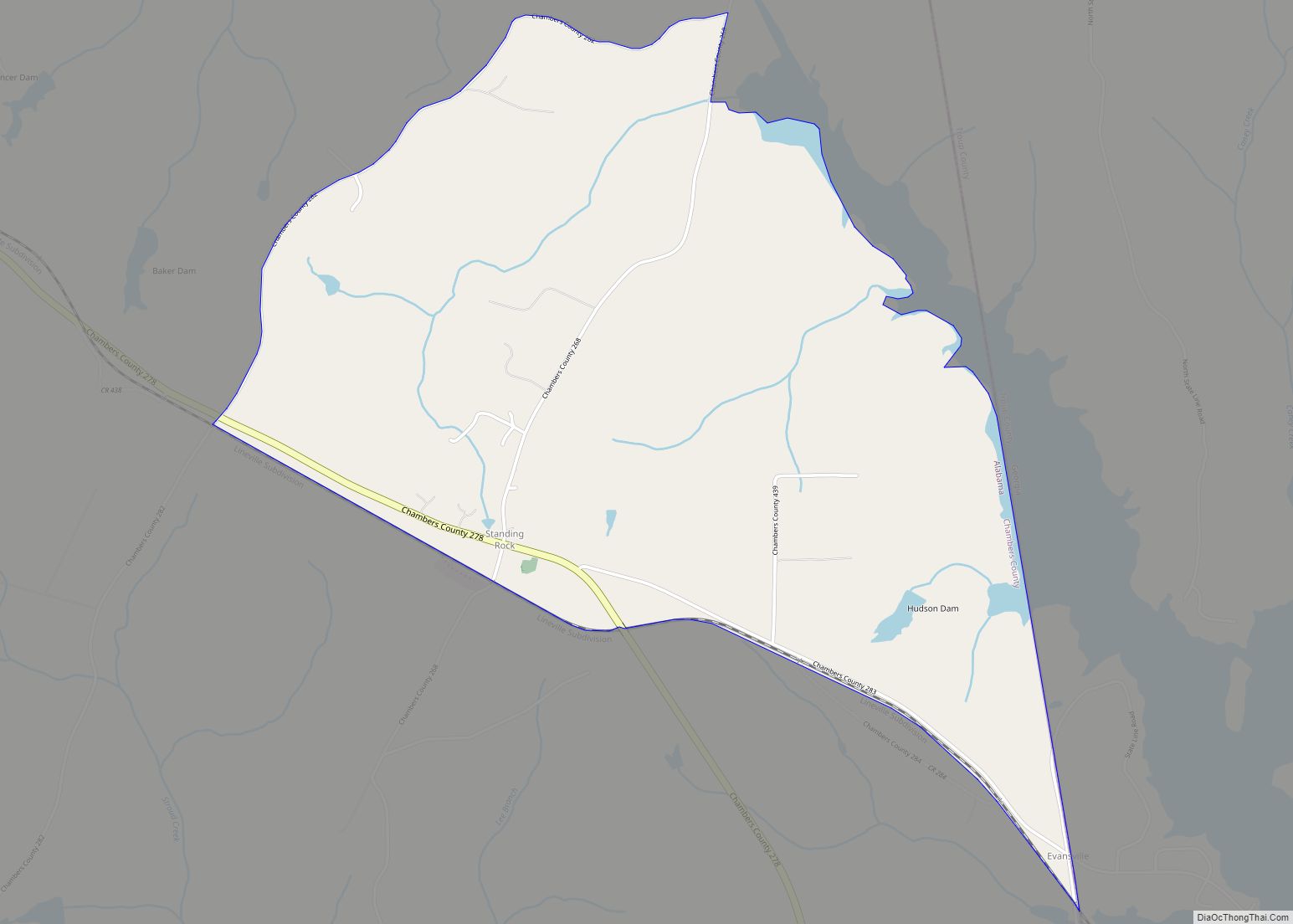
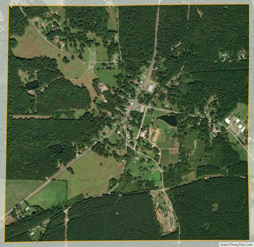
Five Points city Satellite Map
Geography
Five Points is located in northern Chambers County at 33°1’1.880″ North, 85°21’4.349″ West (33.017189, -85.351208). According to the U.S. Census Bureau, the town has a total area of 1.0 square mile (2.7 km) all land.
See also
Map of Alabama State and its subdivision:- Autauga
- Baldwin
- Barbour
- Bibb
- Blount
- Bullock
- Butler
- Calhoun
- Chambers
- Cherokee
- Chilton
- Choctaw
- Clarke
- Clay
- Cleburne
- Coffee
- Colbert
- Conecuh
- Coosa
- Covington
- Crenshaw
- Cullman
- Dale
- Dallas
- De Kalb
- Elmore
- Escambia
- Etowah
- Fayette
- Franklin
- Geneva
- Greene
- Hale
- Henry
- Houston
- Jackson
- Jefferson
- Lamar
- Lauderdale
- Lawrence
- Lee
- Limestone
- Lowndes
- Macon
- Madison
- Marengo
- Marion
- Marshall
- Mobile
- Monroe
- Montgomery
- Morgan
- Perry
- Pickens
- Pike
- Randolph
- Russell
- Saint Clair
- Shelby
- Sumter
- Talladega
- Tallapoosa
- Tuscaloosa
- Walker
- Washington
- Wilcox
- Winston
- Alabama
- Alaska
- Arizona
- Arkansas
- California
- Colorado
- Connecticut
- Delaware
- District of Columbia
- Florida
- Georgia
- Hawaii
- Idaho
- Illinois
- Indiana
- Iowa
- Kansas
- Kentucky
- Louisiana
- Maine
- Maryland
- Massachusetts
- Michigan
- Minnesota
- Mississippi
- Missouri
- Montana
- Nebraska
- Nevada
- New Hampshire
- New Jersey
- New Mexico
- New York
- North Carolina
- North Dakota
- Ohio
- Oklahoma
- Oregon
- Pennsylvania
- Rhode Island
- South Carolina
- South Dakota
- Tennessee
- Texas
- Utah
- Vermont
- Virginia
- Washington
- West Virginia
- Wisconsin
- Wyoming