Fredonia /friˈdoʊniə/ free-DOH-nia is an unincorporated community and census-designated place in Chambers County, Alabama, United States. Its elevation is 794 feet (242 m), and it is located at 32°59′23″N 85°17′19″W / 32.98972°N 85.28861°W / 32.98972; -85.28861 (32.9898462, -85.2885564). As of the 2010 census, its population was 199. Other names for the community have included “Freedona” and “Hursts Store”. It is the location of the New Hope Rosenwald School, which is listed on the National Register of Historic Places.
| Name: | Fredonia CDP |
|---|---|
| LSAD Code: | 57 |
| LSAD Description: | CDP (suffix) |
| State: | Alabama |
| County: | Chambers County |
| Elevation: | 794 ft (242 m) |
| Total Area: | 12.00 sq mi (31.09 km²) |
| Land Area: | 11.98 sq mi (31.03 km²) |
| Water Area: | 0.03 sq mi (0.07 km²) |
| Total Population: | 198 |
| Population Density: | 16.53/sq mi (6.38/km²) |
| Area code: | 334 |
| FIPS code: | 0128120 |
| GNISfeature ID: | 118613 |
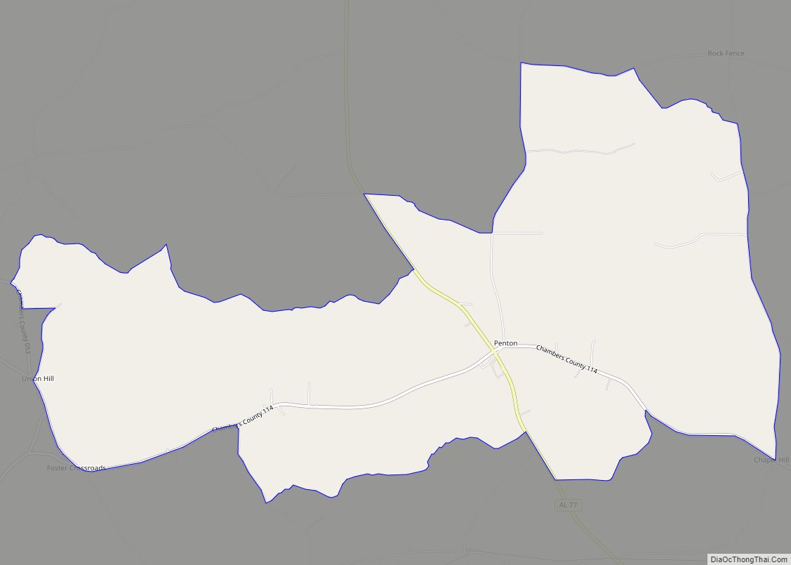
Online Interactive Map
Click on ![]() to view map in "full screen" mode.
to view map in "full screen" mode.
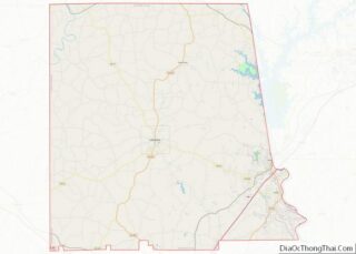
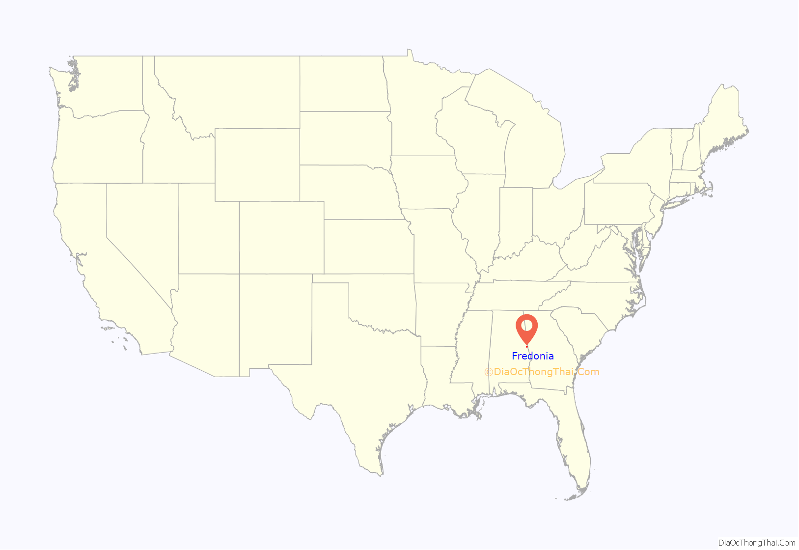
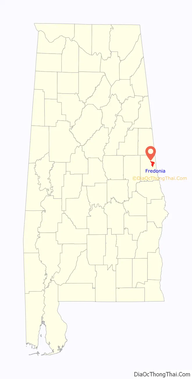
Fredonia location map. Where is Fredonia CDP?
History
From its foundation, Fredonia was the educational and trade center for the northeast section of Chambers County. The town was incorporated September 29, 1853. Sixteen businesses existed including a jug factory, hotels, taverns, blacksmith shop, tan yard, the “Temperance House” as well as the first established Methodist Church in the county. The Southern Military was established in the village by the Alabama State Legislature, but it was forced to close by the Civil War.
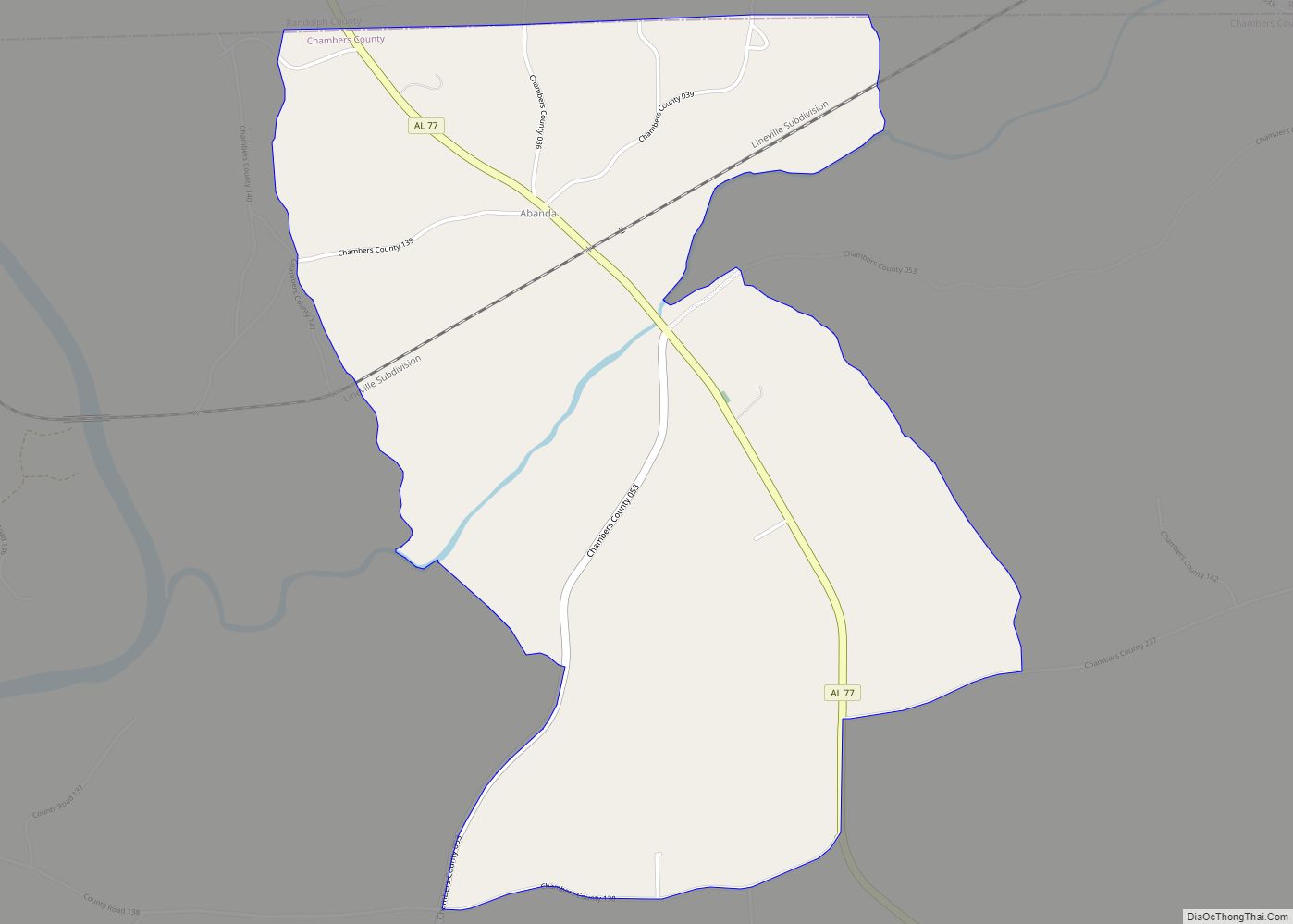
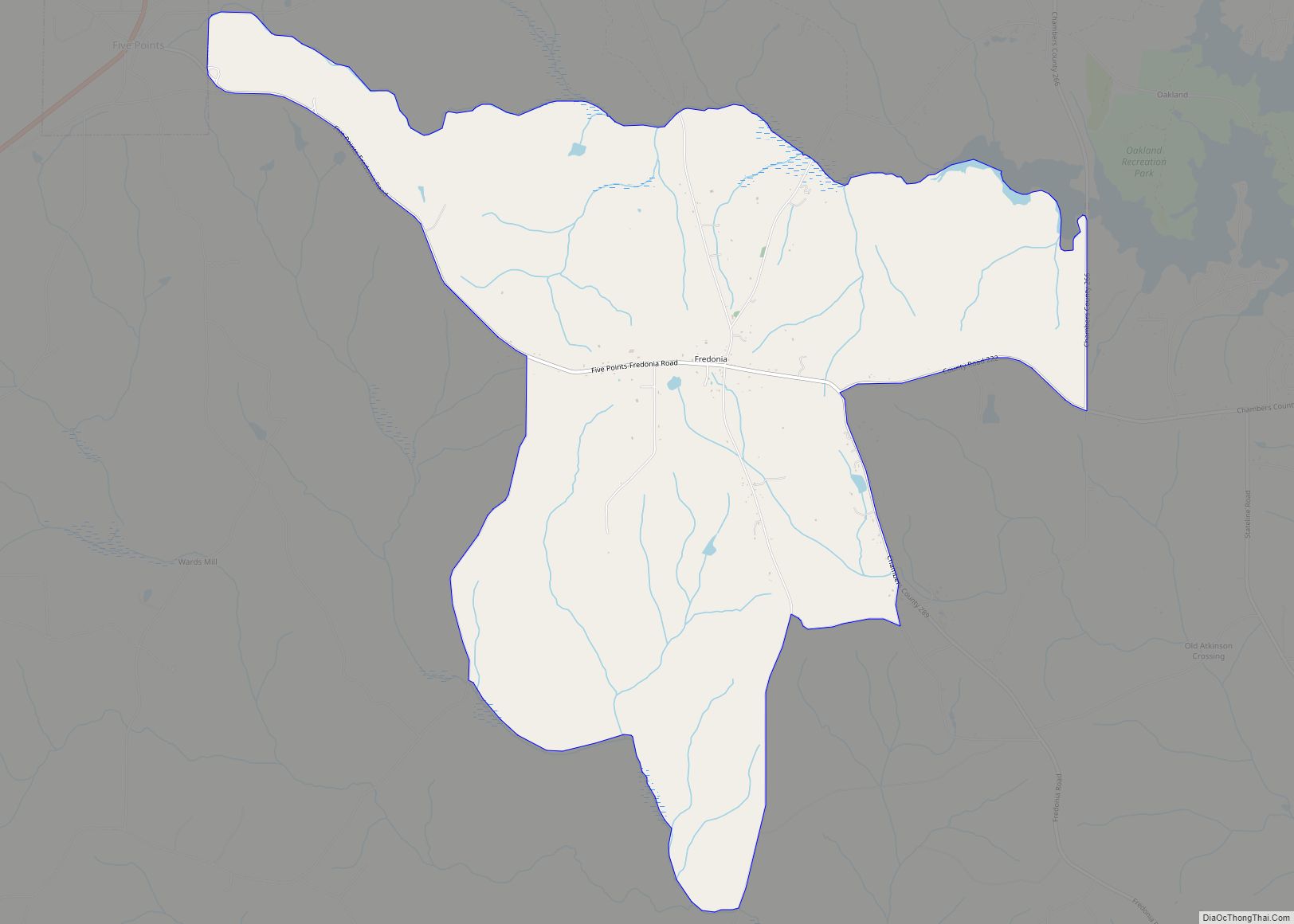
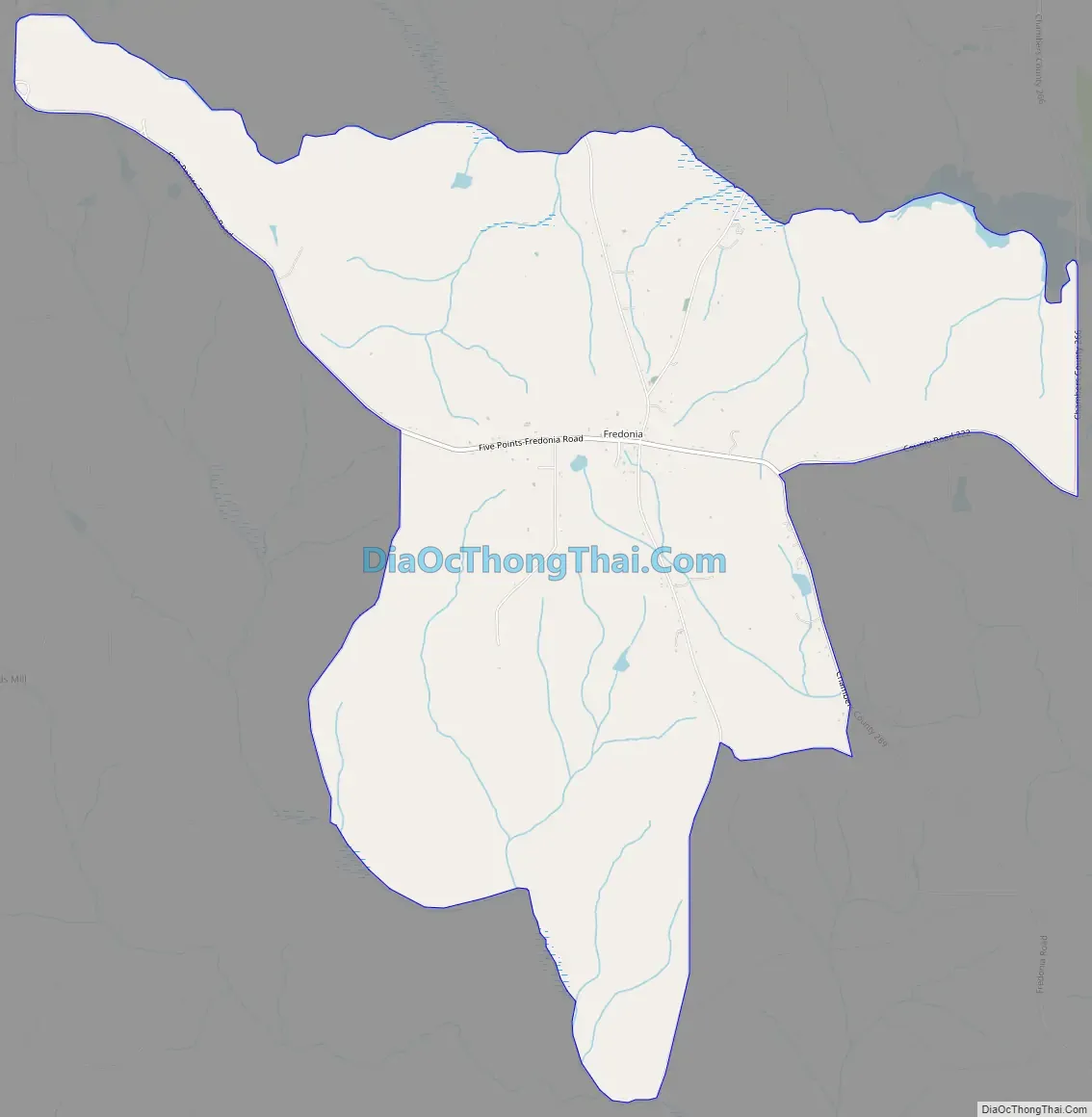
Fredonia Road Map
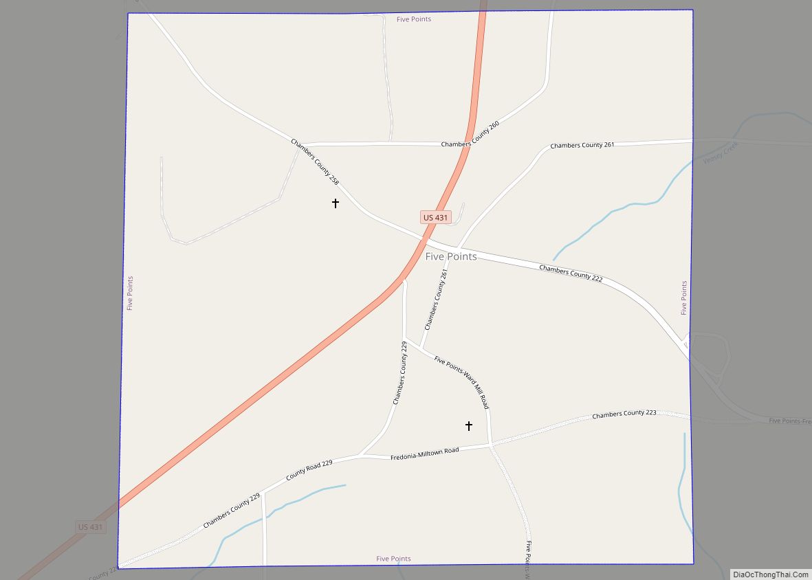
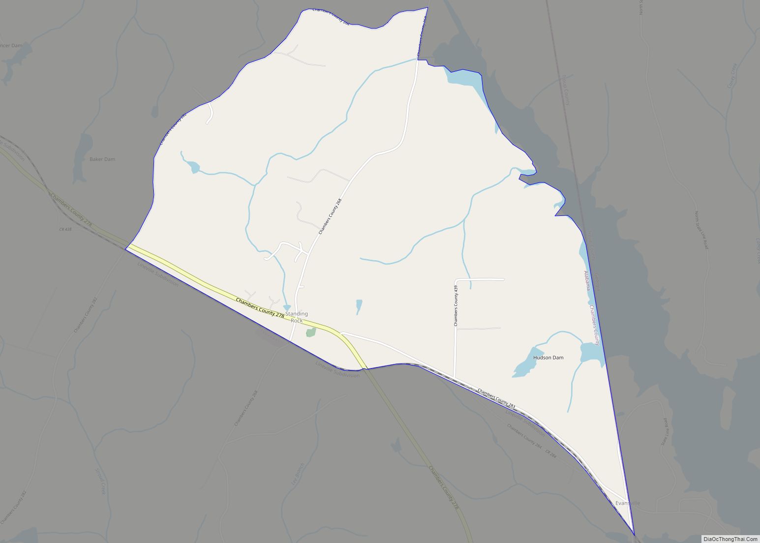
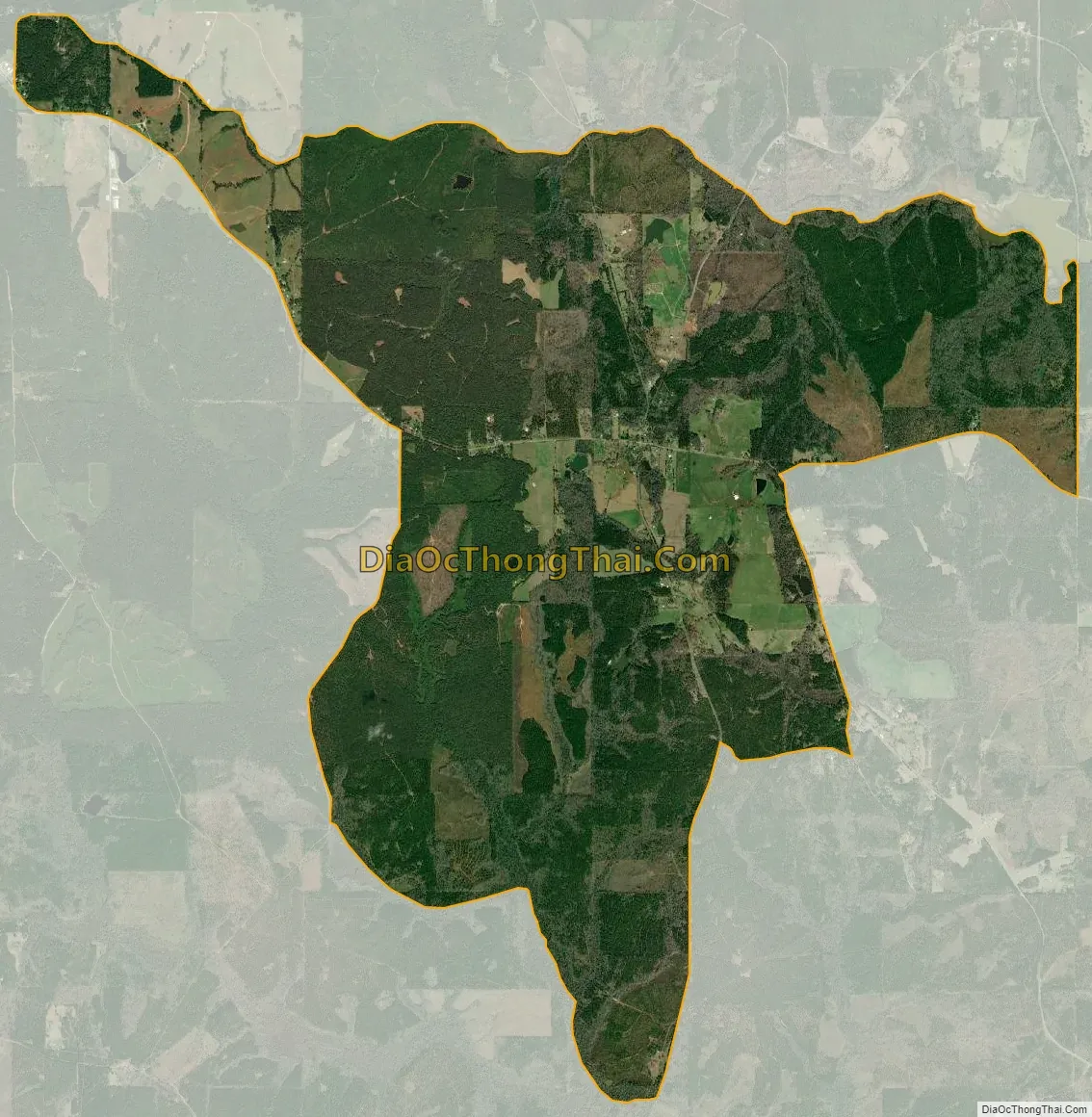
Fredonia city Satellite Map
See also
Map of Alabama State and its subdivision:- Autauga
- Baldwin
- Barbour
- Bibb
- Blount
- Bullock
- Butler
- Calhoun
- Chambers
- Cherokee
- Chilton
- Choctaw
- Clarke
- Clay
- Cleburne
- Coffee
- Colbert
- Conecuh
- Coosa
- Covington
- Crenshaw
- Cullman
- Dale
- Dallas
- De Kalb
- Elmore
- Escambia
- Etowah
- Fayette
- Franklin
- Geneva
- Greene
- Hale
- Henry
- Houston
- Jackson
- Jefferson
- Lamar
- Lauderdale
- Lawrence
- Lee
- Limestone
- Lowndes
- Macon
- Madison
- Marengo
- Marion
- Marshall
- Mobile
- Monroe
- Montgomery
- Morgan
- Perry
- Pickens
- Pike
- Randolph
- Russell
- Saint Clair
- Shelby
- Sumter
- Talladega
- Tallapoosa
- Tuscaloosa
- Walker
- Washington
- Wilcox
- Winston
- Alabama
- Alaska
- Arizona
- Arkansas
- California
- Colorado
- Connecticut
- Delaware
- District of Columbia
- Florida
- Georgia
- Hawaii
- Idaho
- Illinois
- Indiana
- Iowa
- Kansas
- Kentucky
- Louisiana
- Maine
- Maryland
- Massachusetts
- Michigan
- Minnesota
- Mississippi
- Missouri
- Montana
- Nebraska
- Nevada
- New Hampshire
- New Jersey
- New Mexico
- New York
- North Carolina
- North Dakota
- Ohio
- Oklahoma
- Oregon
- Pennsylvania
- Rhode Island
- South Carolina
- South Dakota
- Tennessee
- Texas
- Utah
- Vermont
- Virginia
- Washington
- West Virginia
- Wisconsin
- Wyoming