Hayden is a town in Blount County, Alabama, United States. At the 2020 census, the population was 1,342.
| Name: | Hayden town |
|---|---|
| LSAD Code: | 43 |
| LSAD Description: | town (suffix) |
| State: | Alabama |
| County: | Blount County |
| Elevation: | 564 ft (172 m) |
| Total Area: | 4.01 sq mi (10.39 km²) |
| Land Area: | 4.01 sq mi (10.39 km²) |
| Water Area: | 0.00 sq mi (0.00 km²) |
| Total Population: | 1,342 |
| Population Density: | 334.66/sq mi (129.22/km²) |
| ZIP code: | 35079 |
| Area code: | 205, 659 |
| FIPS code: | 0133640 |
| GNISfeature ID: | 0119877 |
| Website: | www.townofhayden.com |
Online Interactive Map
Click on ![]() to view map in "full screen" mode.
to view map in "full screen" mode.
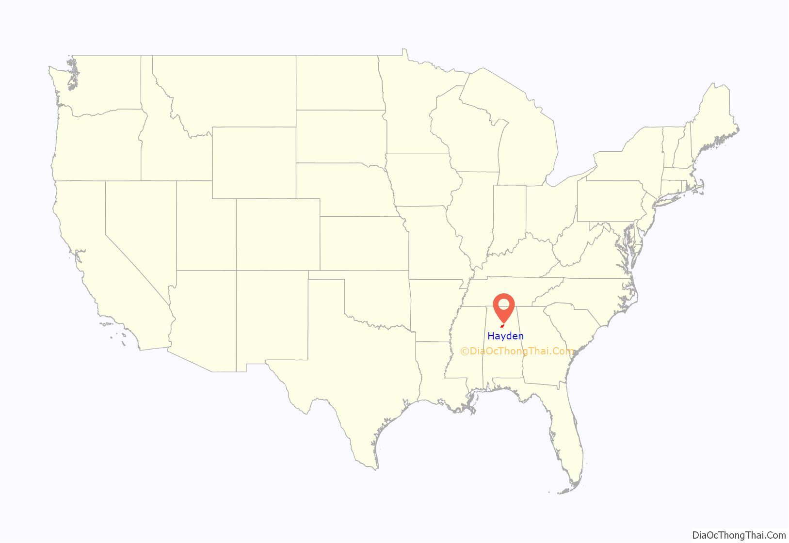
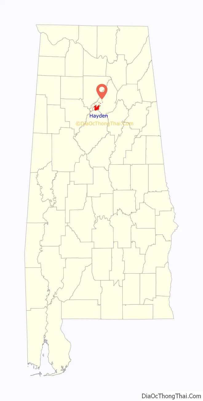
Hayden location map. Where is Hayden town?
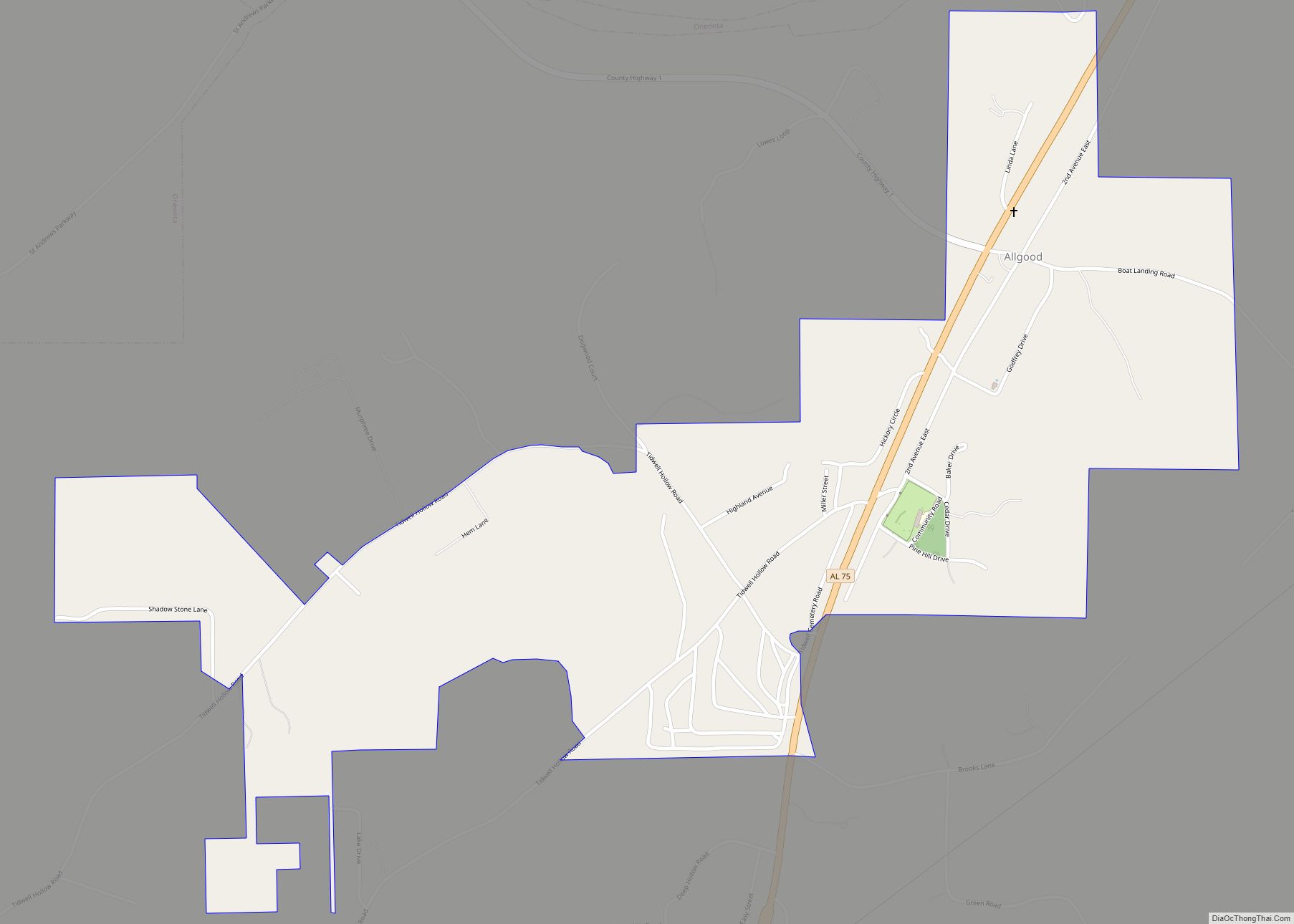
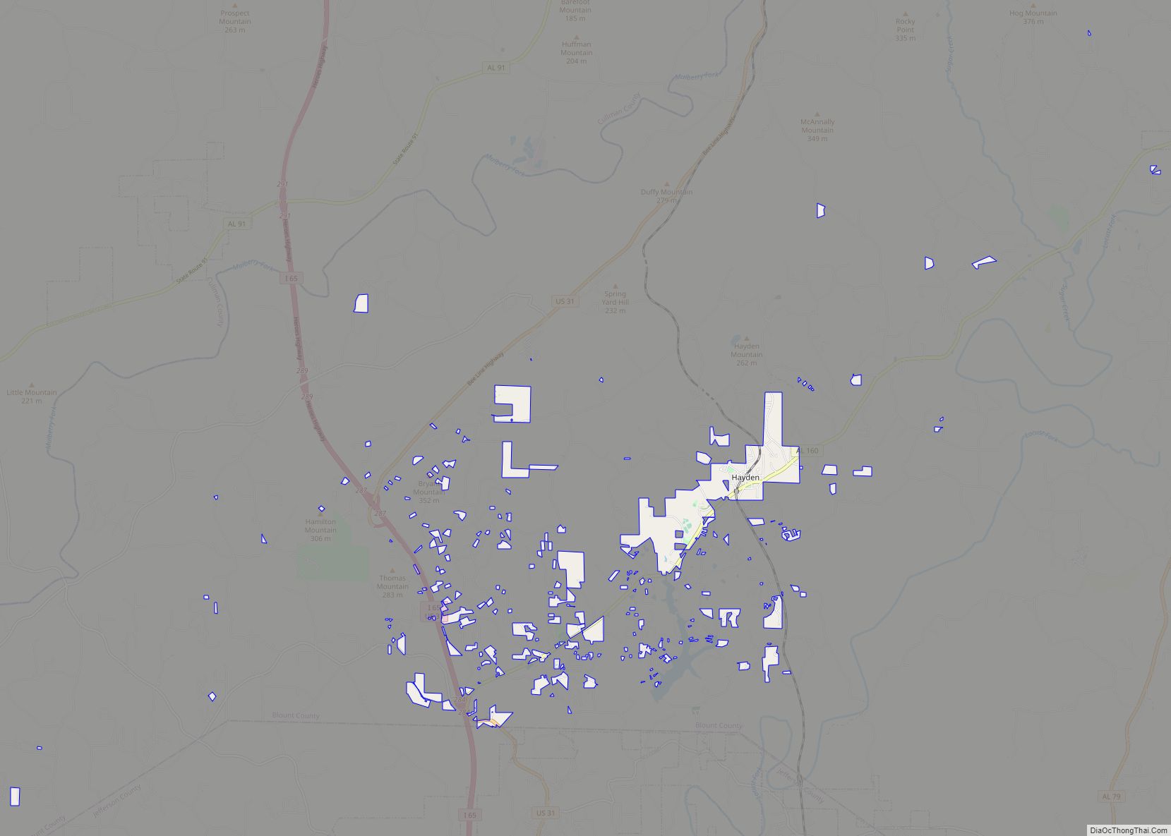
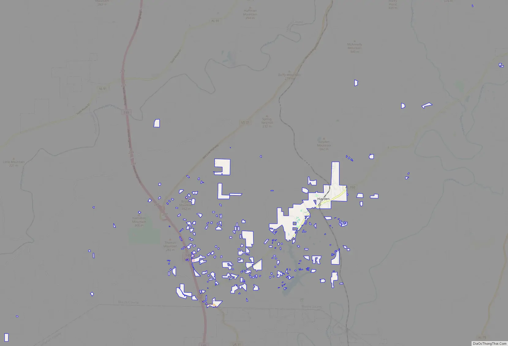
Hayden Road Map
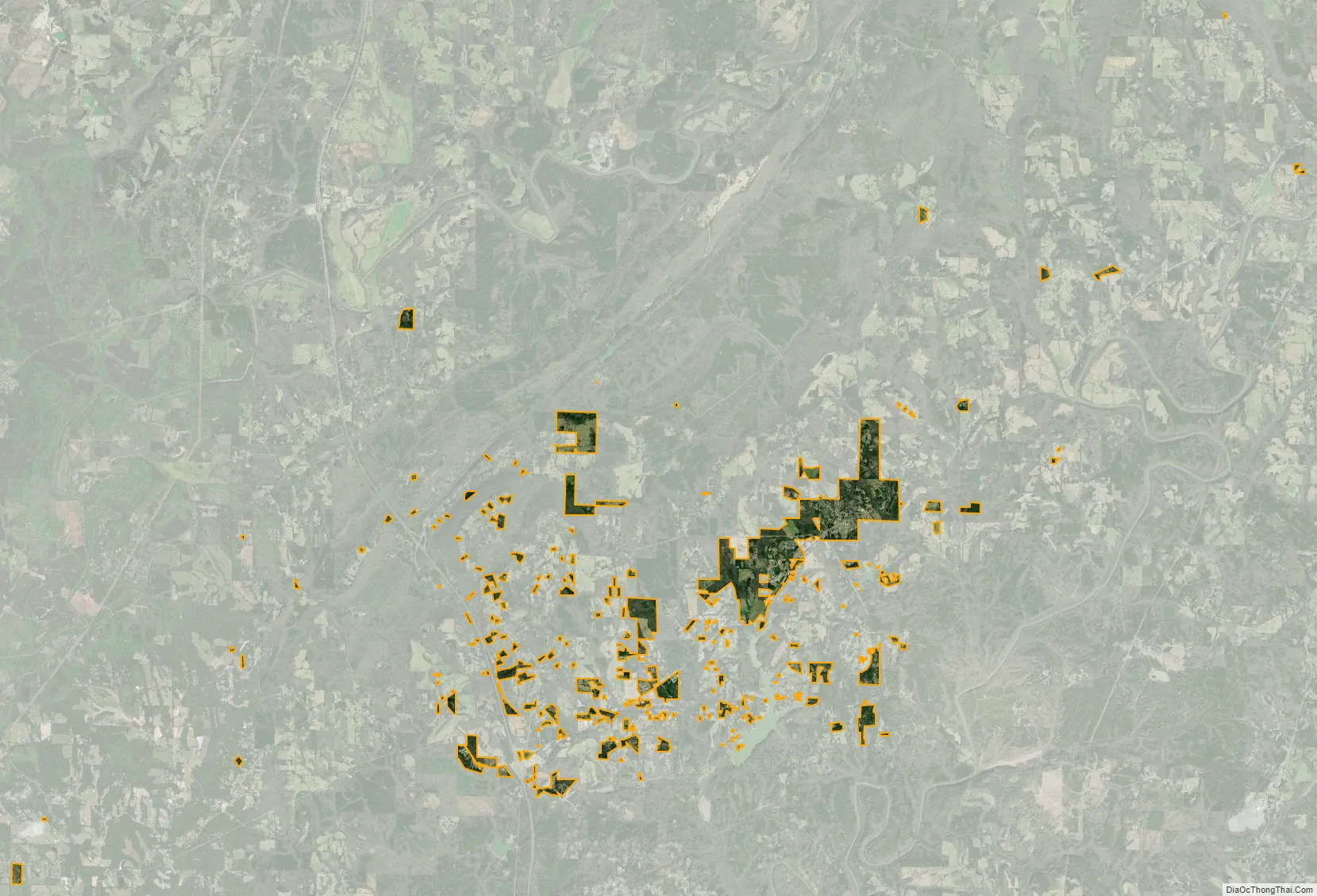
Hayden city Satellite Map
Geography
Hayden is located in southwestern Blount County at 33°53’36.236″ North, 86°45’25.139″ West (33.893399, -86.756983). Hayden Mountain is a broad, low ridge that rises to the northwest above the town. Alabama State Route 160 passes through the center of the town, leading 5 miles (8 km) southwest to Interstate 65 north of Warrior, and northeast 13 miles (21 km) to Cleveland.
According to the U.S. Census Bureau, the town of Hayden has a total area of 4.0 square miles (10.3 km), all land. Hayden has a spread out area consisting of many enclaves and exclaves within the town and the rest of Blount County.
See also
Map of Alabama State and its subdivision:- Autauga
- Baldwin
- Barbour
- Bibb
- Blount
- Bullock
- Butler
- Calhoun
- Chambers
- Cherokee
- Chilton
- Choctaw
- Clarke
- Clay
- Cleburne
- Coffee
- Colbert
- Conecuh
- Coosa
- Covington
- Crenshaw
- Cullman
- Dale
- Dallas
- De Kalb
- Elmore
- Escambia
- Etowah
- Fayette
- Franklin
- Geneva
- Greene
- Hale
- Henry
- Houston
- Jackson
- Jefferson
- Lamar
- Lauderdale
- Lawrence
- Lee
- Limestone
- Lowndes
- Macon
- Madison
- Marengo
- Marion
- Marshall
- Mobile
- Monroe
- Montgomery
- Morgan
- Perry
- Pickens
- Pike
- Randolph
- Russell
- Saint Clair
- Shelby
- Sumter
- Talladega
- Tallapoosa
- Tuscaloosa
- Walker
- Washington
- Wilcox
- Winston
- Alabama
- Alaska
- Arizona
- Arkansas
- California
- Colorado
- Connecticut
- Delaware
- District of Columbia
- Florida
- Georgia
- Hawaii
- Idaho
- Illinois
- Indiana
- Iowa
- Kansas
- Kentucky
- Louisiana
- Maine
- Maryland
- Massachusetts
- Michigan
- Minnesota
- Mississippi
- Missouri
- Montana
- Nebraska
- Nevada
- New Hampshire
- New Jersey
- New Mexico
- New York
- North Carolina
- North Dakota
- Ohio
- Oklahoma
- Oregon
- Pennsylvania
- Rhode Island
- South Carolina
- South Dakota
- Tennessee
- Texas
- Utah
- Vermont
- Virginia
- Washington
- West Virginia
- Wisconsin
- Wyoming