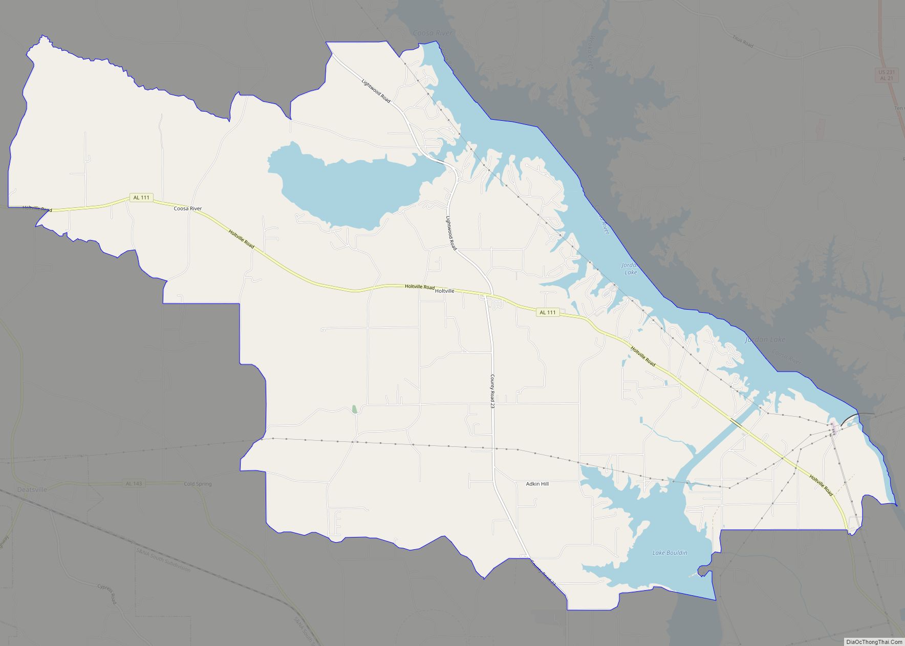
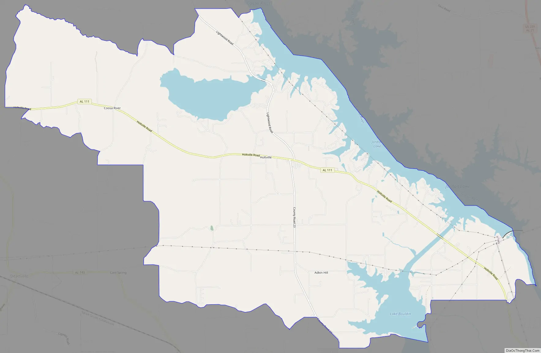
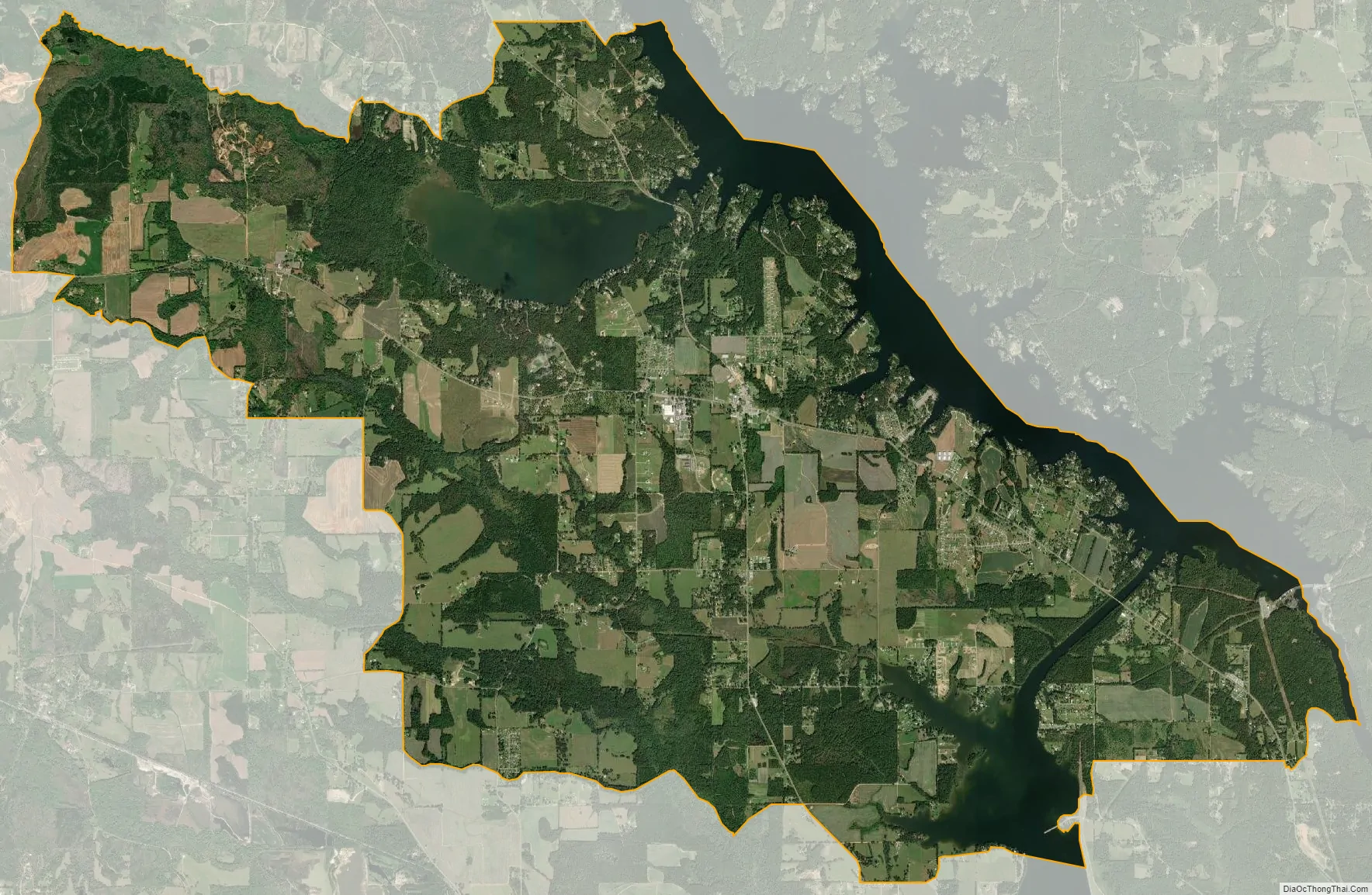
Holtville (also Slapout) is a census-designated place and unincorporated community in Elmore County, Alabama, United States. Its population was 4,940 as of the 2020 census.
Holtville/Slapout is located on the western bank of Lake Jordan, and much of its population lives along this lakeshore, or in the neighboring Lightwood community.
According to tradition, the old name of Slapout was derived from a storekeeper’s way of stating an item was out of stock: he was “slap out of it”.
| Name: | Holtville CDP |
|---|---|
| LSAD Code: | 57 |
| LSAD Description: | CDP (suffix) |
| State: | Alabama |
| County: | Elmore County |
| Elevation: | 354 ft (108 m) |
| Total Area: | 25.18 sq mi (65.22 km²) |
| Land Area: | 21.59 sq mi (55.91 km²) |
| Water Area: | 3.60 sq mi (9.31 km²) |
| Total Population: | 4,940 |
| Population Density: | 228.85/sq mi (88.36/km²) |
| Area code: | 334 |
| FIPS code: | 0135752 |
| GNISfeature ID: | 120302 |
Online Interactive Map
Click on ![]() to view map in "full screen" mode.
to view map in "full screen" mode.
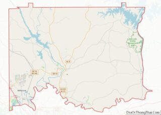
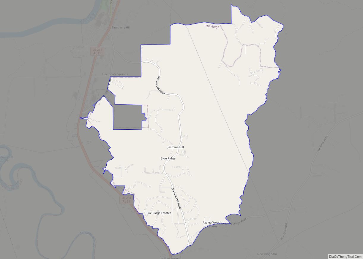
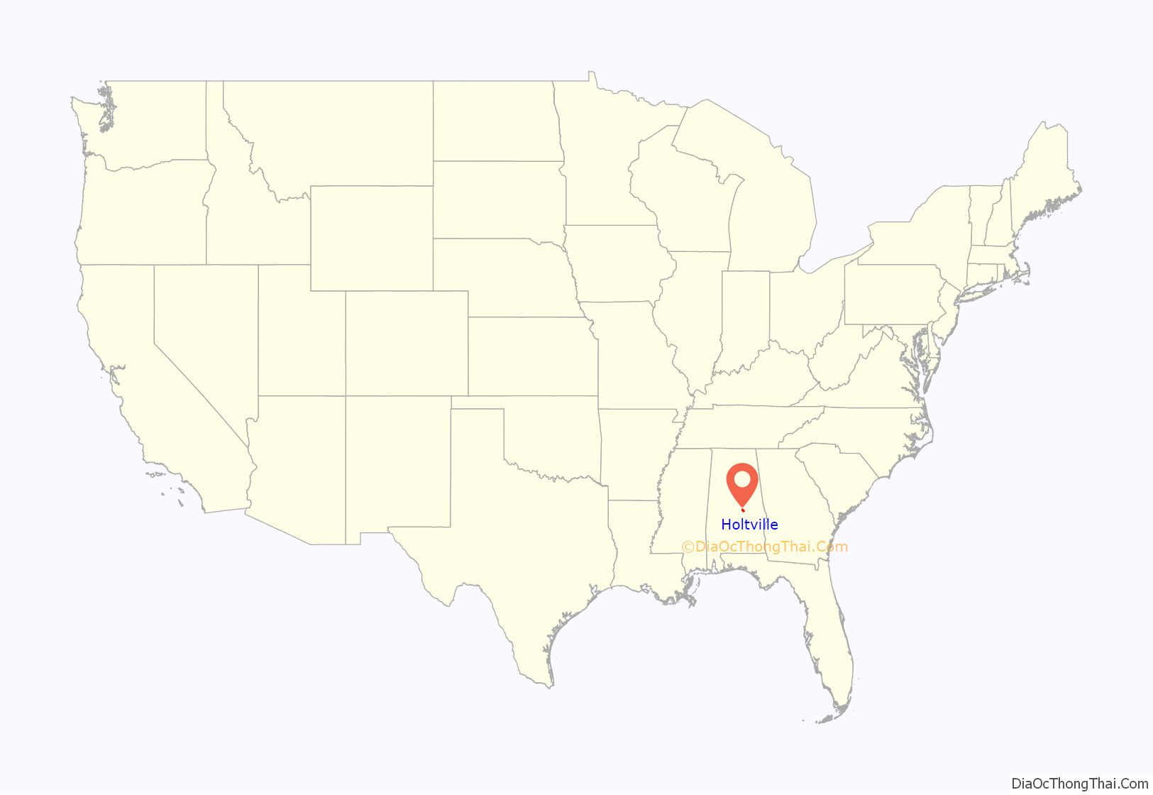
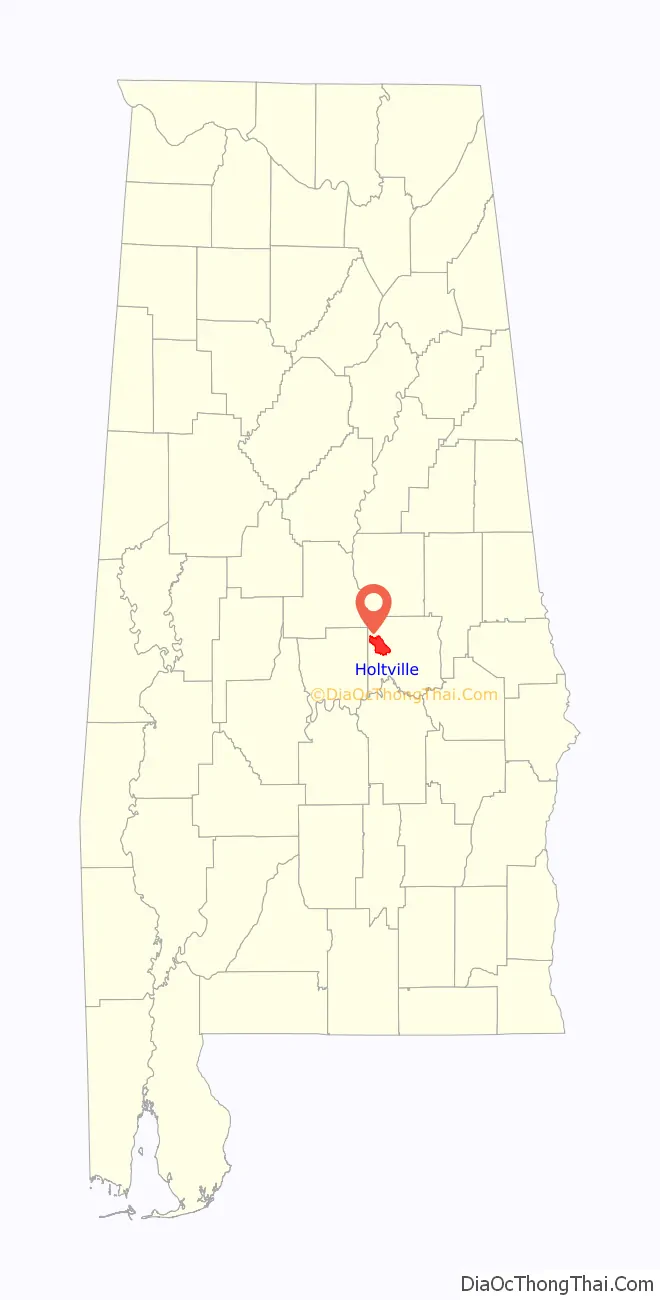
Holtville location map. Where is Holtville CDP?
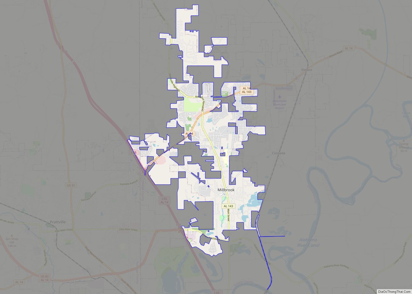
Holtville Road Map
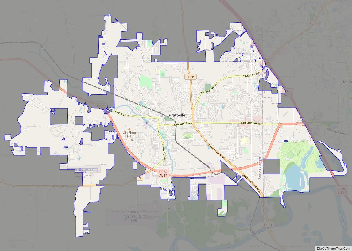
Holtville city Satellite Map
See also
Map of Alabama State and its subdivision:- Autauga
- Baldwin
- Barbour
- Bibb
- Blount
- Bullock
- Butler
- Calhoun
- Chambers
- Cherokee
- Chilton
- Choctaw
- Clarke
- Clay
- Cleburne
- Coffee
- Colbert
- Conecuh
- Coosa
- Covington
- Crenshaw
- Cullman
- Dale
- Dallas
- De Kalb
- Elmore
- Escambia
- Etowah
- Fayette
- Franklin
- Geneva
- Greene
- Hale
- Henry
- Houston
- Jackson
- Jefferson
- Lamar
- Lauderdale
- Lawrence
- Lee
- Limestone
- Lowndes
- Macon
- Madison
- Marengo
- Marion
- Marshall
- Mobile
- Monroe
- Montgomery
- Morgan
- Perry
- Pickens
- Pike
- Randolph
- Russell
- Saint Clair
- Shelby
- Sumter
- Talladega
- Tallapoosa
- Tuscaloosa
- Walker
- Washington
- Wilcox
- Winston
- Alabama
- Alaska
- Arizona
- Arkansas
- California
- Colorado
- Connecticut
- Delaware
- District of Columbia
- Florida
- Georgia
- Hawaii
- Idaho
- Illinois
- Indiana
- Iowa
- Kansas
- Kentucky
- Louisiana
- Maine
- Maryland
- Massachusetts
- Michigan
- Minnesota
- Mississippi
- Missouri
- Montana
- Nebraska
- Nevada
- New Hampshire
- New Jersey
- New Mexico
- New York
- North Carolina
- North Dakota
- Ohio
- Oklahoma
- Oregon
- Pennsylvania
- Rhode Island
- South Carolina
- South Dakota
- Tennessee
- Texas
- Utah
- Vermont
- Virginia
- Washington
- West Virginia
- Wisconsin
- Wyoming