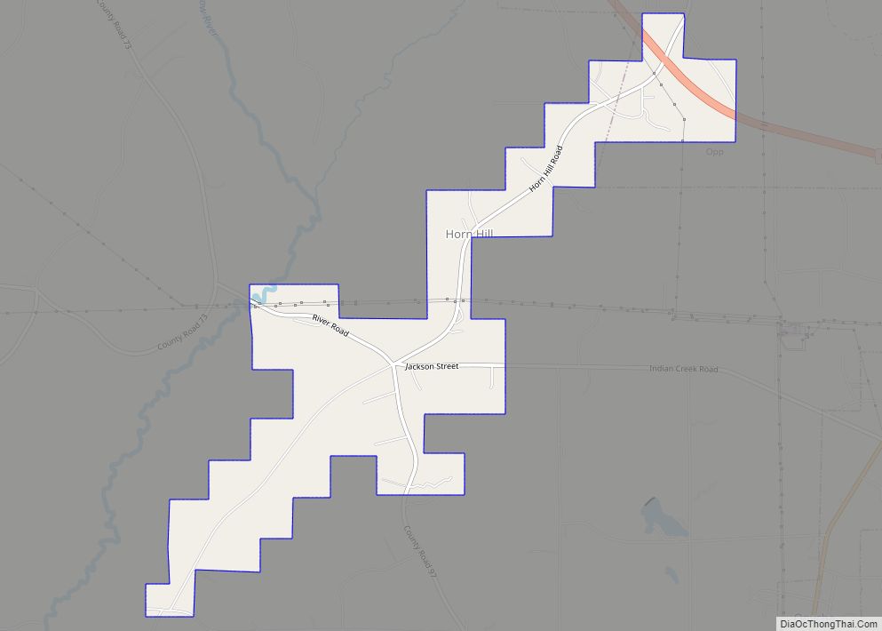
Horn Hill is a town in Covington County, Alabama, United States. At the 2020 census, the population was 207. It had previously been an incorporated community and was listed on the 1970 and 1980 U.S. Census, but was disincorporated in 1985. It later reincorporated on August 26, 1991.
| Name: | Horn Hill town |
|---|---|
| LSAD Code: | 43 |
| LSAD Description: | town (suffix) |
| State: | Alabama |
| County: | Covington County |
| Elevation: | 285 ft (87 m) |
| Total Area: | 2.61 sq mi (6.75 km²) |
| Land Area: | 2.56 sq mi (6.62 km²) |
| Water Area: | 0.05 sq mi (0.14 km²) |
| Total Population: | 207 |
| Population Density: | 81.02/sq mi (31.28/km²) |
| FIPS code: | 0136088 |
| GNISfeature ID: | 0159803 |
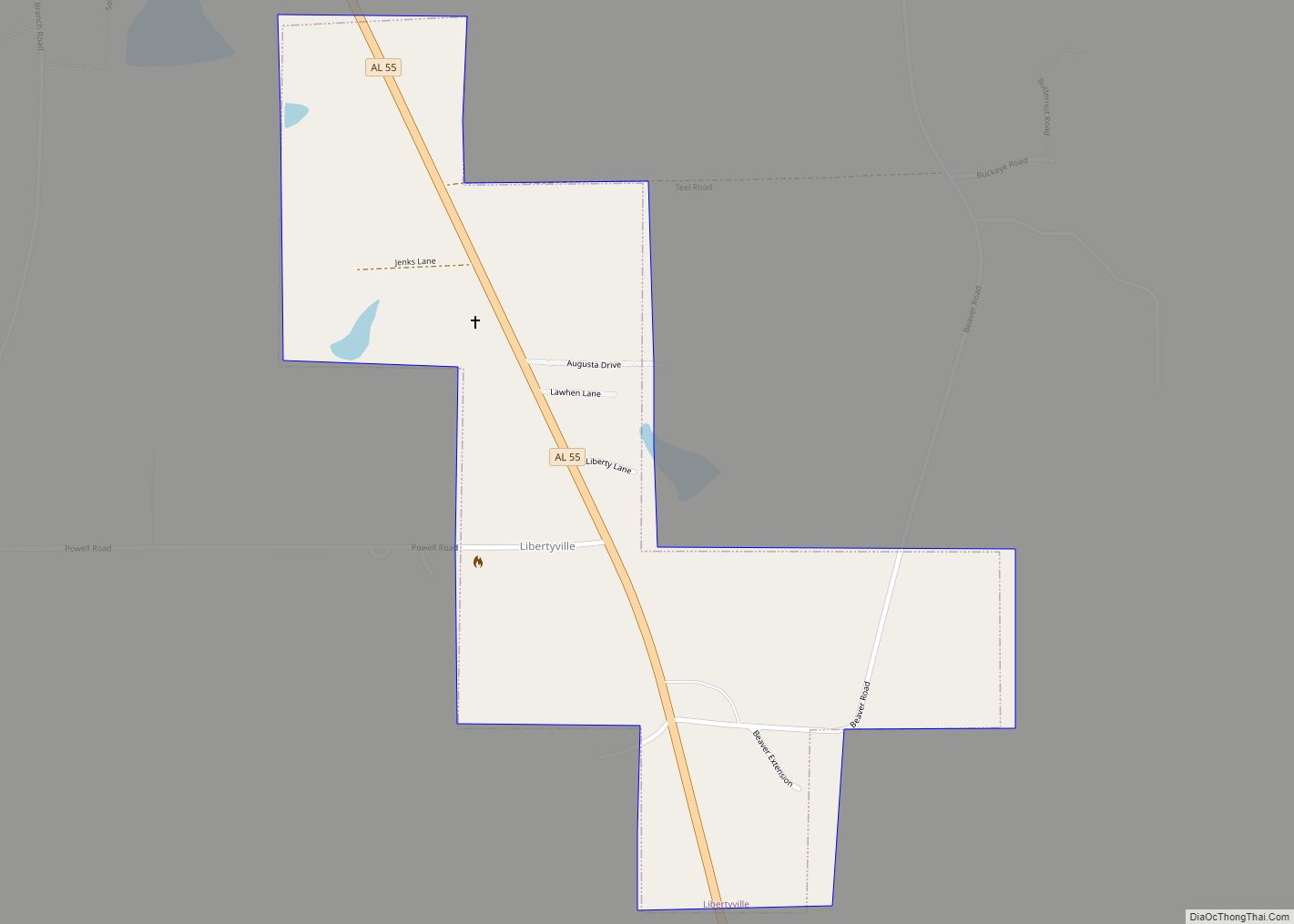
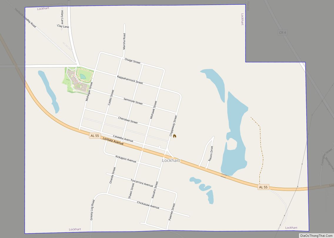
Online Interactive Map
Click on ![]() to view map in "full screen" mode.
to view map in "full screen" mode.
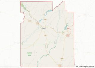
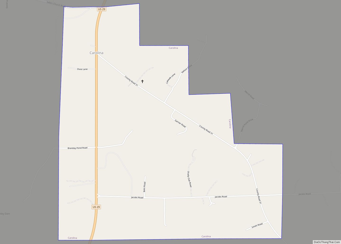
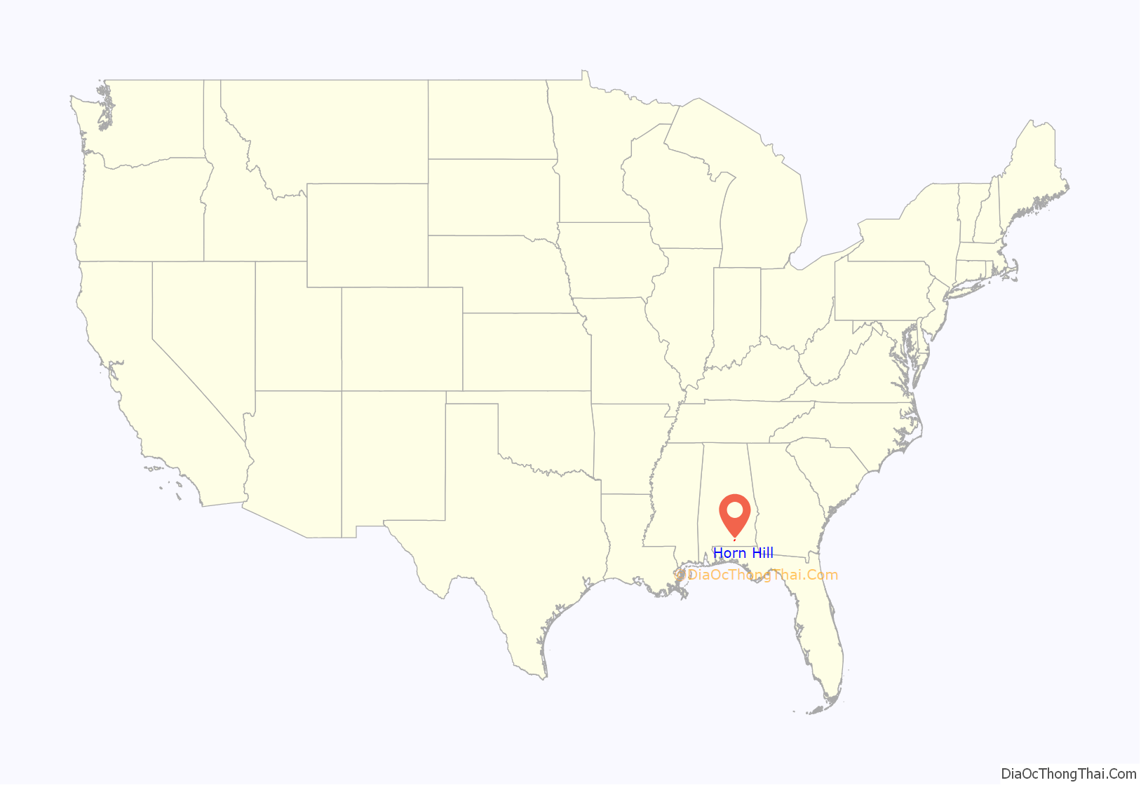
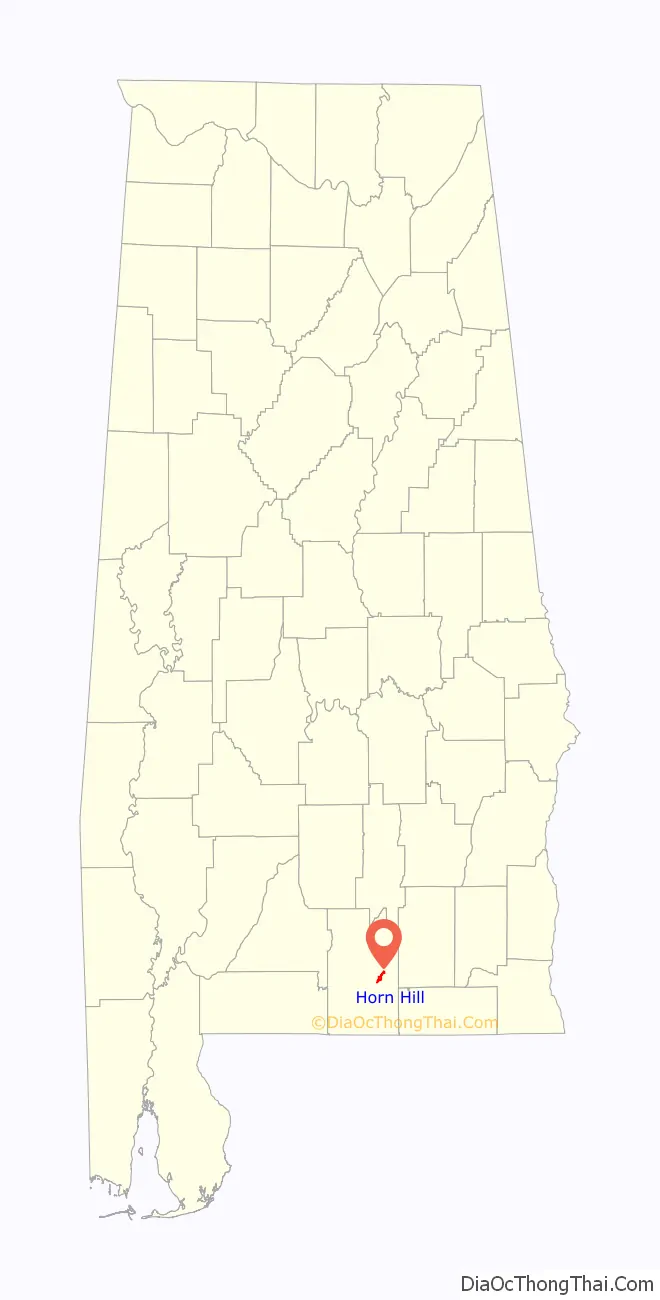
Horn Hill location map. Where is Horn Hill town?
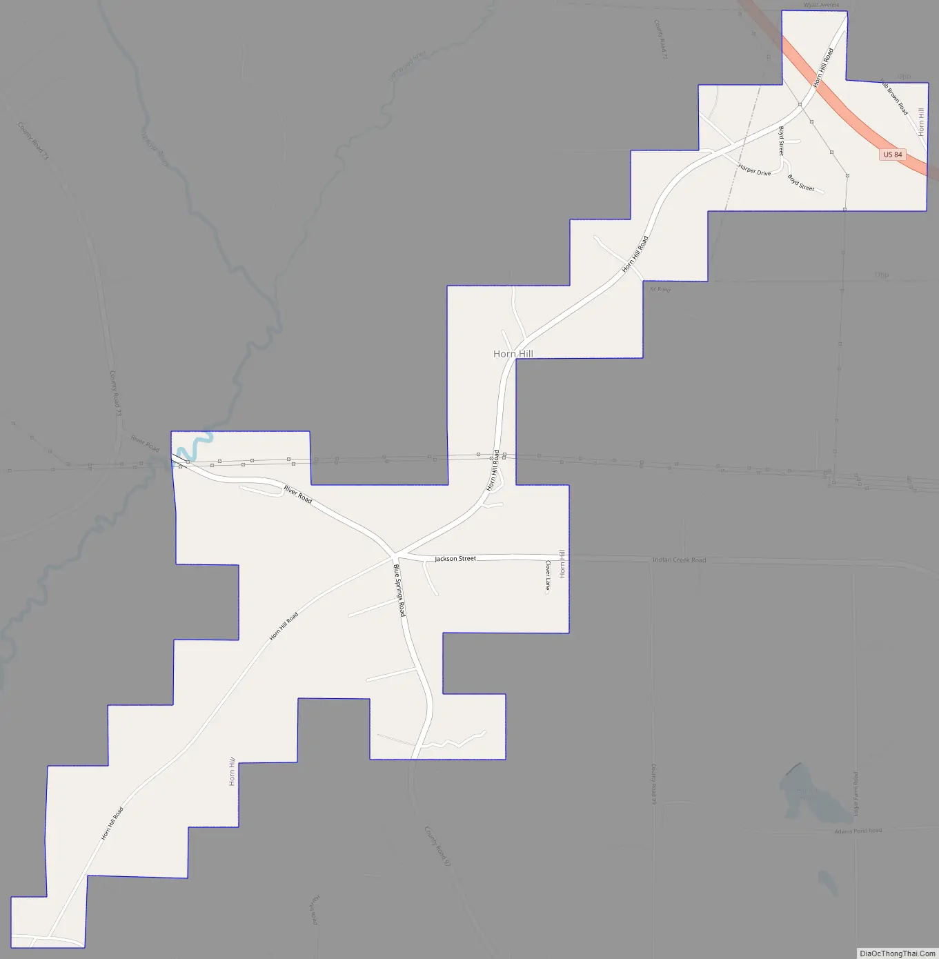
Horn Hill Road Map
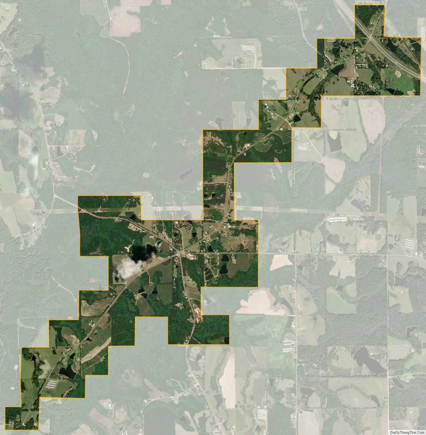
Horn Hill city Satellite Map
Geography
Horn Hill is located at 31°14′26″N 86°19′09″W / 31.240456°N 86.319172°W / 31.240456; -86.319172. According to the U.S. Census Bureau, the town has a total area of 2.6 square miles (6.8 km), of which 2.5 square miles (6.6 km) is land and 0.04 square miles (0.1 km), or 2.01%, is water.
See also
Map of Alabama State and its subdivision:- Autauga
- Baldwin
- Barbour
- Bibb
- Blount
- Bullock
- Butler
- Calhoun
- Chambers
- Cherokee
- Chilton
- Choctaw
- Clarke
- Clay
- Cleburne
- Coffee
- Colbert
- Conecuh
- Coosa
- Covington
- Crenshaw
- Cullman
- Dale
- Dallas
- De Kalb
- Elmore
- Escambia
- Etowah
- Fayette
- Franklin
- Geneva
- Greene
- Hale
- Henry
- Houston
- Jackson
- Jefferson
- Lamar
- Lauderdale
- Lawrence
- Lee
- Limestone
- Lowndes
- Macon
- Madison
- Marengo
- Marion
- Marshall
- Mobile
- Monroe
- Montgomery
- Morgan
- Perry
- Pickens
- Pike
- Randolph
- Russell
- Saint Clair
- Shelby
- Sumter
- Talladega
- Tallapoosa
- Tuscaloosa
- Walker
- Washington
- Wilcox
- Winston
- Alabama
- Alaska
- Arizona
- Arkansas
- California
- Colorado
- Connecticut
- Delaware
- District of Columbia
- Florida
- Georgia
- Hawaii
- Idaho
- Illinois
- Indiana
- Iowa
- Kansas
- Kentucky
- Louisiana
- Maine
- Maryland
- Massachusetts
- Michigan
- Minnesota
- Mississippi
- Missouri
- Montana
- Nebraska
- Nevada
- New Hampshire
- New Jersey
- New Mexico
- New York
- North Carolina
- North Dakota
- Ohio
- Oklahoma
- Oregon
- Pennsylvania
- Rhode Island
- South Carolina
- South Dakota
- Tennessee
- Texas
- Utah
- Vermont
- Virginia
- Washington
- West Virginia
- Wisconsin
- Wyoming