Newbern is a town in Hale County, Alabama, United States. It incorporated in 1854. The population as of the 2010 U.S. Census was 186, down from 231 in 2000. This was its lowest population since the census reported figures for the community beginning in 1880. It is part of the Tuscaloosa, Alabama Metropolitan Statistical Area. The community was named for New Bern, North Carolina. It is in the Central Standard Time Zone. The Rural Studio of Auburn University is based in Newbern; its architecture student practitioners work under the supervision of faculty on designing and building affordable housing and similar projects to support the population of rural areas in Alabama.
| Name: | Newbern town |
|---|---|
| LSAD Code: | 43 |
| LSAD Description: | town (suffix) |
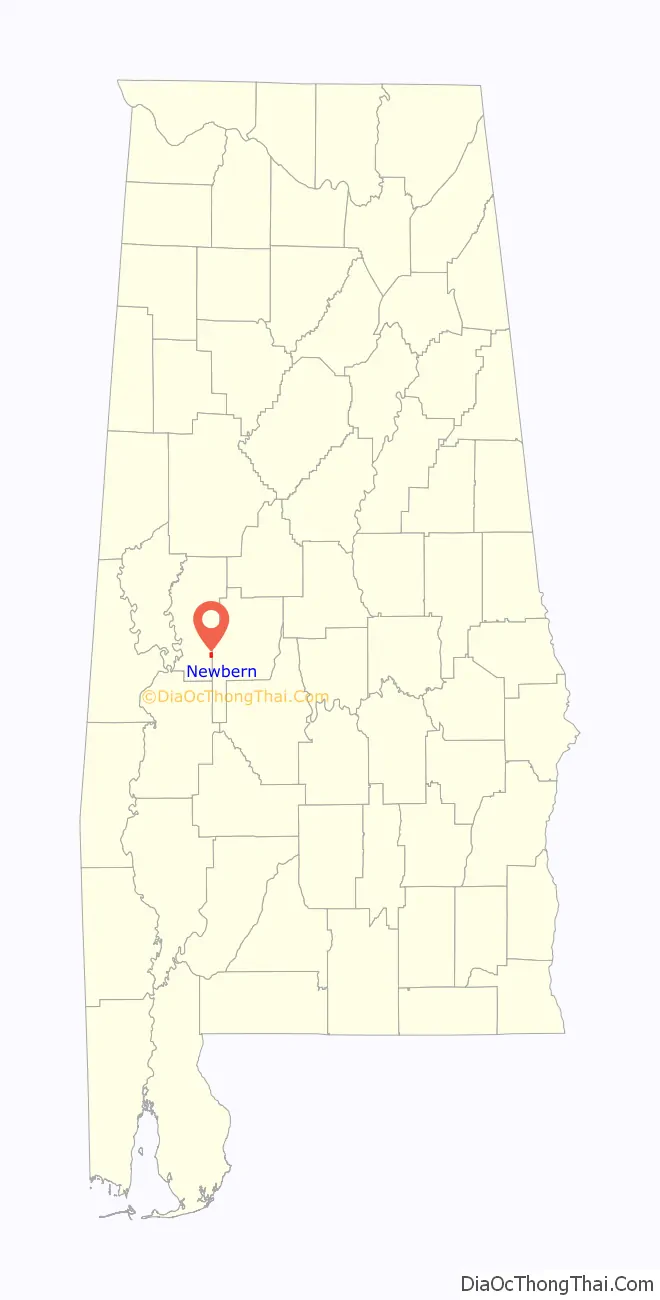
| State: | Alabama |
| County: | Hale County |
| Elevation: | 187 ft (57 m) |
| Total Area: | 1.16 sq mi (3.02 km²) |
| Land Area: | 1.16 sq mi (3.01 km²) |
| Water Area: | 0.00 sq mi (0.01 km²) |
| Total Population: | 133 |
| Population Density: | 114.46/sq mi (44.18/km²) |
| ZIP code: | 36765 |
| Area code: | 334 |
| FIPS code: | 0153784 |
| GNISfeature ID: | 0152687 |
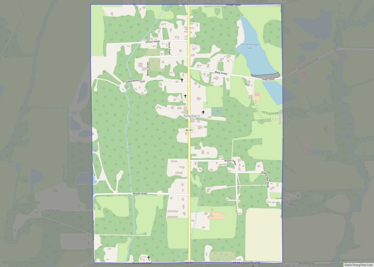
Online Interactive Map
Click on ![]() to view map in "full screen" mode.
to view map in "full screen" mode.
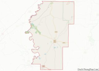
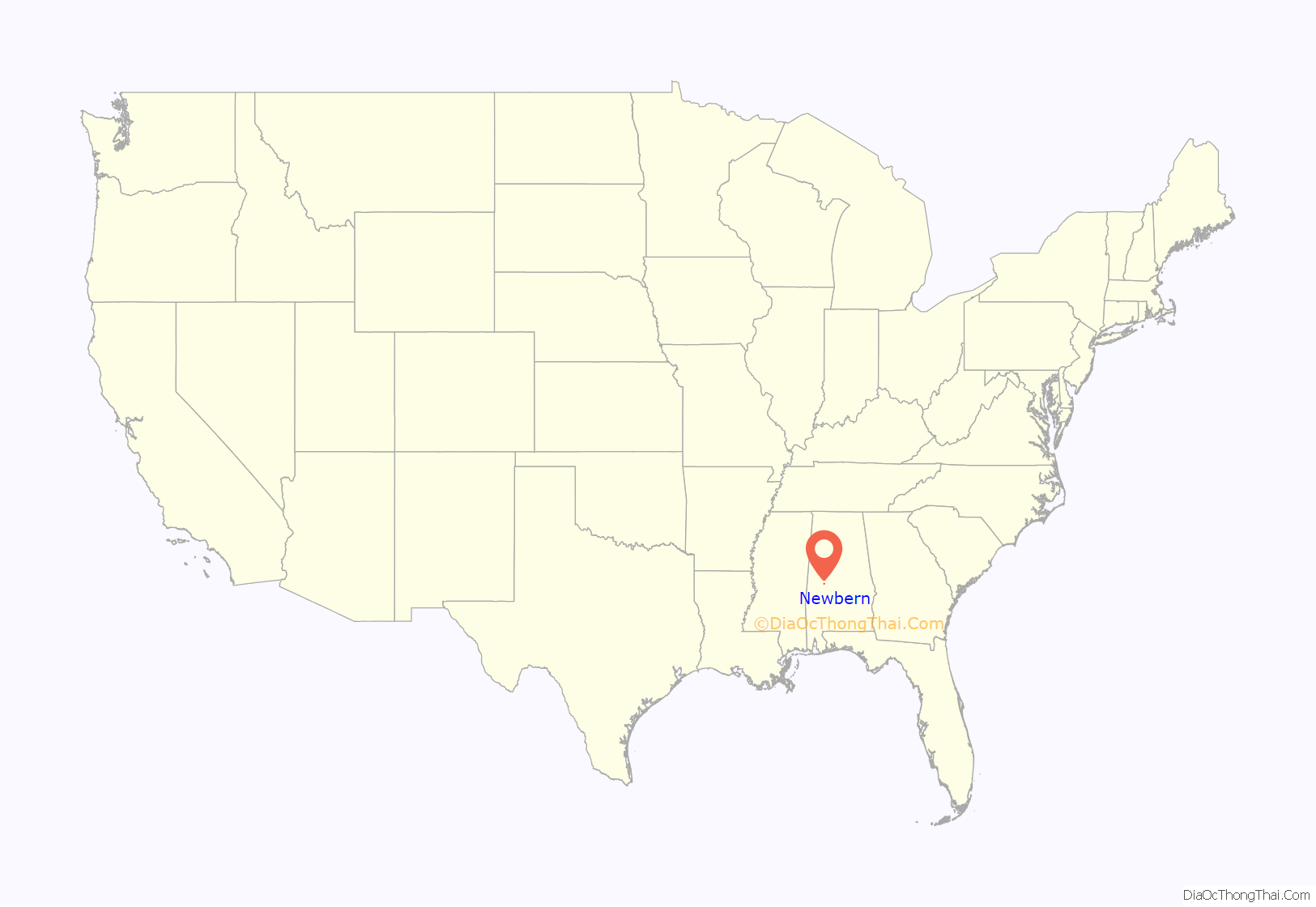
Newbern location map. Where is Newbern town?
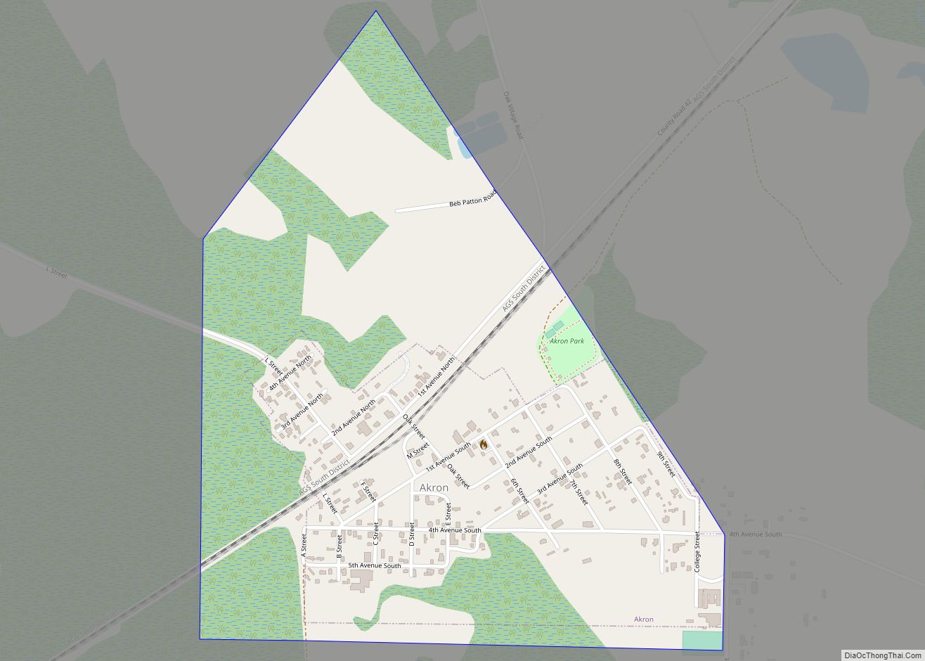
Newbern Road Map
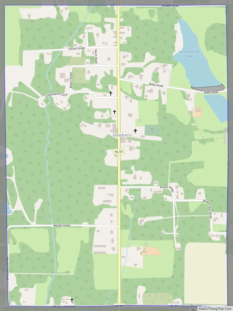
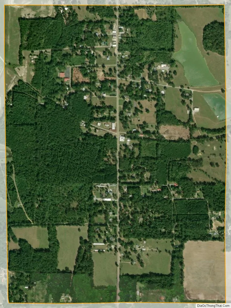
Newbern city Satellite Map
Geography
Newbern is located at 32°35′41″N 87°32′8″W / 32.59472°N 87.53556°W / 32.59472; -87.53556 (32.594818, -87.535431).
According to the U.S. Census Bureau, the town has a total area of 1.2 square miles (3.1 km), all land.
The town is located in the geographic region known as the Black Belt, related to the fertile soil which attracted developers of cotton plantations in the antebellum years, and also to the population of enslaved African Americans who worked at those sites. Many areas of the rural Black Belt are still majority African American in population.
See also
Map of Alabama State and its subdivision:- Autauga
- Baldwin
- Barbour
- Bibb
- Blount
- Bullock
- Butler
- Calhoun
- Chambers
- Cherokee
- Chilton
- Choctaw
- Clarke
- Clay
- Cleburne
- Coffee
- Colbert
- Conecuh
- Coosa
- Covington
- Crenshaw
- Cullman
- Dale
- Dallas
- De Kalb
- Elmore
- Escambia
- Etowah
- Fayette
- Franklin
- Geneva
- Greene
- Hale
- Henry
- Houston
- Jackson
- Jefferson
- Lamar
- Lauderdale
- Lawrence
- Lee
- Limestone
- Lowndes
- Macon
- Madison
- Marengo
- Marion
- Marshall
- Mobile
- Monroe
- Montgomery
- Morgan
- Perry
- Pickens
- Pike
- Randolph
- Russell
- Saint Clair
- Shelby
- Sumter
- Talladega
- Tallapoosa
- Tuscaloosa
- Walker
- Washington
- Wilcox
- Winston
- Alabama
- Alaska
- Arizona
- Arkansas
- California
- Colorado
- Connecticut
- Delaware
- District of Columbia
- Florida
- Georgia
- Hawaii
- Idaho
- Illinois
- Indiana
- Iowa
- Kansas
- Kentucky
- Louisiana
- Maine
- Maryland
- Massachusetts
- Michigan
- Minnesota
- Mississippi
- Missouri
- Montana
- Nebraska
- Nevada
- New Hampshire
- New Jersey
- New Mexico
- New York
- North Carolina
- North Dakota
- Ohio
- Oklahoma
- Oregon
- Pennsylvania
- Rhode Island
- South Carolina
- South Dakota
- Tennessee
- Texas
- Utah
- Vermont
- Virginia
- Washington
- West Virginia
- Wisconsin
- Wyoming