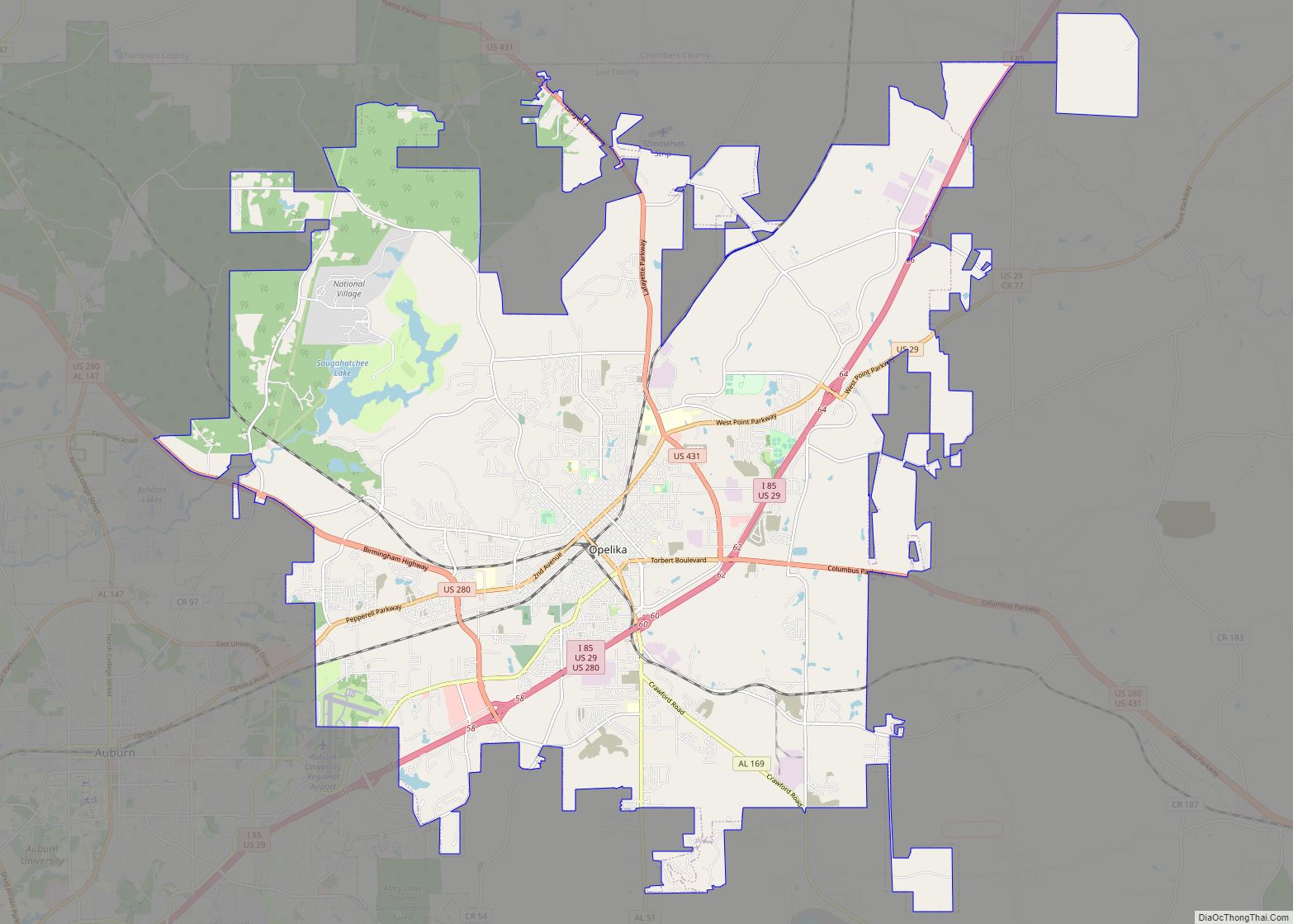
Opelika (pronounced /ˌoʊpəˈlaɪkə/ OH-pə-LY-kə) is a city in and the county seat of Lee County in the east-central part of the U.S. state of Alabama. It is a principal city of the Auburn-Opelika Metropolitan Area. As of the 2020 census, the population of Opelika is 30,995, an increase of 17.1 percent from the 2010 Census where the population was 26,477. The Auburn-Opelika, AL MSA with a population of 150,933, along with the Columbus, Georgia metropolitan area, comprises the Greater Columbus combined statistical area, a region home to 501,649 residents.
| Name: | Opelika city |
|---|---|
| LSAD Code: | 25 |
| LSAD Description: | city (suffix) |
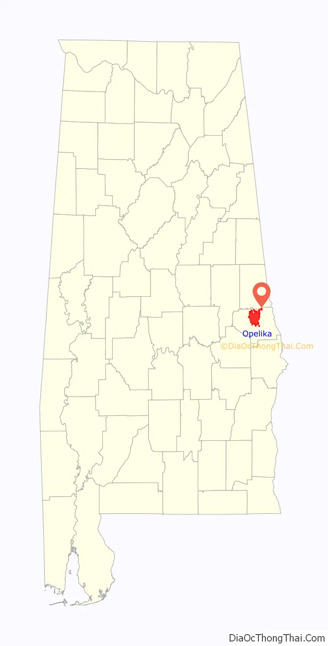
| State: | Alabama |
| County: | Lee County |
| Elevation: | 807 ft (246 m) |
| Land Area: | 61.15 sq mi (158.39 km²) |
| Water Area: | 1.01 sq mi (2.62 km²) |
| Population Density: | 506.84/sq mi (195.69/km²) |
| ZIP code: | 36801-36804 |
| Area code: | 334 |
| FIPS code: | 0157048 |
| GNISfeature ID: | 0152814 |
| Website: | www.opelika-al.gov |
Online Interactive Map
Click on ![]() to view map in "full screen" mode.
to view map in "full screen" mode.
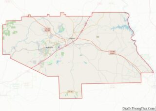
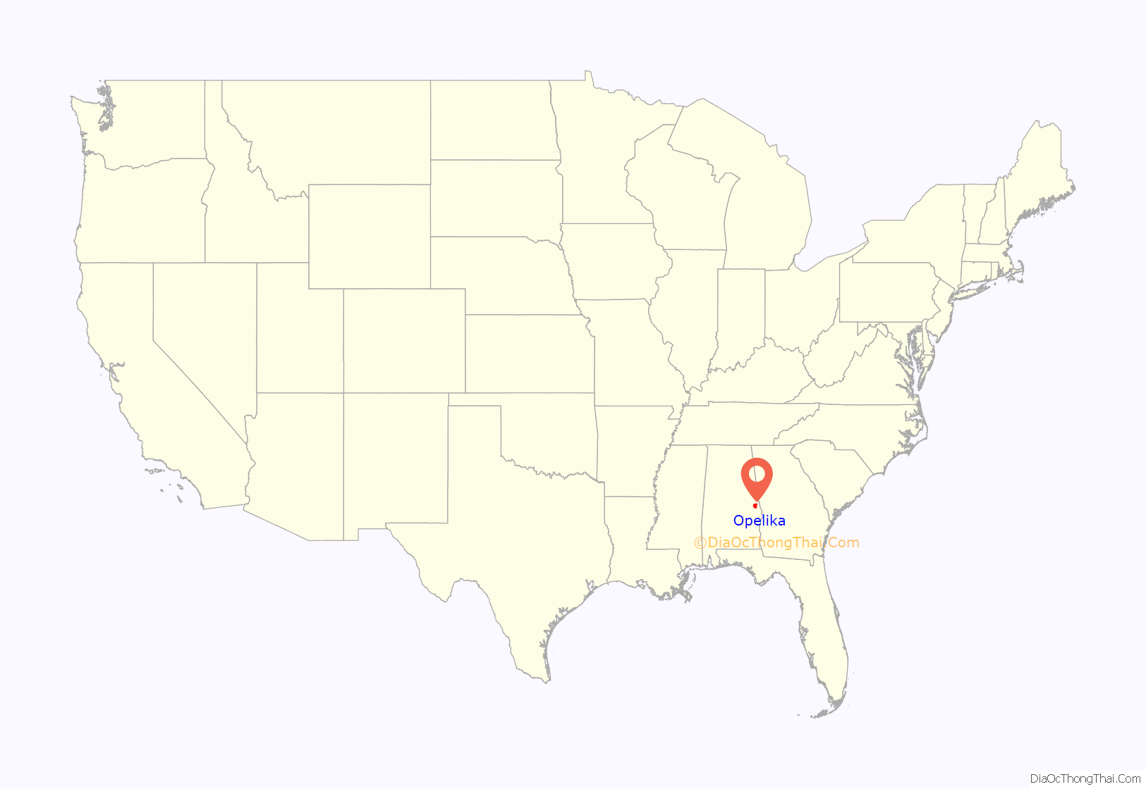
Opelika location map. Where is Opelika city?
History
The Opelika area was first settled in 1832 after the Treaty of Cusseta was signed by the U.S. government and the Creek Nation. This treaty placed the land, and all other Creek territories east of the Mississippi River, under the possession of the United States government. Though the territory now belonged to the U.S., Opelika kept its Creek name, which translates to “large swamp”.
Two decades after settlement, Opelika was chartered as a town on February 9, 1854, thanks to its rapid growth. This growth was due to the Montgomery & West Point Railroad Company’s rail lines, which traversed the town and served as major means of transportation for unprocessed cotton between the northern and southern territories.
Opelika later received a new charter in 1870, and its rapid growth continued. The town nearly doubled in size between 1870 and 1900.
Opelika’s downtown was packed with saloons catering to railroad workers and other men. Frequent gunfire in the street by intoxicated patrons resulted in railroads directing their passengers to duck beneath the windows when their trains passed through the town.
In 1882, two factions claimed to rule the city government, one known as the “Bar room” headed by Mayor Dunbar, a saloon keeper, and another known as the “Citizens”. In a riot in late November–December of that year, a dozen men were wounded. In the end, a few were killed. The Citizens had claimed control of the city via the elections, but Dunbar refused to give up. After continued violence, the state legislature revoked the city’s charter and the governor sent in the militia to restore order. The legislature appointed five commissioners to manage the city, a situation that continued until 1899. That year, the legislature restored the city’s charter.
1900 to present
Opelika’s largest employer is the East Alabama Medical Center, which paid around $119 million in salaries and benefits to more than 2,700 employees in 2009.
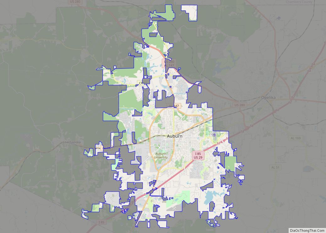
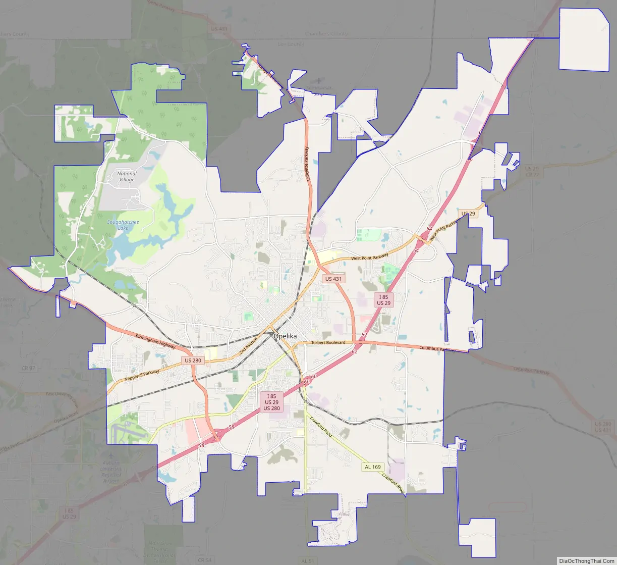
Opelika Road Map
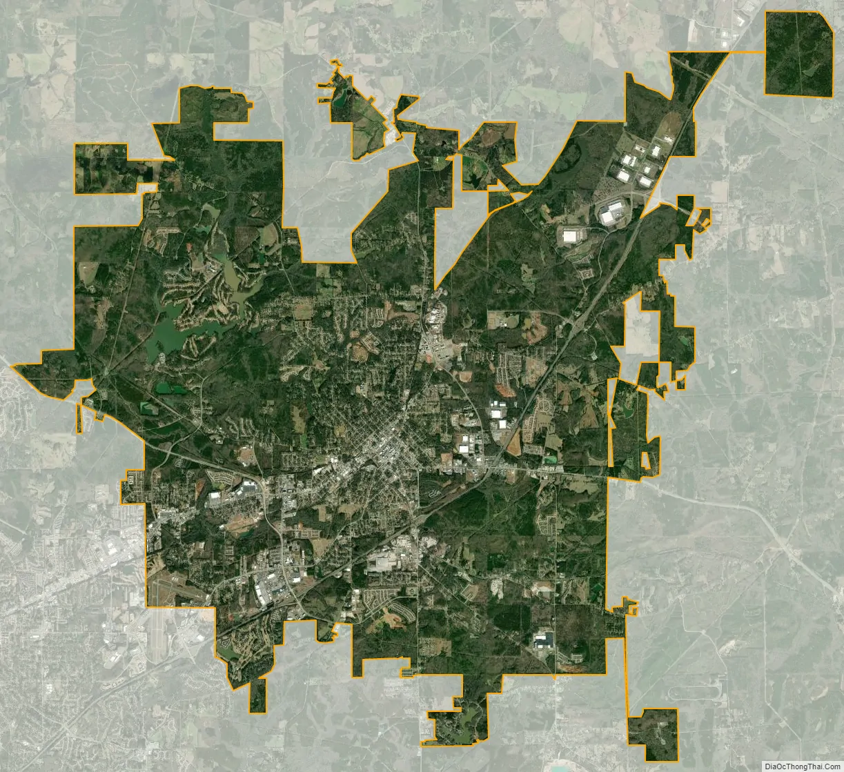
Opelika city Satellite Map
Geography
Climate
See also
Map of Alabama State and its subdivision:- Autauga
- Baldwin
- Barbour
- Bibb
- Blount
- Bullock
- Butler
- Calhoun
- Chambers
- Cherokee
- Chilton
- Choctaw
- Clarke
- Clay
- Cleburne
- Coffee
- Colbert
- Conecuh
- Coosa
- Covington
- Crenshaw
- Cullman
- Dale
- Dallas
- De Kalb
- Elmore
- Escambia
- Etowah
- Fayette
- Franklin
- Geneva
- Greene
- Hale
- Henry
- Houston
- Jackson
- Jefferson
- Lamar
- Lauderdale
- Lawrence
- Lee
- Limestone
- Lowndes
- Macon
- Madison
- Marengo
- Marion
- Marshall
- Mobile
- Monroe
- Montgomery
- Morgan
- Perry
- Pickens
- Pike
- Randolph
- Russell
- Saint Clair
- Shelby
- Sumter
- Talladega
- Tallapoosa
- Tuscaloosa
- Walker
- Washington
- Wilcox
- Winston
- Alabama
- Alaska
- Arizona
- Arkansas
- California
- Colorado
- Connecticut
- Delaware
- District of Columbia
- Florida
- Georgia
- Hawaii
- Idaho
- Illinois
- Indiana
- Iowa
- Kansas
- Kentucky
- Louisiana
- Maine
- Maryland
- Massachusetts
- Michigan
- Minnesota
- Mississippi
- Missouri
- Montana
- Nebraska
- Nevada
- New Hampshire
- New Jersey
- New Mexico
- New York
- North Carolina
- North Dakota
- Ohio
- Oklahoma
- Oregon
- Pennsylvania
- Rhode Island
- South Carolina
- South Dakota
- Tennessee
- Texas
- Utah
- Vermont
- Virginia
- Washington
- West Virginia
- Wisconsin
- Wyoming