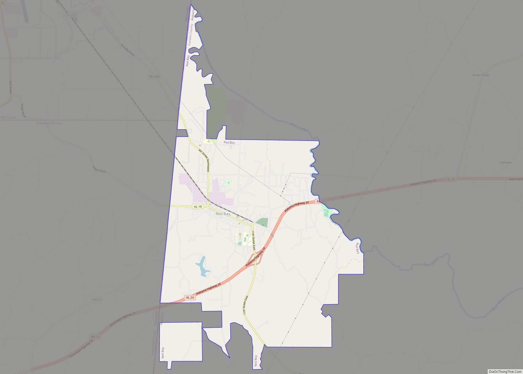
Red Bay is a city in Franklin County, Alabama, United States. It was founded in 1907; its western boundary line is integral with the state line between Mississippi and Alabama. The population was 3,232 at the 2020 census. The town’s name comes from the area’s red clay soil and the many redbay trees (Persea borbonia) in this area of north Alabama.
| Name: | Red Bay city |
|---|---|
| LSAD Code: | 25 |
| LSAD Description: | city (suffix) |
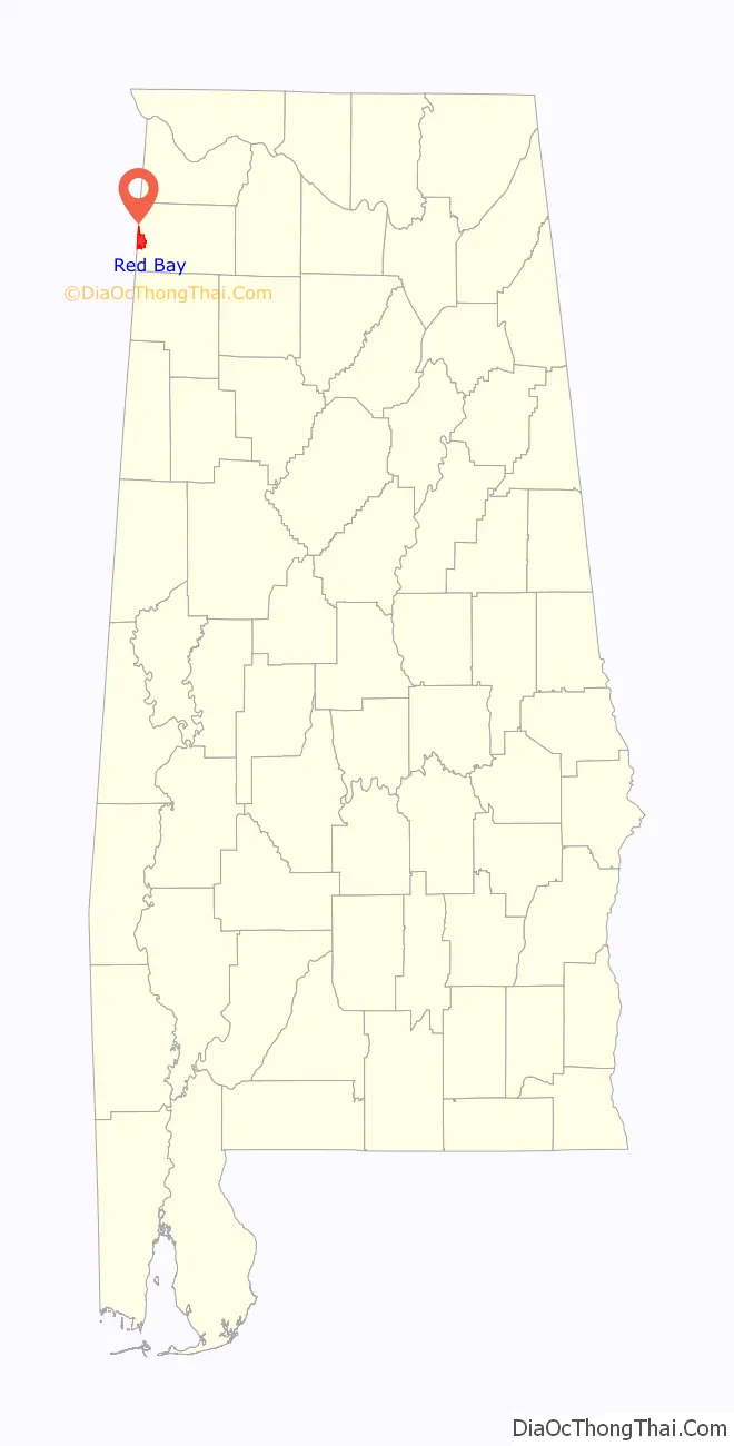
| State: | Alabama |
| County: | Franklin County |
| Elevation: | 643 ft (196 m) |
| Total Area: | 9.84 sq mi (25.49 km²) |
| Land Area: | 9.75 sq mi (25.26 km²) |
| Water Area: | 0.09 sq mi (0.24 km²) |
| Total Population: | 3,232 |
| Population Density: | 331.42/sq mi (127.97/km²) |
| Area code: | 256 |
| FIPS code: | 0163576 |
| GNISfeature ID: | 0155213 |
| Website: | www.cityofredbay.org |
Online Interactive Map
Click on ![]() to view map in "full screen" mode.
to view map in "full screen" mode.
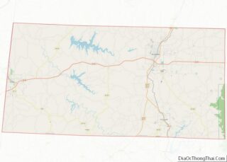
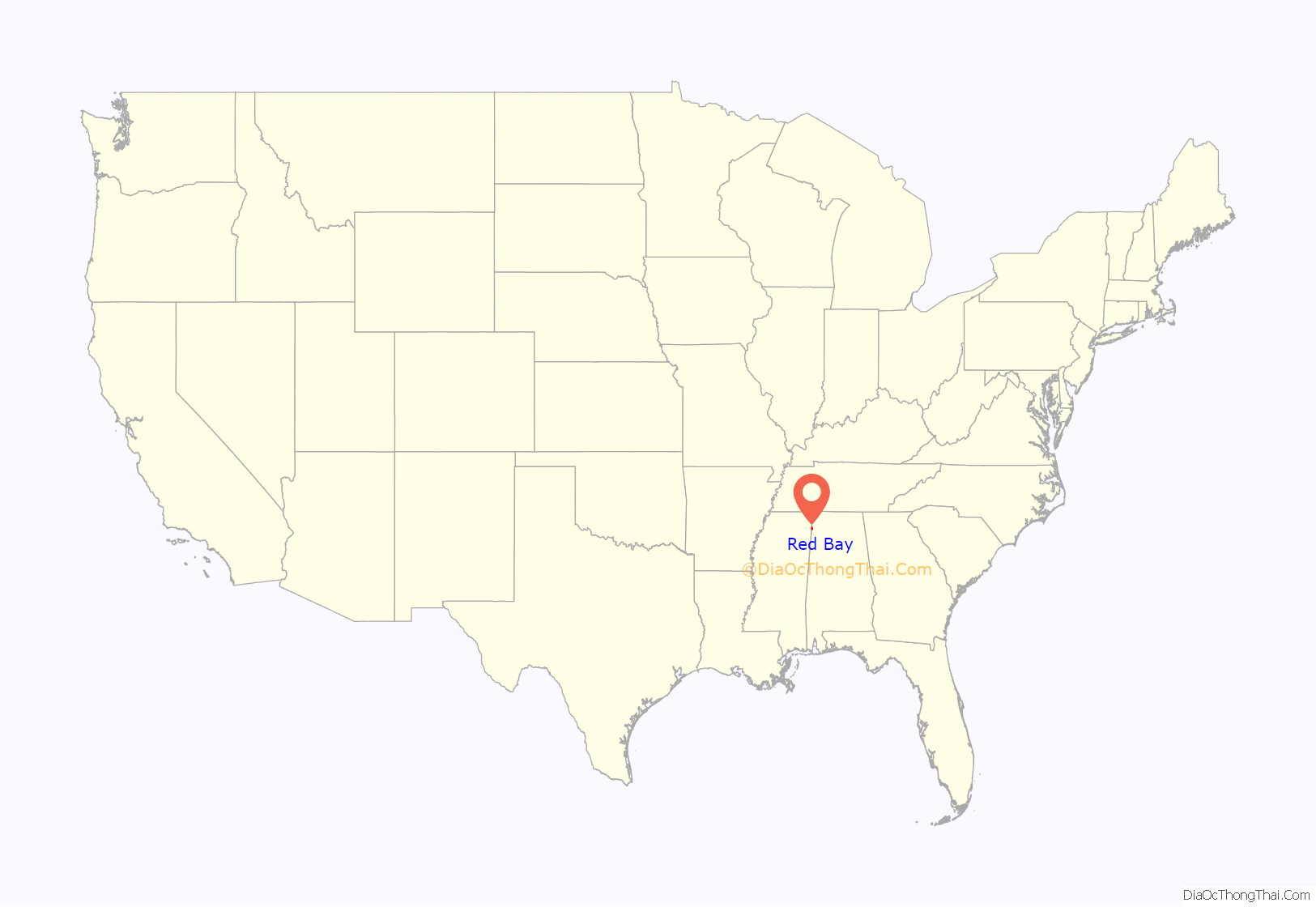
Red Bay location map. Where is Red Bay city?
History
What is now Red Bay was originally known as “Vinson’s Crossroads,” and was initially located further to the southwest along Gum Creek. A branch of the Illinois Central Railroad was constructed through the area in 1907, and Red Bay developed into an important lumber and shipping center. The city incorporated during this same period.
Oak trees
One of the city’s most well known and admired features are the redbay trees. The trees, planted by the Red Bay Garden Club in the 1930s, cast a canopy over Main Street.
Red Bay High School
The first school in Red Bay was located where the First United Methodist Church stands today. In 1903, this school had one faculty member who was responsible for teaching, as well as most of the custodial duties. After crops were harvested, students attended school through the remainder of the fall and winter months until the spring planting season.
The second school was constructed in the early 1900s. It was located on the site that is now the location of the Red Bay City Park. It was a small building with few amenities. The school continued dismissals timed with the local harvests.
In 1927, a new school site was selected, and a new school built for $45,000. Since this construction, the location of the school has not changed. The building constructed in 1927 was a brick “U”, one of the most popular school designs in Alabama at the time. Facing the school, the right wing of the “U” housed the elementary classes while the left wing held the high school. Once inside the school, after going under the stone entryway, the office of the principal was on your immediate left. A small room on the right served as the library. A large auditorium with double wooden seats that could be folded and stored was centrally located between the two wings. The building housing the home economics and agriculture departments was located on the left of the main school building. At a later date, classrooms were added to the left wing of the main building. Due to the slope of the site, a ground-level lunchroom was included in this addition. With steps leading from the hallway, the first cafeteria available to Red Bay students became operational.
Due to increased enrollment, a new high school section was completed in 1962. In 1967, the auditorium and elementary wing of the 1927 building was destroyed by fire. The disaster occurred while school was in session, but no injuries occurred. Plans began immediately to rebuild the school. A new auditorium and elementary classroom section first welcomed students during the 1968–69 school year.
In 1976, Red Bay celebrated both the nation’s bicentennial and the opening of a new gymnasium. Eight years later, in 1984, a new cafeteria was ready for use in time for the school’s annual football banquet. The former cafeteria was renovated providing five additional classrooms, a photography lab, and a yearbook staff workroom.
Football games were first played in a pasture where the present Sunshine Homes plant is located. Later, the games were played at the American Legion Field which is the current location of Tiffin Motor Homes. Red Bay finished runnerup in football in 1974 and 1976. Following the 1976 runner-up game, there was a scandal involving Red Bay football team and coaches on alcohol abuse before the game. The football teams in the following seasons struggled to win a game, until the 1986-87 team which won the first game in years. There were players who, prior to this time, granted scholarships at Alabama and Auburn. One notable player was Van Tiffin, who went on to the University of Alabama and made his mark there by kicking a 52-yard game-winning field goal against Alabama’s archrival Auburn that is now known in Alabama’s hall of fame as “The Kick”. The Red Bay football teams reached state semifinals in 1990, 1997, and 2007.
Red Bay girls basketball has five state championships. Red Bay boys basketball made the final eight teams in 1995 with a 26–5 record. Red Bay’s highest finish in tennis was 2008, in fifth place. Red Bay baseball was class 2A State runnerup in 1987.
City Hall fire
In the summer of 2006, the Red Bay City Hall caught fire after a transformer exploded. Construction on a new city hall building began shortly afterward. The contractor bid for the new city hall by Burton Construction of Belmont, Mississippi, was supposedly $750,000. Bids were also set for a new police department building with the lowest bid being placed at $500,000.
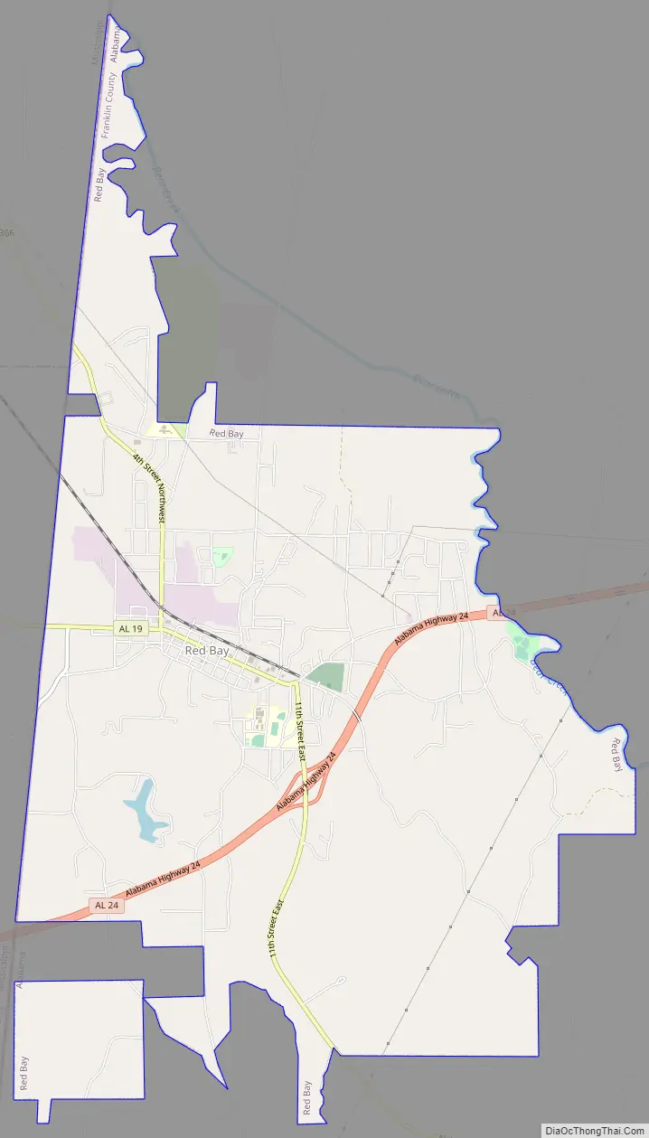
Red Bay Road Map
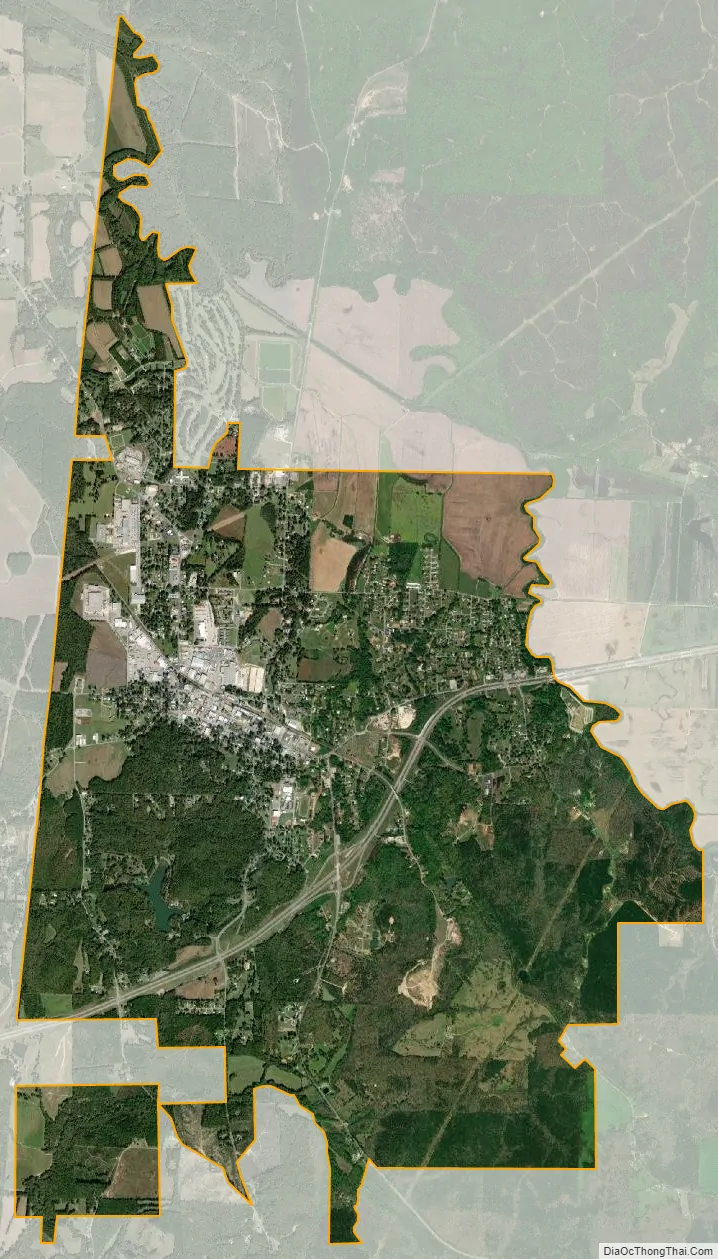
Red Bay city Satellite Map
Geography
Red Bay is located in western Franklin County at 34°26′24″N 88°8′18″W / 34.44000°N 88.13833°W / 34.44000; -88.13833 (34.439898, -88.138208). The western border of the city is the Mississippi state line. It is situated on the Tennessee Valley Divide, with the northern half of the city draining north to Bear Creek, a tributary of the Tennessee River, and the southern half draining south to Gum Creek, a tributary of the Tombigbee River.
Alabama State Route 24 is a four-lane highway that passes south of the city center, leading east 25 miles (40 km) to Russellville and west 2 miles (3 km) to the Mississippi line. Tremont, Mississippi, is 18 miles (29 km) to the southwest.
According to the U.S. Census Bureau, the city has a total area of 9.8 square miles (25.5 km), of which 9.7 square miles (25.2 km) is land and 0.1 square miles (0.3 km), or 1.01%, is water.
See also
Map of Alabama State and its subdivision:- Autauga
- Baldwin
- Barbour
- Bibb
- Blount
- Bullock
- Butler
- Calhoun
- Chambers
- Cherokee
- Chilton
- Choctaw
- Clarke
- Clay
- Cleburne
- Coffee
- Colbert
- Conecuh
- Coosa
- Covington
- Crenshaw
- Cullman
- Dale
- Dallas
- De Kalb
- Elmore
- Escambia
- Etowah
- Fayette
- Franklin
- Geneva
- Greene
- Hale
- Henry
- Houston
- Jackson
- Jefferson
- Lamar
- Lauderdale
- Lawrence
- Lee
- Limestone
- Lowndes
- Macon
- Madison
- Marengo
- Marion
- Marshall
- Mobile
- Monroe
- Montgomery
- Morgan
- Perry
- Pickens
- Pike
- Randolph
- Russell
- Saint Clair
- Shelby
- Sumter
- Talladega
- Tallapoosa
- Tuscaloosa
- Walker
- Washington
- Wilcox
- Winston
- Alabama
- Alaska
- Arizona
- Arkansas
- California
- Colorado
- Connecticut
- Delaware
- District of Columbia
- Florida
- Georgia
- Hawaii
- Idaho
- Illinois
- Indiana
- Iowa
- Kansas
- Kentucky
- Louisiana
- Maine
- Maryland
- Massachusetts
- Michigan
- Minnesota
- Mississippi
- Missouri
- Montana
- Nebraska
- Nevada
- New Hampshire
- New Jersey
- New Mexico
- New York
- North Carolina
- North Dakota
- Ohio
- Oklahoma
- Oregon
- Pennsylvania
- Rhode Island
- South Carolina
- South Dakota
- Tennessee
- Texas
- Utah
- Vermont
- Virginia
- Washington
- West Virginia
- Wisconsin
- Wyoming