Vernon is a city in Lamar County, Alabama, United States. The city is the county seat of Lamar County, and previously served as the seat of its two predecessors, Jones County (not to be confused with Covington County), which briefly existed in 1867, and for Sanford County from 1868 until it was renamed Lamar in 1877. It incorporated in 1870. At the 2010 census the population was 2,000, down from 2,143 in 2000. It is the largest city in Lamar County as of 2010, and previously held the distinction in 1880 and from 1960 to 1990, falling to 2nd place in 2000 behind Sulligent, but since reclaiming the title.
| Name: | Vernon city |
|---|---|
| LSAD Code: | 25 |
| LSAD Description: | city (suffix) |
| State: | Alabama |
| County: | Lamar County |
| Elevation: | 295 ft (90 m) |
| Total Area: | 5.89 sq mi (15.26 km²) |
| Land Area: | 5.89 sq mi (15.26 km²) |
| Water Area: | 0.00 sq mi (0.00 km²) |
| Total Population: | 1,921 |
| Population Density: | 325.92/sq mi (125.85/km²) |
| ZIP code: | 35592 |
| Area code: | 205, 659 |
| FIPS code: | 0178480 |
| GNISfeature ID: | 0153839 |
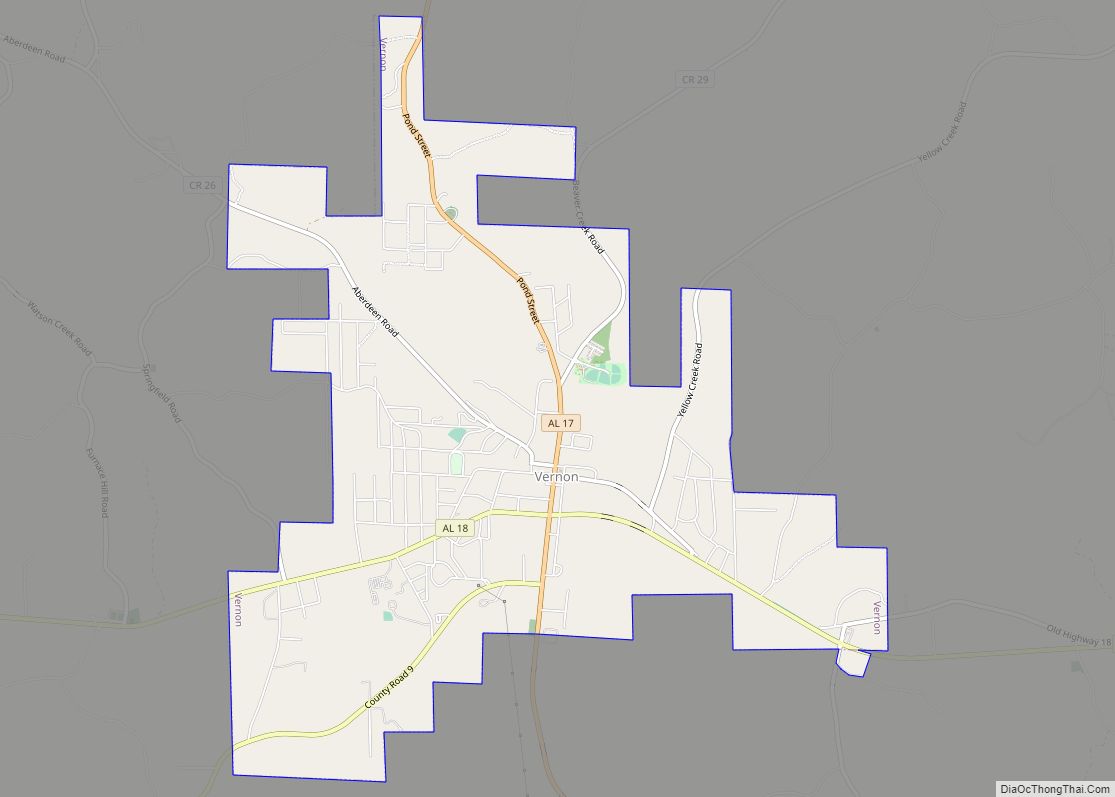
Online Interactive Map
Click on ![]() to view map in "full screen" mode.
to view map in "full screen" mode.
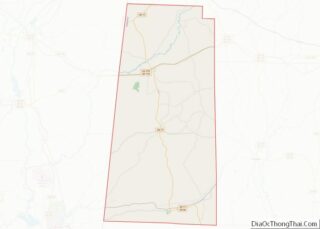
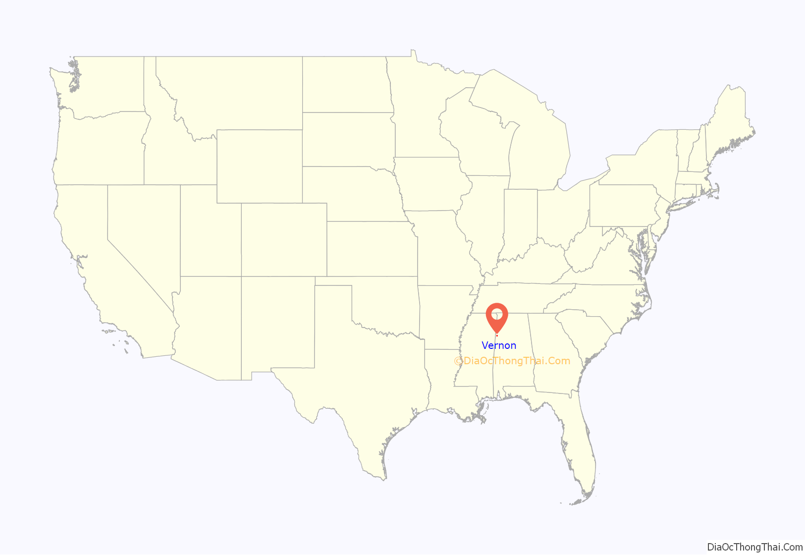
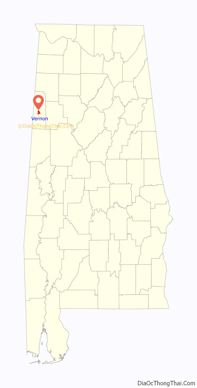
Vernon location map. Where is Vernon city?
History
The city of Vernon was originally known as Swayne Courthouse; it was named for the head of the Freedman’s Bureau, General Wager Swayne, who served in the Chattahoochee District of the state. Many of the records of this time were lost, when the courthouse burned in 1866. The name of the town was changed in 1868 to Vernon after Edmund Vernon.
Both before and after the Civil war, the economy of Vernon was based on timber, agriculture, and milling. After the Civil War, the plantations were sold off to timber interests, which eliminated many jobs. Since the end of Reconstruction, Vernon has experienced waves of manufacturing with textile factories being introduced in the early 20th century. All of these textile factories no longer exist. Some manufacturers remain, such as Marathon, an international manufacturer of trash compactors.
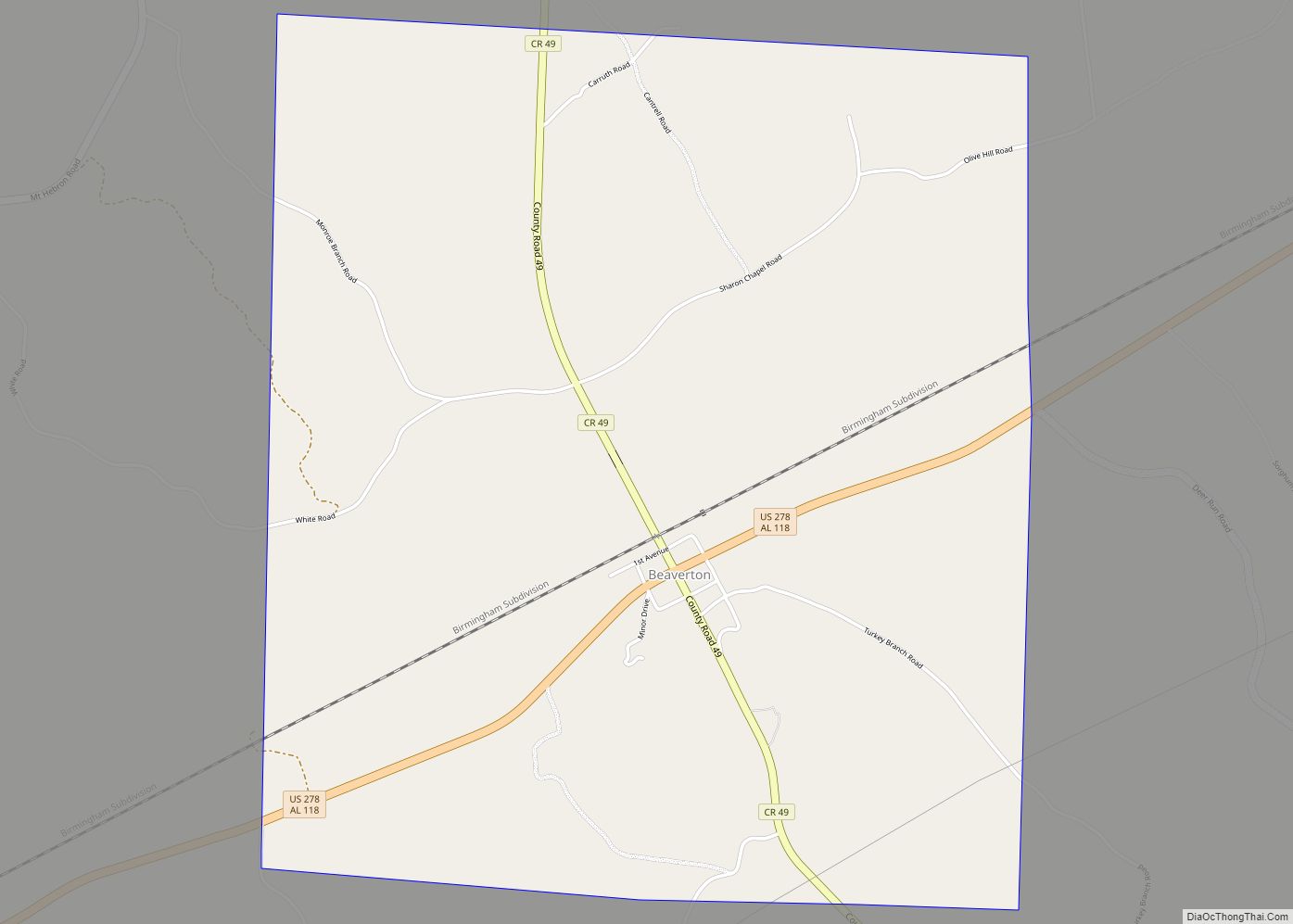
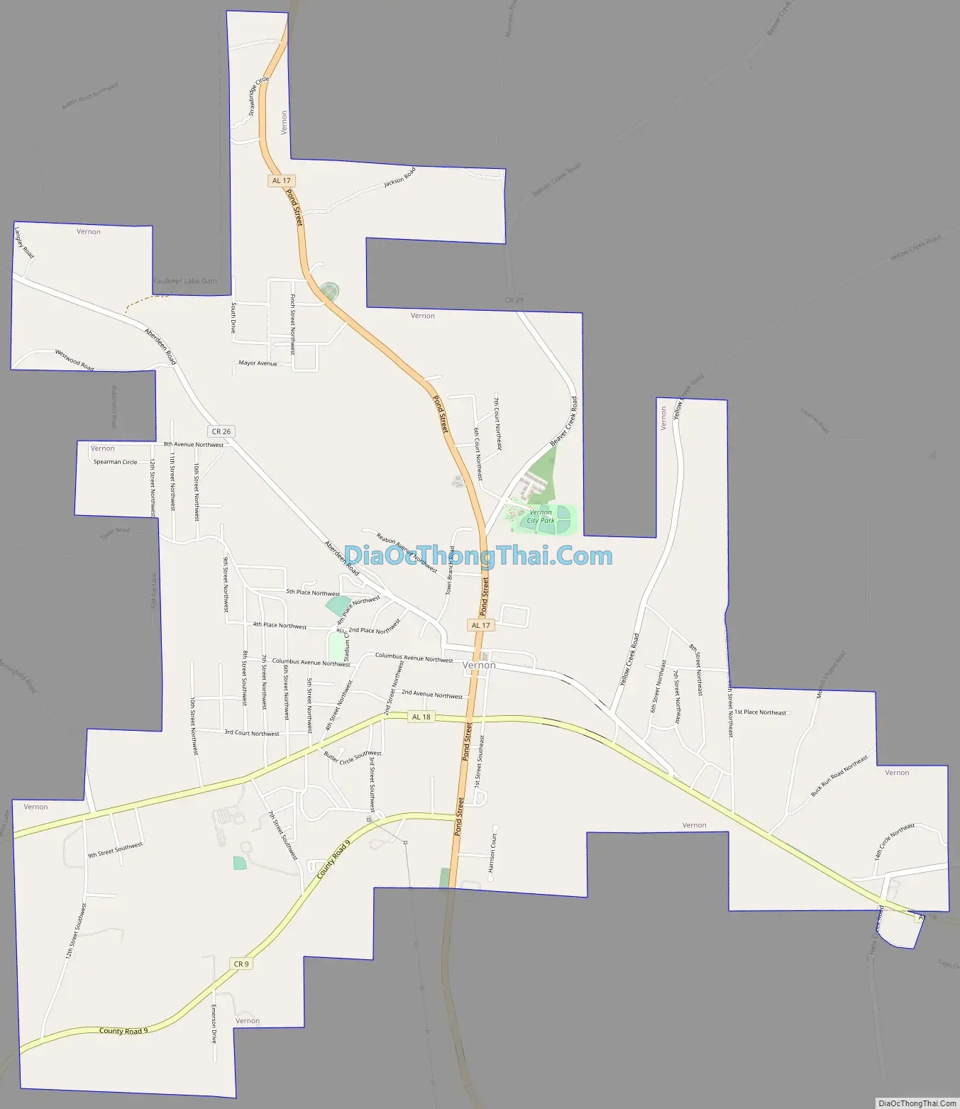
Vernon Road Map
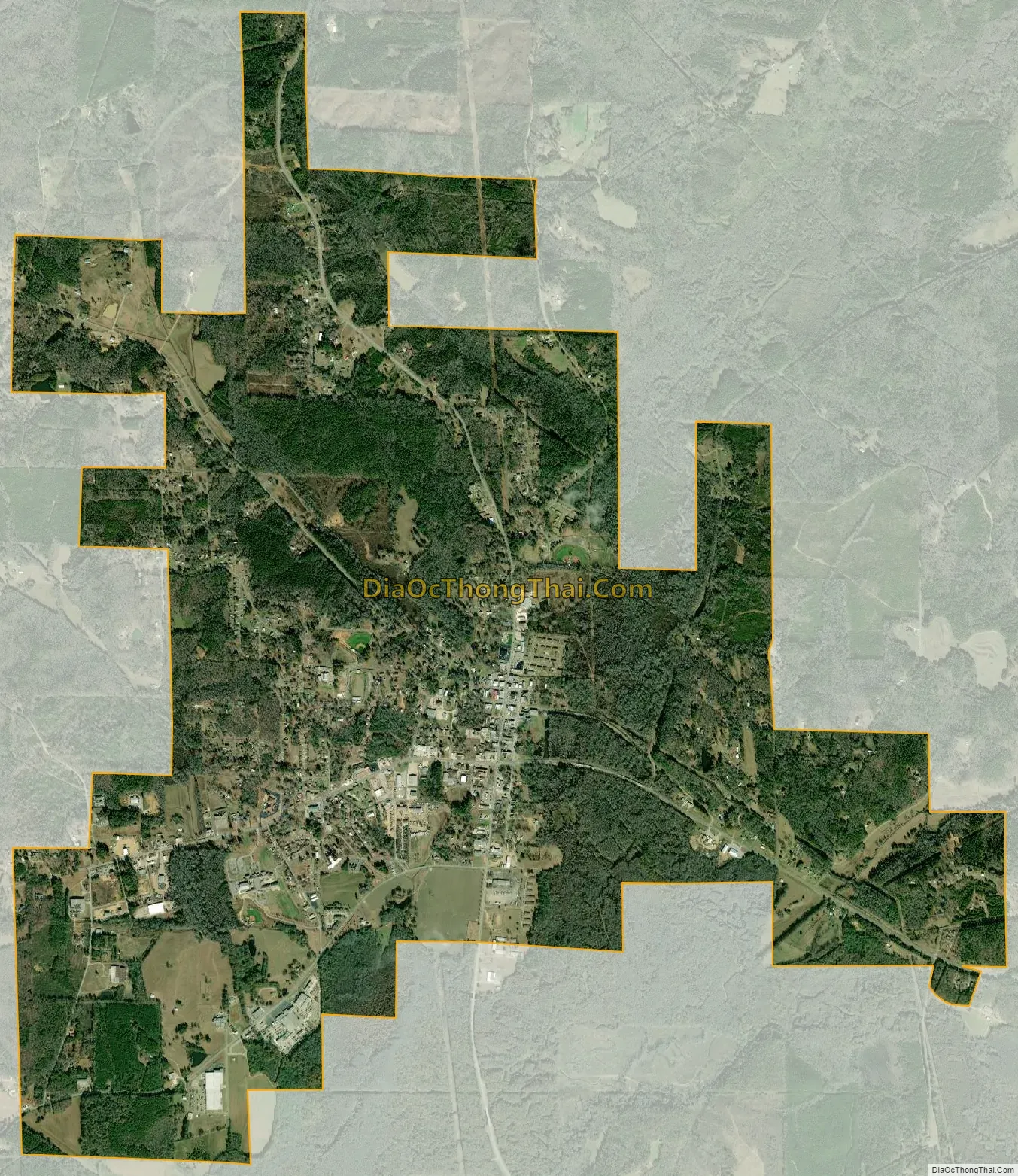
Vernon city Satellite Map
Geography
Vernon is located at 33°45′23″N 88°6′41″W / 33.75639°N 88.11139°W / 33.75639; -88.11139 (33.756414, -88.111409).
According to the U.S. Census Bureau, the city has a total area of 5.9 square miles (15 km), all land.
Climate
See also
Map of Alabama State and its subdivision:- Autauga
- Baldwin
- Barbour
- Bibb
- Blount
- Bullock
- Butler
- Calhoun
- Chambers
- Cherokee
- Chilton
- Choctaw
- Clarke
- Clay
- Cleburne
- Coffee
- Colbert
- Conecuh
- Coosa
- Covington
- Crenshaw
- Cullman
- Dale
- Dallas
- De Kalb
- Elmore
- Escambia
- Etowah
- Fayette
- Franklin
- Geneva
- Greene
- Hale
- Henry
- Houston
- Jackson
- Jefferson
- Lamar
- Lauderdale
- Lawrence
- Lee
- Limestone
- Lowndes
- Macon
- Madison
- Marengo
- Marion
- Marshall
- Mobile
- Monroe
- Montgomery
- Morgan
- Perry
- Pickens
- Pike
- Randolph
- Russell
- Saint Clair
- Shelby
- Sumter
- Talladega
- Tallapoosa
- Tuscaloosa
- Walker
- Washington
- Wilcox
- Winston
- Alabama
- Alaska
- Arizona
- Arkansas
- California
- Colorado
- Connecticut
- Delaware
- District of Columbia
- Florida
- Georgia
- Hawaii
- Idaho
- Illinois
- Indiana
- Iowa
- Kansas
- Kentucky
- Louisiana
- Maine
- Maryland
- Massachusetts
- Michigan
- Minnesota
- Mississippi
- Missouri
- Montana
- Nebraska
- Nevada
- New Hampshire
- New Jersey
- New Mexico
- New York
- North Carolina
- North Dakota
- Ohio
- Oklahoma
- Oregon
- Pennsylvania
- Rhode Island
- South Carolina
- South Dakota
- Tennessee
- Texas
- Utah
- Vermont
- Virginia
- Washington
- West Virginia
- Wisconsin
- Wyoming