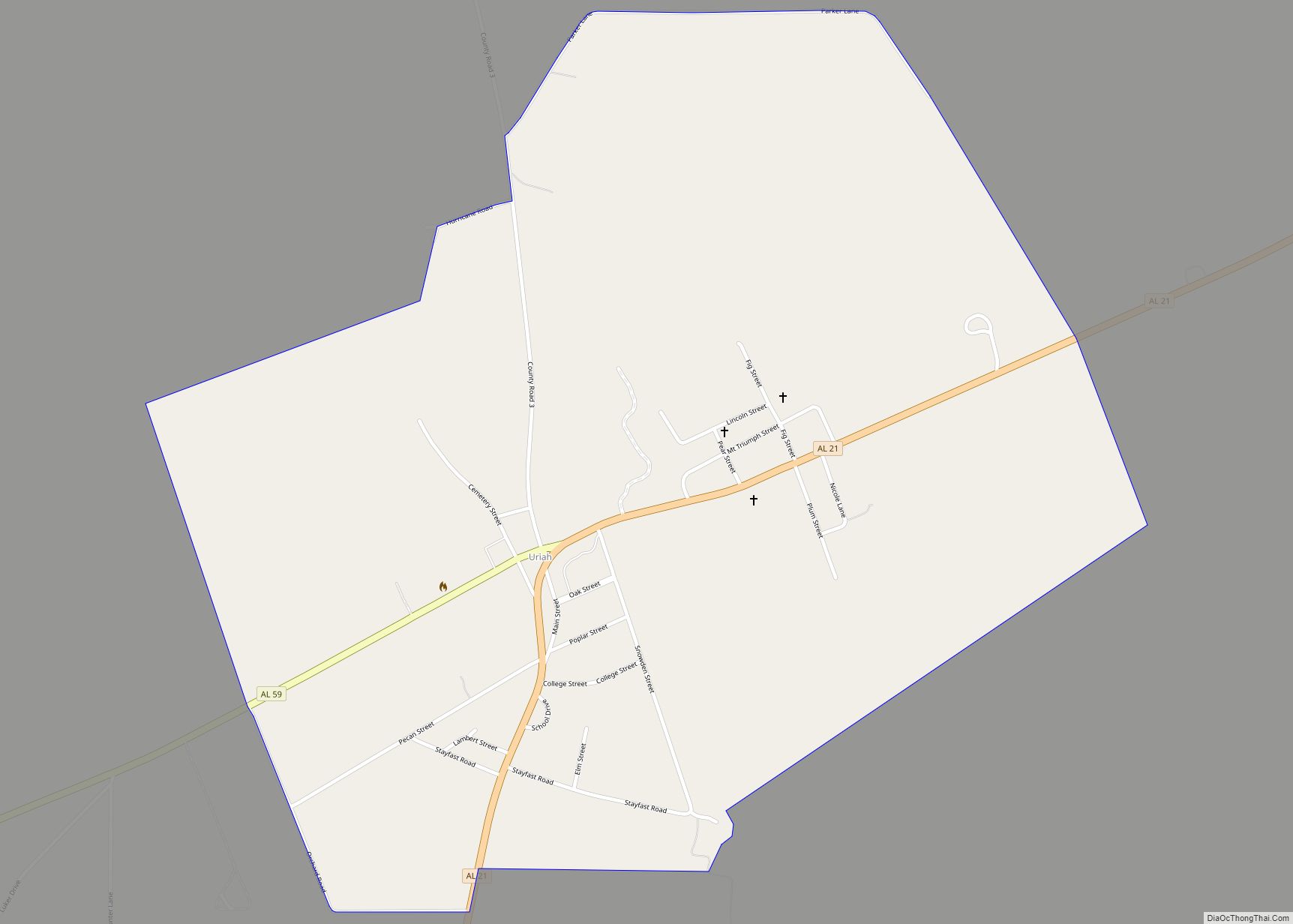
Uriah (pronounced, in the local English dialect, “you-rye”) is a census-designated place and unincorporated community in Monroe County, Alabama. Uriah is located at the junction of State Route 21 and State Route 59. As of the 2020 census, its population was 263, down from 294 at the 2010 census.
| Name: | Uriah CDP |
|---|---|
| LSAD Code: | 57 |
| LSAD Description: | CDP (suffix) |
| State: | Alabama |
| County: | Monroe County |
| Elevation: | 351 ft (107 m) |
| Total Area: | 1.61 sq mi (4.16 km²) |
| Land Area: | 1.61 sq mi (4.16 km²) |
| Water Area: | 0.00 sq mi (0.00 km²) |
| Total Population: | 263 |
| Population Density: | 163.76/sq mi (63.22/km²) |
| ZIP code: | 36480 |
| Area code: | 251 |
| FIPS code: | 0178120 |
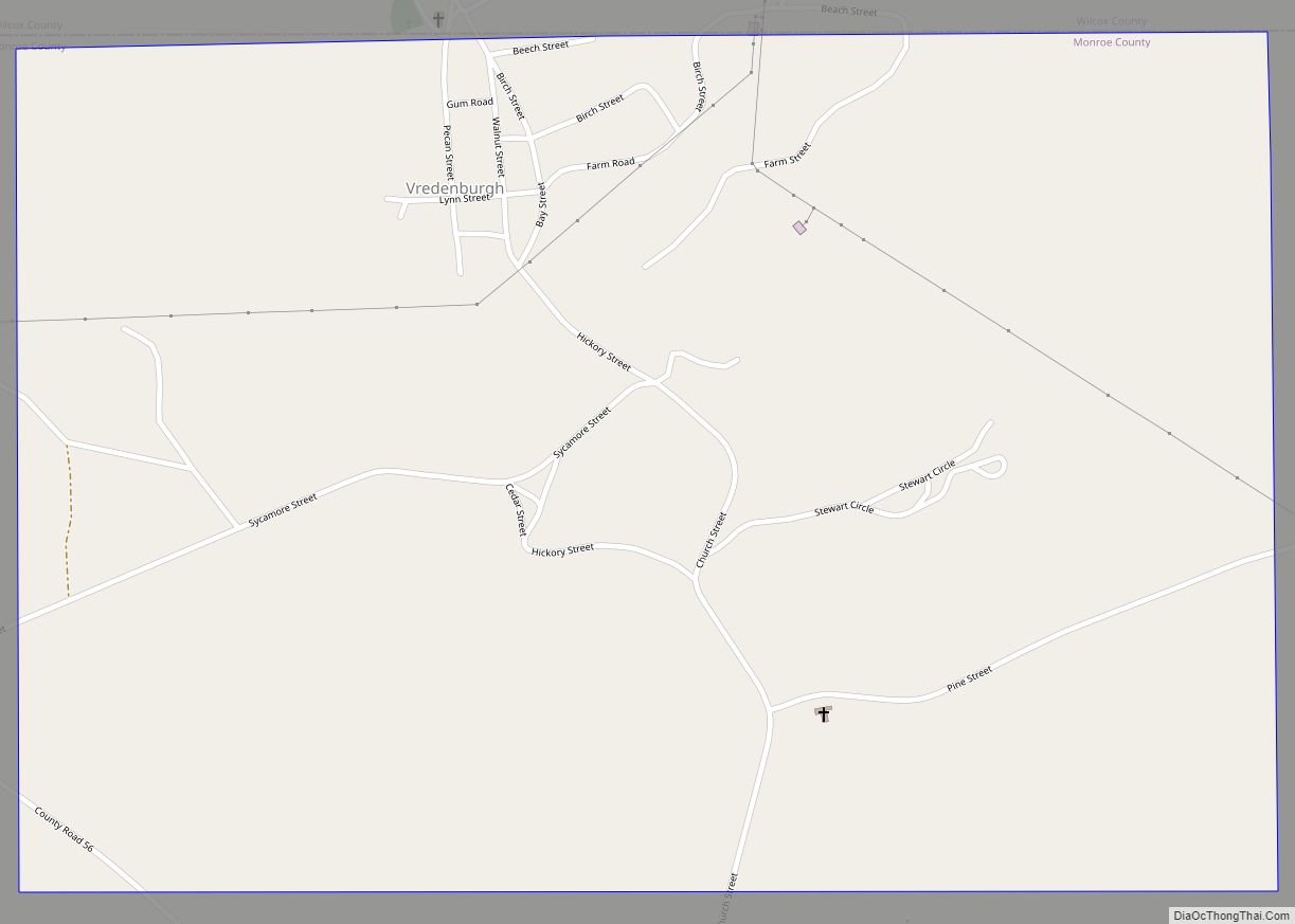
Online Interactive Map
Click on ![]() to view map in "full screen" mode.
to view map in "full screen" mode.
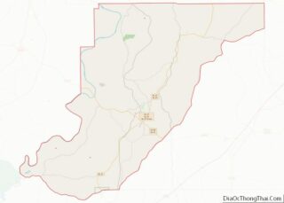
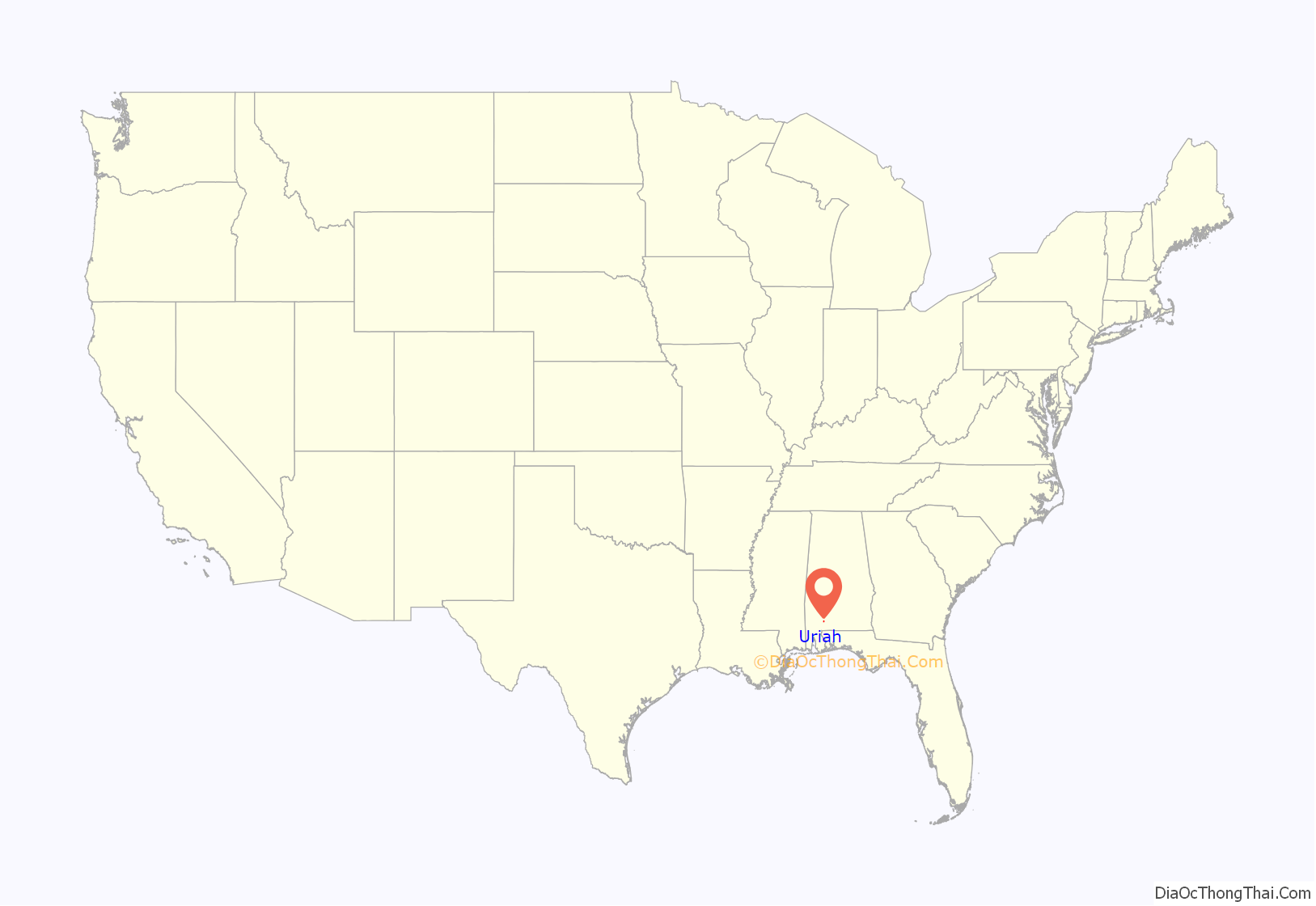
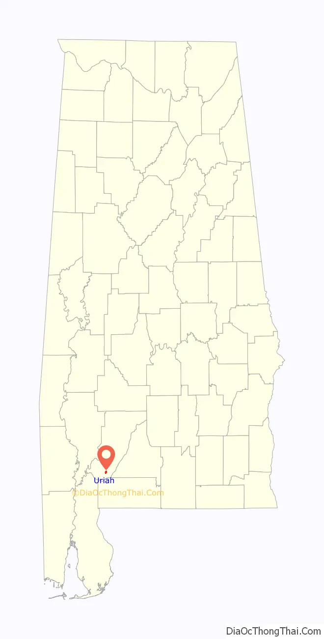
Uriah location map. Where is Uriah CDP?
History
The area was settled around the 1870s after the United States government had forcibly removed a majority of the American Indians to west of the Mississippi River. Anglo-Americans, and other Caucasians with predominantly Creek mixture, settled the area, clearing timber and developing farms.
When Uriah was full of virgin timber it was originally named Maros. The first three families to own property between Jeddo Road (located in Uriah) and the Atmore city limits were the Hollingers, Dees and Lomaxes.
In the 21st century, it continues to be rural, with most people working in agriculture and timber.
Uriah Road Map
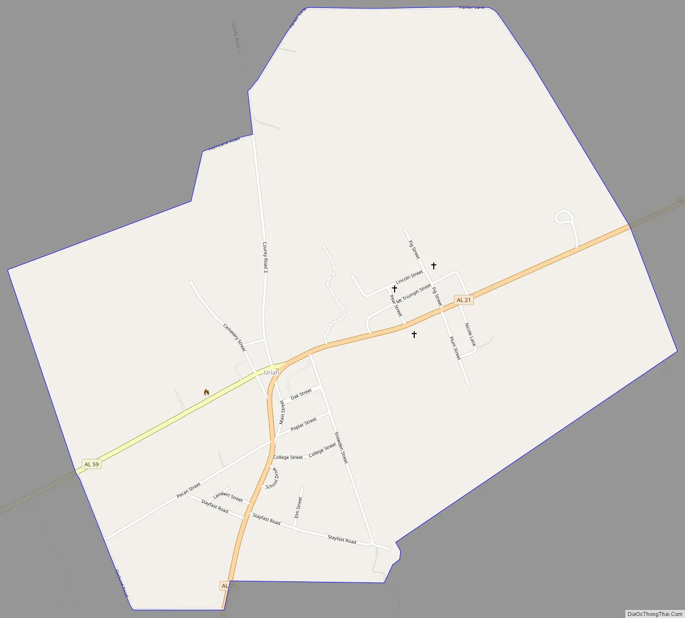
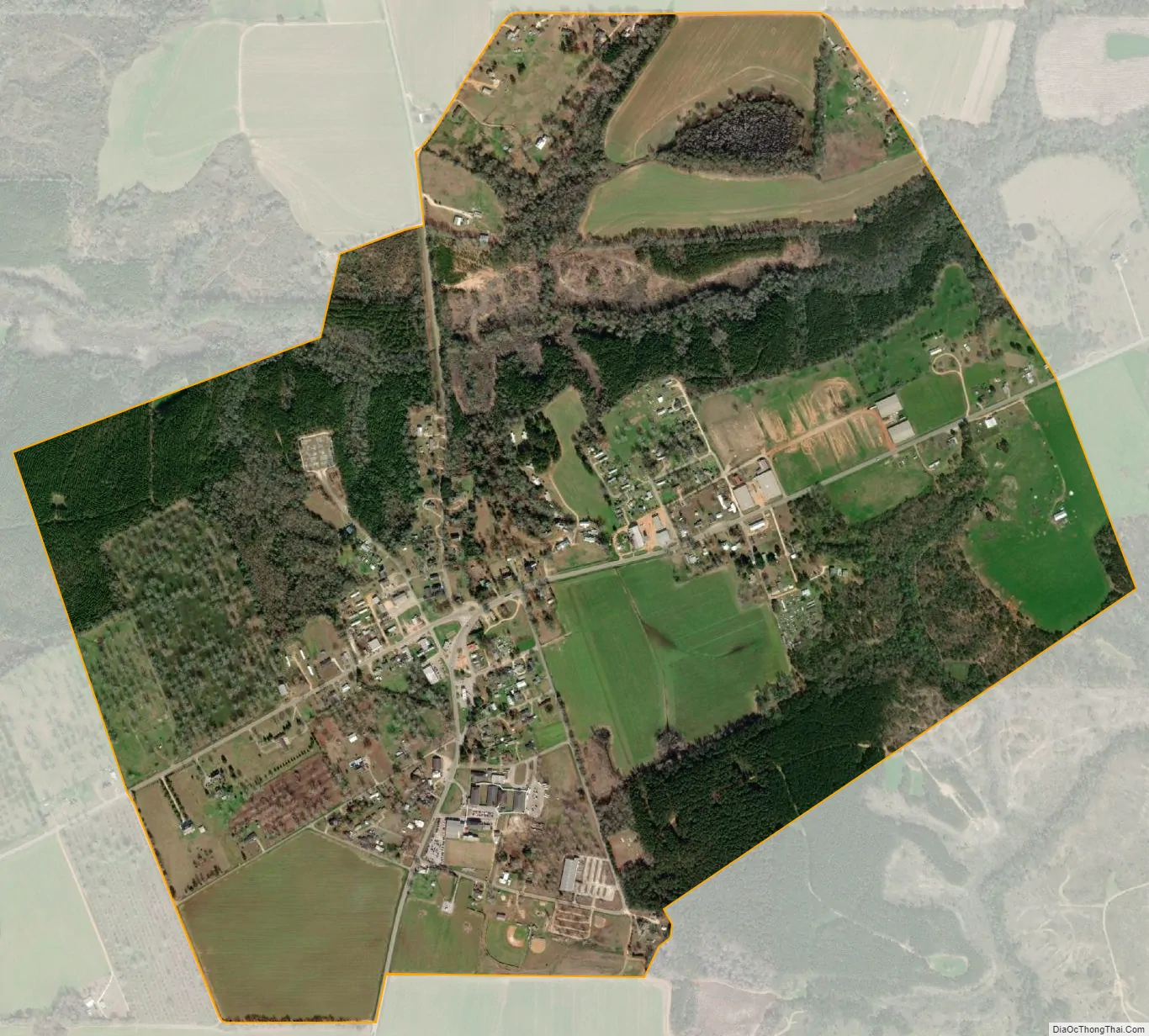
Uriah city Satellite Map
See also
Map of Alabama State and its subdivision:- Autauga
- Baldwin
- Barbour
- Bibb
- Blount
- Bullock
- Butler
- Calhoun
- Chambers
- Cherokee
- Chilton
- Choctaw
- Clarke
- Clay
- Cleburne
- Coffee
- Colbert
- Conecuh
- Coosa
- Covington
- Crenshaw
- Cullman
- Dale
- Dallas
- De Kalb
- Elmore
- Escambia
- Etowah
- Fayette
- Franklin
- Geneva
- Greene
- Hale
- Henry
- Houston
- Jackson
- Jefferson
- Lamar
- Lauderdale
- Lawrence
- Lee
- Limestone
- Lowndes
- Macon
- Madison
- Marengo
- Marion
- Marshall
- Mobile
- Monroe
- Montgomery
- Morgan
- Perry
- Pickens
- Pike
- Randolph
- Russell
- Saint Clair
- Shelby
- Sumter
- Talladega
- Tallapoosa
- Tuscaloosa
- Walker
- Washington
- Wilcox
- Winston
- Alabama
- Alaska
- Arizona
- Arkansas
- California
- Colorado
- Connecticut
- Delaware
- District of Columbia
- Florida
- Georgia
- Hawaii
- Idaho
- Illinois
- Indiana
- Iowa
- Kansas
- Kentucky
- Louisiana
- Maine
- Maryland
- Massachusetts
- Michigan
- Minnesota
- Mississippi
- Missouri
- Montana
- Nebraska
- Nevada
- New Hampshire
- New Jersey
- New Mexico
- New York
- North Carolina
- North Dakota
- Ohio
- Oklahoma
- Oregon
- Pennsylvania
- Rhode Island
- South Carolina
- South Dakota
- Tennessee
- Texas
- Utah
- Vermont
- Virginia
- Washington
- West Virginia
- Wisconsin
- Wyoming