Dermott is a city in Chicot County, Arkansas, United States. The population was 2,316 at the 2010 census. Dermott was incorporated in 1890.
Dermott was home to the Dermott Crawfish Festival.
| Name: | Dermott city |
|---|---|
| LSAD Code: | 25 |
| LSAD Description: | city (suffix) |
| State: | Arkansas |
| County: | Chicot County |
| Elevation: | 141 ft (43 m) |
| Total Area: | 3.49 sq mi (9.05 km²) |
| Land Area: | 3.42 sq mi (8.86 km²) |
| Water Area: | 0.07 sq mi (0.19 km²) |
| Total Population: | 2,021 |
| Population Density: | 590.76/sq mi (228.08/km²) |
| ZIP code: | 71638 |
| Area code: | 870 |
| FIPS code: | 0518520 |
| GNISfeature ID: | 0057646 |
Online Interactive Map
Click on ![]() to view map in "full screen" mode.
to view map in "full screen" mode.
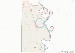
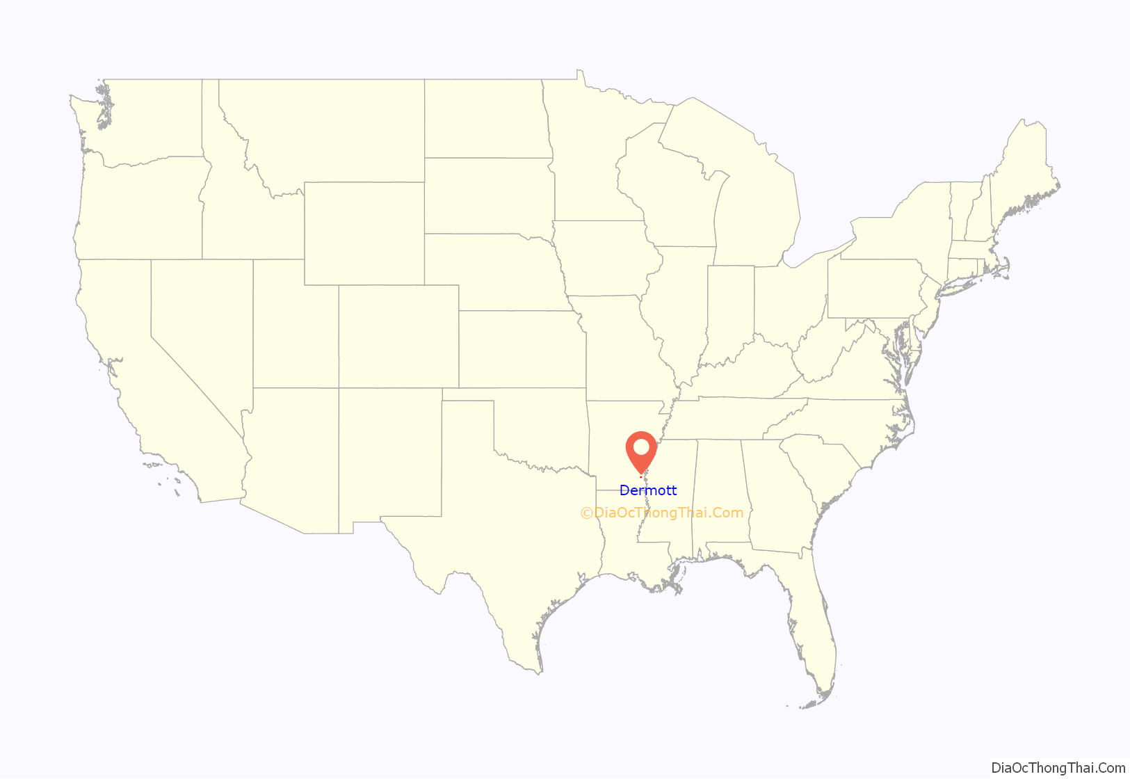
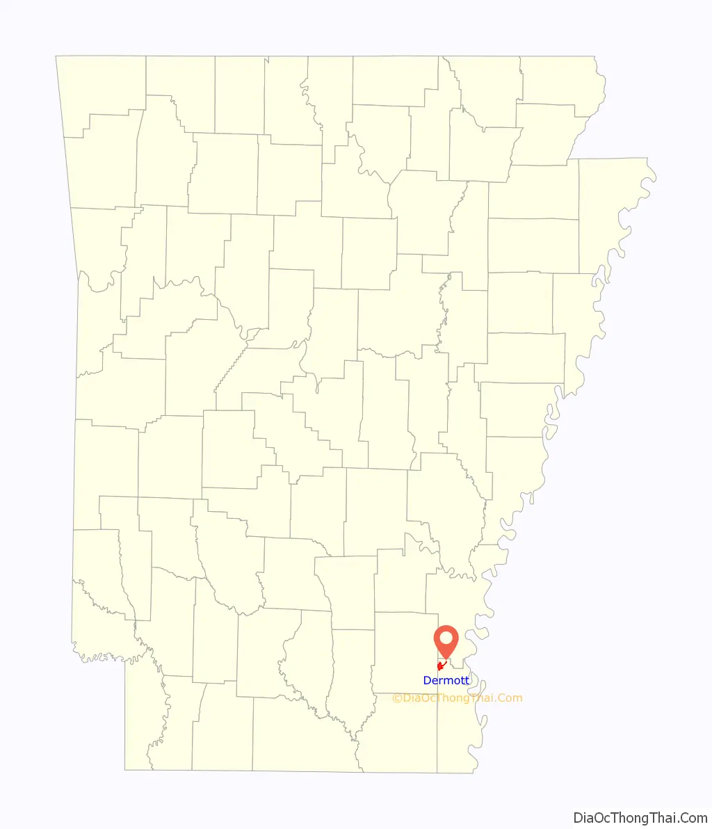
Dermott location map. Where is Dermott city?
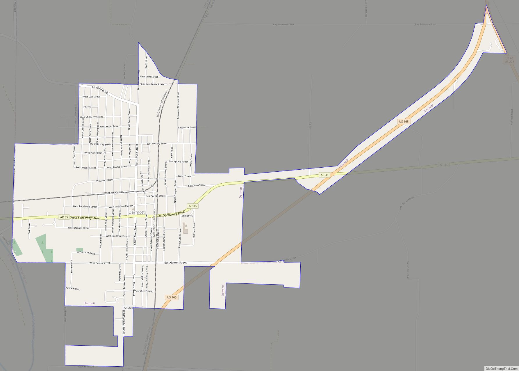
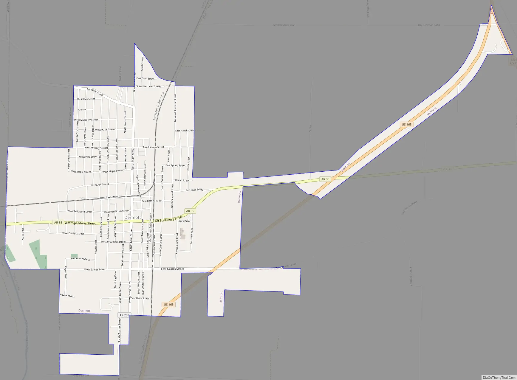
Dermott Road Map
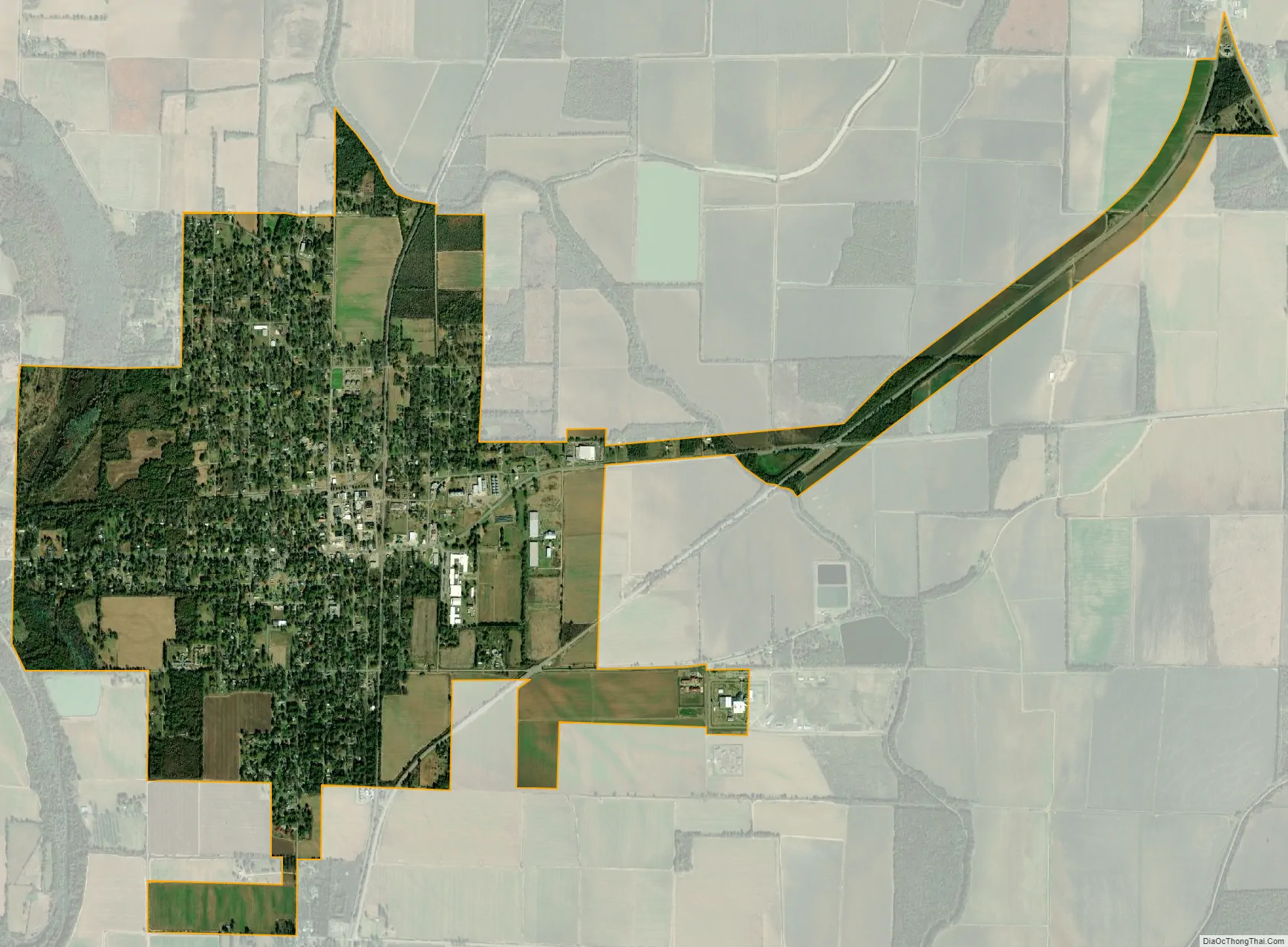
Dermott city Satellite Map
Geography
Dermott is located in the northwest corner of Chicot County at 33°31′43″N 91°26′16″W / 33.52861°N 91.43778°W / 33.52861; -91.43778 (33.528712, -91.437657). Bayou Bartholomew, a tributary of the Ouachita River, touches the southwest corner of the city. U.S. Route 165 passes southeast of the city center, leading north 9 miles (14 km) to McGehee and south 15 miles (24 km) to Montrose. Arkansas Highway 35 passes through the center of Dermott and leads northwest 23 miles (37 km) to Monticello.
According to the United States Census Bureau, Dermott has a total area of 3.6 square miles (9.4 km), of which 3.6 square miles (9.2 km) is land and 0.08 square miles (0.2 km), or 1.97%, is water.
Climate
The climate in this area is characterized by hot, humid summers and generally mild to cool winters. According to the Köppen Climate Classification system, Dermott has a humid subtropical climate, abbreviated “Cfa” on climate maps.
See also
Map of Arkansas State and its subdivision:- Arkansas
- Ashley
- Baxter
- Benton
- Boone
- Bradley
- Calhoun
- Carroll
- Chicot
- Clark
- Clay
- Cleburne
- Cleveland
- Columbia
- Conway
- Craighead
- Crawford
- Crittenden
- Cross
- Dallas
- Desha
- Drew
- Faulkner
- Franklin
- Fulton
- Garland
- Grant
- Greene
- Hempstead
- Hot Spring
- Howard
- Independence
- Izard
- Jackson
- Jefferson
- Johnson
- Lafayette
- Lawrence
- Lee
- Lincoln
- Little River
- Logan
- Lonoke
- Madison
- Marion
- Miller
- Mississippi
- Monroe
- Montgomery
- Nevada
- Newton
- Ouachita
- Perry
- Phillips
- Pike
- Poinsett
- Polk
- Pope
- Prairie
- Pulaski
- Randolph
- Saint Francis
- Saline
- Scott
- Searcy
- Sebastian
- Sevier
- Sharp
- Stone
- Union
- Van Buren
- Washington
- White
- Woodruff
- Yell
- Alabama
- Alaska
- Arizona
- Arkansas
- California
- Colorado
- Connecticut
- Delaware
- District of Columbia
- Florida
- Georgia
- Hawaii
- Idaho
- Illinois
- Indiana
- Iowa
- Kansas
- Kentucky
- Louisiana
- Maine
- Maryland
- Massachusetts
- Michigan
- Minnesota
- Mississippi
- Missouri
- Montana
- Nebraska
- Nevada
- New Hampshire
- New Jersey
- New Mexico
- New York
- North Carolina
- North Dakota
- Ohio
- Oklahoma
- Oregon
- Pennsylvania
- Rhode Island
- South Carolina
- South Dakota
- Tennessee
- Texas
- Utah
- Vermont
- Virginia
- Washington
- West Virginia
- Wisconsin
- Wyoming