McGehee /məˈɡiː/ mə-GHEE is a city in Desha County, Arkansas, United States. The population was 4,219 at the 2010 census.
| Name: | McGehee city |
|---|---|
| LSAD Code: | 25 |
| LSAD Description: | city (suffix) |
| State: | Arkansas |
| County: | Desha County |
| Elevation: | 144 ft (44 m) |
| Total Area: | 6.71 sq mi (17.37 km²) |
| Land Area: | 6.71 sq mi (17.37 km²) |
| Water Area: | 0.00 sq mi (0.00 km²) |
| Total Population: | 3,849 |
| Population Density: | 573.79/sq mi (221.54/km²) |
| ZIP code: | 71654, 71666 |
| Area code: | 870 |
| FIPS code: | 0542770 |
| GNISfeature ID: | 0058148 |
| Website: | cityofmcgehee.com |
Online Interactive Map
Click on ![]() to view map in "full screen" mode.
to view map in "full screen" mode.
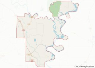
McGehee location map. Where is McGehee city?


History
The history of the city of McGehee and the history of the railroad through McGehee are intricately interwoven. The history of the railroad dates back to 1870 when a railroad was constructed from Pine Bluff southeast through Varner, to Chicot County.
In April 1923, the Gulf Coast Lines and the International-Great Northern were acquired, forming the Missouri Pacific Lines.
Important in the history of the town of McGehee is the McGehee family which came to the area from Alabama in 1857. Benjamin McGehee, his wife, Sarah, a son, Abner, and daughters Laura and Mary settled on land that is now a part of McGehee. Abner McGehee, son of Benjamin and Sarah McGehee, purchased 240 acres (0.97 km) of land on July 1, 1876, on which the town of McGehee was later to be located.
When the railroad came into McGehee in 1878 and continued south and southwest, people began to move into the area. Abner McGehee constructed a large commissary building and entered the mercantile business to accommodate the new arrivals.
One of the first buildings in the area was a sawmill. The lumber cut in this mill was used to build shotgun-type rent houses.
A post office was established in the McGehee commissary, and in 1879 Abner McGehee became the first postmaster. The post office was named McGehee and served between 400 and 500 people.
An order of incorporation was signed March 5, 1906. The first meeting of the town council was held July 21, 1906.
During World War II, the outskirts of McGehee was the site of an American detention camp used to house Japanese and Japanese-American civilians who had previously lived on the U.S. West Coast.
Today the economy of the area is largely dependent upon agriculture. The railroad has been largely replaced by the trucking industry which hauls farm products from the gins and grain bins of the area to their destination. From a population of 400 in 1879, McGehee has grown into a community of about 5,000 citizens. Port facilities on the Mississippi River are being developed, and the present highway system is rebuilt to accommodate increased traffic.
But the city maintains its connections with the railroads, with both the North Louisiana and Arkansas Railroad and the Arkansas Midland Railroad directly serving McGehee, and the Union Pacific indirectly serving it through interchange with the Arkansas Midland.
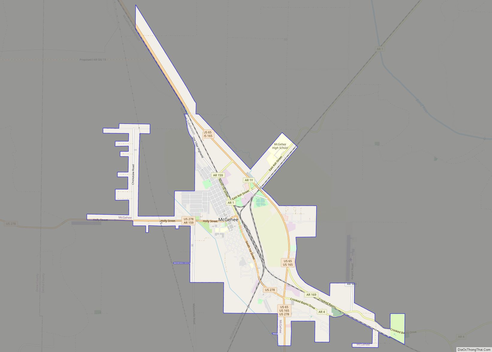
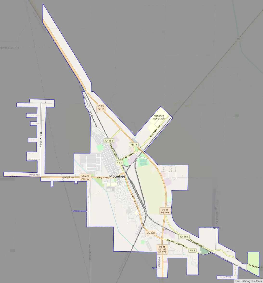
McGehee Road Map
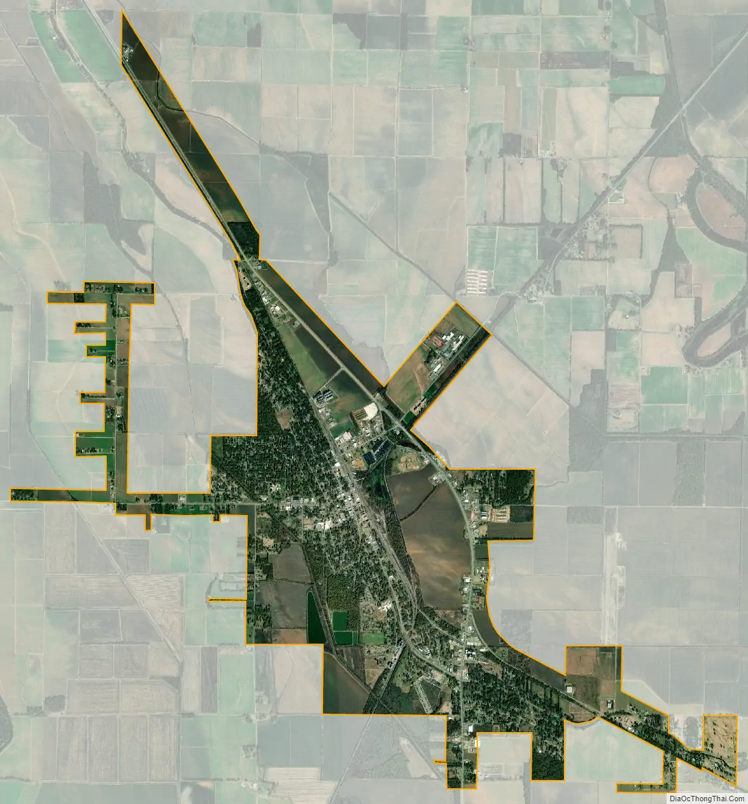
McGehee city Satellite Map
Geography
U.S. Route 278 passes through the center of town, leading west 26 miles (42 km) to Monticello and intersecting U.S. Routes 65 and 165 on the southeast side of town. US 65/165 leads north 19 miles (31 km) to Dumas. The three highways lead south together for 4 miles (6 km) before splitting; US 65 and 278 continue south 17 miles (27 km) to Lake Village, while US 165 turns southwest and leads 19 miles (31 km) to Montrose.
According to the United States Census Bureau, McGehee has a total area of 6.8 square miles (17.5 km), all land.
See also
Map of Arkansas State and its subdivision:- Arkansas
- Ashley
- Baxter
- Benton
- Boone
- Bradley
- Calhoun
- Carroll
- Chicot
- Clark
- Clay
- Cleburne
- Cleveland
- Columbia
- Conway
- Craighead
- Crawford
- Crittenden
- Cross
- Dallas
- Desha
- Drew
- Faulkner
- Franklin
- Fulton
- Garland
- Grant
- Greene
- Hempstead
- Hot Spring
- Howard
- Independence
- Izard
- Jackson
- Jefferson
- Johnson
- Lafayette
- Lawrence
- Lee
- Lincoln
- Little River
- Logan
- Lonoke
- Madison
- Marion
- Miller
- Mississippi
- Monroe
- Montgomery
- Nevada
- Newton
- Ouachita
- Perry
- Phillips
- Pike
- Poinsett
- Polk
- Pope
- Prairie
- Pulaski
- Randolph
- Saint Francis
- Saline
- Scott
- Searcy
- Sebastian
- Sevier
- Sharp
- Stone
- Union
- Van Buren
- Washington
- White
- Woodruff
- Yell
- Alabama
- Alaska
- Arizona
- Arkansas
- California
- Colorado
- Connecticut
- Delaware
- District of Columbia
- Florida
- Georgia
- Hawaii
- Idaho
- Illinois
- Indiana
- Iowa
- Kansas
- Kentucky
- Louisiana
- Maine
- Maryland
- Massachusetts
- Michigan
- Minnesota
- Mississippi
- Missouri
- Montana
- Nebraska
- Nevada
- New Hampshire
- New Jersey
- New Mexico
- New York
- North Carolina
- North Dakota
- Ohio
- Oklahoma
- Oregon
- Pennsylvania
- Rhode Island
- South Carolina
- South Dakota
- Tennessee
- Texas
- Utah
- Vermont
- Virginia
- Washington
- West Virginia
- Wisconsin
- Wyoming