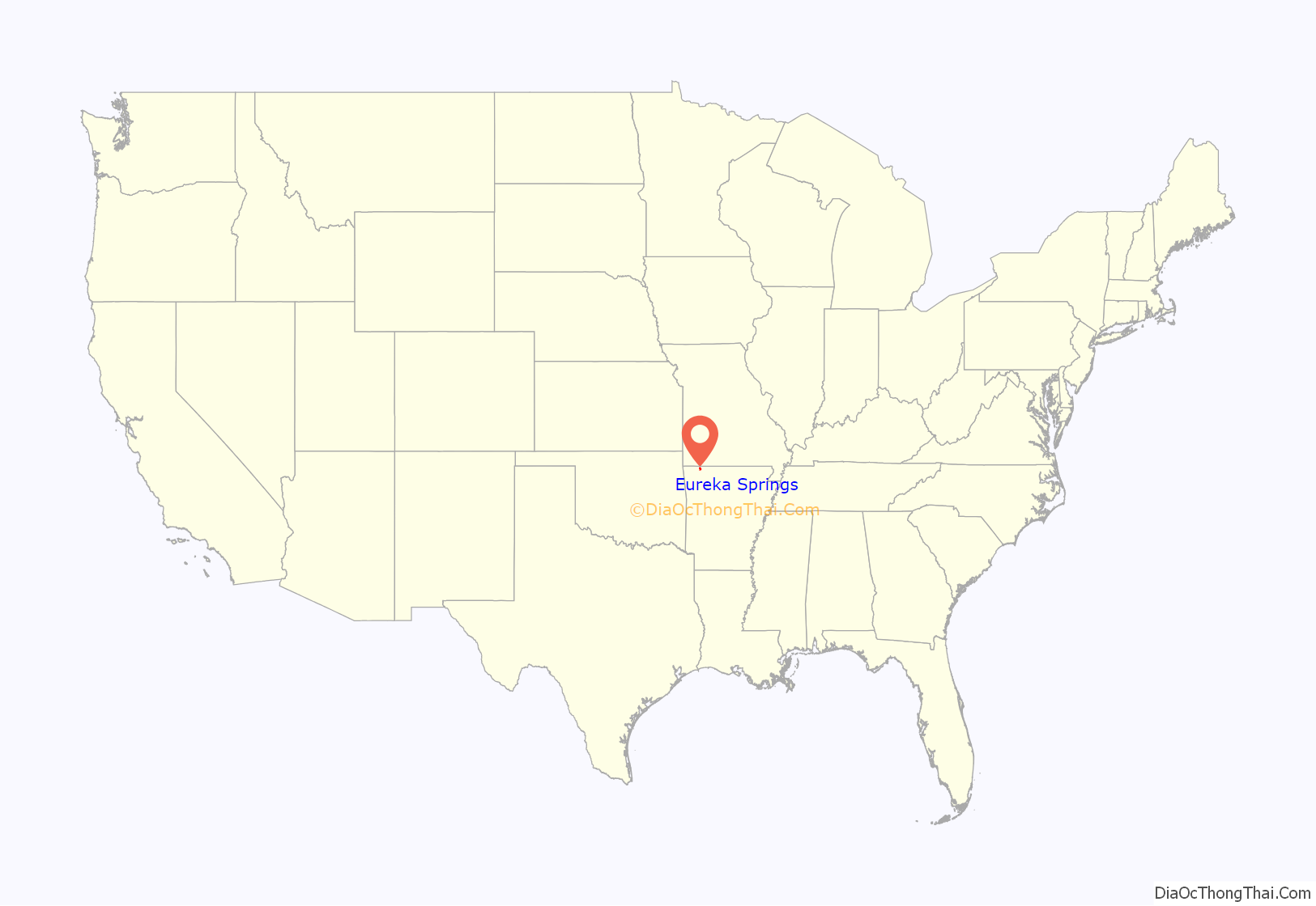
Eureka Springs is a city in Carroll County, Arkansas, United States, and one of two county seats for the county. It is located in the Ozark Mountains of northwest Arkansas, near the border with Missouri. As of the 2020 census, the city population was 2,166.
In 1970 the entire city, as of its borders at that time, was listed on the National Register of Historic Places as the Eureka Springs Historic District. Eureka Springs has been selected as one of America’s Distinctive Destinations by the National Trust for Historic Preservation. Eureka Springs was originally called “The Magic City”, “Little Switzerland of the Ozarks”, and later the “Stairstep Town” because of its mountainous terrain and the winding, up-and-down paths of its streets and walkways.
It is a tourist destination for its unique character as a Victorian resort, which first attracted visitors to use its then believed healing springs. The city has steep winding streets filled with Victorian-style cottages and manors. The historic commercial downtown of the city has an extensive streetscape of well-preserved Victorian buildings. The buildings are primarily constructed of local stone, built along limestone streets that curve around the hills, and rise and fall with the topography in a five-mile long loop. Some buildings have street-level entrances on more than one floor and other such oddities: the Basin Park Hotel has its front entrances on the floor below first, and a ground-level emergency exit in the back of the building on the fifth floor. The streets wind around the town, with few intersecting at right angles. There are no traffic lights.
| Name: | Eureka Springs city |
|---|---|
| LSAD Code: | 25 |
| LSAD Description: | city (suffix) |
| State: | Arkansas |
| County: | Carroll County |
| Incorporated: | 1880 |
| Elevation: | 1,260 ft (380 m) |
| Total Area: | 6.90 sq mi (17.86 km²) |
| Land Area: | 6.76 sq mi (17.50 km²) |
| Water Area: | 0.14 sq mi (0.36 km²) |
| Total Population: | 2,166 |
| Population Density: | 320.51/sq mi (123.75/km²) |
| Area code: | 479 |
| FIPS code: | 0522240 |
| Website: | www.cityofeurekasprings.us |
Online Interactive Map
Click on ![]() to view map in "full screen" mode.
to view map in "full screen" mode.
Eureka Springs location map. Where is Eureka Springs city?
History
19th century
Native American legends tell of a Great Healing Spring in the Eureka Springs area. People of various indigenous cultures long visited the springs for this sacred purpose. The hills and valleys of the area are ancestral lands of the historic Osage Nation, and bands of Delaware and Shawnee peoples also lived in the area before the federal government conducted Indian removal further west.
The European Americans also believed that the natural springs had healing powers. After European Americans arrived, they described the waters of the springs as having magical powers. Dr. Alvah Jackson was credited in American history with locating the major spring, and in 1856 claimed that the waters of Basin Spring had cured his eye ailments. Dr. Jackson established a hospital in a local cave during the Civil War and used the waters from Basin Spring to treat his patients. After the war, Jackson marketed the spring waters as “Dr. Jackson’s Eye Water”.
In 1879 Judge J.B. Saunders, a friend of Jackson, claimed that his crippling disease was cured by the spring waters. Saunders started promoting Eureka Springs to friends and family members across the state and created a boomtown. Within a period of little more than one year, the city expanded from a rural spa village to a major city. Within a short time in the late 19th century, Eureka Springs had become a flourishing city, spa and tourist destination.
On February 14, 1880, Eureka Springs was incorporated as a city. Thousands of visitors came to the springs based on Saunders’s promotion, and covered the area with tents and shanties. In 1881, Eureka Springs enjoyed the status of Arkansas’s fourth-largest city, and by 1889 it had become the second largest city, behind Little Rock.
Early African-American residents were freedmen who had moved to the city from farms where they were previously enslaved. Some visited for employment or for health benefits and stayed. During decades of segregation, Black-owned hotels were available for Black visitors, who were prohibited from whites-only lodging. A school and African Methodist Episcopal (AME) Pilgrim’s Chapel were established in the 1890s by the Black community. Segregation increased in the area after the United States Supreme Court ruling in Plessy v. Ferguson, allowing “separate but equal” facilities. African Americans were banned from all springs except Hardy Spring.
After his term as a Reconstruction-era governor of Arkansas, Republican Powell Clayton moved to the strongly Unionist Eureka Springs in 1872 and began promoting the city and its commercial interests. Clayton marketed the town as a retirement community for the wealthy. Eureka Springs soon became known for gracious living and a wealthy lifestyle.
In 1882, the Eureka Improvement Company was formed to attract a railroad to the city. With the completion of the railroad, Eureka Springs became a more accessible destination and became known as a vacation resort. In two years, thousands of homes and commercial enterprises were constructed. The Crescent Hotel was built in 1886 and the Basin Park Hotel in 1905. In 1892, the New Orleans Hotel and Spa was built along Spring Street. In the 21st century, it operates as an all-suite hotel, furnished with Victorian furniture and art.
These many Victorian buildings have been well preserved, forming a coherent streetscape that has been recognized for its quality. Some continue to be operated for their original purposes others have been adapted for other uses.
20th century
The Ozarka Water Company was formed in Eureka Springs in 1905. Carrie Nation moved there toward the end of her life, founding Hatchet Hall on Steele Street. The building was later operated as a museum, but is now closed.
The only bank robbery to occur in Eureka Springs was on September 27, 1922, when five outlaws from Oklahoma tried to rob the First National Bank. Three of the men were killed and the other two wounded. Today it is reenacted every year during the antique car parade which is NW Arkansas’ longest running car show and was started by Bobby Ball and Frank Green. In 2018 it celebrated its 48th year.
Economic decline, racial segregation and discrimination, Klan activities, and collapse of tourism during World War I resulted in a slow decline of the African-American community through the 1920s and 1930s. The AME church disbanded in 1925. Mattie, Alice, and Richard Banks, descendants of the African-American Fancher family, which had long been associated with the city, continued to reside there until their deaths in 1966, 1969, and 1975, respectively.
Opera in the Ozarks at Inspiration Point was founded in 1950. The organization continues to present an annual summer opera festival in Eureka Springs.
In 1964, Gerald L.K. Smith began building a religious theme park named Sacred Projects that was proposed to include a life size recreation of Jerusalem. The project never fully developed but two of the components are major city-defining projects today—the seven-story Christ of the Ozarks statue designed by Emmet Sullivan and the nearby The Great Passion Play performed during the summer. It is regularly performed from May through October by a cast of 170 actors and dozens of live animals. The script of The Great Passion Play has been altered from the original, which set Jesus’s beating at Herod’s court and included a monologue blaming his death on the Jews. It has been seen by an estimated 7.7 million people, which makes it the largest-attended outdoor drama in the United States, according to the Institute of Outdoor Theatre of the University of East Carolina at Greenville, North Carolina. Christian-themed attractions have been added in association with the drama production. These include a New Holy Land Tour, featuring a full-scale re-creation of the Tabernacle in the Wilderness; a section of the Berlin Wall; and a Bible Museum featuring more than 6,000 Bibles. (Items include an original 1611 King James Bible, a leaf from a Gutenberg Bible, and the only Bible signed by all of the original founders of the Gideons.)
Isolation and affordable property made Eureka Springs an attractive back-to-the-land destination for hippies, counterculture radicals, and lesbian separatists in the late 1960s and 1970s. While first facing resistance from many locals, as businesses were established and increased tourism, so did mutual respect. The accepting environment fostered a network of gay and lesbian business owners, and the town became known as a resort town for LGBT tourism. During the AIDS crisis, community members formed the Ozark AIDS Resources and Service to distribute mutual aid and care. Eureka Springs suffered stronger impacts than other parts of the state, and the community lost many leaders and establishments.
Architect E. Fay Jones designed Thorncrown Chapel in 1980, and it was selected for the “Twenty-five Year Award” by the American Institute of Architects in 2006. The award recognizes structures that have had significant influence on the profession. The chapel was listed on the National Register of Historic Places in 2000 because of the special nature and quality of its architecture.
21st century
On May 10, 2014, Eureka Springs became the first city in Arkansas to issue marriage licenses to same-sex couples. On May 12, 2015, Eureka Springs passed a Non-Discrimination Ordinance (Ord. 2223), with voters choosing 579 for to 261 against. It became the first city in Arkansas to have such a law to cover LGBT residents and tourists. But a state law intended to invalidate the anti-discrimination ordinance went into effect July 22, 2015. This Intrastate Commerce Improvement Act, sponsored by state senator Bart Hester, “prohibits cities from passing civil rights ordinances that extend protections beyond those already afforded by state law.” In response, the town’s mayor stated that they would be “prepared to defend their ordinance in court.”
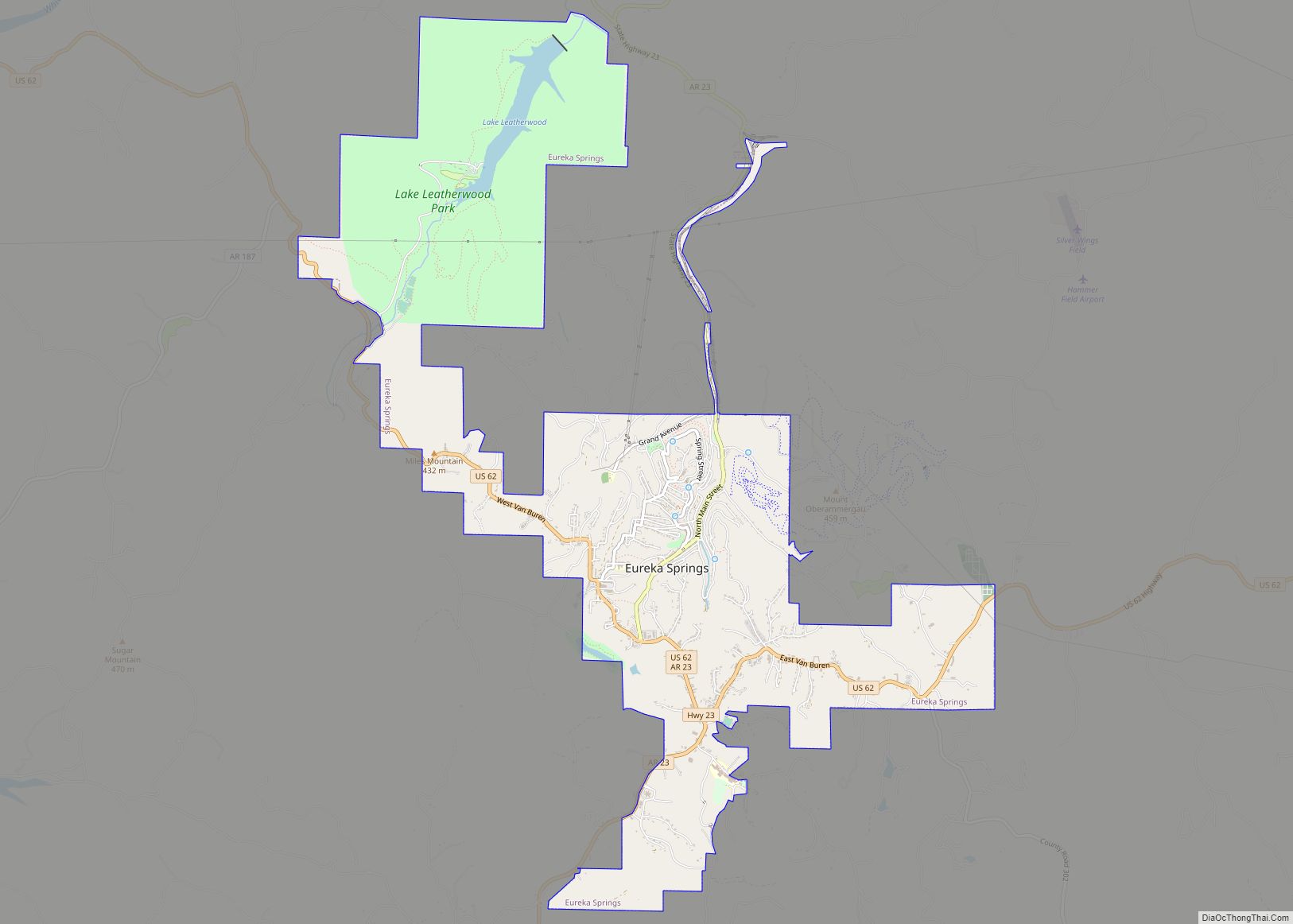
Eureka Springs Road Map
Eureka Springs city Satellite Map
Geography
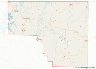
Eureka Springs is located in western Carroll County. The center of the city is in a narrow valley at the headwaters of Leatherwood Creek, a north-flowing tributary of the White River. Houses and streets climb both sides of the valley to the surrounding ridgecrests. U.S. Route 62 runs along a ridgecrest through the southern part of the city and leads east 11 miles (18 km) to Berryville and west 34 miles (55 km) to Rogers. Arkansas Highway 23 is Main Street through the center of Eureka Springs and leads north 11 miles (18 km) to the Missouri state line.
The city was founded when the springs at this location were more evident. Over-extraction of water from the springs has greatly diminished their flow rates. All of the more than 140 springs in the town are cold-water springs.
Climate
The climate in this area is characterized by hot, humid summers and generally mild to cool winters. According to the Köppen Climate Classification system, Eureka Springs has a humid subtropical climate, abbreviated “Cfa” on climate maps.
See also
Map of Arkansas State and its subdivision:- Arkansas
- Ashley
- Baxter
- Benton
- Boone
- Bradley
- Calhoun
- Carroll
- Chicot
- Clark
- Clay
- Cleburne
- Cleveland
- Columbia
- Conway
- Craighead
- Crawford
- Crittenden
- Cross
- Dallas
- Desha
- Drew
- Faulkner
- Franklin
- Fulton
- Garland
- Grant
- Greene
- Hempstead
- Hot Spring
- Howard
- Independence
- Izard
- Jackson
- Jefferson
- Johnson
- Lafayette
- Lawrence
- Lee
- Lincoln
- Little River
- Logan
- Lonoke
- Madison
- Marion
- Miller
- Mississippi
- Monroe
- Montgomery
- Nevada
- Newton
- Ouachita
- Perry
- Phillips
- Pike
- Poinsett
- Polk
- Pope
- Prairie
- Pulaski
- Randolph
- Saint Francis
- Saline
- Scott
- Searcy
- Sebastian
- Sevier
- Sharp
- Stone
- Union
- Van Buren
- Washington
- White
- Woodruff
- Yell
- Alabama
- Alaska
- Arizona
- Arkansas
- California
- Colorado
- Connecticut
- Delaware
- District of Columbia
- Florida
- Georgia
- Hawaii
- Idaho
- Illinois
- Indiana
- Iowa
- Kansas
- Kentucky
- Louisiana
- Maine
- Maryland
- Massachusetts
- Michigan
- Minnesota
- Mississippi
- Missouri
- Montana
- Nebraska
- Nevada
- New Hampshire
- New Jersey
- New Mexico
- New York
- North Carolina
- North Dakota
- Ohio
- Oklahoma
- Oregon
- Pennsylvania
- Rhode Island
- South Carolina
- South Dakota
- Tennessee
- Texas
- Utah
- Vermont
- Virginia
- Washington
- West Virginia
- Wisconsin
- Wyoming
