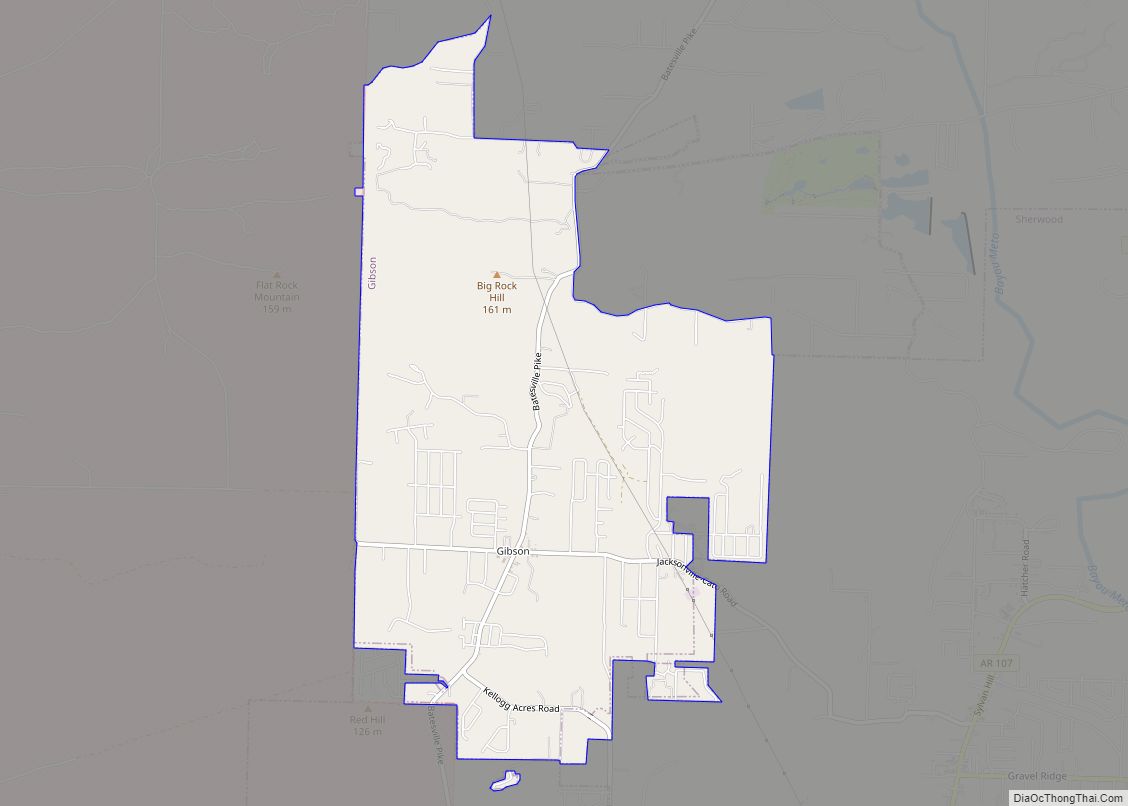
Gibson is a census-designated place (CDP) in Pulaski County, Arkansas, United States. The population was 3,543 at the 2010 census. It is part of the Little Rock–North Little Rock–Conway Metropolitan Statistical Area.
Gibson contains the silver deposits that gave North Little Rock its older name of Argenta (derived from the Latin word for silver).
| Name: | Gibson CDP |
|---|---|
| LSAD Code: | 57 |
| LSAD Description: | CDP (suffix) |
| State: | Arkansas |
| County: | Pulaski County |
| Elevation: | 262 ft (80 m) |
| Total Area: | 4.79 sq mi (12.40 km²) |
| Land Area: | 4.75 sq mi (12.31 km²) |
| Water Area: | 0.03 sq mi (0.08 km²) |
| Total Population: | 4,111 |
| Population Density: | 864.56/sq mi (333.83/km²) |
| ZIP code: | 72120 |
| Area code: | 501 |
| FIPS code: | 0526710 |
| GNISfeature ID: | 0077012 |
Online Interactive Map
Click on ![]() to view map in "full screen" mode.
to view map in "full screen" mode.
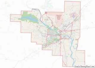
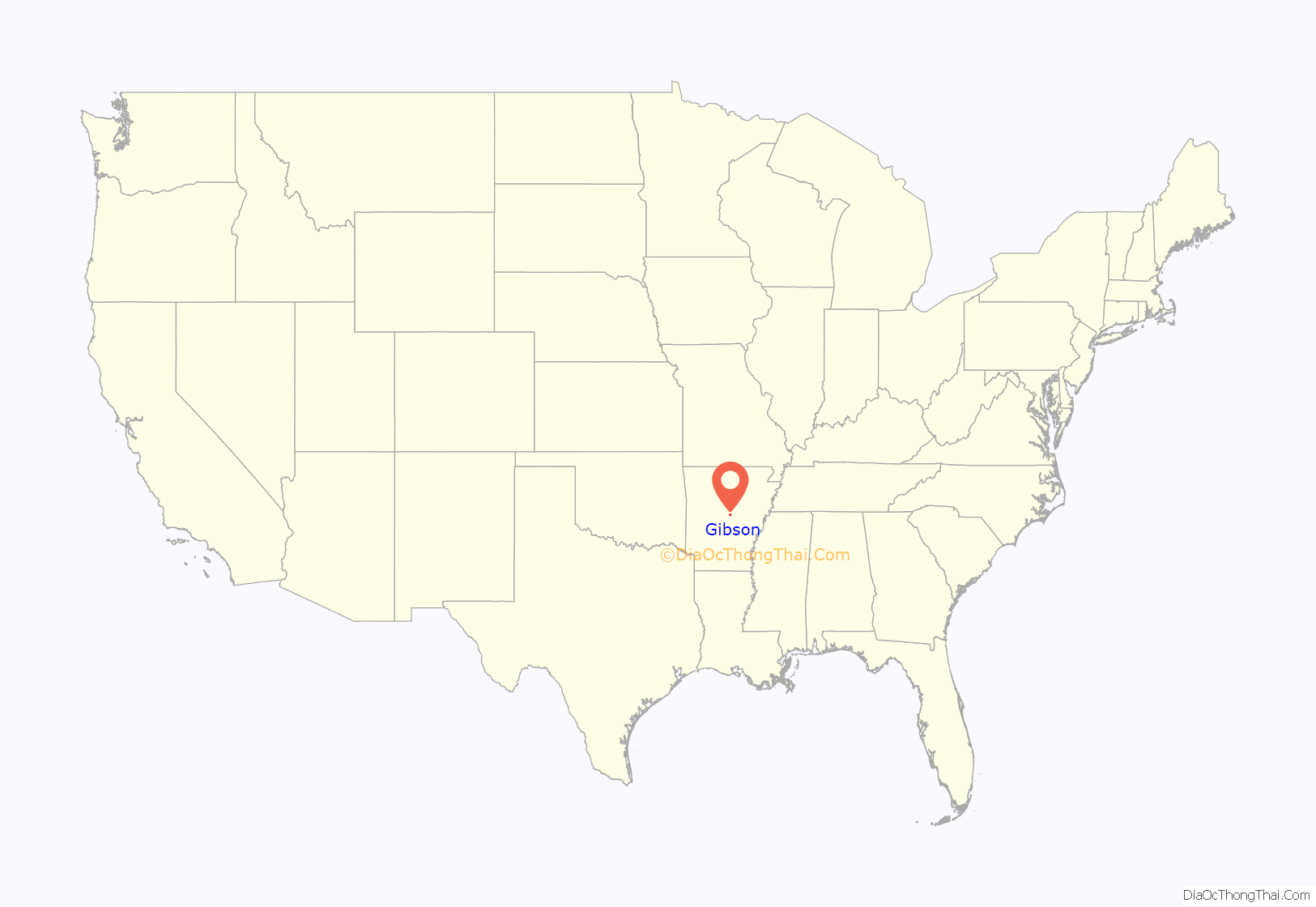
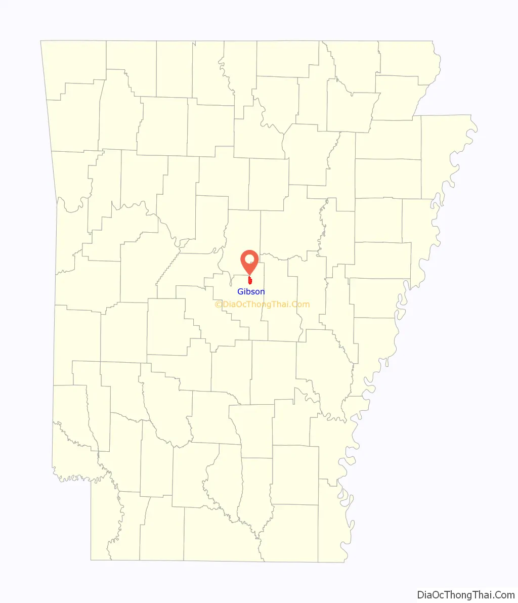
Gibson location map. Where is Gibson CDP?
History
Gibson was an early settlement in the Arkansas territory. The Southwest Trail military road, the route of most Americans headed to Mexico’s Texas territory and the Republic of Texas, passed through Gibson. At one time, some 80 percent of Arkansas’ settlers had arrived using the Southwest Trail.
Also known as the Old Military Road, the route passed from El Paso to North Little Rock through Gibson. From El Paso, Southwest Trail goes through current-day Arkansas Highway 89, then Tate’s Mill Road to Batesville Pike Road through Gibson to Remount Road, to Arkansas Highway 176 and to Arkansas Highway 365 through North Little Rock.
After the Arkansas territorial capital was moved from Arkansas Post (Arkansas County) to Little Rock (Pulaski County) in 1821, settlers began to acquire land around the new capital, including land north of the Arkansas River. Most settlers were farmers growing cotton or subsistence crops. Many used land grants from the War of 1812 to take possession of land. Among the first to claim land in the future Gibson community were William Beech in 1821, William Johnson in 1822 and John Stone in 1822.
Gibson was the family name of some early of the area’s settlers. Among Gibson Cemetery’s dozens of graves are those of Mattie Cordelia Gibson, who died in 1915, and of her husband John Calvin, who died in 1951 on his 81st birthday.
Benjamin Kellogg became the most famous settler in the area. Born in New England (Massachusetts or Vermont) around 1797, Kellogg moved to Little Rock shortly after the city was established. A blacksmith by trade, Kellogg is credited with creating the broadaxe used to construct the Chandler home in Little Rock. This structure was the first hewed-log house in Little Rock. Earlier Little Rock homes were built of round poles.
Kellogg first bought land in northern Pulaski County in 1834 and later reported finding lead ore unearthed by tunneling crayfish. Kellogg bought more lots along the creek that now bears his name, but a mining corporation was formed that claimed to have leased mining rights to Kellogg’s land for 99 years (Kellogg contended the lease was only to last five years). At least three mine shafts were dug, revealing small veins of silver, copper, lead and zinc. Kellogg died in 1848, and most miners left the next year for the richer promises of California gold mining.
Mines were still being worked early in the Civil War, but were abandoned before Major General Frederick Steele’s Union forces passed by en route to Little Rock in 1863. The mines are described in the Goodspeed Publishing Company’s “Biographical and Historical Memoirs of Central Arkansas”, published in 1889, with descriptions of lead and copper ores and of attempts to locate gold. It appears the mines had been long abandoned by the time those accounts were published. An effort to reopen the mines in 1925 produced 3,118 troy ounces of silver valued at $2,164.
Pulaski County Judge C. T. Coffman proposed building a bridge across Kellogg Creek in 1905, but it did not come to fruition. The area remained sparsely settled until after World War II. Establishment of the Little Rock Air Force Base in nearby Jacksonville brought about considerable construction of houses and businesses.
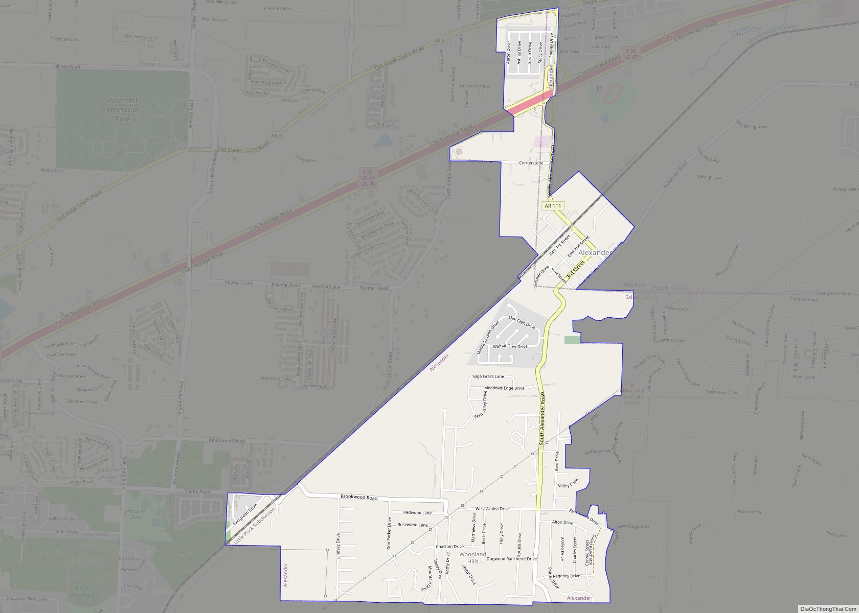
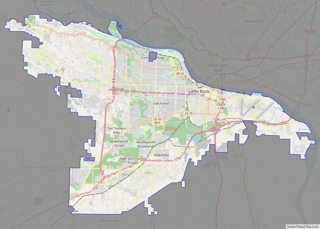
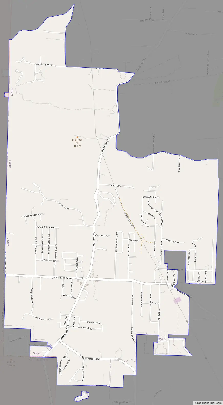
Gibson Road Map
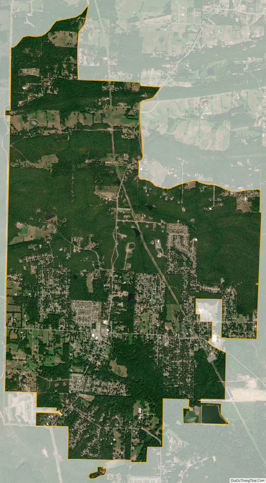
Gibson city Satellite Map
Geography
Gibson is located at 34°52′56″N 92°13′41″W / 34.88222°N 92.22806°W / 34.88222; -92.22806 (34.882353, −92.228059).
According to the United States Census Bureau, the CDP has a total area of 4.5 square miles (12 km), all land.
See also
Map of Arkansas State and its subdivision:- Arkansas
- Ashley
- Baxter
- Benton
- Boone
- Bradley
- Calhoun
- Carroll
- Chicot
- Clark
- Clay
- Cleburne
- Cleveland
- Columbia
- Conway
- Craighead
- Crawford
- Crittenden
- Cross
- Dallas
- Desha
- Drew
- Faulkner
- Franklin
- Fulton
- Garland
- Grant
- Greene
- Hempstead
- Hot Spring
- Howard
- Independence
- Izard
- Jackson
- Jefferson
- Johnson
- Lafayette
- Lawrence
- Lee
- Lincoln
- Little River
- Logan
- Lonoke
- Madison
- Marion
- Miller
- Mississippi
- Monroe
- Montgomery
- Nevada
- Newton
- Ouachita
- Perry
- Phillips
- Pike
- Poinsett
- Polk
- Pope
- Prairie
- Pulaski
- Randolph
- Saint Francis
- Saline
- Scott
- Searcy
- Sebastian
- Sevier
- Sharp
- Stone
- Union
- Van Buren
- Washington
- White
- Woodruff
- Yell
- Alabama
- Alaska
- Arizona
- Arkansas
- California
- Colorado
- Connecticut
- Delaware
- District of Columbia
- Florida
- Georgia
- Hawaii
- Idaho
- Illinois
- Indiana
- Iowa
- Kansas
- Kentucky
- Louisiana
- Maine
- Maryland
- Massachusetts
- Michigan
- Minnesota
- Mississippi
- Missouri
- Montana
- Nebraska
- Nevada
- New Hampshire
- New Jersey
- New Mexico
- New York
- North Carolina
- North Dakota
- Ohio
- Oklahoma
- Oregon
- Pennsylvania
- Rhode Island
- South Carolina
- South Dakota
- Tennessee
- Texas
- Utah
- Vermont
- Virginia
- Washington
- West Virginia
- Wisconsin
- Wyoming