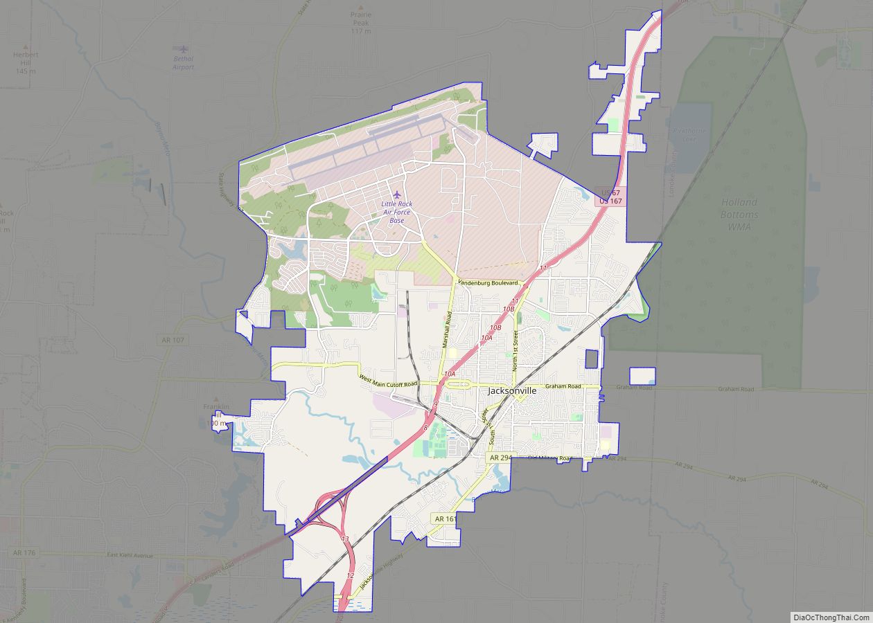
Jacksonville is a city in Pulaski County, Arkansas, United States, and a suburb of Little Rock. As of the 2010 census, the population of the city was 28,364. It is part of the Little Rock–North Little Rock–Conway Metropolitan Statistical Area with 729,135 people as of 2014.
The city is named for Nicholas Jackson, a landowner who deeded the land for the railroad right-of-way to the Cairo & Fulton Railroad in 1870. The community evolved from the settlement surrounding the railroad depot, eventually incorporating in 1941. In 1941, construction began on the Arkansas Ordnance Plant (AOP), which served as the primary facility for the development of fuses and detonators for World War II. Following the war, AOP ceased operations and the land was sold for commercial interests, including the development of the Little Rock Air Force Base in 1955. Today, portions of AOP still remain, including the Arkansas Ordnance Plant Guard House, which is on the National Register of Historic Places and the Jacksonville Museum of Military History. Despite Pulaski County being an Arkansas county that is not a “dry” county, as it allows the sales of beer and liquor, the municipal limits of Jacksonville are “moist”, as it does not allow the sales of alcohol in stores, but allows the sale of alcohol in some restaurants with special permits.
| Name: | Jacksonville city |
|---|---|
| LSAD Code: | 25 |
| LSAD Description: | city (suffix) |
| State: | Arkansas |
| County: | Pulaski County |
| Founded: | 1870 |
| Incorporated: | 1941 |
| Elevation: | 282 ft (86 m) |
| Land Area: | 28.65 sq mi (74.19 km²) |
| Water Area: | 0.21 sq mi (0.54 km²) |
| Population Density: | 1,029.01/sq mi (397.30/km²) |
| ZIP code: | 72076 |
| Area code: | 501 |
| FIPS code: | 0534750 |
| GNISfeature ID: | 0057978 |
| Website: | www.cityofjacksonville.net |
Online Interactive Map
Click on ![]() to view map in "full screen" mode.
to view map in "full screen" mode.
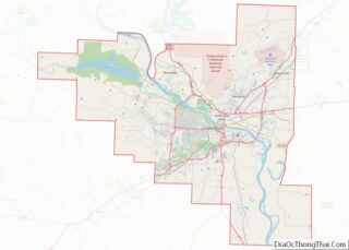
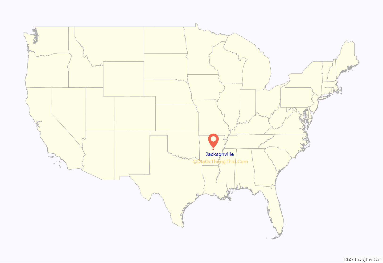
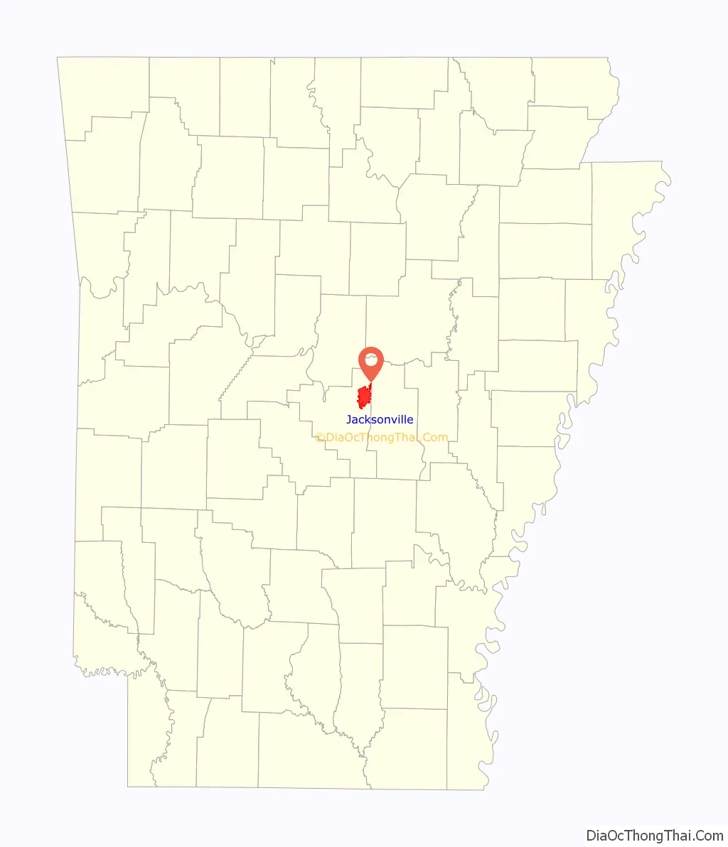
Jacksonville location map. Where is Jacksonville city?
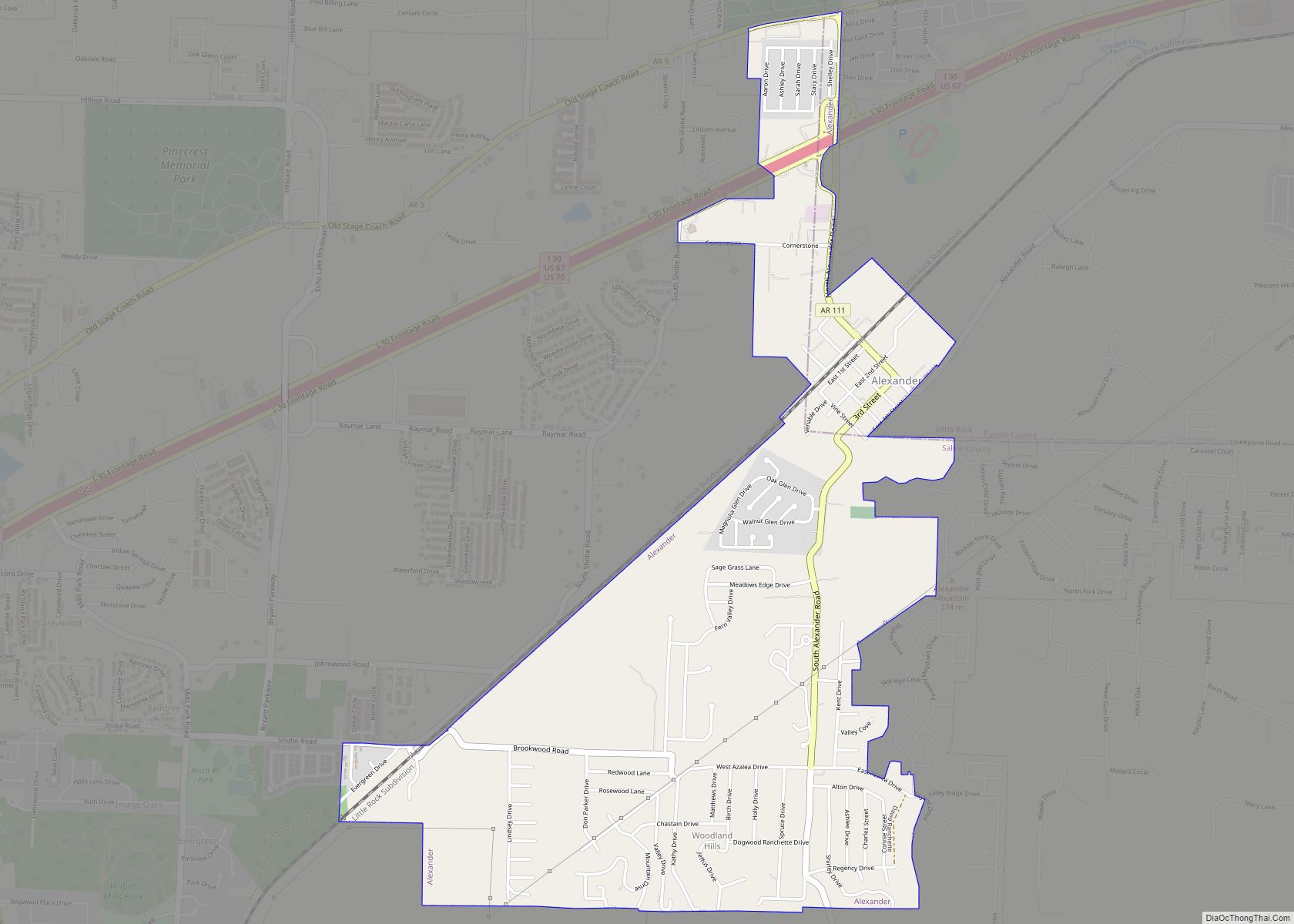
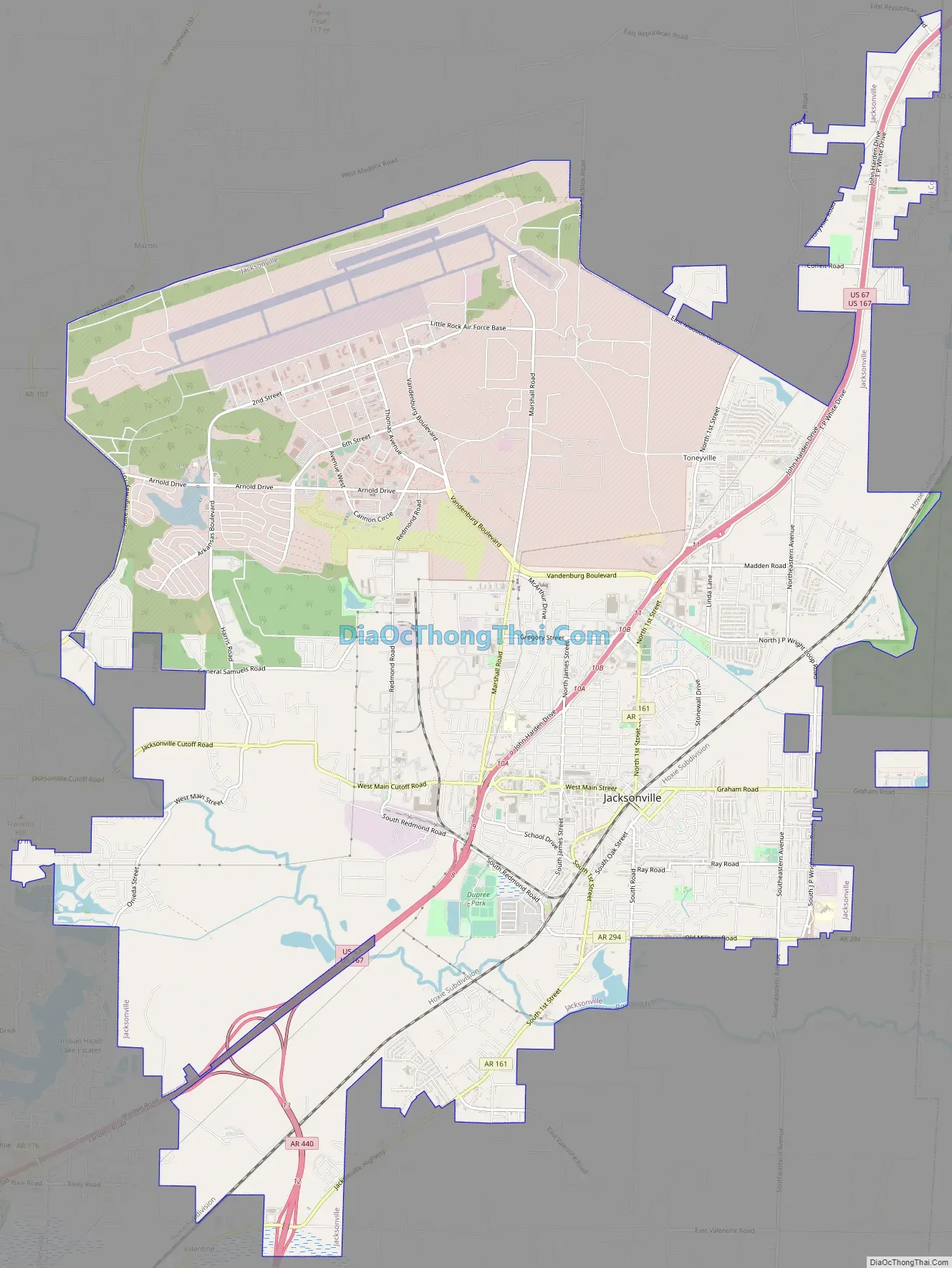
Jacksonville Road Map
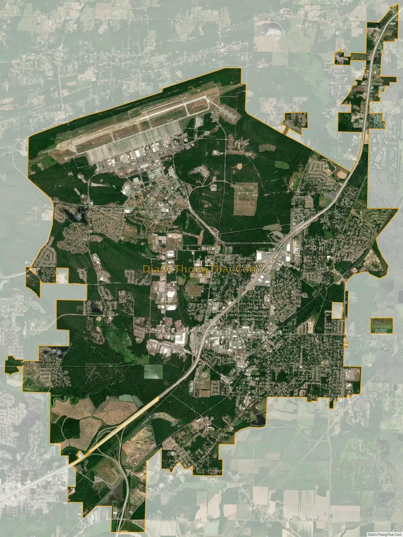
Jacksonville city Satellite Map
Geography
Jacksonville is located at 34°52′13″N 92°6′55″W / 34.87028°N 92.11528°W / 34.87028; -92.11528 (34.870345, −92.115164).
According to the United States Census Bureau, the city has a total area of 28.2 square miles (73.1 km), of which 28.1 square miles (72.8 km) is land and 0.12 square miles (0.3 km), or 0.42%, is water.
See also
Map of Arkansas State and its subdivision:- Arkansas
- Ashley
- Baxter
- Benton
- Boone
- Bradley
- Calhoun
- Carroll
- Chicot
- Clark
- Clay
- Cleburne
- Cleveland
- Columbia
- Conway
- Craighead
- Crawford
- Crittenden
- Cross
- Dallas
- Desha
- Drew
- Faulkner
- Franklin
- Fulton
- Garland
- Grant
- Greene
- Hempstead
- Hot Spring
- Howard
- Independence
- Izard
- Jackson
- Jefferson
- Johnson
- Lafayette
- Lawrence
- Lee
- Lincoln
- Little River
- Logan
- Lonoke
- Madison
- Marion
- Miller
- Mississippi
- Monroe
- Montgomery
- Nevada
- Newton
- Ouachita
- Perry
- Phillips
- Pike
- Poinsett
- Polk
- Pope
- Prairie
- Pulaski
- Randolph
- Saint Francis
- Saline
- Scott
- Searcy
- Sebastian
- Sevier
- Sharp
- Stone
- Union
- Van Buren
- Washington
- White
- Woodruff
- Yell
- Alabama
- Alaska
- Arizona
- Arkansas
- California
- Colorado
- Connecticut
- Delaware
- District of Columbia
- Florida
- Georgia
- Hawaii
- Idaho
- Illinois
- Indiana
- Iowa
- Kansas
- Kentucky
- Louisiana
- Maine
- Maryland
- Massachusetts
- Michigan
- Minnesota
- Mississippi
- Missouri
- Montana
- Nebraska
- Nevada
- New Hampshire
- New Jersey
- New Mexico
- New York
- North Carolina
- North Dakota
- Ohio
- Oklahoma
- Oregon
- Pennsylvania
- Rhode Island
- South Carolina
- South Dakota
- Tennessee
- Texas
- Utah
- Vermont
- Virginia
- Washington
- West Virginia
- Wisconsin
- Wyoming