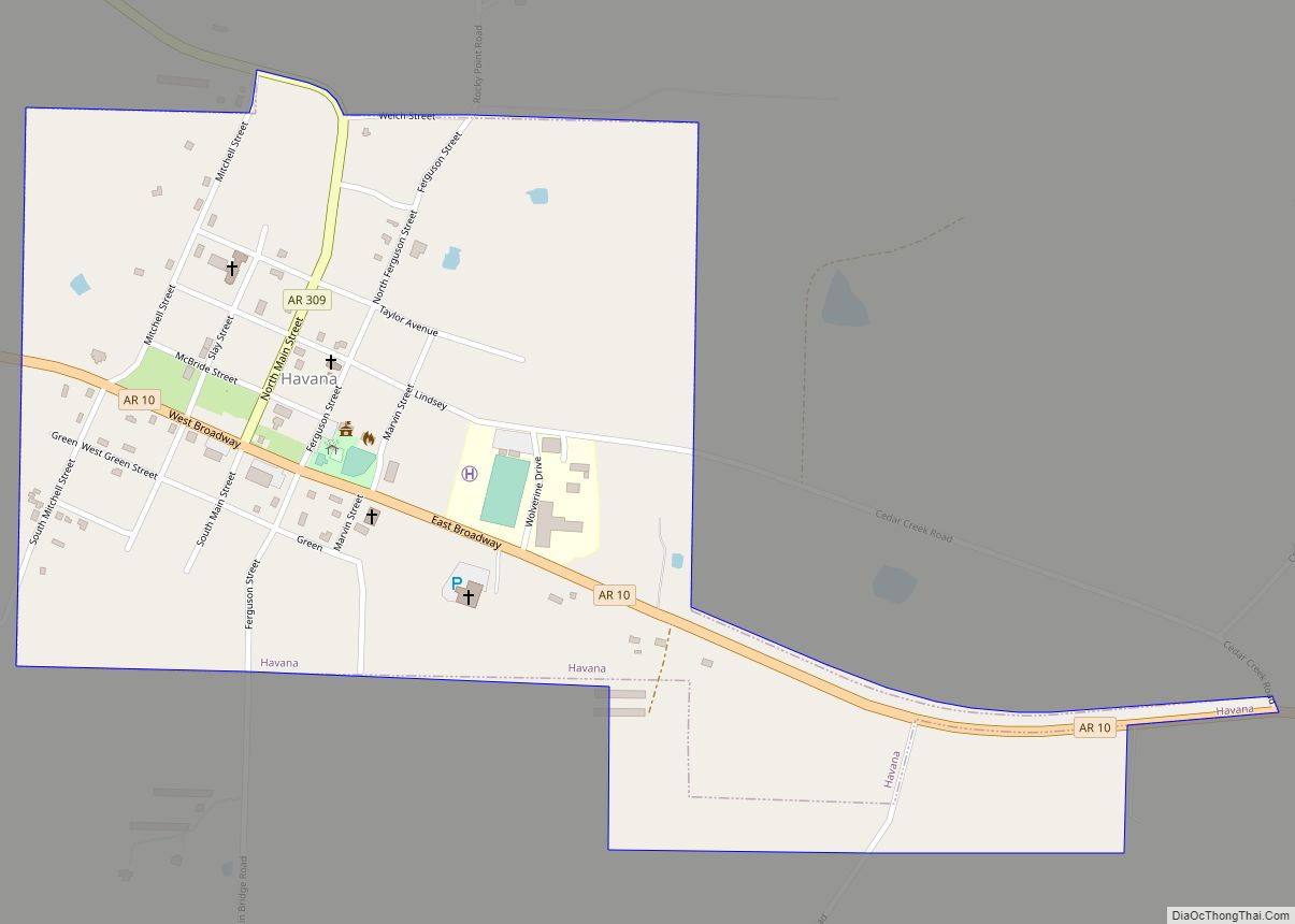
Havana is a city in northwest Yell County, Arkansas, United States. The population was 375 at the 2010 census. It is part of the Russellville Micropolitan Statistical Area. Arkansas Scenic State Highway 309 leads from Havana to the top of Mount Magazine, home of Arkansas’s newest State Park, and the highest peak in Arkansas.
Havana is located between Booneville and Danville on State Highway 10. The area has views of Mount Magazine, the tallest mountain in Arkansas. West of Havana lies Blue Mountain Lake, a US Army Corps of Engineers Lake, which provides recreational fishing, camping, swimming and boating.
Havana is in the Petit Jean River Valley, with the Ouachita Mountain range to the south, and the Ozark Mountain range to the north. Mount Magazine to the north provides camping, cabins, a brand new 100 room (each with an incredible view) lodge, hiking, hang gliding and rock climbing.
Havana is home to several small businesses, and the Western Yell County High School and Jr. High School Wolverines.
The area is rural, covered with timber, pastures and row crop fields. Local industry centers on poultry, livestock and crops. Trucking businesses, garment production, poultry equipment supplies, and wood-working industries are also present. Natural Gas production has also increased dramatically since approximately 2004.
Although small, the City of Havana provides city water, sewer and trash service to its residents, as well as a Rural Fire Department with several pumper, tanker and brush fire trucks.
Just opened in January, 2008, was the Western Yell County Medical Clinic on AR 10 West, followed by a new High School which opened in December 2008.
| Name: | Havana city |
|---|---|
| LSAD Code: | 25 |
| LSAD Description: | city (suffix) |
| State: | Arkansas |
| County: | Yell County |
| Elevation: | 381 ft (116 m) |
| Total Area: | 0.60 sq mi (1.56 km²) |
| Land Area: | 0.60 sq mi (1.56 km²) |
| Water Area: | 0.00 sq mi (0.00 km²) |
| Total Population: | 239 |
| Population Density: | 397.67/sq mi (153.55/km²) |
| ZIP code: | 72842 |
| Area code: | 479 |
| FIPS code: | 0530790 |
| GNISfeature ID: | 0071938 |
Online Interactive Map
Click on ![]() to view map in "full screen" mode.
to view map in "full screen" mode.
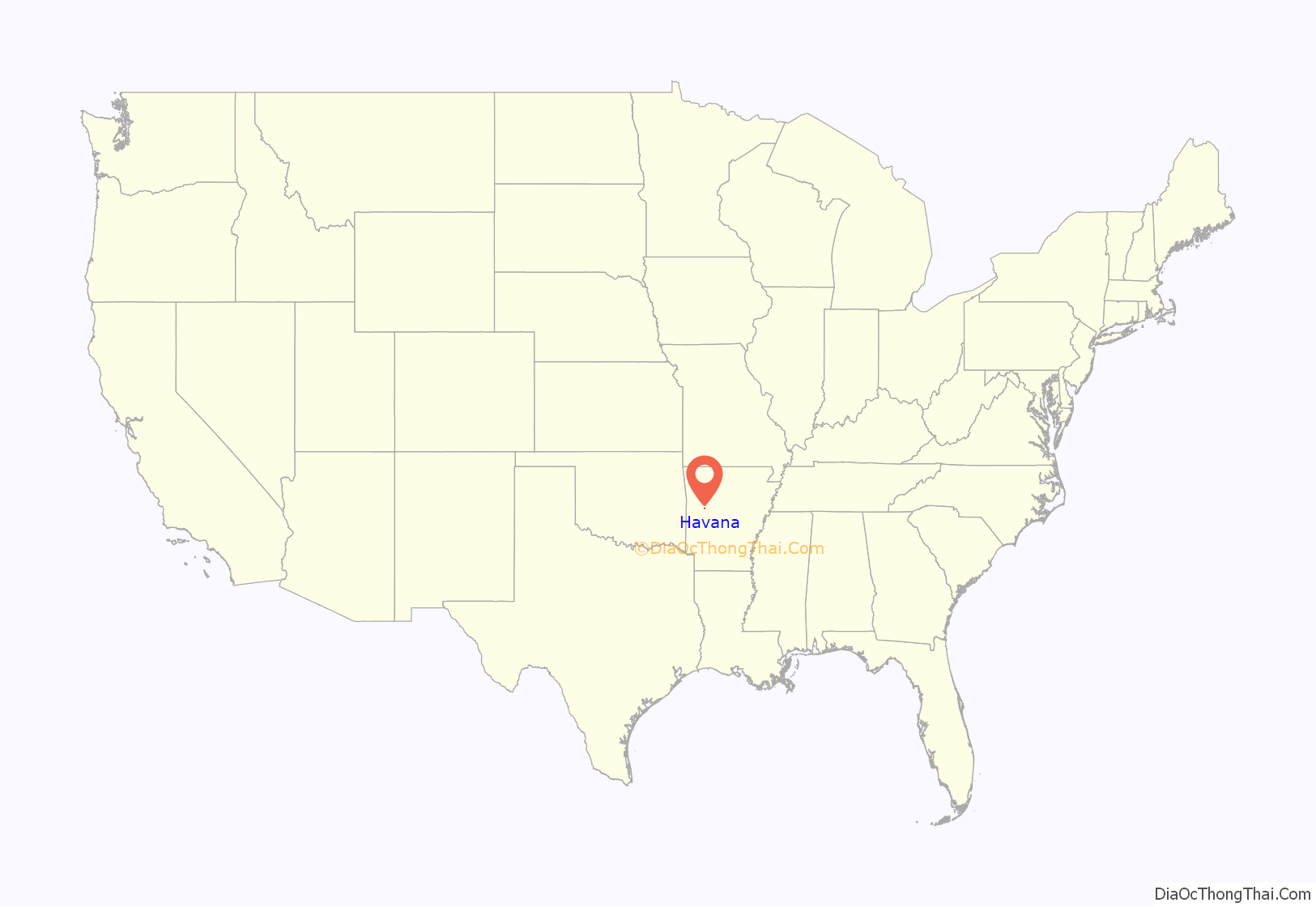
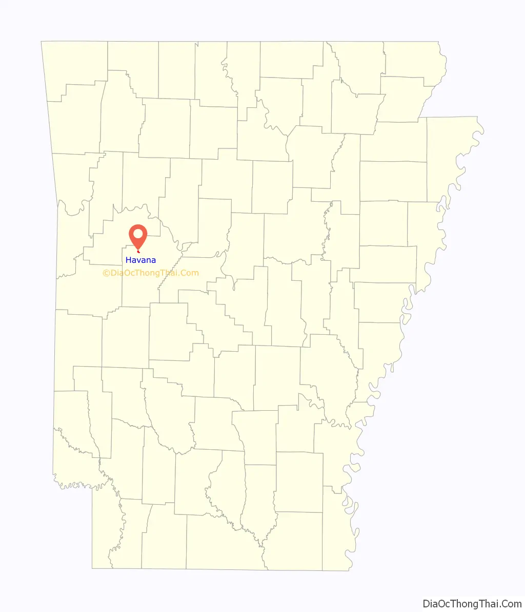
Havana location map. Where is Havana city?
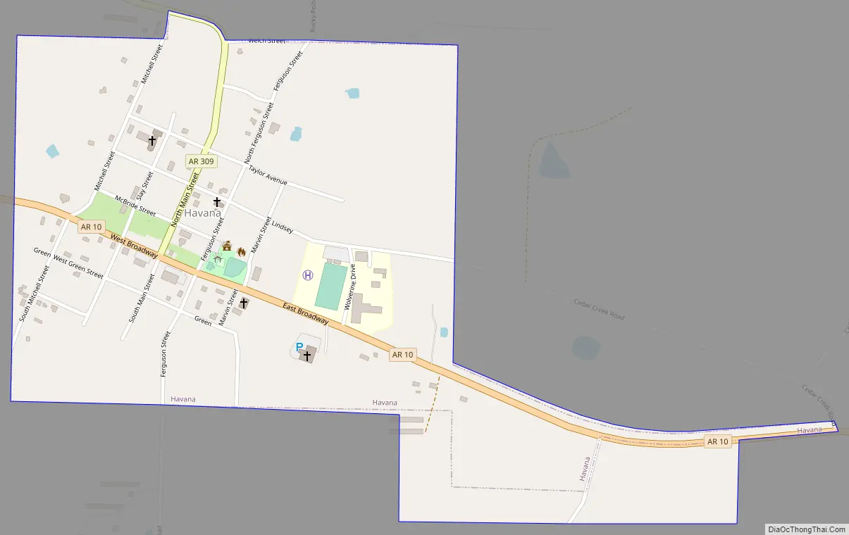
Havana Road Map
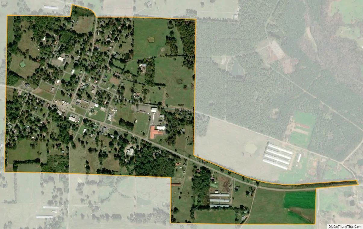
Havana city Satellite Map
Geography
Havana is located at 35°6′40″N 93°31′45″W / 35.11111°N 93.52917°W / 35.11111; -93.52917 (35.111021, -93.529064).
According to the United States Census Bureau, the city has a total area of 0.5 square miles (1.3 km), all land.
See also
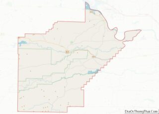
Map of Arkansas State and its subdivision:- Arkansas
- Ashley
- Baxter
- Benton
- Boone
- Bradley
- Calhoun
- Carroll
- Chicot
- Clark
- Clay
- Cleburne
- Cleveland
- Columbia
- Conway
- Craighead
- Crawford
- Crittenden
- Cross
- Dallas
- Desha
- Drew
- Faulkner
- Franklin
- Fulton
- Garland
- Grant
- Greene
- Hempstead
- Hot Spring
- Howard
- Independence
- Izard
- Jackson
- Jefferson
- Johnson
- Lafayette
- Lawrence
- Lee
- Lincoln
- Little River
- Logan
- Lonoke
- Madison
- Marion
- Miller
- Mississippi
- Monroe
- Montgomery
- Nevada
- Newton
- Ouachita
- Perry
- Phillips
- Pike
- Poinsett
- Polk
- Pope
- Prairie
- Pulaski
- Randolph
- Saint Francis
- Saline
- Scott
- Searcy
- Sebastian
- Sevier
- Sharp
- Stone
- Union
- Van Buren
- Washington
- White
- Woodruff
- Yell
- Alabama
- Alaska
- Arizona
- Arkansas
- California
- Colorado
- Connecticut
- Delaware
- District of Columbia
- Florida
- Georgia
- Hawaii
- Idaho
- Illinois
- Indiana
- Iowa
- Kansas
- Kentucky
- Louisiana
- Maine
- Maryland
- Massachusetts
- Michigan
- Minnesota
- Mississippi
- Missouri
- Montana
- Nebraska
- Nevada
- New Hampshire
- New Jersey
- New Mexico
- New York
- North Carolina
- North Dakota
- Ohio
- Oklahoma
- Oregon
- Pennsylvania
- Rhode Island
- South Carolina
- South Dakota
- Tennessee
- Texas
- Utah
- Vermont
- Virginia
- Washington
- West Virginia
- Wisconsin
- Wyoming