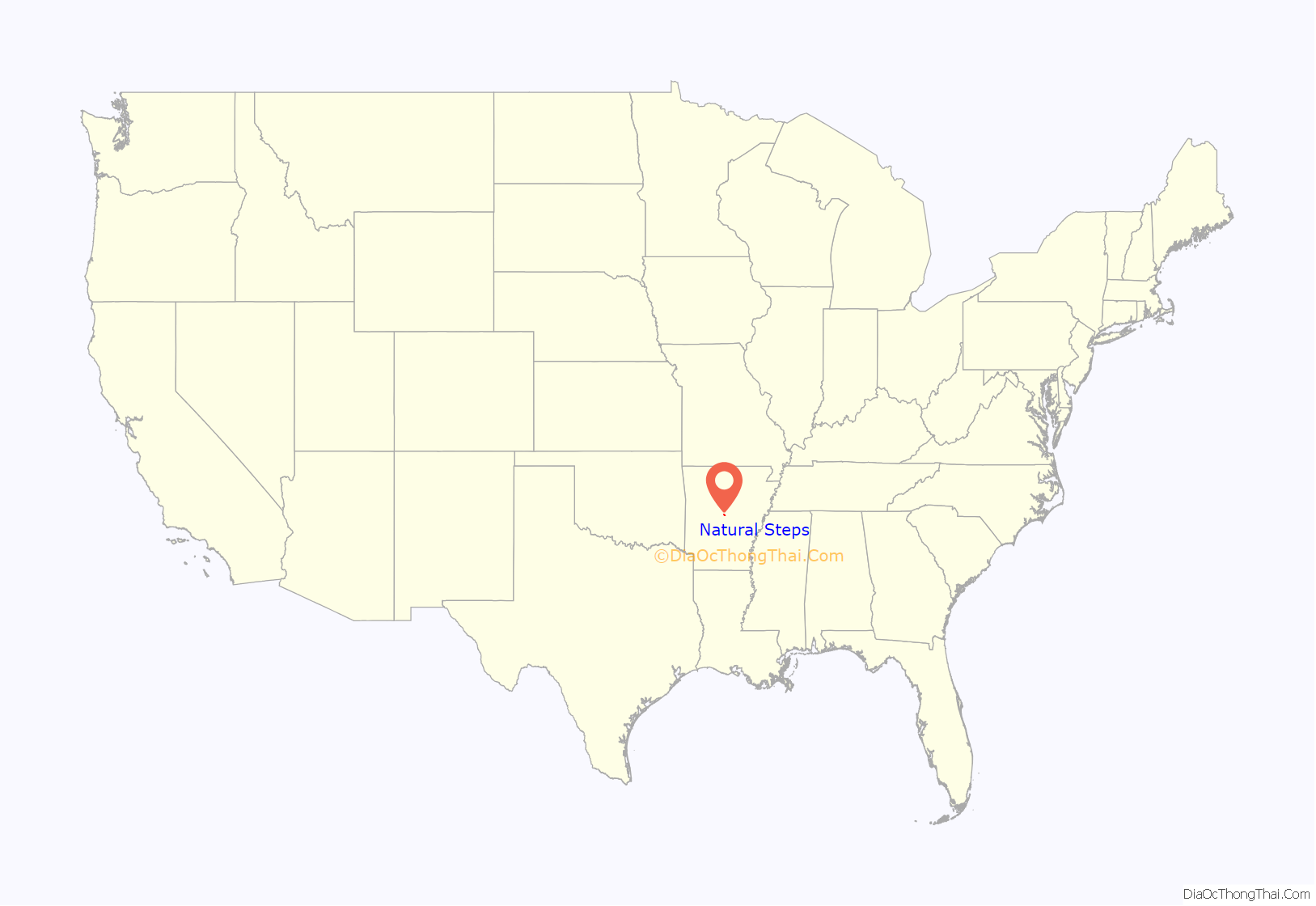
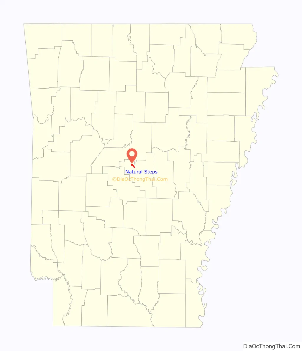
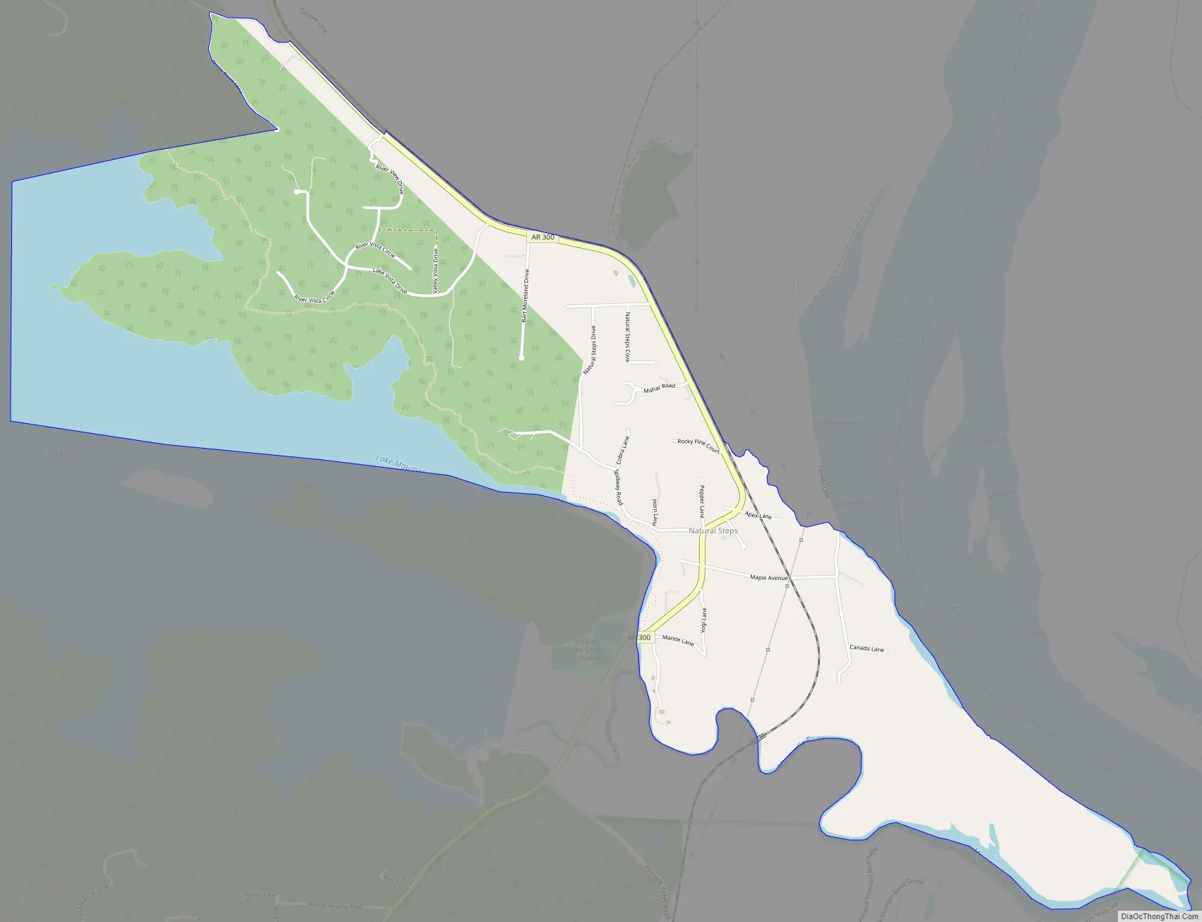
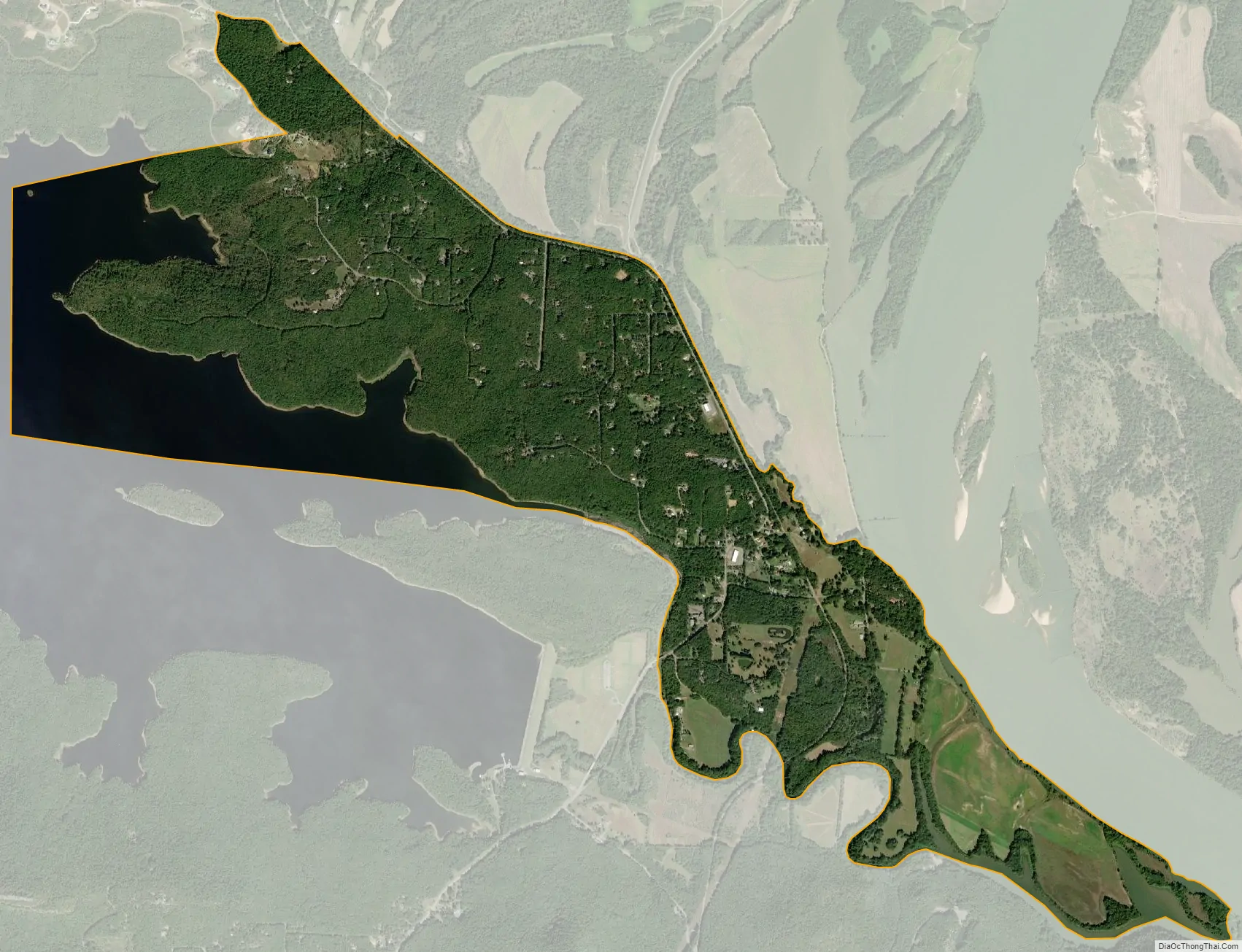
Natural Steps is an unincorporated census-designated place in Pulaski County, Arkansas, United States. It is located 18 miles (29 km) northwest of Little Rock along the southern bank of the Arkansas River, on Arkansas Highway 300. Per the 2020 census, the population was 413. Today, it is a small farming community with scattered businesses. Most of the natural steps, a geologic formation, still stand today and are used as a marker for river runners. The Natural Steps are not open to the public for viewing.
| Name: | Natural Steps CDP |
|---|---|
| LSAD Code: | 57 |
| LSAD Description: | CDP (suffix) |
| State: | Arkansas |
| County: | Pulaski County |
| Founded: | 1822 |
| Elevation: | 272 ft (83 m) |
| Total Area: | 3.56 sq mi (9.22 km²) |
| Land Area: | 2.76 sq mi (7.15 km²) |
| Water Area: | 0.80 sq mi (2.07 km²) |
| Total Population: | 413 |
| Population Density: | 149.64/sq mi (57.78/km²) |
| FIPS code: | 0548680 |
Online Interactive Map
Click on ![]() to view map in "full screen" mode.
to view map in "full screen" mode.
Natural Steps location map. Where is Natural Steps CDP?
History
The small town was named after “two perfectly parallel vertical walls of sandstone, twenty feet apart, [that] jut out from the disintegrated soft slates, in prominent conformity, descending steplike, fifty-one feet from the top of the bank, where they first show themselves, to the edge of the lowest water-mark of the Arkansas River, and can be seen running their course beneath the stream. These form a conspicuous landmark to boatman and travelers on the Arkansas River, and are known under the name of the “Natural Steps”. Beginning in 1822, the local “Natural Steps” provided a convenient stop for Little Rock visitors to disembark for their hike to the mountain.”
The Natural Steps were first written about and drawn by David Dale Owen (Principal Geologist) in his Second Report of a Geological Reconnaissance of the Middle and Southern Counties of Arkansas (1859) ordered by Elias Nelson Conway, Governor of Arkansas. He wrote,
In 1870, United States Army Corps of Engineers Col. John Navarre Macomb, along with Assistant Engineer S.T. Abert, set out to map the Arkansas River and show low-water depths and other features important to river travel across the channel. In their maps, a drawing and location of the “Natural Steps” were included.
Native Americans
Fred O. Henker, M.D. wrote, “The first inhabitants of the Natural Steps area were Native Americans, Indians whose presence in the vicinity dates back possibly 10,000 years.” During early European explorations and the colonial period, local Native Americans, from about 1500 to the late 1700s, were the Quapaw, which translates to “down stream people.”
Naturalist Thomas Nuttall wrote A Journal of Travels into the Arkansas Territory During the Year 1819 based on his travels from 1819–1821 to study botany along the Arkansas River. He also observed the Quapaw and other Native Americans. “A number of families were now about to settle, or rather take provisionary possession of the land purchased from the Osage, situated along the banks of the Arkansas, from Frog bayou to the falls of the Verdigris …” Nuttall’s travels took him to the mouth of the Verdigris River.
”
Thomas Nuttall found few Native Americans in the Natural Steps area in 1819.
French Explorers
The Pinnacle Mountain Community Post wrote:
Steamboat Landing
The Natural Steps used to be famous for boatloads of picnickers that went up and down the Arkansas river in steamboats in the 19th century. “Natural Steps was a natural port with water at the bank of sufficient depth to enable convenient docking, and sufficient population to provide passengers and cargo. By 1849 the Arkansas Gazette reported fifteen to twenty steamboat arrivals and departures weekly.”
The Arkansas Gazette on May 19, 1878 wrote,
A riverboat pilot on the Arkansas River in the late 19th century, R. E. Cross wrote in 1938:
Later, cotton, corn and firewood were shipped from the steamboat landing at Natural Steps.
The Battle of Palarm
This was a battle that began with the Brooks-Baxter War and occurred on the stern wheel steamboat “Hallie” on May 8, 1874. Palarm is a small community on the north side of the Arkansas River from Natural Steps.
Robert W. Meriwether of the Faulkner County Historical Society wrote:
Natural Steps Road Map
Natural Steps city Satellite Map
See also
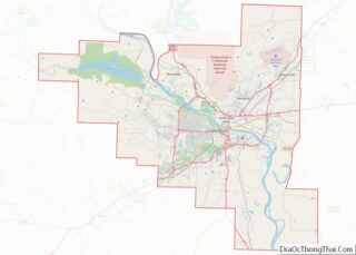
Map of Arkansas State and its subdivision:- Arkansas
- Ashley
- Baxter
- Benton
- Boone
- Bradley
- Calhoun
- Carroll
- Chicot
- Clark
- Clay
- Cleburne
- Cleveland
- Columbia
- Conway
- Craighead
- Crawford
- Crittenden
- Cross
- Dallas
- Desha
- Drew
- Faulkner
- Franklin
- Fulton
- Garland
- Grant
- Greene
- Hempstead
- Hot Spring
- Howard
- Independence
- Izard
- Jackson
- Jefferson
- Johnson
- Lafayette
- Lawrence
- Lee
- Lincoln
- Little River
- Logan
- Lonoke
- Madison
- Marion
- Miller
- Mississippi
- Monroe
- Montgomery
- Nevada
- Newton
- Ouachita
- Perry
- Phillips
- Pike
- Poinsett
- Polk
- Pope
- Prairie
- Pulaski
- Randolph
- Saint Francis
- Saline
- Scott
- Searcy
- Sebastian
- Sevier
- Sharp
- Stone
- Union
- Van Buren
- Washington
- White
- Woodruff
- Yell
- Alabama
- Alaska
- Arizona
- Arkansas
- California
- Colorado
- Connecticut
- Delaware
- District of Columbia
- Florida
- Georgia
- Hawaii
- Idaho
- Illinois
- Indiana
- Iowa
- Kansas
- Kentucky
- Louisiana
- Maine
- Maryland
- Massachusetts
- Michigan
- Minnesota
- Mississippi
- Missouri
- Montana
- Nebraska
- Nevada
- New Hampshire
- New Jersey
- New Mexico
- New York
- North Carolina
- North Dakota
- Ohio
- Oklahoma
- Oregon
- Pennsylvania
- Rhode Island
- South Carolina
- South Dakota
- Tennessee
- Texas
- Utah
- Vermont
- Virginia
- Washington
- West Virginia
- Wisconsin
- Wyoming