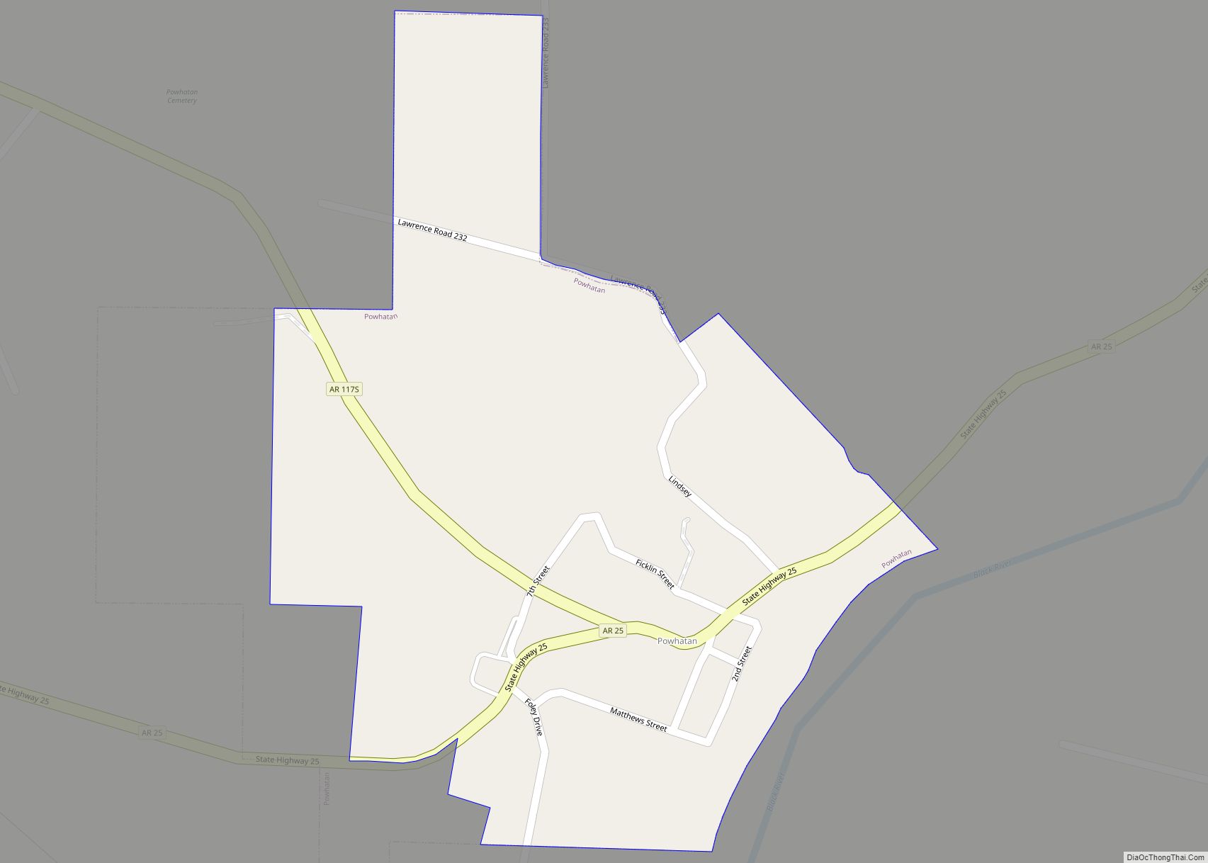
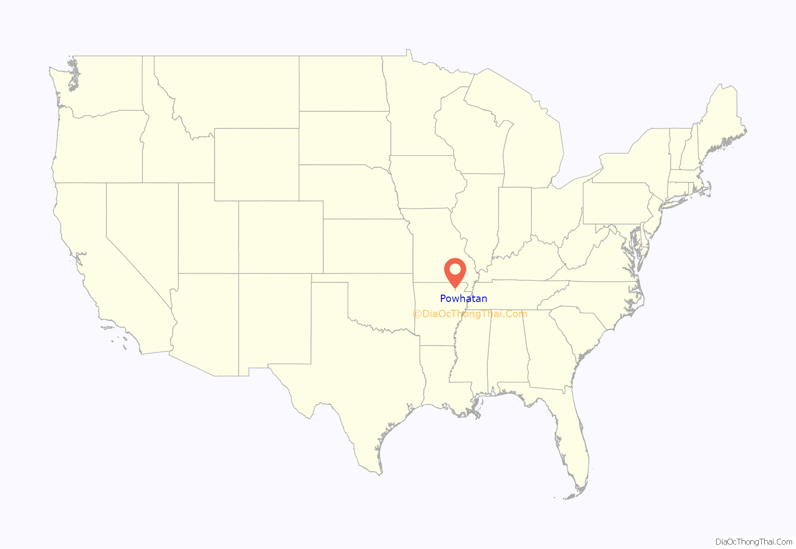
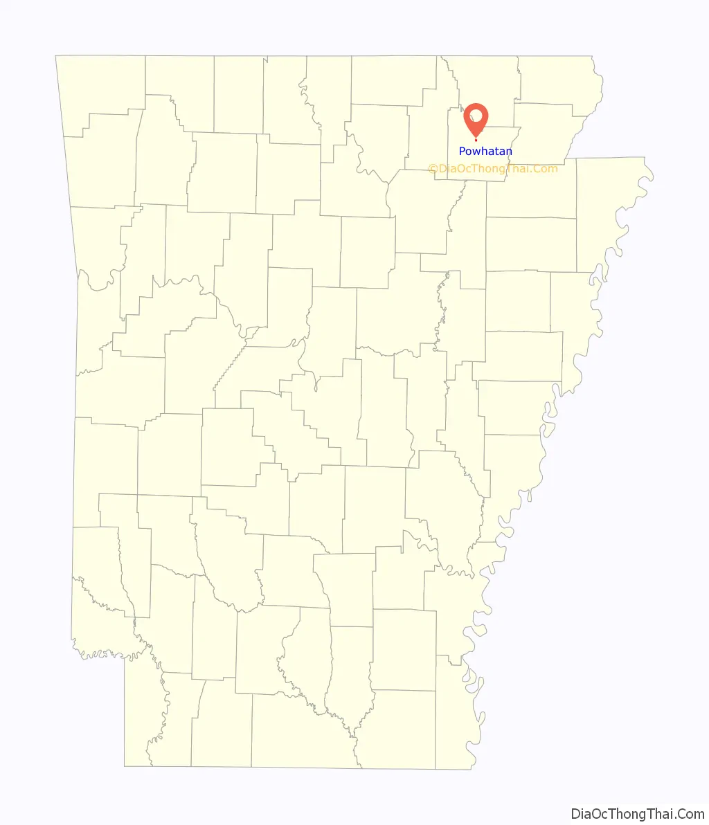
Powhatan is a town in Lawrence County, Arkansas, United States, along the Black River. The population was 72 at the 2010 census, up from 50 at the 2000 census.
| Name: | Powhatan town |
|---|---|
| LSAD Code: | 43 |
| LSAD Description: | town (suffix) |
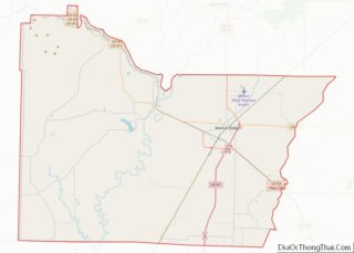
| State: | Arkansas |
| County: | Lawrence County |
| Elevation: | 285 ft (87 m) |
| Total Area: | 0.55 sq mi (1.42 km²) |
| Land Area: | 0.55 sq mi (1.42 km²) |
| Water Area: | 0.00 sq mi (0.00 km²) |
| Total Population: | 104 |
| Population Density: | 190.13/sq mi (73.36/km²) |
| ZIP code: | 72458 |
| Area code: | 870 |
| FIPS code: | 0557050 |
| GNISfeature ID: | 0058422 |
Online Interactive Map
Click on ![]() to view map in "full screen" mode.
to view map in "full screen" mode.
Powhatan location map. Where is Powhatan town?
History
The community was the economic hub of Lawrence County even before first platting in 1849. Situated on the Black River, the community took advantage of river traffic both along the river and as a ferry point for crossing the river. The Military Road passed nearby in the 1830s, and the local economy was flourishing. The Civil War shut down commerce on the river, especially after the Union regained control of Arkansas. Skirmishes throughout the region caused havoc for residents, but a slow recovery began to take place following the war. County government was relocated to Powhatan from Clover Bend, a decision greatly helping Powhatan recover.
The Kansas City-Memphis Railway chose to bypass Powhatan around 1880, causing nearby Black Rock to grow to prominence instead. The Lawrence County judiciary chose to split in 1887, allowing court to be held in Walnut Ridge and Powhatan. US Route 63 (US 63) was rerouted to bypass Powhatan in the 1950s, and all county government moved to Walnut Ridge in 1963.
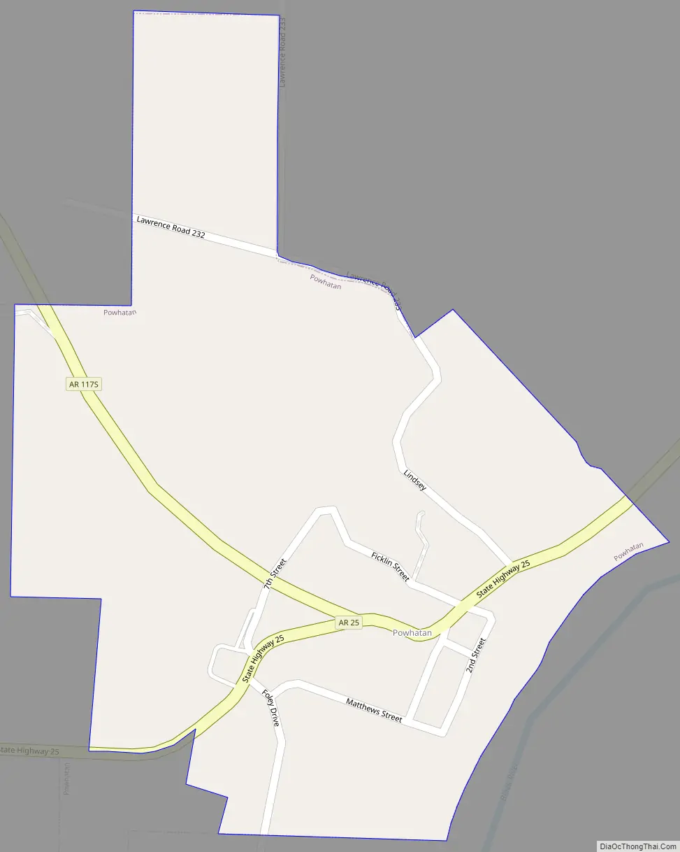
Powhatan Road Map
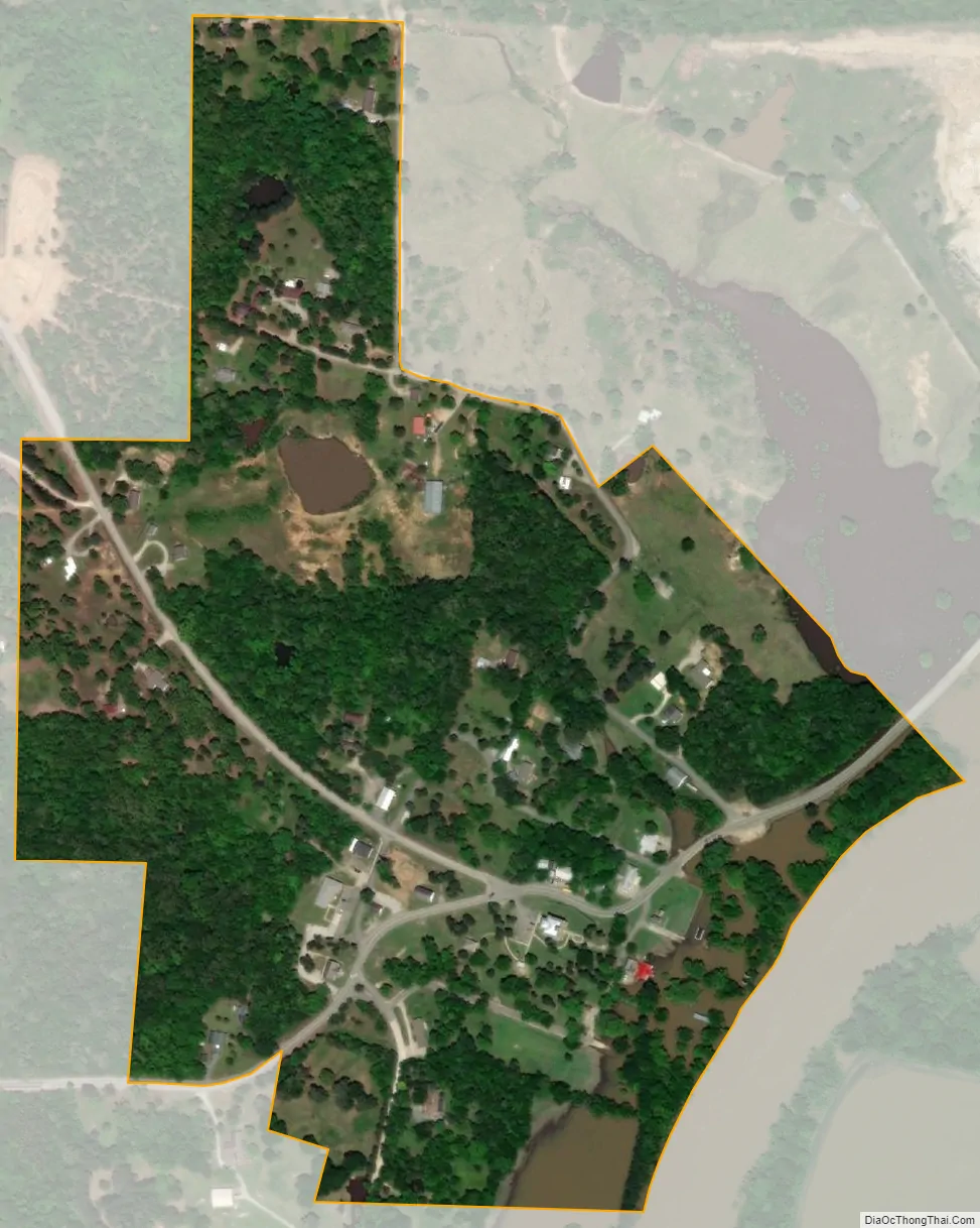
Powhatan city Satellite Map
Geography
Powhatan is located in northern Lawrence County at 36°4′59″N 91°7′11″W / 36.08306°N 91.11972°W / 36.08306; -91.11972 (36.083098, -91.119626).
According to the United States Census Bureau, the town has a total area of 0.22 square miles (0.56 km), all land.
Transportation
The main highway serving Powhatan is Arkansas Highway 25 (AR 25). The route continues northeast from Powhatan 2 miles (3 km) to Black Rock and southwest 48 miles (77 km) to Batesville. Highway 117S, a short spur route of Highway 117, runs into Powhatan and terminates at AR 25. Access to US Route 62/US Route 63/US Route 412 (US 62/US 63/US 412), a concurrency of major east–west routes, is available in Black Rock.
See also
Map of Arkansas State and its subdivision:- Arkansas
- Ashley
- Baxter
- Benton
- Boone
- Bradley
- Calhoun
- Carroll
- Chicot
- Clark
- Clay
- Cleburne
- Cleveland
- Columbia
- Conway
- Craighead
- Crawford
- Crittenden
- Cross
- Dallas
- Desha
- Drew
- Faulkner
- Franklin
- Fulton
- Garland
- Grant
- Greene
- Hempstead
- Hot Spring
- Howard
- Independence
- Izard
- Jackson
- Jefferson
- Johnson
- Lafayette
- Lawrence
- Lee
- Lincoln
- Little River
- Logan
- Lonoke
- Madison
- Marion
- Miller
- Mississippi
- Monroe
- Montgomery
- Nevada
- Newton
- Ouachita
- Perry
- Phillips
- Pike
- Poinsett
- Polk
- Pope
- Prairie
- Pulaski
- Randolph
- Saint Francis
- Saline
- Scott
- Searcy
- Sebastian
- Sevier
- Sharp
- Stone
- Union
- Van Buren
- Washington
- White
- Woodruff
- Yell
- Alabama
- Alaska
- Arizona
- Arkansas
- California
- Colorado
- Connecticut
- Delaware
- District of Columbia
- Florida
- Georgia
- Hawaii
- Idaho
- Illinois
- Indiana
- Iowa
- Kansas
- Kentucky
- Louisiana
- Maine
- Maryland
- Massachusetts
- Michigan
- Minnesota
- Mississippi
- Missouri
- Montana
- Nebraska
- Nevada
- New Hampshire
- New Jersey
- New Mexico
- New York
- North Carolina
- North Dakota
- Ohio
- Oklahoma
- Oregon
- Pennsylvania
- Rhode Island
- South Carolina
- South Dakota
- Tennessee
- Texas
- Utah
- Vermont
- Virginia
- Washington
- West Virginia
- Wisconsin
- Wyoming