Acton (pronunciation) is an unincorporated census-designated place in Los Angeles County, California, near the Antelope Valley. According to the 2010 census, Acton had a population of 7,596.
Acton is a small residential community located between the Sierra Pelona Mountains and the San Gabriel Mountains. It is off the Antelope Valley Freeway (Highway 14) south of Palmdale. Acton is roughly 20 miles (32 km) northeast of the San Fernando Valley, and 47 miles (76 km) north of downtown Los Angeles by highway. The town has a rural western theme which can be seen in its homes, commercial buildings and historical buildings, some of which date back to the late 1800s. The homes in the mountains around Acton have views of the valley below. In the valley are ranch style homes, often with equestrian facilities. While Acton is not a part of the Antelope Valley, it is grouped together with the Valley in the General Plan. Acton has a Metrolink commuter rail station on its border with Palmdale that is themed in an “old western” style and has been seen in various movies and commercials.
| Name: | Acton CDP |
|---|---|
| LSAD Code: | 57 |
| LSAD Description: | CDP (suffix) |
| State: | California |
| County: | Los Angeles County |
| Elevation: | 2,710 ft (826 m) |
| Total Area: | 39.28 sq mi (101.74 km²) |
| Land Area: | 39.26 sq mi (101.68 km²) |
| Water Area: | 0.02 sq mi (0.06 km²) 0.06% |
| Total Population: | 7,431 |
| Population Density: | 189.28/sq mi (73.08/km²) |
| ZIP code: | 93510 |
| Area code: | 661 |
| FIPS code: | 0600212 |
Online Interactive Map
Click on ![]() to view map in "full screen" mode.
to view map in "full screen" mode.
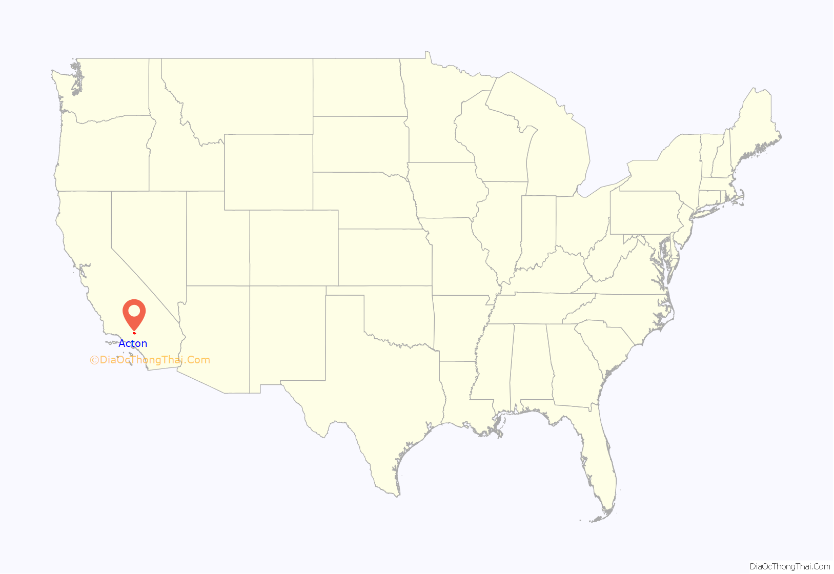
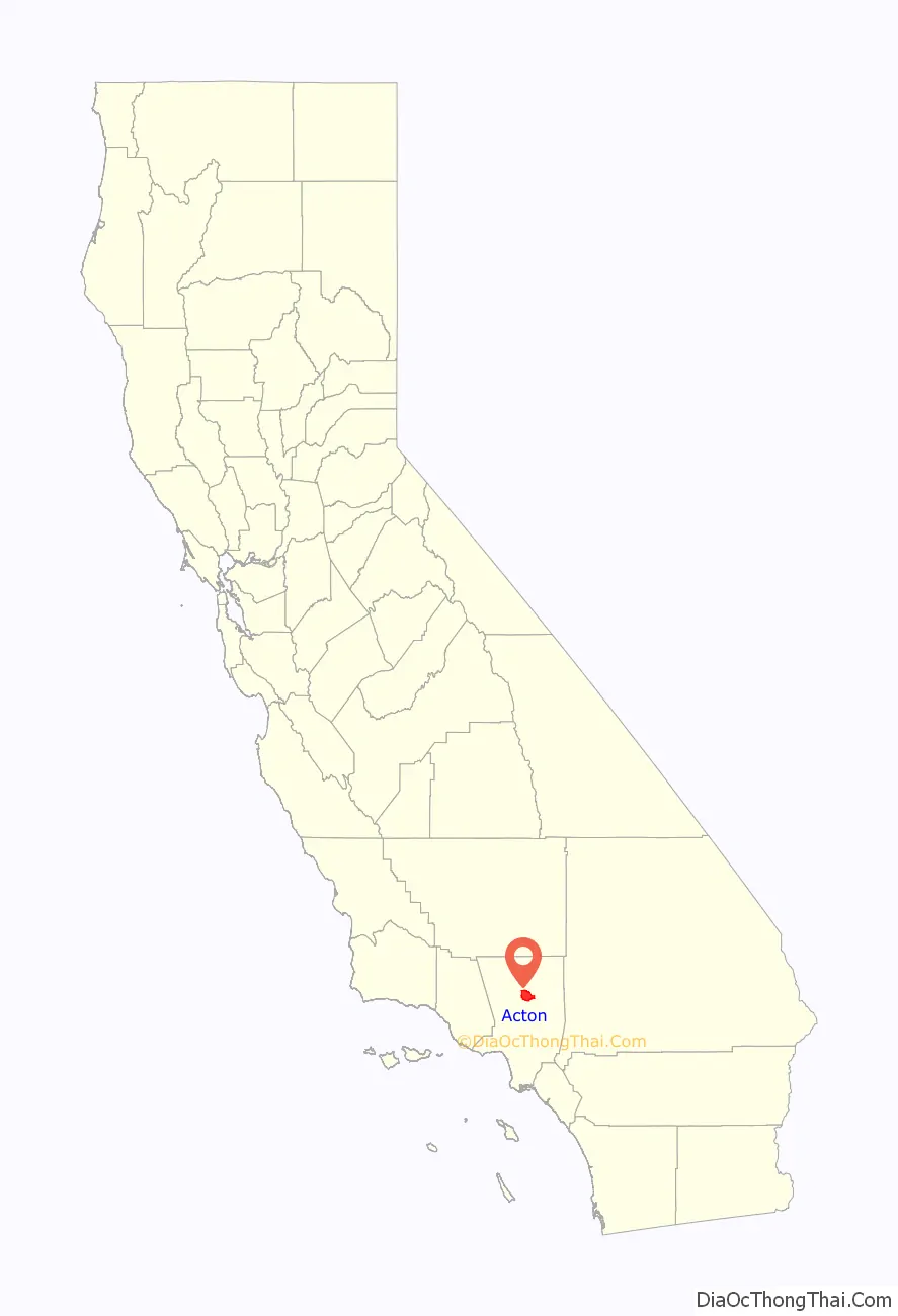
Acton location map. Where is Acton CDP?
History
Acton was founded in 1887 by gold miners who were working in the Red Rover Mine. It was named after Acton, Massachusetts by one of the miners. Two of the best-known gold mines located in Acton were the Red Rover mine and the Governor mine. Mining of gold, copper, and titanium ore continued into the early 1900s. The town originally had served as a railroad camp from 1873 to 1876 when the Saugus-Mojave section of the Southern Pacific Railroad was under construction.
Acton was once considered for the State capital of California. California Governor Henry T. Gage (1899–1903) owned the Governor Mine, hence the name, and sought to relocate the capital to Acton. This effort ultimately failed and the capital was not moved from Sacramento. In the late 1880s, Acton started to become more of a ranching and farming community. In 1889 Acton’s first hotel and its first saloon, the “49er” (formerly Sutter’s Mill), was opened and is still in business today.
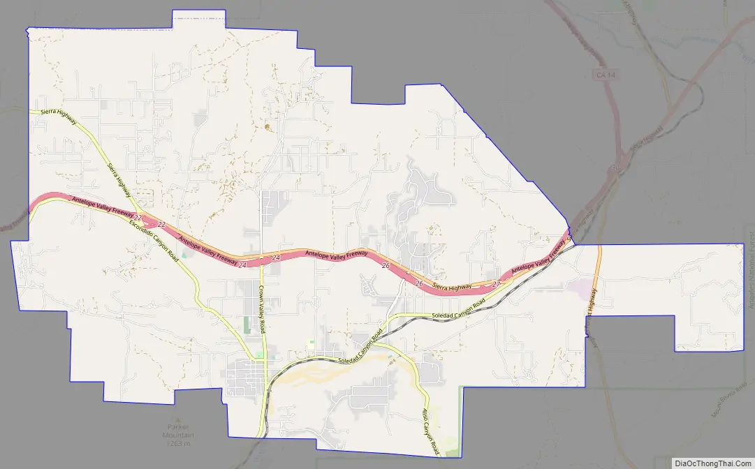
Acton Road Map
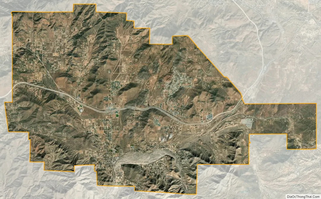
Acton city Satellite Map
Geography
Acton is located at 34°28′22″N 118°11′1″W / 34.47278°N 118.18361°W / 34.47278; -118.18361 (34.472777, -118.183696), 20 miles (32 km) east of Santa Clarita and 8 miles (13 km) south of Palmdale. According to the United States Census Bureau, the CDP has a total area of 39.3 square miles (102 km), over 99% of it land. Mount Gleason, one of the peaks of the San Gabriel Mountains, is located 7 miles (11 km) south of Acton and can be seen in the town or by passersby on the 14.
Climate
This region experiences warm (but not very hot) and dry summers, with no average monthly temperatures above 71.6 °F. According to the Köppen Climate Classification system, Acton has a warm-summer Mediterranean climate, abbreviated “Csb” on climate maps. Summer month days average 88 °F and above.
See also
Map of California State and its subdivision:- Alameda
- Alpine
- Amador
- Butte
- Calaveras
- Colusa
- Contra Costa
- Del Norte
- El Dorado
- Fresno
- Glenn
- Humboldt
- Imperial
- Inyo
- Kern
- Kings
- Lake
- Lassen
- Los Angeles
- Madera
- Marin
- Mariposa
- Mendocino
- Merced
- Modoc
- Mono
- Monterey
- Napa
- Nevada
- Orange
- Placer
- Plumas
- Riverside
- Sacramento
- San Benito
- San Bernardino
- San Diego
- San Francisco
- San Joaquin
- San Luis Obispo
- San Mateo
- Santa Barbara
- Santa Clara
- Santa Cruz
- Shasta
- Sierra
- Siskiyou
- Solano
- Sonoma
- Stanislaus
- Sutter
- Tehama
- Trinity
- Tulare
- Tuolumne
- Ventura
- Yolo
- Yuba
- Alabama
- Alaska
- Arizona
- Arkansas
- California
- Colorado
- Connecticut
- Delaware
- District of Columbia
- Florida
- Georgia
- Hawaii
- Idaho
- Illinois
- Indiana
- Iowa
- Kansas
- Kentucky
- Louisiana
- Maine
- Maryland
- Massachusetts
- Michigan
- Minnesota
- Mississippi
- Missouri
- Montana
- Nebraska
- Nevada
- New Hampshire
- New Jersey
- New Mexico
- New York
- North Carolina
- North Dakota
- Ohio
- Oklahoma
- Oregon
- Pennsylvania
- Rhode Island
- South Carolina
- South Dakota
- Tennessee
- Texas
- Utah
- Vermont
- Virginia
- Washington
- West Virginia
- Wisconsin
- Wyoming


