Aromas (Spanish for “Perfumes”) is an unincorporated community and census-designated place (CDP) in Monterey County and San Benito County, California, United States. The population was 2,708 at the 2020 census.
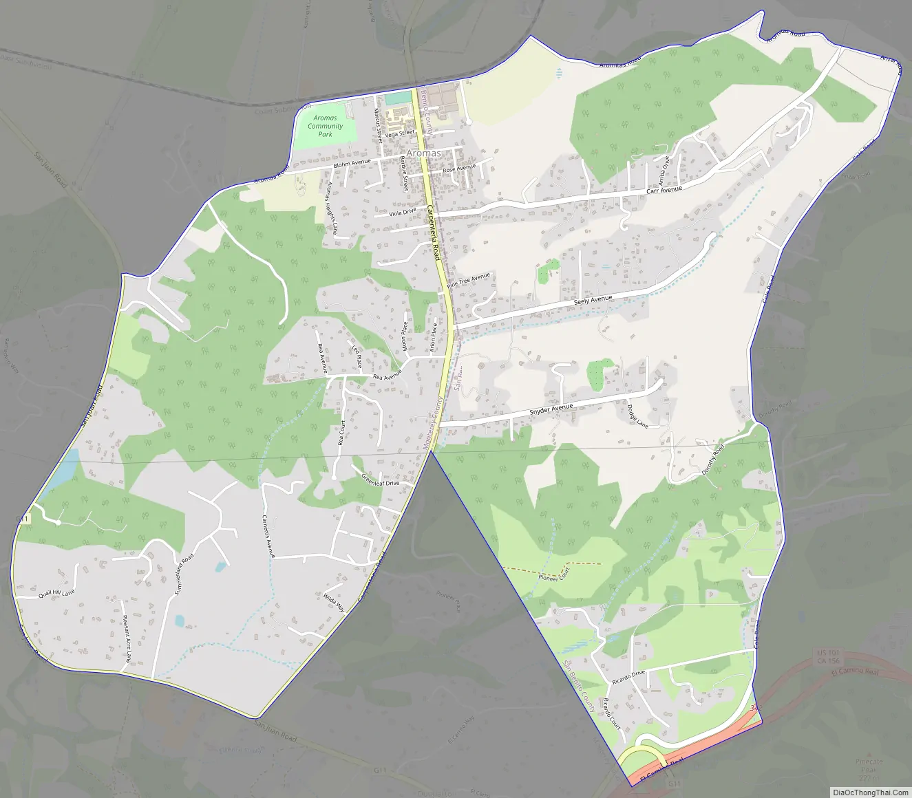
The CDP straddles the border of the two counties, with Monterey County to the west and San Benito County to the east. The Santa Cruz County line is less than a mile to the northwest, and Santa Clara County is about 2 miles (3 km) to the north. Its population was almost equally distributed between the two counties with 1,358 in Monterey County and 1,292 in San Benito County; this was down from a population of 2,797 during the 2000 census (1,427 in Monterey County and 1,370 in San Benito County). Aromas is one of four CDPs in California that are divided between two or more counties. The others are Kingvale (divided between Placer County and Nevada County), Kirkwood (divided between Alpine County and Amador County), and Tahoma (divided between Placer County and El Dorado County).
| Name: | Aromas CDP |
|---|---|
| LSAD Code: | 57 |
| LSAD Description: | CDP (suffix) |
| State: | California |
| County: | Monterey County, San Benito County |
| Elevation: | 131 ft (40 m) |
| Total Area: | 4.75 sq mi (12.3 km²) |
| Land Area: | 4.74 sq mi (12.3 km²) |
| Water Area: | 0.01 sq mi (0.03 km²) 0.22% |
| Total Population: | 2,708 |
| Population Density: | 571.91/sq mi (220.82/km²) |
| ZIP code: | 95004 |
| Area code: | 831 |
| FIPS code: | 0602812 |
| GNISfeature ID: | 1657949 |
Online Interactive Map
Click on ![]() to view map in "full screen" mode.
to view map in "full screen" mode.
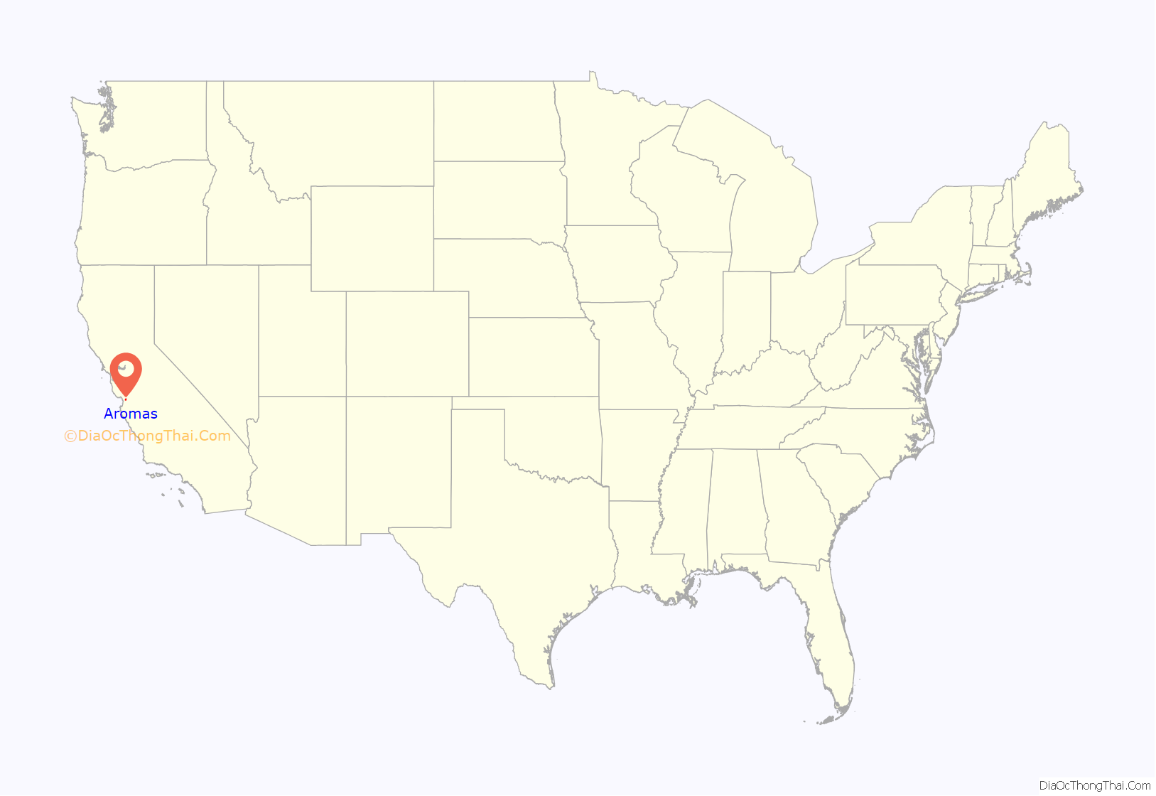
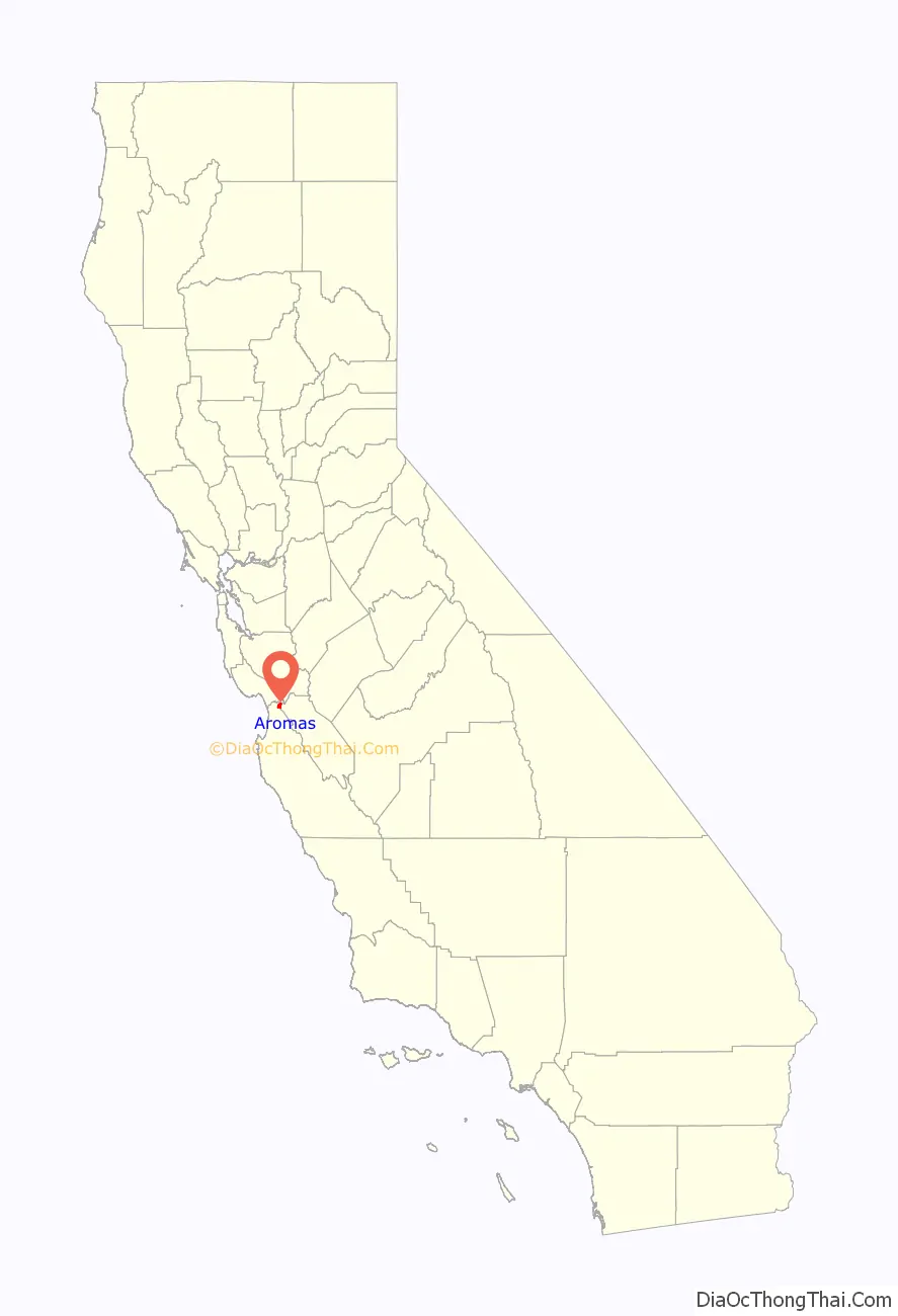
Aromas location map. Where is Aromas CDP?
History
The settlement was originally known as “Sand Cut”, named from the Southern Pacific Railroad tunnel constructed nearby in 1871. The settlement was renamed Aromas, after Rancho Las Aromitas y Agua Caliente, around 1895.
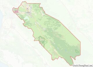
Aromas Road Map
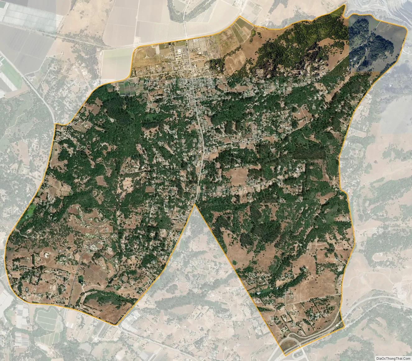
Aromas city Satellite Map
Geography
Aromas is located in northern Monterey County and northwestern San Benito County at 36°53′13″N 121°38′29″W / 36.88694°N 121.64139°W / 36.88694; -121.64139 (36.886988, -121.641396). Is it bordered to the south by Prunedale. U.S. Route 101 runs along the southeastern edge of the community, leading north 13 miles (21 km) to Gilroy and south 14 miles (23 km) to Salinas.
According to the United States Census Bureau, the Aromas CDP has a total area of 4.75 square miles (12.3 km). 4.74 square miles (12.3 km) of it are land and 0.01 square miles (0.026 km), or 0.22%, are water. The center of town is on the south side of the valley of the Pajaro River, about 1 mile (1.6 km) southwest of where the river cuts through Pajaro Gap (Chittenden Pass) at the south end of the Santa Cruz Mountains.
See also
Map of California State and its subdivision:- Alameda
- Alpine
- Amador
- Butte
- Calaveras
- Colusa
- Contra Costa
- Del Norte
- El Dorado
- Fresno
- Glenn
- Humboldt
- Imperial
- Inyo
- Kern
- Kings
- Lake
- Lassen
- Los Angeles
- Madera
- Marin
- Mariposa
- Mendocino
- Merced
- Modoc
- Mono
- Monterey
- Napa
- Nevada
- Orange
- Placer
- Plumas
- Riverside
- Sacramento
- San Benito
- San Bernardino
- San Diego
- San Francisco
- San Joaquin
- San Luis Obispo
- San Mateo
- Santa Barbara
- Santa Clara
- Santa Cruz
- Shasta
- Sierra
- Siskiyou
- Solano
- Sonoma
- Stanislaus
- Sutter
- Tehama
- Trinity
- Tulare
- Tuolumne
- Ventura
- Yolo
- Yuba
- Alabama
- Alaska
- Arizona
- Arkansas
- California
- Colorado
- Connecticut
- Delaware
- District of Columbia
- Florida
- Georgia
- Hawaii
- Idaho
- Illinois
- Indiana
- Iowa
- Kansas
- Kentucky
- Louisiana
- Maine
- Maryland
- Massachusetts
- Michigan
- Minnesota
- Mississippi
- Missouri
- Montana
- Nebraska
- Nevada
- New Hampshire
- New Jersey
- New Mexico
- New York
- North Carolina
- North Dakota
- Ohio
- Oklahoma
- Oregon
- Pennsylvania
- Rhode Island
- South Carolina
- South Dakota
- Tennessee
- Texas
- Utah
- Vermont
- Virginia
- Washington
- West Virginia
- Wisconsin
- Wyoming