Avalon is the only incorporated city on Santa Catalina Island, in the California Channel Islands, and the southernmost city in Los Angeles County. The city is a resort community with the waterfront dominated by tourism-oriented businesses. The older parts of the town on the valley floor consist primarily of small houses and two and three-story buildings in various traditional architectural styles.
In 1919, William Wrigley Jr. gained control of Avalon and oversaw much of the development of Avalon, including the construction of the landmark Catalina Casino. From the late 19th century to the early 20th century, several different developers tried to develop Avalon into a resort destination community, but most before Wrigley went bankrupt.
The population was 3,460 at the 2020 census. Avalon attracts about 1 million visitors a year and is frequently visited by cruise ships. Before European colonization, the island was inhabited by the Tongva people.
| Name: | Avalon city |
|---|---|
| LSAD Code: | 25 |
| LSAD Description: | city (suffix) |
| State: | California |
| County: | Los Angeles County |
| Elevation: | 30 ft (9 m) |
| Total Area: | 7.66 sq mi (19.83 km²) |
| Land Area: | 2.89 sq mi (7.47 km²) |
| Water Area: | 4.77 sq mi (12.35 km²) 0.07% |
| Total Population: | 3,460 |
| Population Density: | 1,198.89/sq mi (462.94/km²) |
| ZIP code: | 90704 |
| Area code: | 310/424 |
| FIPS code: | 0603274 |
| GNISfeature ID: | 1660283 |
| Website: | http://cityofavalon.com/ |
Online Interactive Map
Click on ![]() to view map in "full screen" mode.
to view map in "full screen" mode.
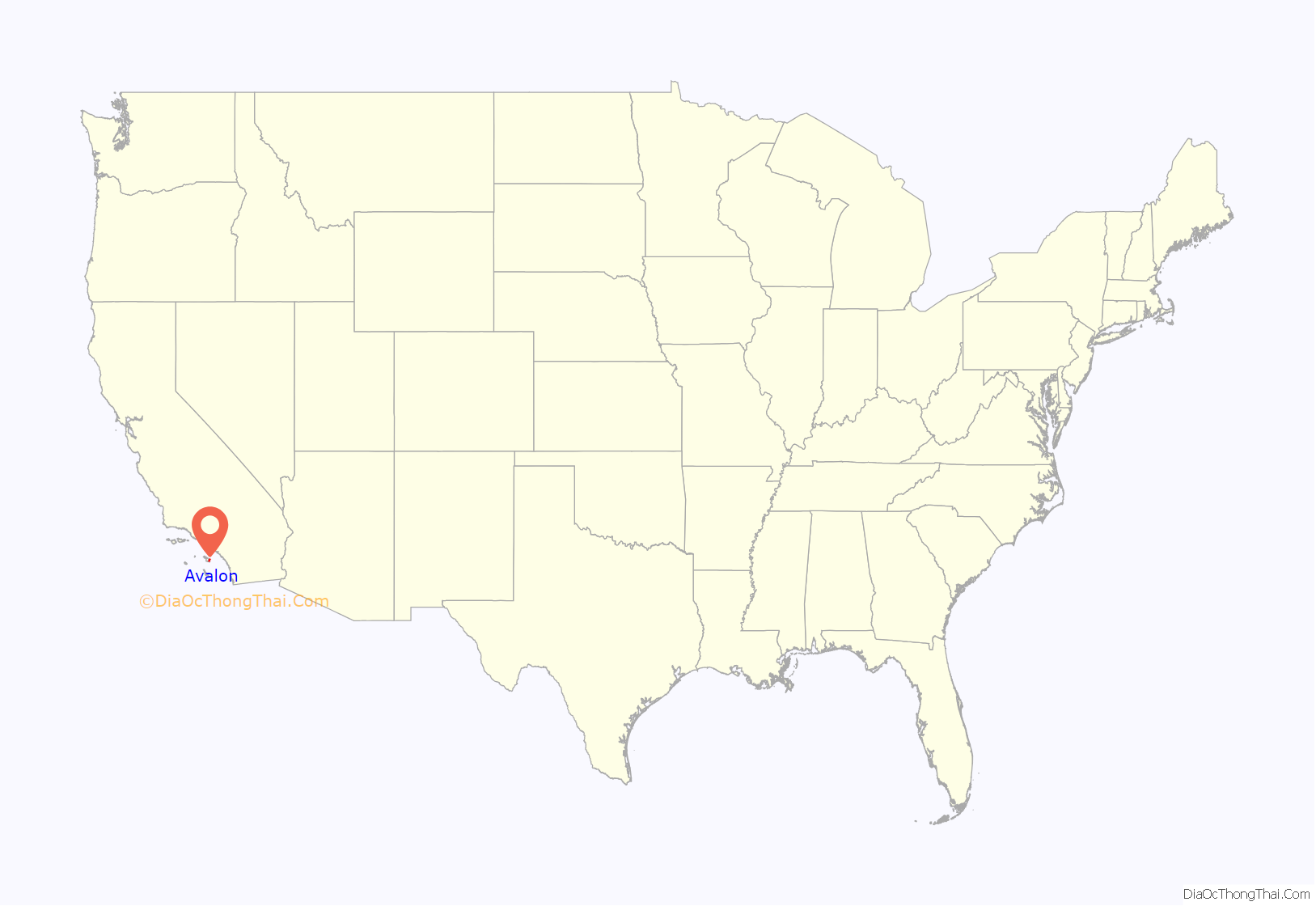
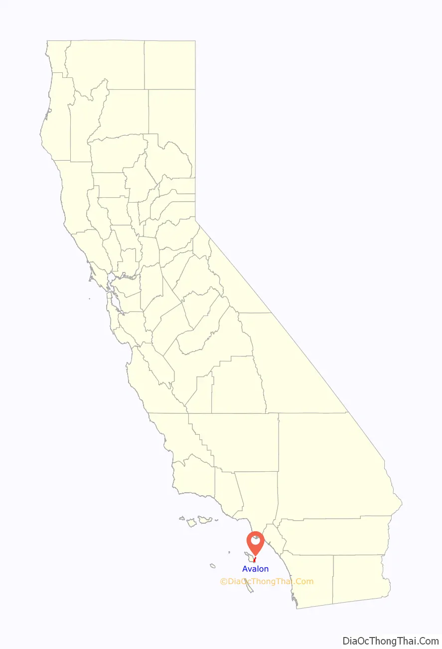
Avalon location map. Where is Avalon city?
History
Prior to the modern era, Avalon Bay was inhabited by people of the Gabrielino/Tongva tribe. The island was a major source of soapstone to the Tongva, who used the material to make stone vessels for cooking. The Tongva called the island Pimu or Pimugna and referred to themselves as the Pimugnans. However, by the 1830s, the entire island’s native population had either died off, or had undergone forcible relocation to the mainland to work in the missions or as ranch hands for the many private land owners.
In the 1860s, German immigrant Augustus William Timms ran a sheep herding business on Catalina Island. One of his vessels, the Rosita, would also ferry pleasure seekers across the channel to Avalon Bay for bathing and fishing. The settlement in Avalon was then referred to as Timms’s Landing in his honor. By the summer of 1883, there were thirty tents and three wooden buildings at Timms’s Landing.
The first owner to try to develop Avalon Bay into a resort destination was George Shatto, a real estate speculator from Grand Rapids, Michigan. Shatto purchased the island for $200,000 from the estate of James Lick at the height of a real estate boom in Southern California in 1887. Shatto created the settlement that would become Avalon, and can be credited with building the town’s first hotel, the original Hotel Metropole, and pier. Though early maps labeled the town Shatto, Shatto’s sister-in-law Etta Whitney came up with the permanent name of Avalon in reference from a poem by Lord Tennyson called “Idylls of the King” about the legend of King Arthur (which features an island of the same name). Shatto laid out Avalon’s streets, and introduced it as a vacation destination to the general public. Despite Shatto’s efforts, in a few years he had to default on his loan and the island went back to the Lick estate.
The sons of Phineas Banning bought the island in 1891 from the Lick estate and established the Santa Catalina Island Company to develop it as a resort. The Banning brothers fulfilled Shatto’s dream of making Avalon a resort community. They built a dance pavilion in the center of town, made additions to the Hotel Metropole and steamer-wharf, built an aquarium, and created the Pilgrim Club (a gambling club for men only). Just as the Bannings were anticipating the construction of a new, Hotel Saint Catherine, their efforts were set back on November 29, 1915, when a fire burned half of Avalon’s buildings, including six hotels and several clubs. In 1919, due to debt related to the 1915 fire and a general decline in tourism during World War I, the Bannings were forced to sell the island in shares.
In February 1919, chewing gum magnate William Wrigley, Jr. bought a controlling interest in Santa Catalina Island and its associated properties from the Banning Brothers. Wrigley devoted himself to preserving and promoting it, investing millions in needed infrastructure and attractions, including the construction of the new Catalina Casino, completed May 29, 1929. In order to encourage growth, Wrigley purchased additional steamships to service Avalon, including the SS Virginia (renamed the SS Avalon) and the SS Catalina which was launched on the morning of May 3, 1924. Wrigley also brought attention to the town of Avalon by having his Chicago Cubs use the island for the team’s spring training from 1921 to 1951, absent the war years of 1942–45. The ball field was at the southwest border of Avalon, between Tremont Street and the golf course.
Following the death of William Wrigley, Jr. in 1932, his son Philip K. Wrigley took over the Santa Catalina Island Company. Philip continued his father’s work in the improvement of the infrastructure of the City of Avalon. During World War II, the island was closed to tourists and used for military training facilities, including a U.S. Maritime Service training facility in Avalon. Catalina’s steamships were expropriated for use as troop transports, and the U.S. Maritime Service set up a training facility in Avalon. The Maritime Service announced on September 19, 1945, that the facility would soon be abandoned and all apprentice seaman on the west coast trained aboard three ocean-going vessels at Long Beach.
In 1975, Philip Wrigley deeded the Wrigley shares in the Santa Catalina Island Company to the Catalina Island Conservancy that he had helped create. The Conservancy now stewards 88 percent of the island, primarily outside of the City of Avalon. The Santa Catalina Island Company maintains control of much of its resort properties and operations within the City of Avalon. It still owns and operates many of the main tourist attractions in Avalon, including the Catalina Visitors Country Club, Catalina Island Golf Course, Descanso Beach Club and the Casino Ballroom.
In May 2007, the Island Fire burned 4,750 acres (19.2 km) of land just outside Avalon’s city limits. Over 200 firefighting recruits were brought over by U.S. Marine hovercraft and helicopter to protect the city. Ultimately, only one residence and six commercial structures were destroyed.
In February 2011, water regulators cited the city for letting tens of thousands of gallons of sewage reach the ocean in six spills since 2005. A report in June 2011 by the Natural Resources Defense Council listed Avalon as having one of the 10 most chronically polluted beaches in the United States. The pollution was caused by the city’s sewer system, made of century-old clay and metal pipes. By 2011, the city had spent $3.5 million testing and rehabilitating sewer lines, but the water was no cleaner. In February 2012, a cease and desist order was issued against the city for illegally discharging polluted water into the bay. After the cease and desist order, the city invested an additional $5.7 million on sewer main improvements and inspection and tracking systems. As a result of these efforts, the 2014 report showed that water quality had improved, and Avalon Beach was removed from the list of the most polluted beaches.
In the 2010s, the Santa Catalina Island Company began a series of projects to upgrade the tourist amenities in Avalon, including the installation of a zip line at Descanso Beach. By 2014, the Santa Catalina Island Company was working on a number of redevelopment and remodeling projects, including a spa, aquatic facility, community center, new hotel, and 120 new homes. The largest project was a new $6-million museum building on Metropole Street to replace the old location in the Casino building. Some community members, including a member of the City Council, expressed concerns about the pace of the changes to the town.
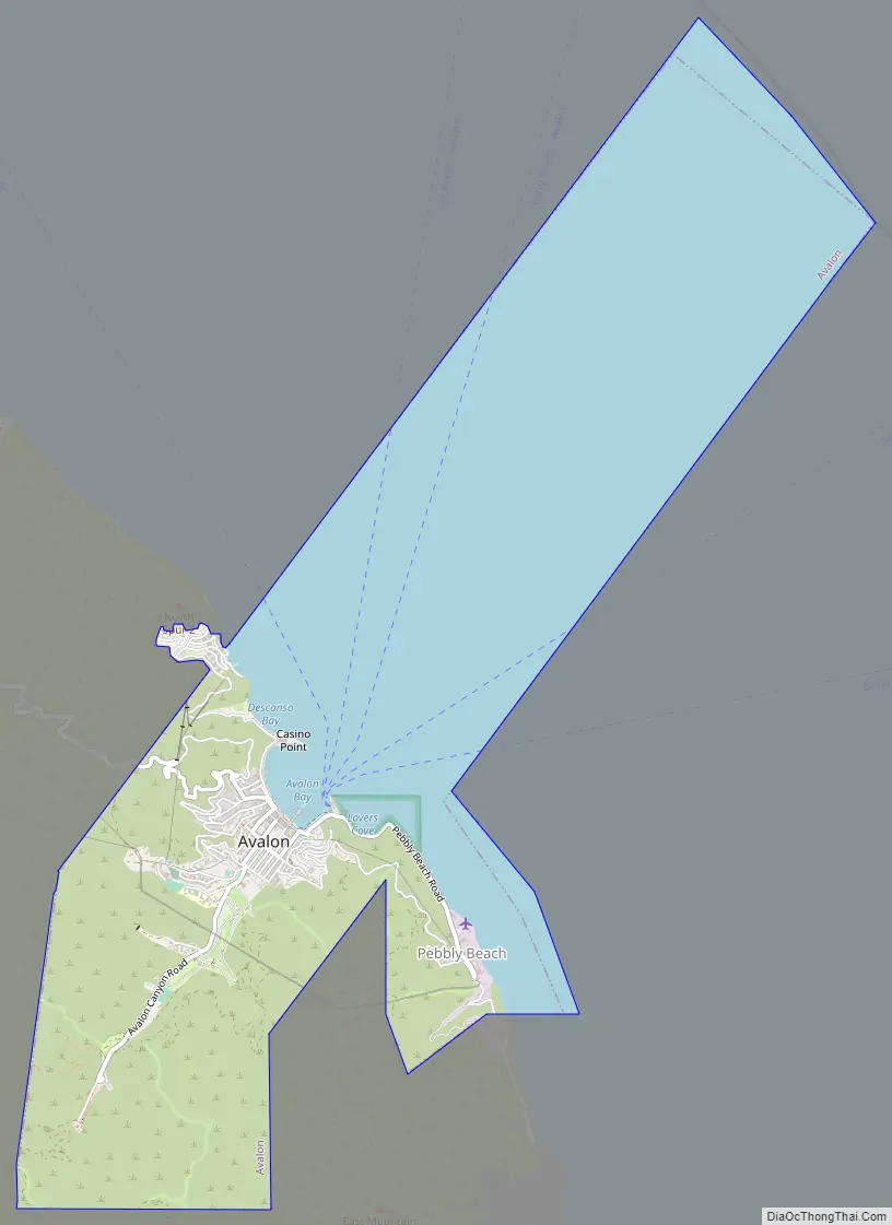
Avalon Road Map
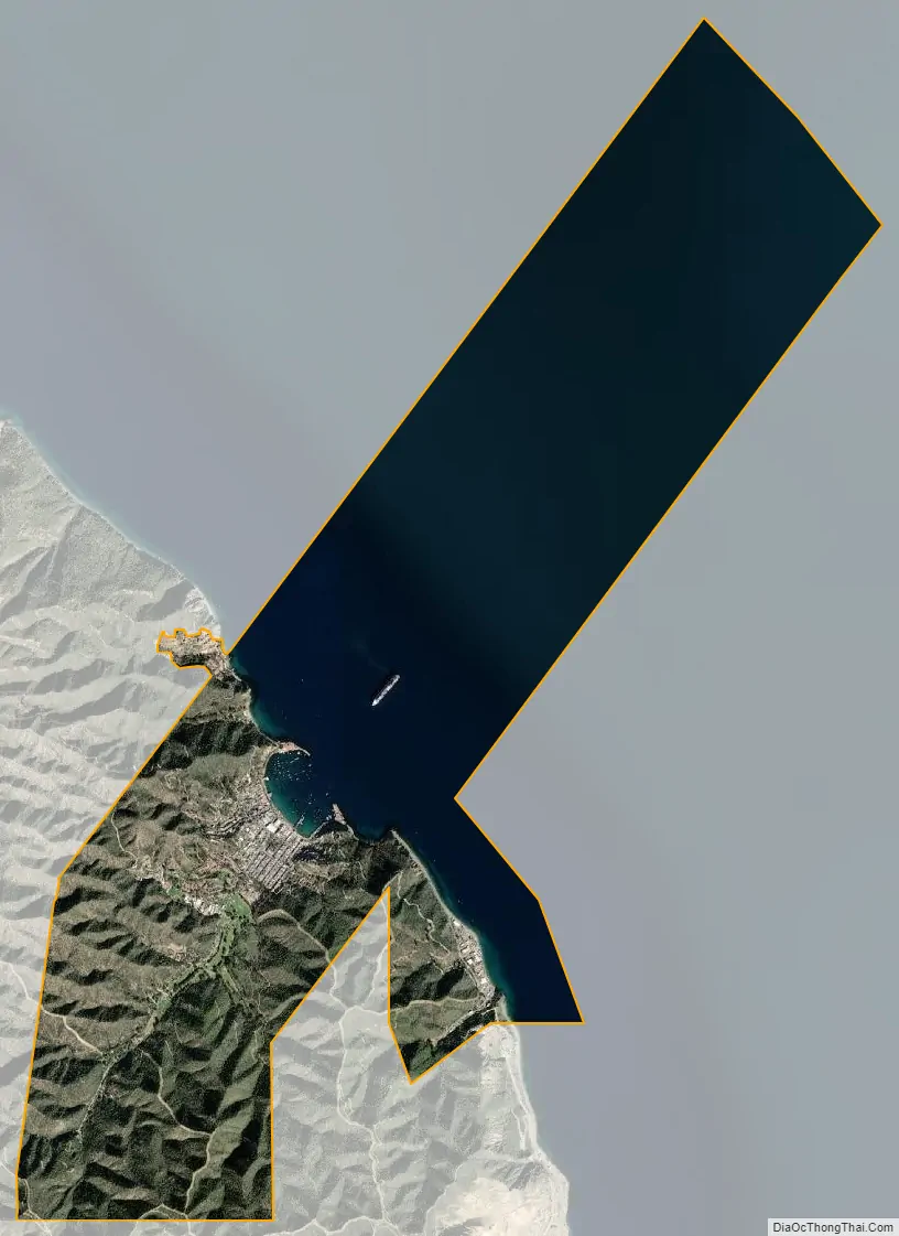
Avalon city Satellite Map
Geography
Avalon is located on Santa Catalina Island, approximately 22 miles (35 km) south-by-southwest of the Los Angeles Harbor breakwater. It is the only incorporated city to be located on one of the eight Channel Islands of California. Due to its location on Catalina Island, it is the southernmost city in Los Angeles County. According to the United States Census Bureau, the city has a total area of 2.9 sq mi (8 km) on land and 58,975 sq ft (5,479 m) on water.
Cityscape
The City of Avalon is oriented around Avalon Bay, with the harbor and beaches forming the center of the town’s activity. The Cabrillo Mole, located at the south end of the harbor, acts both as a breakwater and the main docks for the cross-channel passenger boats. Many of the commercial businesses dedicated to serving visitors are located along the Crescent Street pedestrian mall, which runs just behind the three main beaches of Avalon Bay. The pedestrian walkway is adorned throughout with decorative pavers, fountains, palm trees, and a decorative serpentine seawall. Many of these features were introduced to Avalon during an extensive re-design undertaken by Philip K. Wrigley in 1934. Extending out into the center of the harbor is the green Pleasure Pier. The north end of the harbor is dominated by the Catalina Casino. Built in a style described as a cross between Art Deco and Mediterranean Revival, the Casino serves as Avalon’s most distinctive landmark.
Outside of the bay and just north of the Casino is Descanso Beach, a private beach, entertainment and meetings venue run by the Santa Catalina Island Company. At the farthest north end of town are the Hamilton Cove condominiums, a gated community consisting mostly of second homes. South of the bay is Lovers Cove dive park, a marine reserve frequented by both snorkelers and the classic glass-bottom boat tours. Further south still is Pebbly Beach, an industrial area home to the Pebbly Beach Seaplane Base & Heliport and Pebbly Beach Generating Station, where Avalon gets its power.
Most of the residential units in Avalon are tucked away off of the beachfront, either in the flat lands further back into the canyon or on the hills that constitute the sides of Avalon Valley. Many of the major municipal amenities are located even further into the canyon, including City Hall, the fire station, the Catalina Island Medical Center, and Avalon Schools. The William Wrigley Jr. Summer Cottage, also known as Mount Ada, is now a hotel. The Wrigley Memorial and Botanical Gardens are located at the farthest end of town away from the bay. The Memorial prominently features native Catalina Island building materials, including the famous pottery and tile that were made on the island from 1927 through 1937.
Climate
Avalon has a very mild warm-summer Mediterranean climate Csb, with mild temperatures year-round. The National Weather Service maintained a cooperative station at the Avalon Pleasure Pier from 1909 through 1988. Average January temperatures are a maximum of 64.6 °F (18.1 °C) and a minimum of 49.3 °F (9.6 °C) and average August temperatures are a maximum of 75.4 °F (24.1 °C) and a minimum of 64.1 °F (17.8 °C). The highest recorded temperature was 105.1 °F (40.6 °C) on July 6, 2018, during a major Southern California heatwave, and the lowest recorded temperature was 29 °F (−2 °C) on January 2, 1973.
Annual average precipitation is 11.88 inches (30.2 cm) and there are 34 days with measurable precipitation. The wettest year was 1983 with 34.54 inches (87.7 cm) and the driest year was 1953 with 4.10 inches (10.4 cm). The most rainfall in one month was 11.68 inches (29.7 cm) in May 1921. The most rainfall in 24 hours was 6.75 inches (17.1 cm) on October 22, 1941. Weather records are still maintained at the Santa Catalina airport.
See also
Map of California State and its subdivision:- Alameda
- Alpine
- Amador
- Butte
- Calaveras
- Colusa
- Contra Costa
- Del Norte
- El Dorado
- Fresno
- Glenn
- Humboldt
- Imperial
- Inyo
- Kern
- Kings
- Lake
- Lassen
- Los Angeles
- Madera
- Marin
- Mariposa
- Mendocino
- Merced
- Modoc
- Mono
- Monterey
- Napa
- Nevada
- Orange
- Placer
- Plumas
- Riverside
- Sacramento
- San Benito
- San Bernardino
- San Diego
- San Francisco
- San Joaquin
- San Luis Obispo
- San Mateo
- Santa Barbara
- Santa Clara
- Santa Cruz
- Shasta
- Sierra
- Siskiyou
- Solano
- Sonoma
- Stanislaus
- Sutter
- Tehama
- Trinity
- Tulare
- Tuolumne
- Ventura
- Yolo
- Yuba
- Alabama
- Alaska
- Arizona
- Arkansas
- California
- Colorado
- Connecticut
- Delaware
- District of Columbia
- Florida
- Georgia
- Hawaii
- Idaho
- Illinois
- Indiana
- Iowa
- Kansas
- Kentucky
- Louisiana
- Maine
- Maryland
- Massachusetts
- Michigan
- Minnesota
- Mississippi
- Missouri
- Montana
- Nebraska
- Nevada
- New Hampshire
- New Jersey
- New Mexico
- New York
- North Carolina
- North Dakota
- Ohio
- Oklahoma
- Oregon
- Pennsylvania
- Rhode Island
- South Carolina
- South Dakota
- Tennessee
- Texas
- Utah
- Vermont
- Virginia
- Washington
- West Virginia
- Wisconsin
- Wyoming


