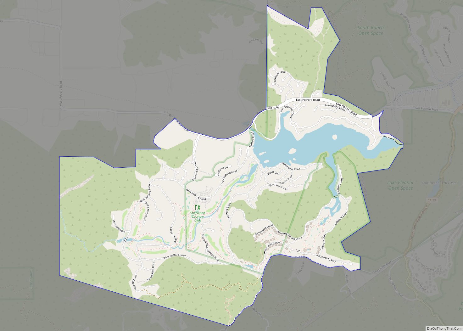
Bell Canyon is an unincorporated community in eastern Ventura County, California, United States. Bell Canyon is a gated community in the Simi Hills with the main access through the Los Angeles community of West Hills and the western San Fernando Valley. Bell Canyon sits at an elevation of 1,368 feet (417 m). The 2010 United States census reported Bell Canyon’s population was 2,049. For statistical purposes, the United States Census Bureau has defined Bell Canyon as a census-designated place (CDP). According to a 2016 study, Bell Canyon is the seventh wealthiest community in the state of California with an annual median income of $230,000.
| Name: | Bell Canyon CDP |
|---|---|
| LSAD Code: | 57 |
| LSAD Description: | CDP (suffix) |
| State: | California |
| County: | Ventura County |
| Elevation: | 1,368 ft (417 m) |
| Total Area: | 3.62 sq mi (9.38 km²) |
| Land Area: | 3.62 sq mi (9.38 km²) |
| Water Area: | 0.00 sq mi (0.00 km²) 0% |
| Total Population: | 2,049 |
| ZIP code: | 91307 |
| FIPS code: | 0604938 |
| GNISfeature ID: | 2585403 |
| Website: | http://www.bellcanyon.com/ |
Online Interactive Map
Click on ![]() to view map in "full screen" mode.
to view map in "full screen" mode.
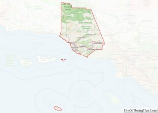
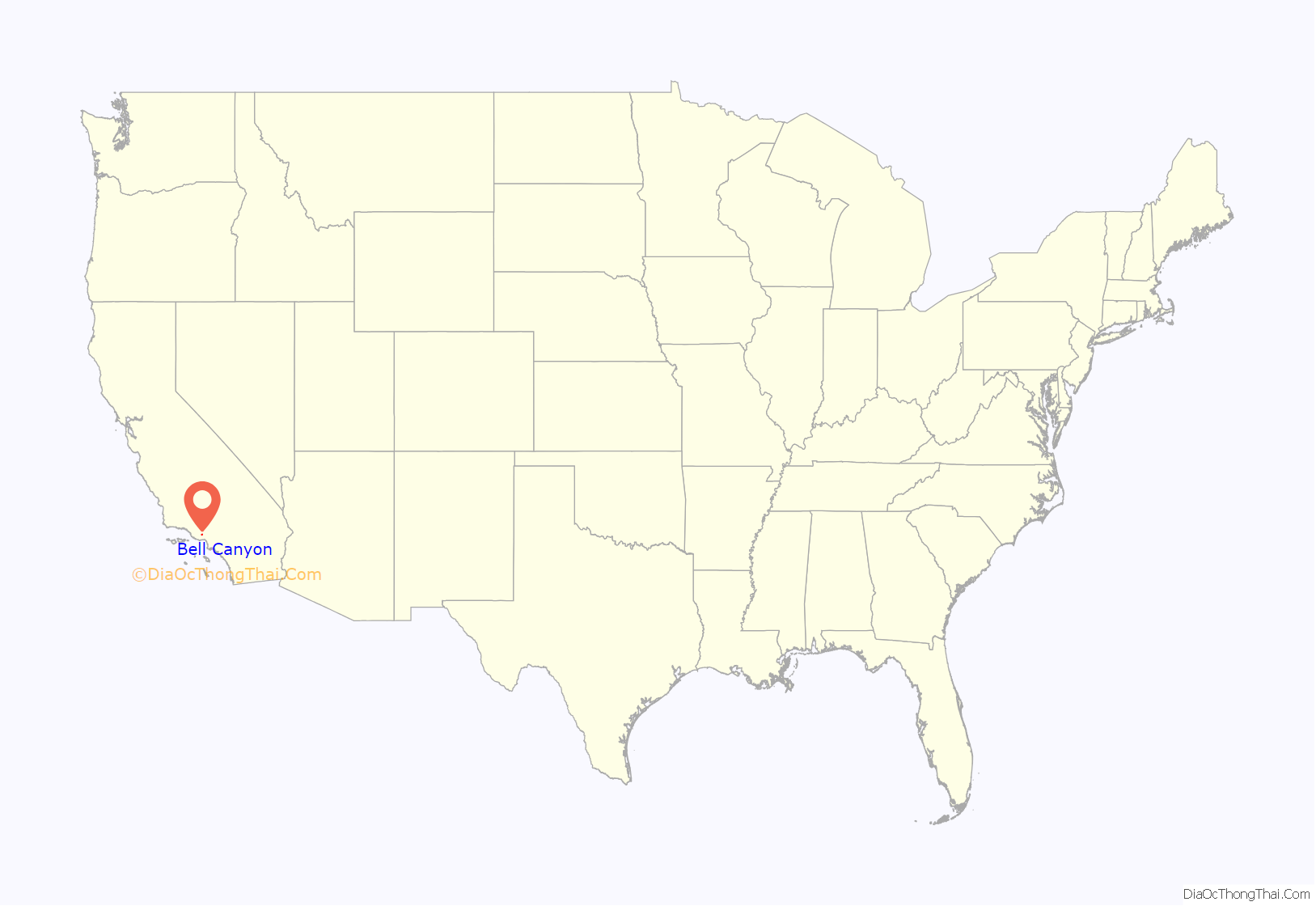
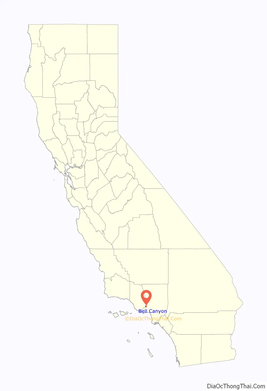
Bell Canyon location map. Where is Bell Canyon CDP?
History
Pre-20th century
Chumash Native Americans lived in the canyon for around 8,000 years B.P. The Chumash had the village of Hu’wam here in the canyon on Bell Creek upstream from Escorpión Peak. It was multi-cultural, where Chumash, Tongva, and Tataviam peoples lived and traded together. Nearby is the Burro Flats Painted Cave. Escorpión Peak (aka: Castle Peak) is one of nine alignment points in Chumash territory and is considered essential to maintaining the balance of the natural world.
In 1845 the Mexican land grant for Rancho El Escorpión, named for the peak and located beside it at the mouth of Bell Canyon, was given by Mexican Governor Pío Pico. Chumash-Ventureño Chief Odón Eusebia (1795–), his brother-in-law Urbano, and Urbano’s son Mañuel were the grantees of the Rancho grant, formerly Mission San Fernando Rey de España (Mission San Fernando) lands. After California U.S. statehood, as required by the Land Act of 1851, a claim for Rancho El Escorpión was filed with the United States Public Land Commission in 1852, and the grant was patented to Odón Eusebia, Urbano, and Mañuel in 1876. In 1871, Miguel Leonis acquired Odón Eusebia’s holdings of Rancho El Escorpión, along with an adobe on the adjacent southern ranch lands in Calabasas. He used the land for cattle and sheep herds. Through various landowners that use continued at the Rancho until 1959 and Bell Canyon until 1967.
20th century – onward
In 1967 the Spruce Land Corporation and Boise Cascade joined in a partnership to purchase the Bell Canyon area to develop the community of Bell Canyon. In the fall of 1968, the Bell Canyon Equestrian Center, designed by ‘Southern California modern ranch style’ architect Cliff May, was built and began operation. In 1969 a new subdivision called “Woodland Hills Country Estates” was developed and opened for sales. It was a success, selling nearly all the 800 home site lots within ten days. In the fall of 1969 the new residential property owners took leadership of the community association and renamed the development “Bell Canyon,” after Charles A. Bell, the original homesteader here and son of pioneer Horace Bell. He was a leading late 1880s newspaper publisher, Los Angeles attorney winning many cases for clients against neighbor Miguel Leonis, and the 1906 Justice of the Peace for Calabasas. Legend says he lost a right arm in an 1887 shootout when raiding a moonshiner. The Rancho El Escorpión compound adobes, from the 1840s to the 1960s at the mouth of Bell Canyon, were actually outside the land grant and on Bell’s property.
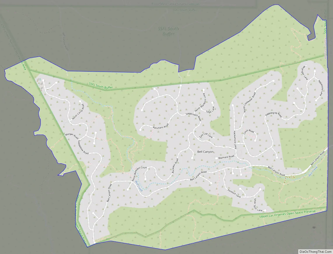
Bell Canyon Road Map
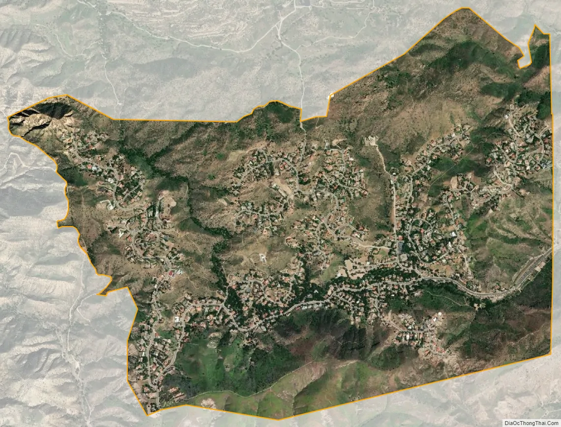
Bell Canyon city Satellite Map
Geography
Bell Creek, a tributary to the headwaters of the Los Angeles River, winds its way through the community. Bell Canyon is an important part of the crucial Simi Hills Wildlife corridor linking migrations between the Santa Monica Mountains and Santa Susana Mountains.
There are many hiking and riding trails around the community, some of which border the Upper Las Virgenes Canyon Open Space Preserve Park connecting to the south and west. The Bell Canyon Trail extends 4.5 miles (7.2 km) north from Bell Canyon Park.
See also
Map of California State and its subdivision:- Alameda
- Alpine
- Amador
- Butte
- Calaveras
- Colusa
- Contra Costa
- Del Norte
- El Dorado
- Fresno
- Glenn
- Humboldt
- Imperial
- Inyo
- Kern
- Kings
- Lake
- Lassen
- Los Angeles
- Madera
- Marin
- Mariposa
- Mendocino
- Merced
- Modoc
- Mono
- Monterey
- Napa
- Nevada
- Orange
- Placer
- Plumas
- Riverside
- Sacramento
- San Benito
- San Bernardino
- San Diego
- San Francisco
- San Joaquin
- San Luis Obispo
- San Mateo
- Santa Barbara
- Santa Clara
- Santa Cruz
- Shasta
- Sierra
- Siskiyou
- Solano
- Sonoma
- Stanislaus
- Sutter
- Tehama
- Trinity
- Tulare
- Tuolumne
- Ventura
- Yolo
- Yuba
- Alabama
- Alaska
- Arizona
- Arkansas
- California
- Colorado
- Connecticut
- Delaware
- District of Columbia
- Florida
- Georgia
- Hawaii
- Idaho
- Illinois
- Indiana
- Iowa
- Kansas
- Kentucky
- Louisiana
- Maine
- Maryland
- Massachusetts
- Michigan
- Minnesota
- Mississippi
- Missouri
- Montana
- Nebraska
- Nevada
- New Hampshire
- New Jersey
- New Mexico
- New York
- North Carolina
- North Dakota
- Ohio
- Oklahoma
- Oregon
- Pennsylvania
- Rhode Island
- South Carolina
- South Dakota
- Tennessee
- Texas
- Utah
- Vermont
- Virginia
- Washington
- West Virginia
- Wisconsin
- Wyoming