Calimesa (portmanteau of California and Mesa, Spanish for “table”) is a city in Riverside County, California, United States in the Greater Los Angeles area. The population was 7,879 at the 2010 census, up from 7,139 at the 2000 census. It is situated in the San Gorgonio Pass.
| Name: | Calimesa city |
|---|---|
| LSAD Code: | 25 |
| LSAD Description: | city (suffix) |
| State: | California |
| County: | Riverside County |
| Elevation: | 2,392 ft (729 m) |
| Total Area: | 14.87 sq mi (38.50 km²) |
| Land Area: | 14.87 sq mi (38.50 km²) |
| Water Area: | 0.00 sq mi (0.00 km²) 0% |
| Total Population: | 10,026 |
| Population Density: | 674.38/sq mi (260.39/km²) |
| ZIP code: | 92320 |
| Area code: | 909 |
| FIPS code: | 0609864 |
| Website: | www.cityofcalimesa.net |
Online Interactive Map
Click on ![]() to view map in "full screen" mode.
to view map in "full screen" mode.
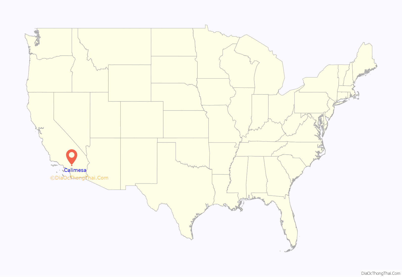
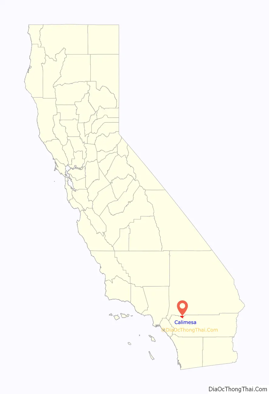
Calimesa location map. Where is Calimesa city?
History
Etymology
Historically, Calimesa began as a small rural town with mostly single-family homes and ranches. With completion of U.S. Route 99 (modern day I-10), businesses opened and Calimesa began to take on a separate identity from the larger neighboring town of Yucaipa. In June 1929, nearly 100 residents attended a meeting and decided to apply for their own post office and to start a “name contest” in which the winner was paid $10. Calimesa was chosen from 107 names submitted, and is said to come from “cali” (referring to California) and “mesa” from the Spanish word meaning “table” or “table-lands.” The first post office was the grocery store at Calimesa Boulevard and Avenue K.
Beginnings
The modern history of the area was initiated with the establishment of Spanish missions in Alta California in 1769. The need for a land route to these missions inspired Captain Juan Bautista de Anza to lead a party through the area in 1774. As early as 1820, reference can be found to the messenger footpath for the missions in Arizona to the San Gabriel Mission.
The Assistencia in Redlands (which has been rebuilt), and Rancho San Gorgonio, were part of the San Gabriel Mission located near today’s Los Angeles. The San Gorgonio rancheria covered most of the San Gorgonio Pass area. A site within the rancheria, the location of the present Highland Springs Ranch & Inn, along with Whitewater, and a house at the east end of present-day Singleton Road in Calimesa, all became stage stops along this path.
The post office reinforced the residents’ feeling of a community separate from the town of Yucaipa. In 1939 or 1940, the Calimesa Improvement Association, Inc. was formed. According to the constitution of the association, “The object and purpose of the association shall be the development and improvement of Calimesa and The Community”. Volunteers built a community center at the corner of Bryant and Avenue H, which had been designated a park site by the Redlands-Yucaipa Land Company. The “South Mesa Water Company” purchased the land for a well site and allowed the association to use it for community events.
In 1962, the Calimesa Improvement Association became the Calimesa Chamber of Commerce. The Improvement Association and the Chamber have operated as a mix of promoting Calimesa, providing community service, and being a sounding board for residents’ problems. Prior to 1949, the fire protection for the valley was provided by the California Department of Forestry at the Avenue A station, which today is the office of County Service Area 63 in Yucaipa. Calimesa community members felt the need for more protection on the south side of the wash, so in 1949 they formed the Volunteer Fire Department.
Incorporation
The City of Calimesa was incorporated on December 1, 1990, soon after the incorporation of its northern neighbor, the City of Yucaipa. Prior to its incorporation, the City of Calimesa existed as an unincorporated census designated town that straddled the Riverside–San Bernardino County line at the location where Interstate 10 climbs the San Gorgonio Pass going eastward from Redlands, California.
Future
The previous decade saw several planned communities approved for development within the city, including the JP Ranch Development (approximately 750 total homes), Calimesa Springs Development (approximately 270 homes), Summerwind Ranch at Oak Valley (3,841 homes, 260 acres of mixed-use commercial), and Mesa Verde (3,500 homes, and 64 acres of mixed-use commercial space). The number of approved units currently outnumbers the total population within the city. However, development of these large tracts have been slow to move forward until the demand increases.
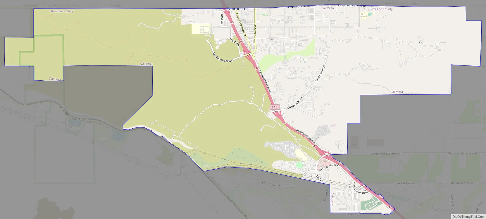
Calimesa Road Map
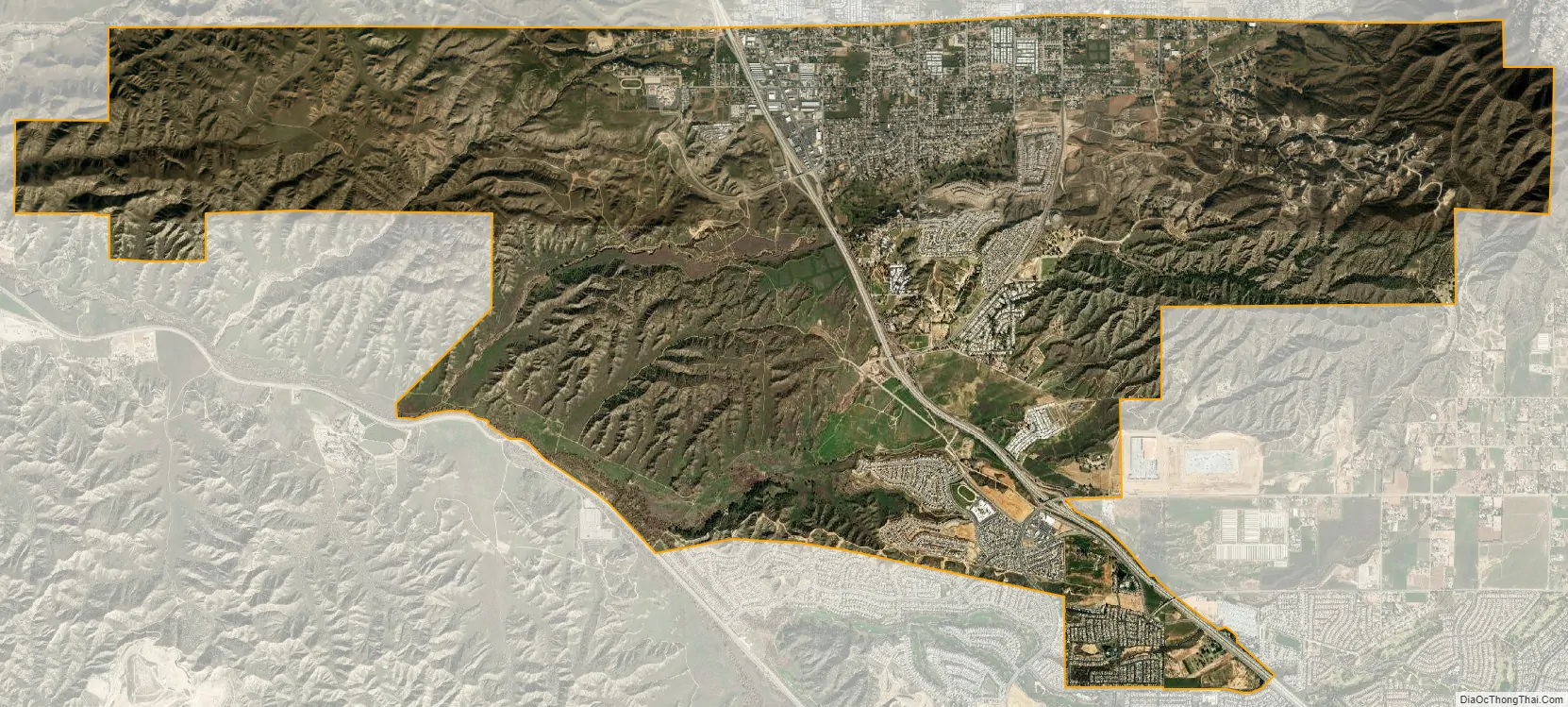
Calimesa city Satellite Map
Geography
The city is located in the northwestern portion of Riverside County, between Yucaipa and Beaumont. It is within the Yucaipa Valley section of Southern California’s Inland Valley, and at the western edge of the San Gorgonio Pass between San Bernardino and Palm Springs. Calimesa is located in the region known as the Inland Empire, which covers San Bernardino and Riverside Counties.
Situated within the foothills of the San Bernardino Mountains, the city’s elevation ranges between 2,300 to 3,500 feet (700 to 1,070 m) above sea level.
According to the United States Census Bureau, the city has a total area of 14.8 square miles (38 km), all of it land.
City limits
Historically, Calimesa is divided from the City of Yucaipa by the Wildwood Canyon Wash; politically, “County Line Road” divides the two towns. Much of what was originally known as “Calimesa” actually lies within the city boundaries of Yucaipa, including “I-Street” (Calimesa) Park and Calimesa Elementary School. Because State of California law prohibits the incorporation or annexation of cities over county lines, the city was unable to adjoin what was considered the town of Calimesa when it finally incorporated. When Yucaipa incorporated, it included the area outside of the Yucaipa Valley on the “hilltop” or “mesa” that was traditionally known as Calimesa within its city boundaries, so as not to leave a gap of unincorporated area between the two towns. Although the two cities are in separate counties, both Yucaipa and Calimesa share the same basic street grid system and addressing, including many named and alphabetical streets which extend from Yucaipa well into Calimesa. The general boundary between the two cities is County Line Road, which does not follow the exact county line in some places due to the alignment of Calimesa Creek, which meanders in and out of both Yucaipa and Calimesa.
The city limits of Calimesa also extend south to the City of Beaumont, California. Although much less refined, the boundaries between Beaumont and Calimesa fall generally along the Southern California Edison (SCE) right-of-way that extends from the El Casco electrical sub-station facility near Moreno Valley, California, eastward. Near Interstate 10, Champions Drive is the common boundary between the two cities.
See also
Map of California State and its subdivision:- Alameda
- Alpine
- Amador
- Butte
- Calaveras
- Colusa
- Contra Costa
- Del Norte
- El Dorado
- Fresno
- Glenn
- Humboldt
- Imperial
- Inyo
- Kern
- Kings
- Lake
- Lassen
- Los Angeles
- Madera
- Marin
- Mariposa
- Mendocino
- Merced
- Modoc
- Mono
- Monterey
- Napa
- Nevada
- Orange
- Placer
- Plumas
- Riverside
- Sacramento
- San Benito
- San Bernardino
- San Diego
- San Francisco
- San Joaquin
- San Luis Obispo
- San Mateo
- Santa Barbara
- Santa Clara
- Santa Cruz
- Shasta
- Sierra
- Siskiyou
- Solano
- Sonoma
- Stanislaus
- Sutter
- Tehama
- Trinity
- Tulare
- Tuolumne
- Ventura
- Yolo
- Yuba
- Alabama
- Alaska
- Arizona
- Arkansas
- California
- Colorado
- Connecticut
- Delaware
- District of Columbia
- Florida
- Georgia
- Hawaii
- Idaho
- Illinois
- Indiana
- Iowa
- Kansas
- Kentucky
- Louisiana
- Maine
- Maryland
- Massachusetts
- Michigan
- Minnesota
- Mississippi
- Missouri
- Montana
- Nebraska
- Nevada
- New Hampshire
- New Jersey
- New Mexico
- New York
- North Carolina
- North Dakota
- Ohio
- Oklahoma
- Oregon
- Pennsylvania
- Rhode Island
- South Carolina
- South Dakota
- Tennessee
- Texas
- Utah
- Vermont
- Virginia
- Washington
- West Virginia
- Wisconsin
- Wyoming


