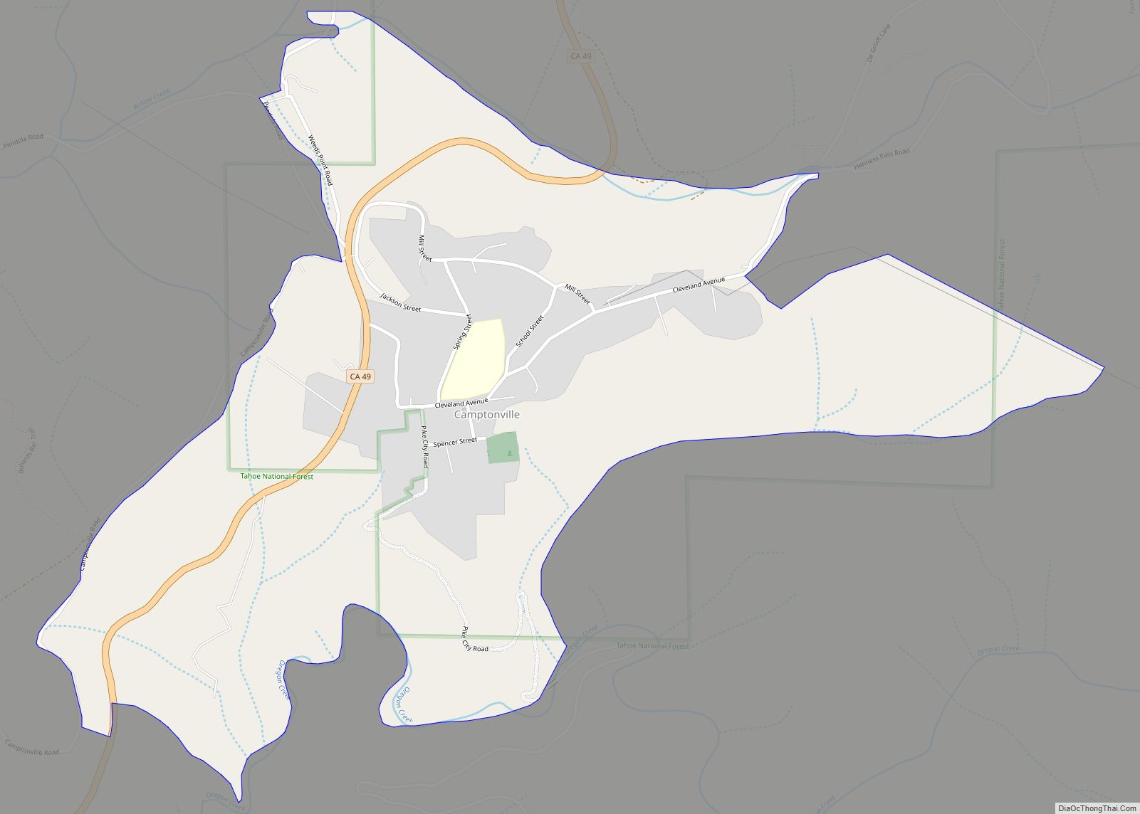
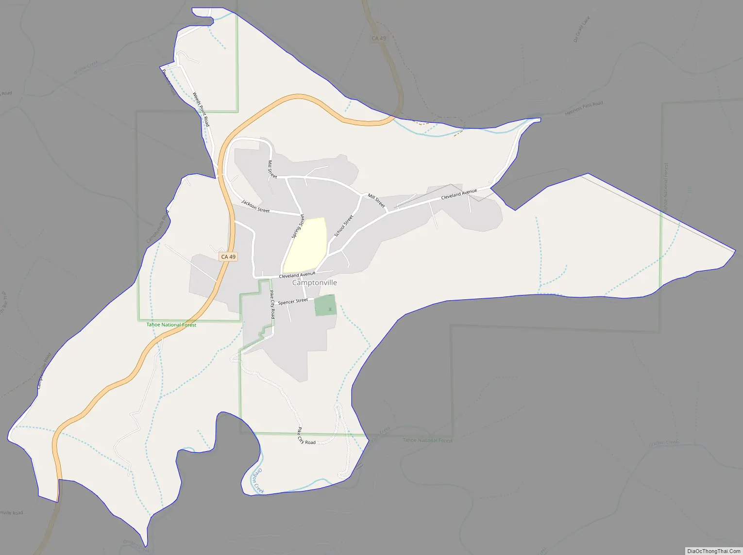
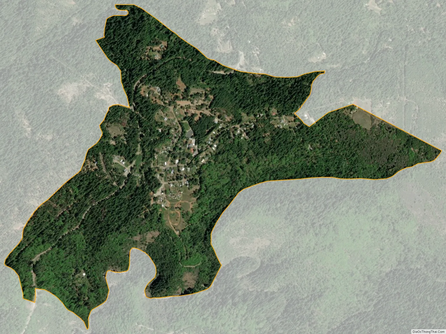
Camptonville (formerly, Comptonville and Gold Ridge) is a small town and census-designated place (CDP) located in northeastern Yuba County, California. The town is located 36 miles (58 km) northeast of Marysville, off Highway 49 between Downieville and Nevada City. It is located on a ridge between the North Fork and Middle Fork of the Yuba River, not far from New Bullards Bar Dam Reservoir. Camptonville lies at an elevation of 2825 feet (861 m). The population was 158 at the 2010 census.
| Name: | Camptonville CDP |
|---|---|
| LSAD Code: | 57 |
| LSAD Description: | CDP (suffix) |
| State: | California |
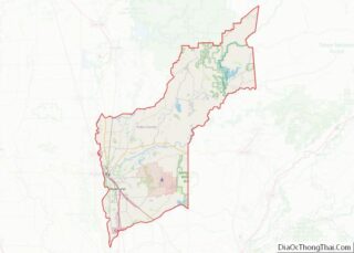
| County: | Yuba County |
| Elevation: | 2,825 ft (861 m) |
| Total Area: | 0.86 sq mi (2.22 km²) |
| Land Area: | 0.86 sq mi (2.22 km²) |
| Water Area: | 0.00 sq mi (0.00 km²) 0% |
| Total Population: | 158 |
| Population Density: | 184.15/sq mi (71.13/km²) |
| FIPS code: | 0610676 |
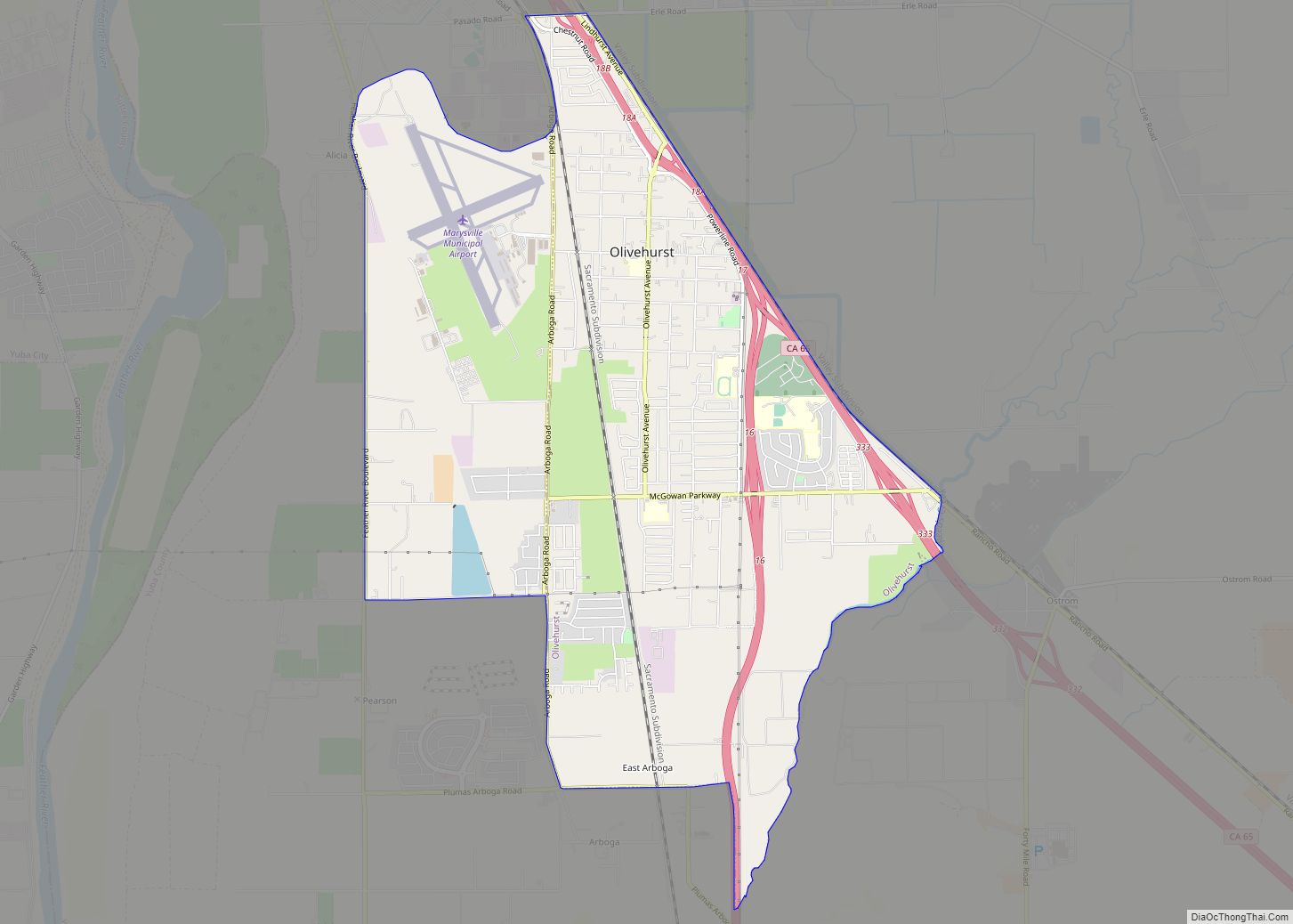
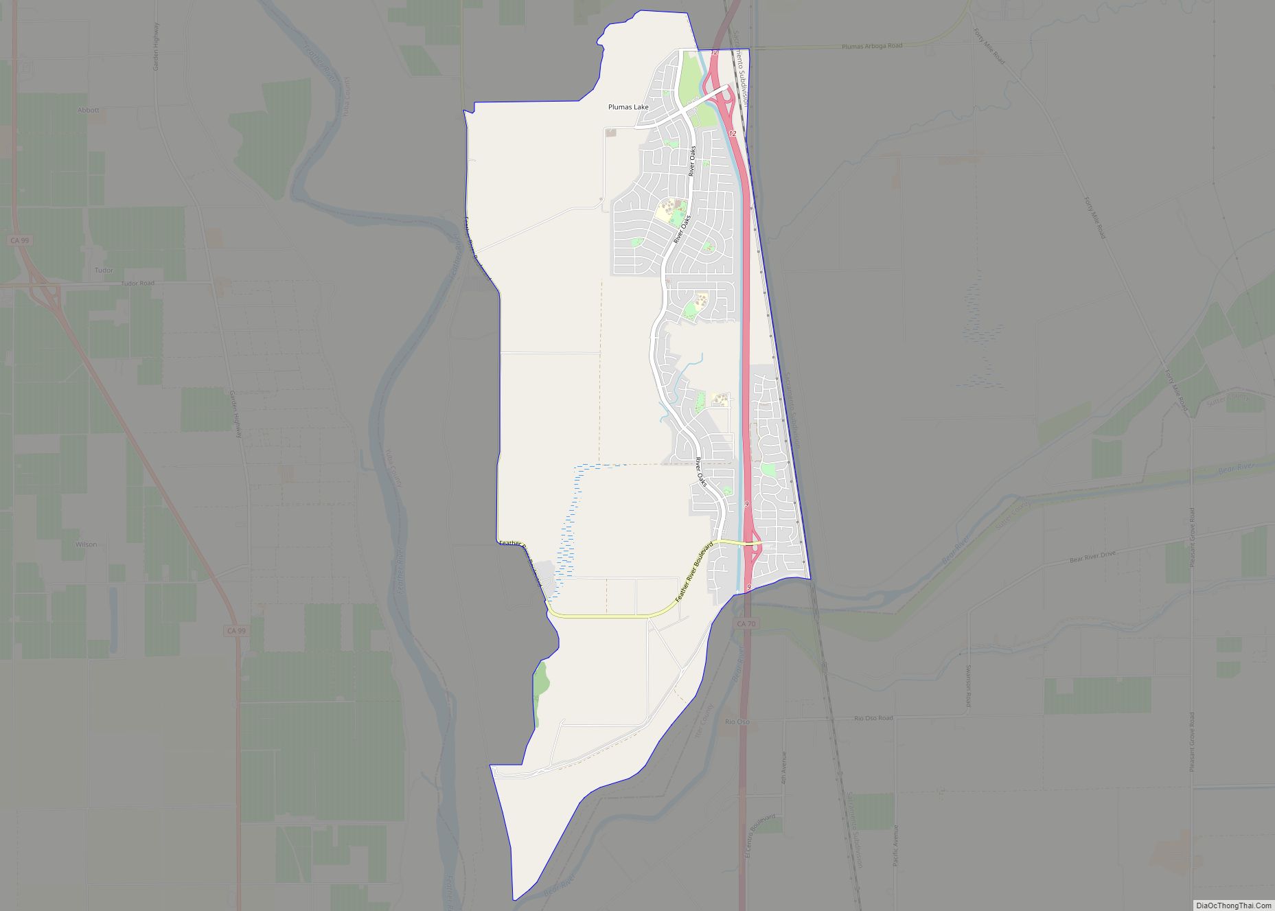
Online Interactive Map
Click on ![]() to view map in "full screen" mode.
to view map in "full screen" mode.
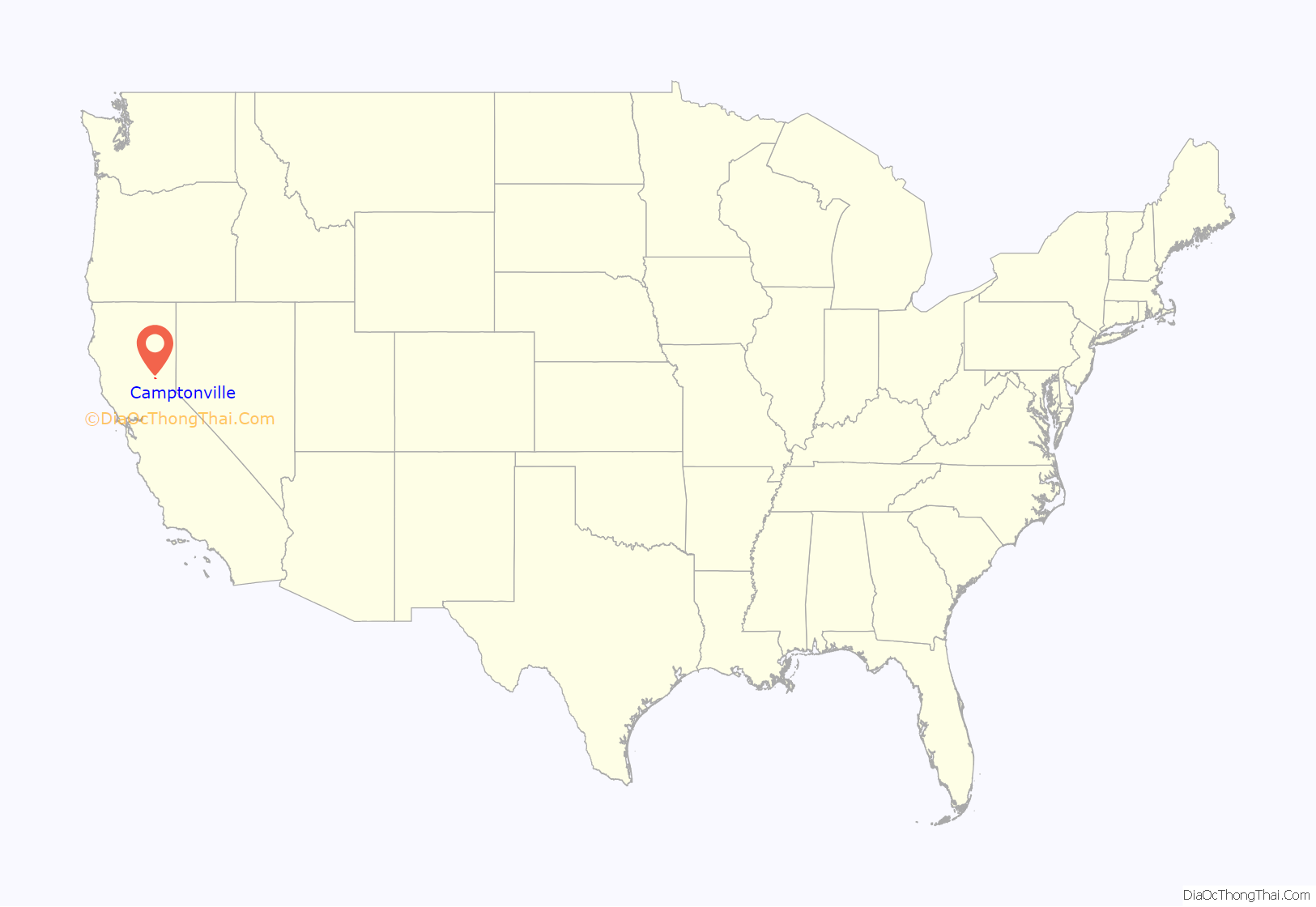
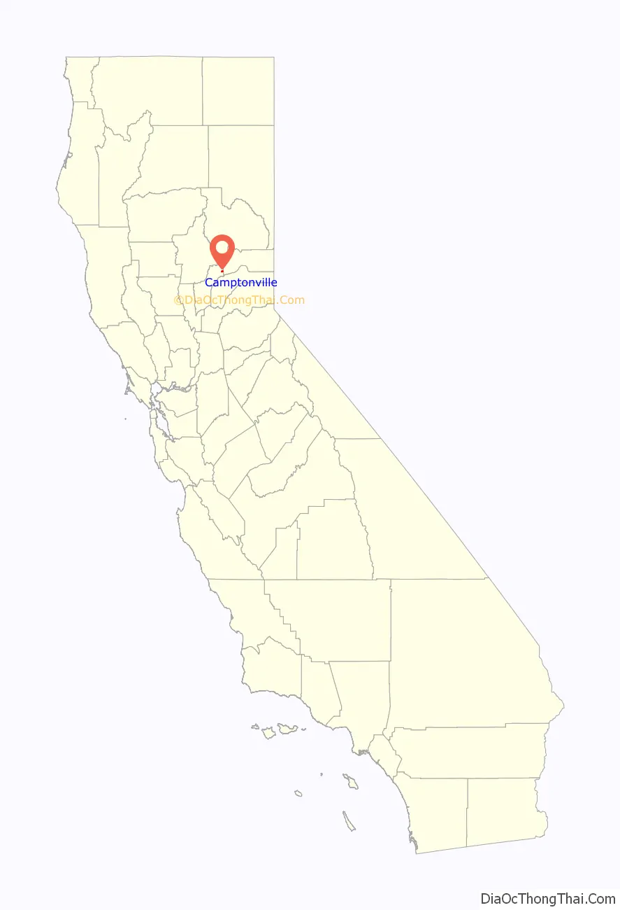
Camptonville location map. Where is Camptonville CDP?
History
Gold was discovered here in 1850, and the place became known as Gold Ridge. The name was changed to Camptonville in 1854 when the first post office opened. The name honors Robert Campton, the town blacksmith.
It was a significant community in the California Gold Rush era and a stopping point for travelers and freight haulers along Henness Pass Road, a major route over the Sierra Nevada via Henness Pass in the 1850s and 1860s. A plaque in Camptonville says the roaring town had over fifty saloons had brothels and even a bowling alley at one time. However, by 1863 William H. Brewer passed through Camptonville and described it in his journal as follows:
As gold mining in the area waned, the local economy depended on the timber industry. When Sierra Mountain Mills closed in 1994 putting 75 people out of work, many people moved away. Today the town includes the Lost Nugget gas station and convenience store, a post office, Camptonville Elementary School; a monument to the Pelton wheel, the inventor of which lived here in the 1860s; and the original Mayo Saloon, currently home to a restaurant and bar called Burgee Dave’s at the Mayo; and the Yuba River Ranger District Office of the Tahoe National Forest, which is also the headquarters of the Tahoe Hotshots fire crew.
Camptonville Road Map
Camptonville city Satellite Map
Geography
According to the United States Census Bureau, the CDP covers an area of 0.9 square miles (2.3 km), all of it land.
Climate
According to the Köppen Climate Classification system, Camptonville has a warm-summer Mediterranean climate, abbreviated “Csa” on climate maps.
See also
Map of California State and its subdivision:- Alameda
- Alpine
- Amador
- Butte
- Calaveras
- Colusa
- Contra Costa
- Del Norte
- El Dorado
- Fresno
- Glenn
- Humboldt
- Imperial
- Inyo
- Kern
- Kings
- Lake
- Lassen
- Los Angeles
- Madera
- Marin
- Mariposa
- Mendocino
- Merced
- Modoc
- Mono
- Monterey
- Napa
- Nevada
- Orange
- Placer
- Plumas
- Riverside
- Sacramento
- San Benito
- San Bernardino
- San Diego
- San Francisco
- San Joaquin
- San Luis Obispo
- San Mateo
- Santa Barbara
- Santa Clara
- Santa Cruz
- Shasta
- Sierra
- Siskiyou
- Solano
- Sonoma
- Stanislaus
- Sutter
- Tehama
- Trinity
- Tulare
- Tuolumne
- Ventura
- Yolo
- Yuba
- Alabama
- Alaska
- Arizona
- Arkansas
- California
- Colorado
- Connecticut
- Delaware
- District of Columbia
- Florida
- Georgia
- Hawaii
- Idaho
- Illinois
- Indiana
- Iowa
- Kansas
- Kentucky
- Louisiana
- Maine
- Maryland
- Massachusetts
- Michigan
- Minnesota
- Mississippi
- Missouri
- Montana
- Nebraska
- Nevada
- New Hampshire
- New Jersey
- New Mexico
- New York
- North Carolina
- North Dakota
- Ohio
- Oklahoma
- Oregon
- Pennsylvania
- Rhode Island
- South Carolina
- South Dakota
- Tennessee
- Texas
- Utah
- Vermont
- Virginia
- Washington
- West Virginia
- Wisconsin
- Wyoming