Carmel Valley Village is an unincorporated community and census-designated place (CDP) in Monterey County, California, United States. In 1946, Byington Ford and Tirey L. Ford Jr. developed the Carmel Valley Village, which included an airpark, shops, and homes. At the time of the 2020 census the CDP population was 4,524, up from 4,407 at the 2010 census. In November 2009, a majority of residents voted against incorporation.
| Name: | Carmel Valley Village CDP |
|---|---|
| LSAD Code: | 57 |
| LSAD Description: | CDP (suffix) |
| State: | California |
| County: | Monterey County |
| Elevation: | 846 ft (258 m) |
| Total Area: | 19.18 sq mi (49.7 km²) |
| Land Area: | 18.98 sq mi (49.2 km²) |
| Water Area: | 0.20 sq mi (0.5 km²) 1.02% |
| Total Population: | 4,524 |
| Population Density: | 238.32/sq mi (92.02/km²) |
| ZIP code: | 93924 (“Carmel Valley”) |
| Area code: | 831 |
| FIPS code: | 0611324 |
| GNISfeature ID: | 1867002 |
Online Interactive Map
Click on ![]() to view map in "full screen" mode.
to view map in "full screen" mode.
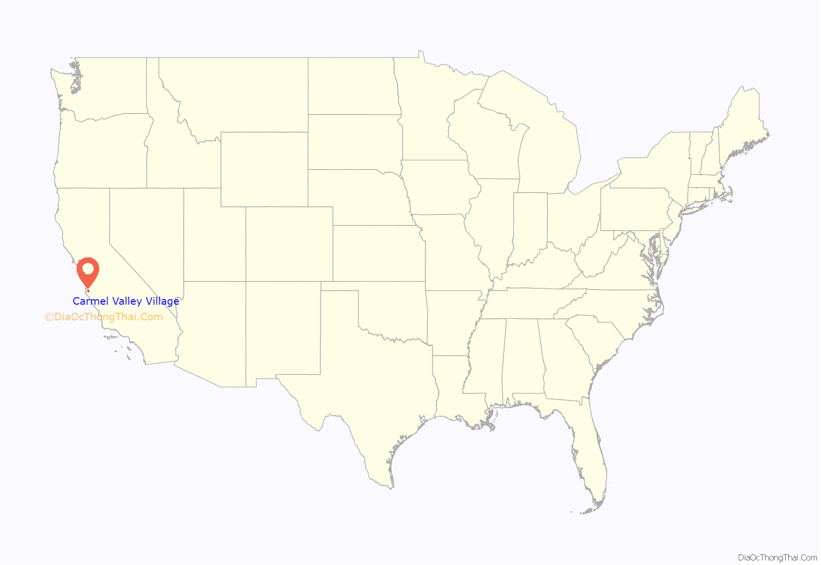
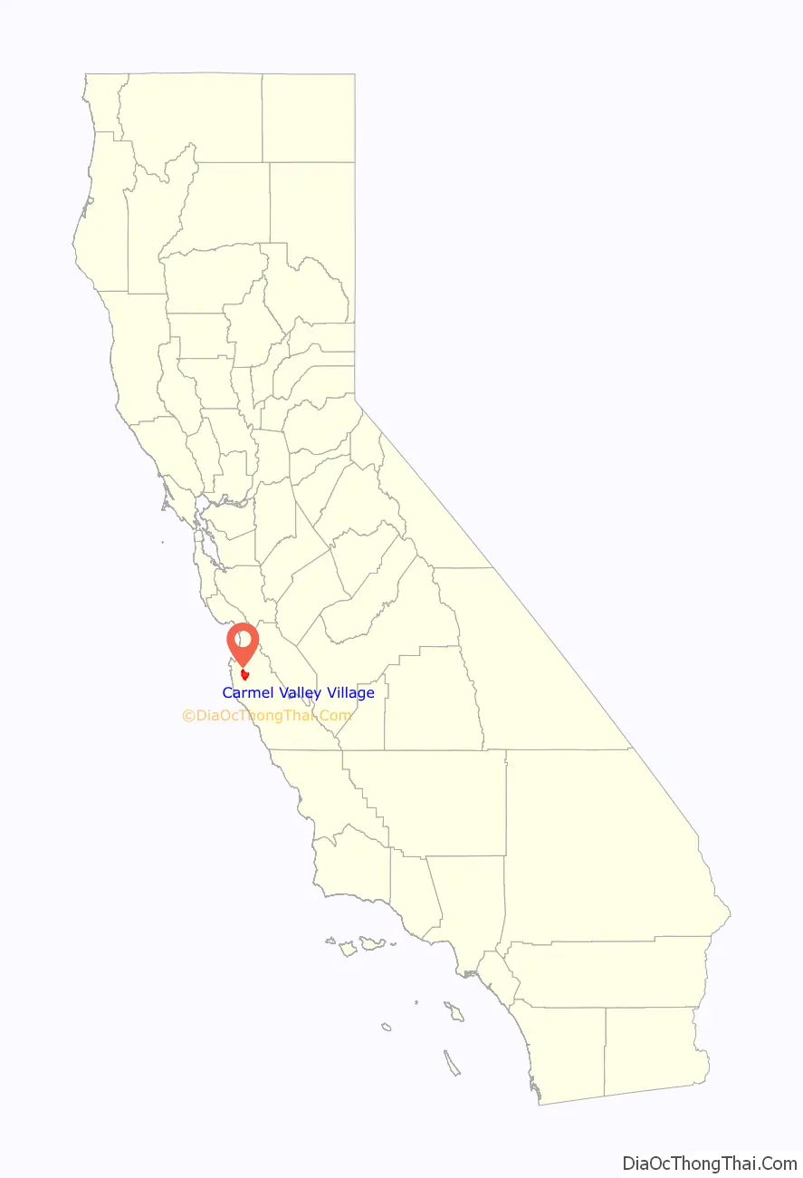
Carmel Valley Village location map. Where is Carmel Valley Village CDP?
History
The Rancho Los Laureles, a 6,625-acre (26.81 km) Mexican land grant in present-day Monterey County, was given in 1839 by Governor Juan Bautista Alvarado to José Manuel Boronda and Vicente Blas Martínez. The grant extended along the Carmel River and the Carmel Valley, and encompassed present-day Carmel Valley Village. In 1882, the Pacific Improvement Company (PIC) purchased the Rancho Los Laureles. In 1916, Samuel F.B. Morse became the manager of the PIC; his job was to liquidate the PIC holdings (10,000 acres (4,000 ha)). In 1919, Morse formed the Del Monte Properties and acquired PIC. In 1923, the Del Monte Properties divided the land into 11 parcels. Marion Hollins bought 2,000 acres (800 ha). In 1926, developer Frank B. Porter bought 600 acres (240 ha). He later acquired a portion of the Hollins ranch and sold it to Byington Ford. Ford and his wife Marion used 400 acres (160 ha) as a summer ranch and named it Moon Trail Ranch. It was located at Via Las Encinas in Carmel Valley.
In 1946, Byington Ford and his brother, Tirey Ford Jr., developed the “Airway Village” that years later was renamed the Carmel Valley Village. It included an Airway Market. By 1947, the Airway General Store, barbershop, drug store (with soda fountain), beauty shop, Stirrup Cup bar, and the Grapevine liquor store had been built. All were in walking distance of the Airpark and decorated to resemble a Mexican village. Artist Bruce Ariss painted murals on each store to resemble a Spanish village.
Ford and his brother developed the Carmel Valley Airfield for pilot-owners who would want to be “at home a minute or two after getting out of their planes.” His brother Tirey built a prototype hangar house off Ford Road at the west end of the airfield to serve as an example for the airborne community of the future. Ford Road was originally called “Adobe Road” because adobe bricks were made there. The name was changed by realtor Herbert Brownell to honor Ford, as the first major developer of the Village.
Following World War II it became apparent that there would not be a plane in every garage, so Ford had to adjust his enterprise, combining sales to plane owners with sales to home seekers. He enjoyed a brisk trade. Only two true hangar houses were ever built at Carmel Valley Airfield: Tirey’s (which later burned), and one other, on the north side of the runway which was dismantled. Non-pilots bought up many of the runway Airpark sites, and to suit their many tastes Byington created ranch-house sites of 1 to 3 acres (0.40 to 1.21 ha) and envisioned hillside homes where residents could look down on incoming planes. During World War II, the airfield served as an alternative landing field for military planes flying out of Watsonville and King City. A clubhouse built for the Airpark later became an integral part of the Village’s Blue Sky Lodge, which is still in operation today.
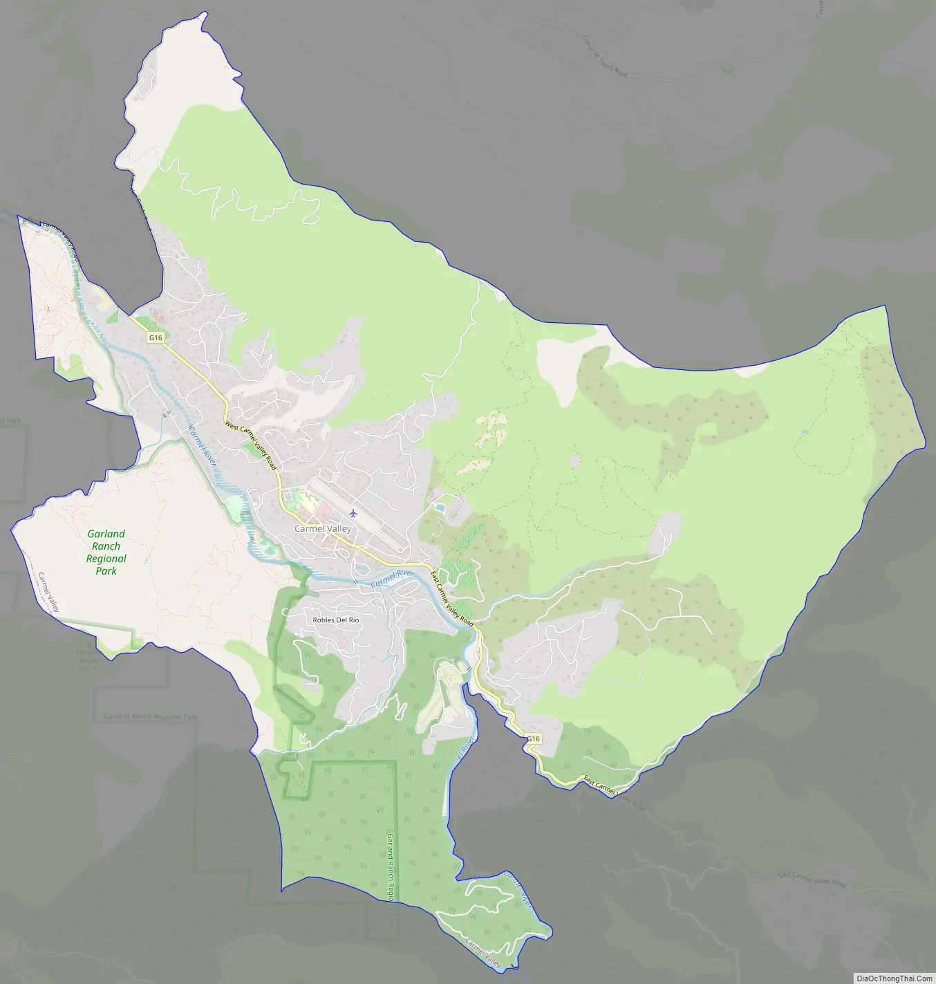
Carmel Valley Village Road Map
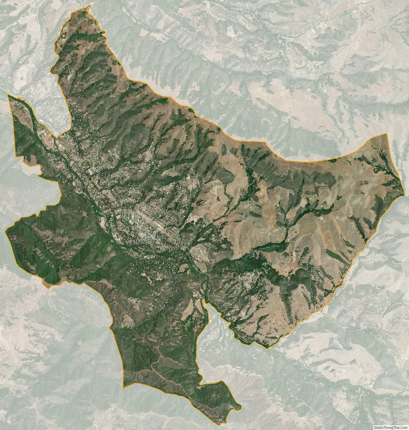
Carmel Valley Village city Satellite Map
Geography
Carmel Valley Village is in northern Monterey County, 13 miles (21 km) east-southeast of Carmel-by-the-Sea and 16 miles (26 km) southeast of Monterey. The Carmel Valley Village CDP comprises the main community of Carmel Valley on the northeast side of the Carmel River, as well as the community of Robles del Rio on the southwest side of the river. The CDP has a total area of 19.2 square miles (50 km), 98.98% of it land and 1.02% of it water.
The Carmel River flows northwest through the community, reaching the Pacific Ocean at the city of Carmel-by-the-Sea. Primary ecosystems of the vicinity include California oak woodland, riparian woodland, chaparral, grassland and savanna. Dominant oak trees include Quercus agrifolia. The locale of Carmel Valley is the northernmost range of the hybrid oak Quercus x alvordiana.
The Garland Ranch Regional Park is located at 700 West Carmel Valley Road. The Monterey Peninsula Regional Park District (MPRPD) manages the Garland Ranch Regional Park.
Climate
The region experiences warm dry summers, with no average monthly temperatures above 71.6 °F (22.0 °C), with heat waves in the upper 70s to 101 degrees F. the further inland you go. According to the Köppen Climate Classification system, Carmel Valley Village has a warm-summer Mediterranean climate, abbreviated “Csb” on climate maps.
See also
Map of California State and its subdivision:- Alameda
- Alpine
- Amador
- Butte
- Calaveras
- Colusa
- Contra Costa
- Del Norte
- El Dorado
- Fresno
- Glenn
- Humboldt
- Imperial
- Inyo
- Kern
- Kings
- Lake
- Lassen
- Los Angeles
- Madera
- Marin
- Mariposa
- Mendocino
- Merced
- Modoc
- Mono
- Monterey
- Napa
- Nevada
- Orange
- Placer
- Plumas
- Riverside
- Sacramento
- San Benito
- San Bernardino
- San Diego
- San Francisco
- San Joaquin
- San Luis Obispo
- San Mateo
- Santa Barbara
- Santa Clara
- Santa Cruz
- Shasta
- Sierra
- Siskiyou
- Solano
- Sonoma
- Stanislaus
- Sutter
- Tehama
- Trinity
- Tulare
- Tuolumne
- Ventura
- Yolo
- Yuba
- Alabama
- Alaska
- Arizona
- Arkansas
- California
- Colorado
- Connecticut
- Delaware
- District of Columbia
- Florida
- Georgia
- Hawaii
- Idaho
- Illinois
- Indiana
- Iowa
- Kansas
- Kentucky
- Louisiana
- Maine
- Maryland
- Massachusetts
- Michigan
- Minnesota
- Mississippi
- Missouri
- Montana
- Nebraska
- Nevada
- New Hampshire
- New Jersey
- New Mexico
- New York
- North Carolina
- North Dakota
- Ohio
- Oklahoma
- Oregon
- Pennsylvania
- Rhode Island
- South Carolina
- South Dakota
- Tennessee
- Texas
- Utah
- Vermont
- Virginia
- Washington
- West Virginia
- Wisconsin
- Wyoming


