Watsonville is a city in Santa Cruz County, California, in the Monterey Bay Area of the Central Coast of California. The population was 52,590 at the 2020 census. Predominantly Latino, working-class, and Democratic, Watsonville is a self-designated sanctuary city.
| Name: | Watsonville city |
|---|---|
| LSAD Code: | 25 |
| LSAD Description: | city (suffix) |
| State: | California |
| County: | Santa Cruz County |
| Incorporated: | March 30, 1868 (1868-03-30) |
| Elevation: | 29 ft (9 m) |
| Total Area: | 6.80 sq mi (17.62 km²) |
| Land Area: | 6.71 sq mi (17.37 km²) |
| Water Area: | 0.10 sq mi (0.25 km²) 1.42% |
| Total Population: | 52,590 |
| Population Density: | 8,029.82/sq mi (3,100.33/km²) |
| ZIP code: | 95076, 95077 |
| Area code: | 831 |
| FIPS code: | 0683668 |
| Website: | cityofwatsonville.org |
Online Interactive Map
Click on ![]() to view map in "full screen" mode.
to view map in "full screen" mode.
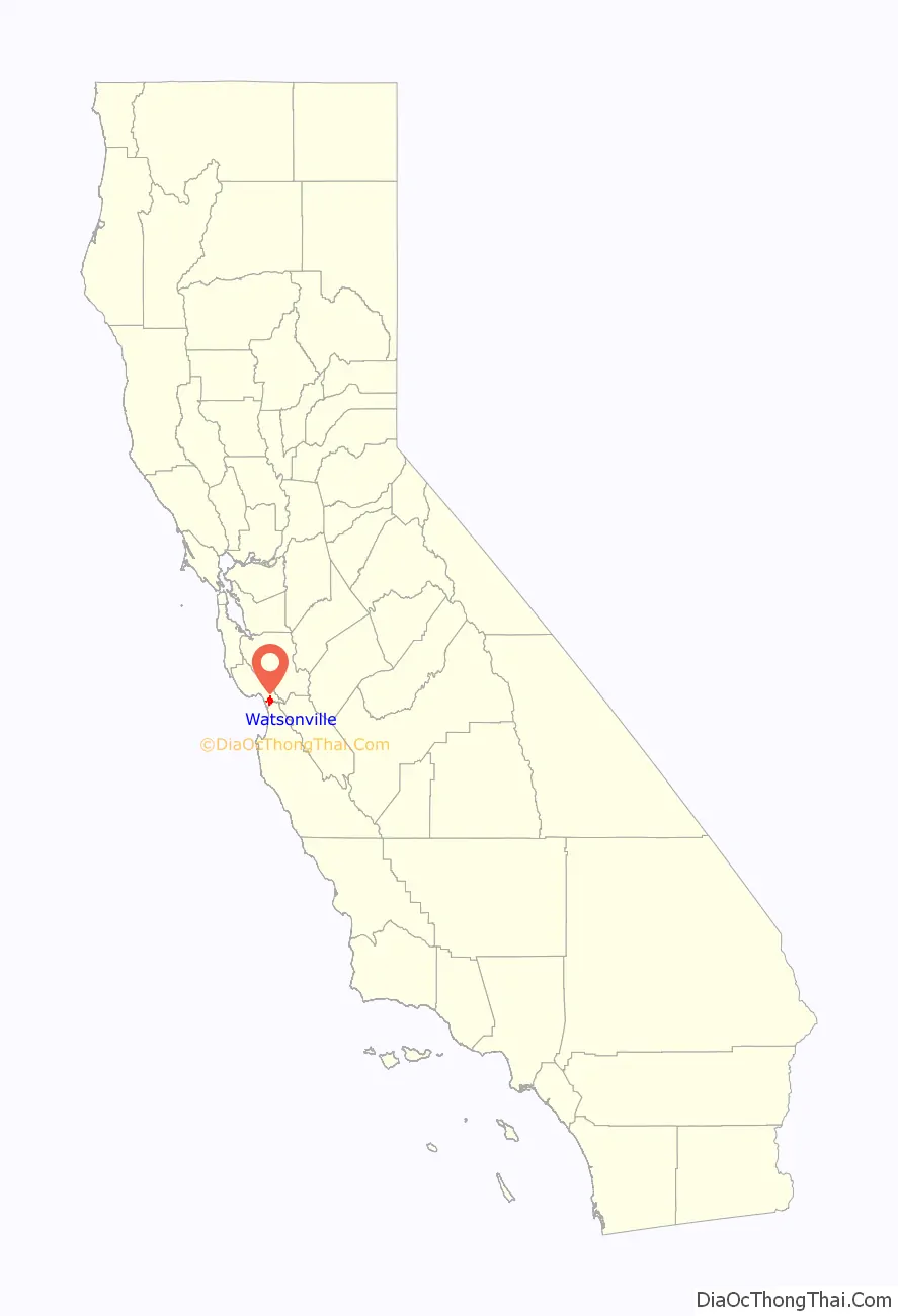
Watsonville location map. Where is Watsonville city?

History
Watsonville’s land was first inhabited by an Ohlone nation of Indigenous Californians. This tribe settled along the Pajaro Dunes since the land was fertile and useful for the cultivation of their plants and animals.
Spanish era
In 1769, the Portolá expedition, the first Europeans to explore the area, arrived from the south, where soldiers described a big bird they saw near a large river. The story survived in the river’s name, Rio del Pajaro (River of the Bird).
The Portolá expedition continued north through the area, camping at one of the lakes north of town for five nights, on October 10–14, 1769. Many of the expedition’s soldiers had scurvy, so progress was slow. While the sick recuperated, scouts led by Sergeant Ortega looked for the best way forward. On the fifth day, Franciscan missionary Juan Crespi, traveling with the expedition, wrote in his diary, “This afternoon the explorers returned. The sergeant reported that he had gone ahead twelve leagues without getting any information of the harbor that we are looking for, and that he went to the foot of a high, white mountain range.”
During the October 10 march, the explorers first saw the Coast redwood tree (Spanish: palo colorado). A bronze plaque at Pinto Lake (now a city park) commemorates the event. On October 15, the expedition continued to the northwest past today’s community of Freedom, camping that night at Corralitos Lagoon.
The area became part of the Spanish colonial province of Las Californias, and in 1804 the northern part was split off to form Alta California. The area’s pasture lands were assigned to the Spanish mission to the south, in Carmel.
Mexican era
When Mexico gained independence, it took possession of Alta California. The Spanish missions were secularized in the 1830s, and the future Watsonville area became Rancho Bolsa del Pajaro, a land grant made to Sebastian Rodríguez in 1837. Under Mexico’s more liberal land-ownership laws, immigration to the area from Europe and the U.S. increased.
In 1833, Governor José Figueroa granted Rancho San Andrés to José Joaquín Castro, who came to California as part of the 1776 Anza Expedition and later became patriarch of a locally prominent Californio family. His son, Juan José Castro, built the Castro Adobe, the only two-story hacienda in the area at the time. Today, the adobe is owned by California State Parks and is undergoing restoration to serve as the Rancho San Andrés Castro Adobe State Historic Park.
Post-Conquest era
Following the American Conquest of California and the ratification of the Treaty of Guadalupe Hidalgo in 1848, the region began to receive large waves of migrants, mainly Americans from the East Coast and Europeans.
John H. Watson and D.S. Gregory laid out the town in 1852. The community was incorporated as the Town of Watsonville on or about March 30, 1868, named after Watson. It became the City of Watsonville about 1889. Voters adopted a charter in 1903.
Modern era
From 1904 to 1913, the Watsonville Railway and Navigation Company operated an interurban railway to Port Watsonville on Monterey Bay, where it connected with an overnight produce packet boat to San Francisco.
The Watsonville riots were a period of racial violence in the 1930s against Filipino American farmworkers committed by White Americans.
Watonsville’s present city charter was adopted on February 16, 1960.
In 1985, cannery workers in Watsonville went on strike for 18 months to protest a decrease in their wages and benefits. In the end, they won a new contract. The movement was led by primarily Latina women, and was noted as a historic labor rights win for the Mexicano/Chicano community.
Watsonville Road Map

Watsonville city Satellite Map

Geography
Watsonville is in the Monterey Bay area, at the southern end of Santa Cruz County.
According to the United States Census Bureau, the city has an area of 6.8 square miles (18 km), of which 6.7 square miles (17 km) is land and 0.1 square miles (0.26 km) is water.
Watsonville has habitat areas that support the endangered species Santa Cruz Tarweed on the California coastal prairie ecosystem. Population has grown considerably since 1980, requiring preparation of a number of Environmental Impact Reports, with resultant development removing certain lands of the city from productive natural habitat.
Most of the coastal land adjacent to Watsonville is part of the Monterey Bay National Marine Sanctuary. Another protected natural resource is the Watsonville wetlands, a system of fresh water sloughs with open water and native vegetation that extend from the city to the ocean. The slough system is only one of a few remaining wetland areas of its kind in the California Coastal Region. Not only are the wetlands home to approximately nine species of fish and over 200 species of waterfowl, raptors and songbirds; they are also a vital stop on the Pacific Flyway for thousands of migrating birds. In 1990, private and municipal organizations worked together to stop development and protect this resource. The Watsonville Wetlands Watch was established at that time with the task of restoring and protecting the slough’s natural habit.
Climate
The National Weather Service cooperative station at the Watsonville Waterworks reports cool, relatively wet winters and mild, dry summers. Fog and low overcast is common in the night and morning, especially in the summer, when warmer air from inland areas mixes with the cool, moist air near Monterey Bay. Its Köppen classification is cool-summer mediterranean climate.
January, normally the coldest month, has an average maximum of 59.9 °F (15.5 °C) and an average minimum of 38.5 °F (3.6 °C). September, normally the warmest month, has an average maximum of 73.2 °F (22.9 °C) and an average minimum of 51.7 °F (10.9 °C). There are an average of 4.9 days annually with highs of 90 °F (32 °C) or higher and an average of 13.5 days annually with lows of 32 °F (0 °C) or lower. Cool nights are common in the summer, due to the influence of chilly Monterey Bay. The record high temperature from the late 20th century onward was 106 °F (41 °C) on October 2, 1980. (An earlier June day has been recorded as 110 °F (43 °C).) The record low temperature from the late 20th century onward was 12 °F (−11 °C) on December 22, 1990, though a 2 °F (−17 °C) low was previously recorded.
Average annual rainfall is 22.42 inches (569 mm), with measurable precipitation falling on an average of 61 days each year. The wettest year on record was 1983, with 48.35 inches (1,228 mm), and the driest was 1976, with 10.66 inches (271 mm). The most rainfall in one month was 15.99 inches (406 mm) in February 1998. The most rainfall in 24 hours was 5.93 inches (151 mm) on February 14, 2000. Although significant snowfall occurs several times a year on the higher mountains nearby, measurable snowfall is a rarity along Monterey Bay. On February 26, 2011, there was slight snowfall in Watsonville, but there was so little snow that it could not be measured.
See also
Map of California State and its subdivision:- Alameda
- Alpine
- Amador
- Butte
- Calaveras
- Colusa
- Contra Costa
- Del Norte
- El Dorado
- Fresno
- Glenn
- Humboldt
- Imperial
- Inyo
- Kern
- Kings
- Lake
- Lassen
- Los Angeles
- Madera
- Marin
- Mariposa
- Mendocino
- Merced
- Modoc
- Mono
- Monterey
- Napa
- Nevada
- Orange
- Placer
- Plumas
- Riverside
- Sacramento
- San Benito
- San Bernardino
- San Diego
- San Francisco
- San Joaquin
- San Luis Obispo
- San Mateo
- Santa Barbara
- Santa Clara
- Santa Cruz
- Shasta
- Sierra
- Siskiyou
- Solano
- Sonoma
- Stanislaus
- Sutter
- Tehama
- Trinity
- Tulare
- Tuolumne
- Ventura
- Yolo
- Yuba
- Alabama
- Alaska
- Arizona
- Arkansas
- California
- Colorado
- Connecticut
- Delaware
- District of Columbia
- Florida
- Georgia
- Hawaii
- Idaho
- Illinois
- Indiana
- Iowa
- Kansas
- Kentucky
- Louisiana
- Maine
- Maryland
- Massachusetts
- Michigan
- Minnesota
- Mississippi
- Missouri
- Montana
- Nebraska
- Nevada
- New Hampshire
- New Jersey
- New Mexico
- New York
- North Carolina
- North Dakota
- Ohio
- Oklahoma
- Oregon
- Pennsylvania
- Rhode Island
- South Carolina
- South Dakota
- Tennessee
- Texas
- Utah
- Vermont
- Virginia
- Washington
- West Virginia
- Wisconsin
- Wyoming


