Culver City is a city in Los Angeles County, California, United States. As of the 2020 census, the population was 40,779.
In the 1920s, the city became a center for film and later television production, best known as the home of Metro-Goldwyn-Mayer studios from 1924 to 1986. From 1932 to 1986, it was the headquarters for the Hughes Aircraft Company. National Public Radio West and Sony Pictures Entertainment have headquarters in the city. The city was named after its founder, Harry Culver. It is mostly surrounded by the city of Los Angeles, but also shares a border with the unincorporated area of Ladera Heights. Over the years, it has annexed more than 40 pieces of adjoining land and now comprises about five square miles (13 km).
| Name: | Culver City city |
|---|---|
| LSAD Code: | 25 |
| LSAD Description: | city (suffix) |
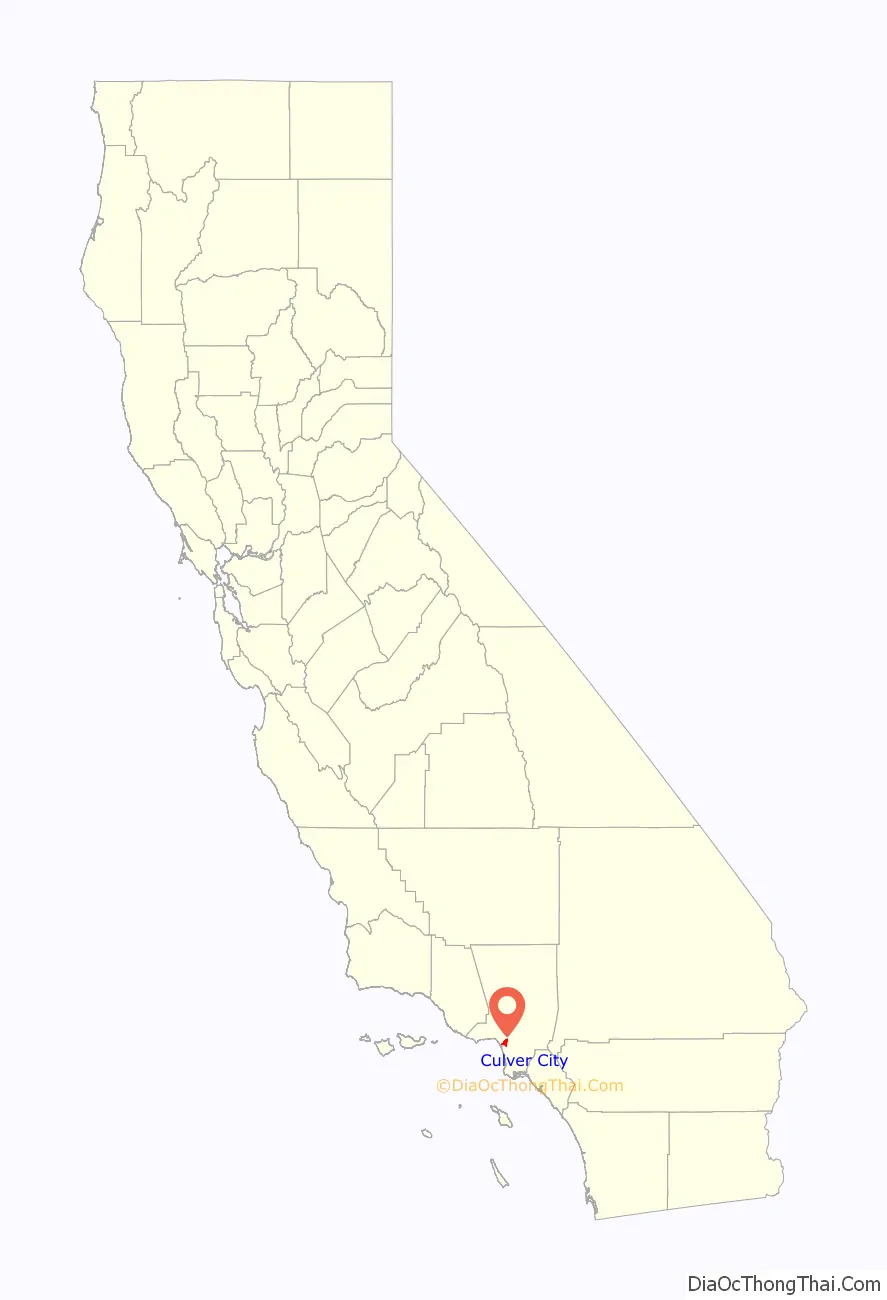
| State: | California |
| County: | Los Angeles County |
| Incorporated: | September 20, 1917 |
| Elevation: | 95 ft (29 m) |
| Total Area: | 5.14 sq mi (13.31 km²) |
| Land Area: | 5.11 sq mi (13.24 km²) |
| Water Area: | 0.03 sq mi (0.07 km²) 0.54% |
| Total Population: | 40,779 |
| Population Density: | 7,977.11/sq mi (3,080.15/km²) |
| FIPS code: | 0617568 |
| Website: | www.culvercity.org |
Online Interactive Map
Click on ![]() to view map in "full screen" mode.
to view map in "full screen" mode.
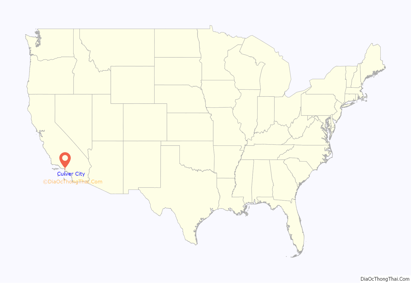
Culver City location map. Where is Culver City city?
History
Early history
Archaeological evidence suggests a human presence in the area of present-day Culver City since at least 8000 BC. The region was the homeland of the Tongva-Gabrieliño Native Americans. For centuries, native people lived in areas currently part of and surrounding Culver City. California’s native people were massacred by waves of Spanish, Mexican and Euro-American invaders through a combination of slavery, disease, relocation, forced labor, imprisonment, broken treaties and a genocidal war of extermination, including paid bounties for dead “Indians”. The Spanish and Mexican governments offered concessions and land grants from 1785 to 1846 forming the Ranchos of California. Culver City was founded on the lands of the former Rancho La Ballona and Rancho Rincon de los Bueyes. When Culver City was founded, native, Hispanic or Latino people were not allowed to buy property.
During the American Civil War U.S. Army post called Camp Latham was established from 1861 to 1862 on the south bank of Ballona Creek.
Culver City
Harry Culver first attempted to establish Culver City in 1913. It was officially incorporated on September 20, 1917, and named after its founder. The area benefited from pre-existing transportation links; Culver’s first ads read “All roads lead to Culver City”. While this slogan might seem welcoming to all, the city was explicitly founded as a whites-only sundown town, as were most of the suburbs and towns outside the downtown and Central Avenue districts of Los Angeles. Culver ran ads promoting “this model little white city”, while his close associate, Guy M. Rush, promoted lot sales “restricted to Caucasian race”. The city also at times excluded people of non-Christian religious faiths.
The weekly Culver City Call was the first newspaper in the community. The paper was founded in 1915.
The first film studio in Culver City was built by Thomas Ince in 1918 for The Triangle Motion Picture Company. Silent film comedy producer Hal Roach built his studios there in 1919, and Metro Goldwyn Mayer (MGM) took over the Triangle studio complex in 1924. During Prohibition, speakeasies and nightclubs such as the Cotton Club lined Washington Boulevard.
Culver Center, one of Southern California’s first shopping malls, was completed in 1950 on Venice Boulevard near the Overland Avenue intersection. Many other retail stores, including a Rite Aid and several banks and restaurants, have occupied the center since then.
Hughes Aircraft Company
Hughes Aircraft opened its Culver City plant in July 1941. There the company built the H-4 Hercules transport (commonly called the “Spruce Goose”). Hughes was also an active subcontractor during World War II. It developed and patented a flexible feed chute for faster loading of machine guns on B-17 bombers, and manufactured electric booster drives for machine guns. Hughes produced more ammunition belts than any other American manufacturer, and built 5,576 wings and 6,370 rear fuselage sections for Vultee BT-13 trainers.
Hughes grew after the war, and in 1953 Howard Hughes donated all his stock in the company to the Howard Hughes Medical Institute. After he died in 1976, the institute sold the company, which made it the second-best-endowed medical research foundation in the world.
The studios (1960s, 1970s and 1980s)
The Hal Roach Studios were demolished in 1963. In the late 1960s, much of the MGM backlot acreage (lot 3 and other property on Jefferson Boulevard), and the nearby 28.5 acres (11.5 ha) known as RKO Forty Acres, once owned by RKO Pictures and later Desilu Productions, were sold by their owners. In 1976 the sets were razed to make way for redevelopment. Today, the RKO site is the southern expansion of the Hayden Industrial Tract, while the MGM property has been converted into a subdivision and a shopping center known as Raintree Plaza.
Rebirth of downtown (1990s and 2000s)
In the early 1990s, Culver City launched a successful revitalization program in which it renovated its downtown as well as several shopping centers in the Sepulveda Boulevard corridor near Westfield Culver City. Around the same time, Sony’s motion picture subsidiaries, Columbia Pictures and TriStar Pictures, moved into the former Metro-Goldwyn-Mayer lot which was renamed Columbia Studios in 1990 and took on its current name, Sony Pictures Studios, a year later.
There was an influx of art galleries and restaurants on the eastern part of the city, which was formally designated the Culver City Art District.
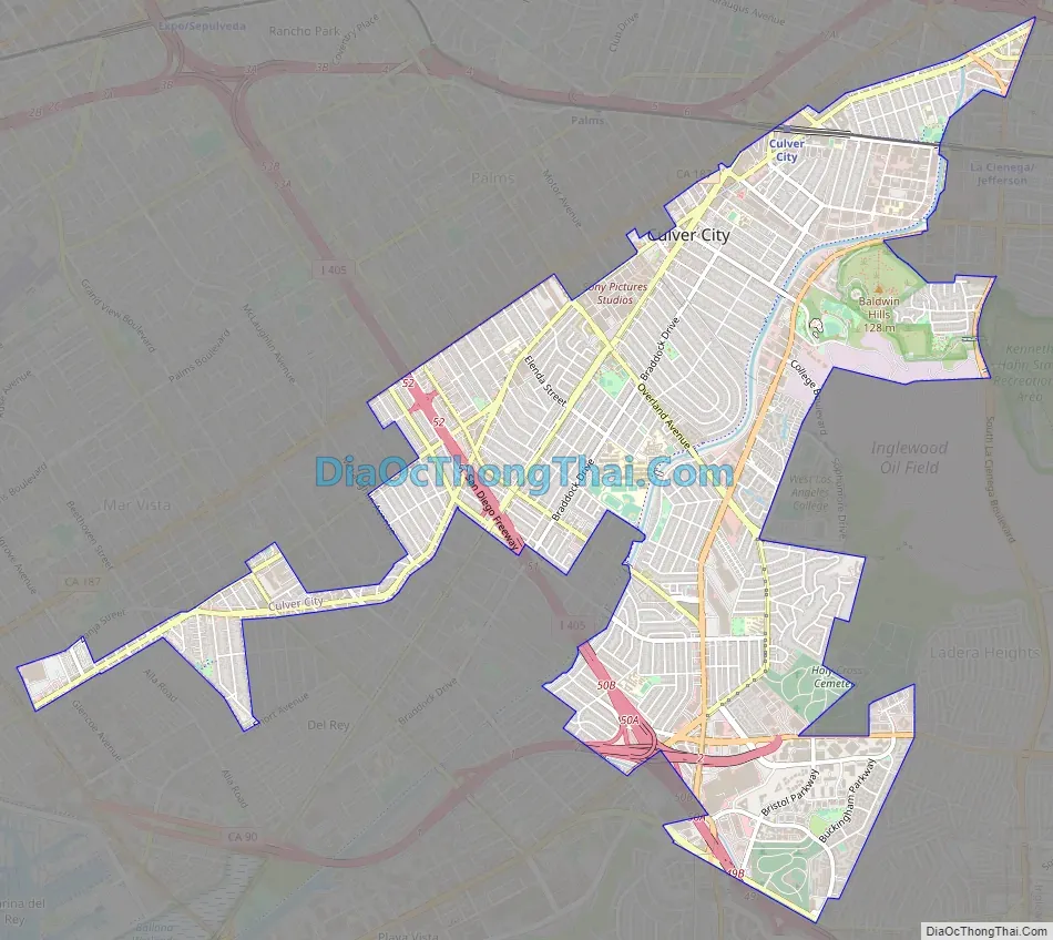
Culver City Road Map
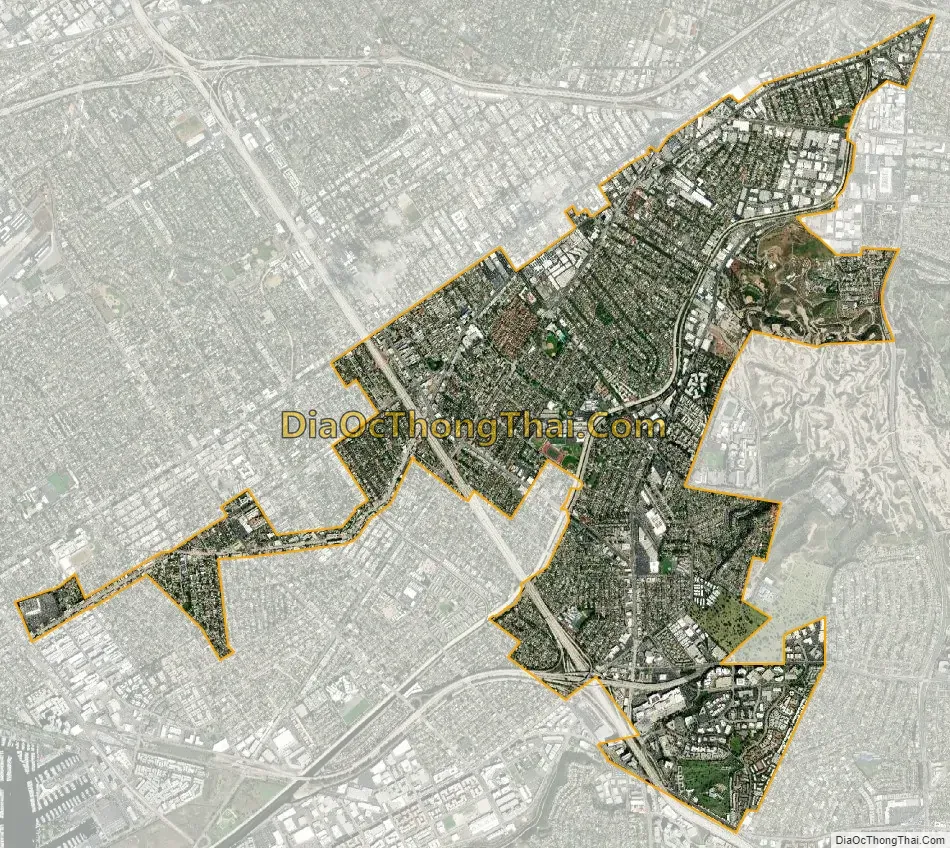
Culver City city Satellite Map
Geography
The city is surrounded by the Los Angeles neighborhoods of Mar Vista and Palms to the north; Westchester to the south; Mid-City, West Adams, and Baldwin Hills to the east; the Ladera Heights unincorporated area to the southeast; and the L.A. neighborhoods of Venice and Playa Vista to the west, along with the unincorporated area of Marina Del Rey.
Culver City’s major geographic feature is Ballona Creek, which runs northeast to southwest through most of the city before it drains into Santa Monica Bay in Marina Del Rey.
According to the United States Census Bureau, the city has a total area of 5.1 square miles (13.2 km), over 99% of which is land.
Neighborhoods
The city recognizes 15 neighborhoods within city limits.
- Blair Hills
- Blanco-Culver Crest
- Clarkdale
- Culver West
- Downtown Culver City
- Fox Hills
- Jefferson
- Lucerne-Higuera
- McLaughlin
- McManus
- Park East (also known as Carlson Park)
- Park West (also known as Veterans Park)
- Studio Village
- Sunkist Park
- Washington Culver
Climate
See also
Map of California State and its subdivision:- Alameda
- Alpine
- Amador
- Butte
- Calaveras
- Colusa
- Contra Costa
- Del Norte
- El Dorado
- Fresno
- Glenn
- Humboldt
- Imperial
- Inyo
- Kern
- Kings
- Lake
- Lassen
- Los Angeles
- Madera
- Marin
- Mariposa
- Mendocino
- Merced
- Modoc
- Mono
- Monterey
- Napa
- Nevada
- Orange
- Placer
- Plumas
- Riverside
- Sacramento
- San Benito
- San Bernardino
- San Diego
- San Francisco
- San Joaquin
- San Luis Obispo
- San Mateo
- Santa Barbara
- Santa Clara
- Santa Cruz
- Shasta
- Sierra
- Siskiyou
- Solano
- Sonoma
- Stanislaus
- Sutter
- Tehama
- Trinity
- Tulare
- Tuolumne
- Ventura
- Yolo
- Yuba
- Alabama
- Alaska
- Arizona
- Arkansas
- California
- Colorado
- Connecticut
- Delaware
- District of Columbia
- Florida
- Georgia
- Hawaii
- Idaho
- Illinois
- Indiana
- Iowa
- Kansas
- Kentucky
- Louisiana
- Maine
- Maryland
- Massachusetts
- Michigan
- Minnesota
- Mississippi
- Missouri
- Montana
- Nebraska
- Nevada
- New Hampshire
- New Jersey
- New Mexico
- New York
- North Carolina
- North Dakota
- Ohio
- Oklahoma
- Oregon
- Pennsylvania
- Rhode Island
- South Carolina
- South Dakota
- Tennessee
- Texas
- Utah
- Vermont
- Virginia
- Washington
- West Virginia
- Wisconsin
- Wyoming


