East Pasadena (pronunciation) is an unincorporated community in Los Angeles County, California, United States. The population was 6,144 at the 2010 census, up from 6,045 at the 2000 census. For statistical purposes, the United States Census Bureau has defined East Pasadena as a census-designated place (CDP).
| Name: | East Pasadena CDP |
|---|---|
| LSAD Code: | 57 |
| LSAD Description: | CDP (suffix) |
| State: | California |
| County: | Los Angeles County |
| Elevation: | 725 ft (221 m) |
| Total Area: | 1.32 sq mi (3.43 km²) |
| Land Area: | 1.32 sq mi (3.41 km²) |
| Water Area: | 0.01 sq mi (0.01 km²) 0.39% |
| Total Population: | 6,021 |
| Population Density: | 4,571.75/sq mi (1,764.74/km²) |
| ZIP code: | 91107 |
| Area code: | 626 |
| FIPS code: | 0620984 |
| GNISfeature ID: | 1660585 |
Online Interactive Map
Click on ![]() to view map in "full screen" mode.
to view map in "full screen" mode.
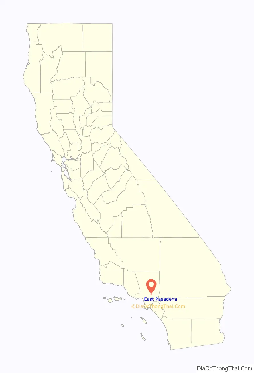
East Pasadena location map. Where is East Pasadena CDP?

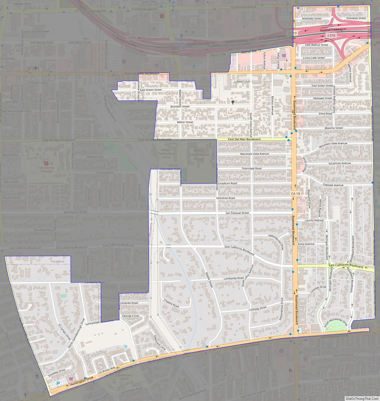
East Pasadena Road Map
East Pasadena city Satellite Map

Geography
The land area of East Pasadena is separated into two non-contiguous segments:
- The main portion, bordered by Pasadena city limits on the north, California Boulevard on the south, Michillinda Avenue (Arcadia city limits) on the east, and San Gabriel Boulevard on the west.
- A smaller district to the west, bordered by Del Mar Boulevard to the north, San Marino city limits to the south, Berkeley Avenue to the west and San Gabriel Boulevard to the east.
The community has become considerably smaller as the city of Pasadena has expanded its boundaries to include more of the unincorporated area of East Pasadena.
According to the United States Census Bureau, the CDP has a total area of 1.3 square miles (3.4 km), all land. The definition of the area was created by the Census Bureau for statistical purposes and may not precisely correspond to local understanding of the area with the same name.
See also
Map of California State and its subdivision:- Alameda
- Alpine
- Amador
- Butte
- Calaveras
- Colusa
- Contra Costa
- Del Norte
- El Dorado
- Fresno
- Glenn
- Humboldt
- Imperial
- Inyo
- Kern
- Kings
- Lake
- Lassen
- Los Angeles
- Madera
- Marin
- Mariposa
- Mendocino
- Merced
- Modoc
- Mono
- Monterey
- Napa
- Nevada
- Orange
- Placer
- Plumas
- Riverside
- Sacramento
- San Benito
- San Bernardino
- San Diego
- San Francisco
- San Joaquin
- San Luis Obispo
- San Mateo
- Santa Barbara
- Santa Clara
- Santa Cruz
- Shasta
- Sierra
- Siskiyou
- Solano
- Sonoma
- Stanislaus
- Sutter
- Tehama
- Trinity
- Tulare
- Tuolumne
- Ventura
- Yolo
- Yuba
- Alabama
- Alaska
- Arizona
- Arkansas
- California
- Colorado
- Connecticut
- Delaware
- District of Columbia
- Florida
- Georgia
- Hawaii
- Idaho
- Illinois
- Indiana
- Iowa
- Kansas
- Kentucky
- Louisiana
- Maine
- Maryland
- Massachusetts
- Michigan
- Minnesota
- Mississippi
- Missouri
- Montana
- Nebraska
- Nevada
- New Hampshire
- New Jersey
- New Mexico
- New York
- North Carolina
- North Dakota
- Ohio
- Oklahoma
- Oregon
- Pennsylvania
- Rhode Island
- South Carolina
- South Dakota
- Tennessee
- Texas
- Utah
- Vermont
- Virginia
- Washington
- West Virginia
- Wisconsin
- Wyoming


