San Marino is a residential city in Los Angeles County, California, United States. It was incorporated on April 25, 1913. At the 2010 census the population was 13,147. The city is one of the wealthiest places in the nation in terms of household income. By extension, with a median home price of $2,699,098, San Marino is one of the most expensive and exclusive neighborhoods in the Los Angeles area.
| Name: | San Marino city |
|---|---|
| LSAD Code: | 25 |
| LSAD Description: | city (suffix) |
| State: | California |
| County: | Los Angeles County |
| Incorporated: | April 25, 1913 |
| Elevation: | 564 ft (172 m) |
| Total Area: | 3.77 sq mi (9.77 km²) |
| Land Area: | 3.77 sq mi (9.75 km²) |
| Water Area: | 0.01 sq mi (0.02 km²) 0.18% |
| Total Population: | 13,147 |
| Population Density: | 3,464.68/sq mi (1,337.85/km²) |
| ZIP code: | 91108, 91118 |
| Area code: | 626 |
| FIPS code: | 0668224 |
| GNISfeature ID: | 1652789 |
| Website: | ci.san-marino.ca.us |
Online Interactive Map
Click on ![]() to view map in "full screen" mode.
to view map in "full screen" mode.
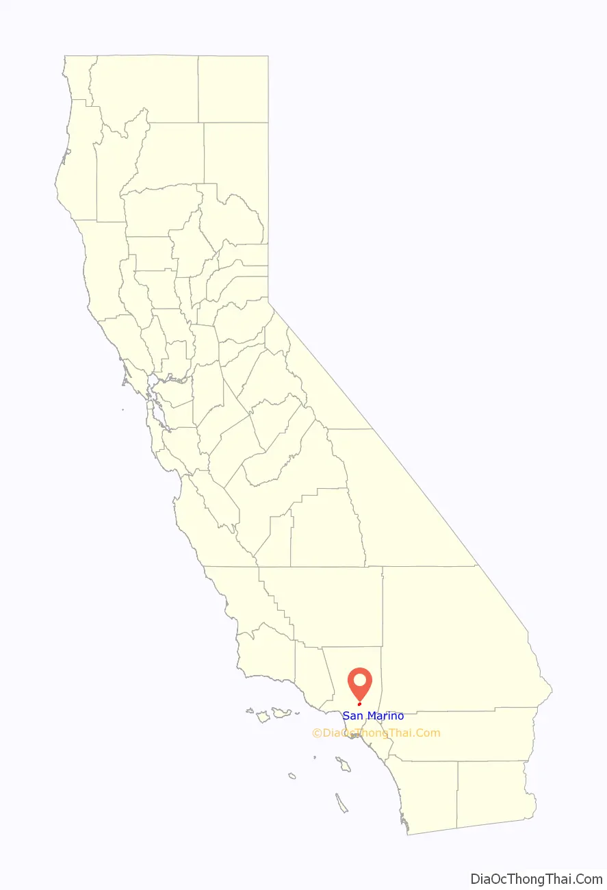
San Marino location map. Where is San Marino city?

History
Origin of name
The city takes its name from the ancient Republic of San Marino, founded by Saint Marinus who fled his home in Dalmatia (modern Croatia) at the time of the Diocletianic Persecution of Christians. Marinus took refuge at Monte Titano on the Italian peninsula, where he built a chapel and founded a monastic community in 301 A.D. The state which grew from the monastery is the world’s oldest surviving republic.
The seal of the City of San Marino, California is modeled on that of the republic, depicting the Three Towers of San Marino each capped with a bronze plume, surrounded by a heart-shaped scroll with two roundels and a lozenge (of unknown significance) at the top. The crown representing sovereignty on the original was replaced with five stars, representing the five members of the city’s governing body. Beneath the city’s seal are crossed palm fronds and orange branches. Other than the city’s use of the name and copy of the Republic of San Marino seal, there is absolutely no historical connection between them.
The city celebrated its centennial in 2013, including publication by the San Marino Historical Society of a 268-page book, San Marino, A Centennial History, by Elizabeth Pomeroy. In September 2014, this book and author Elizabeth Pomeroy received a prestigious Award of Merit for Leadership in History from the American Association for State and Local History (AASLH).
Early history
The site of San Marino was originally occupied by a village of Tongva (Gabrieleño) Indians located approximately where the Huntington School is today. The area was part of the lands of the San Gabriel Mission. Principal portions of San Marino were included in an 1838 Mexican land grant of 128 acres to Victoria Bartolmea Reid, a Gabrieleña Indian. (After her first husband, also a Gabrieleño, died in 1836 of smallpox, she remarried Scotsman Hugo Reid in 1837). She called the property Rancho Huerta de Cuati. After Hugo Reid’s death in 1852, Señora Reid sold her rancho in 1854 to Don Benito Wilson, the first Anglo owner of Rancho San Pascual. In 1873, Don Benito conveyed to his son-in-law, James DeBarth Shorb, 500 acres (2.0 km), including Rancho Huerta de Cuati, which Shorb named “San Marino” after his grandfather’s plantation in Maryland, which, in turn, was named after the Republic of San Marino located on the Italian Peninsula in Europe.
History (1900s)
In 1903, the Shorb rancho was purchased by Henry E. Huntington (1850–1927), who built a large mansion on the property. The site of the Shorb/Huntington rancho is occupied today by the Huntington Library, which houses a world-renowned art collection, research and rare-book library, and botanical gardens. In 1913 the three primary ranchos of Wilson, Patton, and Huntington, together with the subdivided areas from those and smaller ranchos, such as the Stoneman, White, and Rose ranchos, were incorporated as the city of San Marino.
The first mayor of the city of San Marino was George Smith Patton (1856-1927), the son of a slain Confederate States of America colonel in the U.S. Civil War (also named George Smith Patton, 1833–1864). He married Ruth Wilson, the daughter of Don Benito Wilson. Their son was the World War II general George S. Patton Jr.
To a prior generation of Southern Californians, San Marino was known for its old-money wealth and as a bastion of the region’s WASP gentry. By mid-century, however, other European ethnic groups had become the majority.
In 1970, the city was 99.7% White. By 1990, the city’s households were 23.7% Asian.
In 2000, the city’s Asian households increased to 40%.
In recent decades, immigrants of Chinese and Taiwanese ancestry have come to represent more than 60% of the population, perhaps due to its location in the San Gabriel Valley, known to be a popular destination for East Asian immigrants.
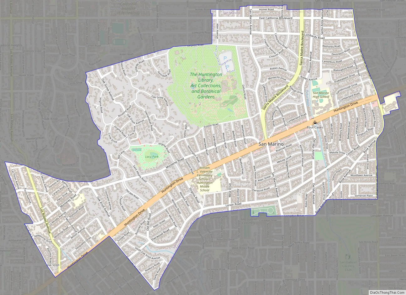
San Marino Road Map
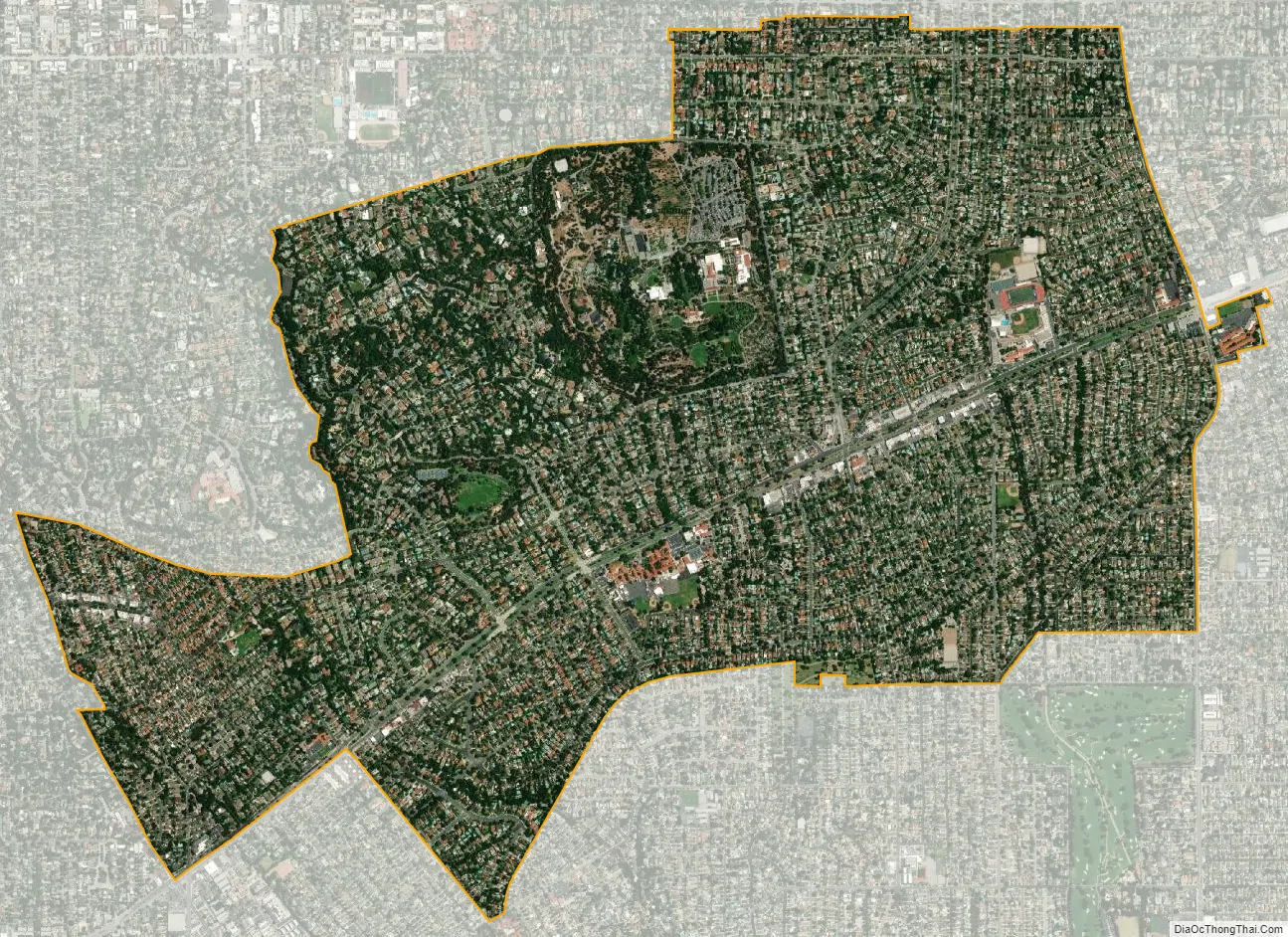
San Marino city Satellite Map
Geography
The city is located in the San Rafael Hills, and it is divided into seven zones, based on minimum lot size. The smallest lot size is about 4,500 square feet (420 m), with many averaging over 30,000 square feet (2,800 m). Because of this and other factors, most of the homes in San Marino, built between 1920 and 1950, do not resemble the houses in surrounding Southern California neighborhoods (with the exception, perhaps, of neighboring portions of Pasadena). San Marino has also fostered a sense of historic preservation among its homeowners. With minor exceptions, the city’s strict design review and zoning laws have thus far prevented the development of large homes found elsewhere in Los Angeles.
According to the United States Census Bureau, the city has a total area of 3.8 square miles (9.8 km), virtually all land.
San Marino is highly restrictive of commercial operations in the city. It is one of the few cities that requires commercial vehicles to have permits to work within the city. The rationale is that commercial vehicle operators and service providers, such as gardeners, pool service providers and maintenance workers, are more likely to cause social disruption within the city, and so must be preauthorized for crime control and prosecutorial purposes. This regulation and others, including the bans on apartment buildings, townhouses and overnight parking, are some of the more obvious examples.
See also
Map of California State and its subdivision:- Alameda
- Alpine
- Amador
- Butte
- Calaveras
- Colusa
- Contra Costa
- Del Norte
- El Dorado
- Fresno
- Glenn
- Humboldt
- Imperial
- Inyo
- Kern
- Kings
- Lake
- Lassen
- Los Angeles
- Madera
- Marin
- Mariposa
- Mendocino
- Merced
- Modoc
- Mono
- Monterey
- Napa
- Nevada
- Orange
- Placer
- Plumas
- Riverside
- Sacramento
- San Benito
- San Bernardino
- San Diego
- San Francisco
- San Joaquin
- San Luis Obispo
- San Mateo
- Santa Barbara
- Santa Clara
- Santa Cruz
- Shasta
- Sierra
- Siskiyou
- Solano
- Sonoma
- Stanislaus
- Sutter
- Tehama
- Trinity
- Tulare
- Tuolumne
- Ventura
- Yolo
- Yuba
- Alabama
- Alaska
- Arizona
- Arkansas
- California
- Colorado
- Connecticut
- Delaware
- District of Columbia
- Florida
- Georgia
- Hawaii
- Idaho
- Illinois
- Indiana
- Iowa
- Kansas
- Kentucky
- Louisiana
- Maine
- Maryland
- Massachusetts
- Michigan
- Minnesota
- Mississippi
- Missouri
- Montana
- Nebraska
- Nevada
- New Hampshire
- New Jersey
- New Mexico
- New York
- North Carolina
- North Dakota
- Ohio
- Oklahoma
- Oregon
- Pennsylvania
- Rhode Island
- South Carolina
- South Dakota
- Tennessee
- Texas
- Utah
- Vermont
- Virginia
- Washington
- West Virginia
- Wisconsin
- Wyoming


