Eastvale is a city located in northwestern Riverside County, California, in the Inland Empire region of Southern California. The area transitioned from a dairy farm enclave to a developed community starting in the 1990s and was formally incorporated on October 1, 2010. As of the 2020 census, the city had a population of 69,757. The city’s name is derived from “East Vale” as a listed school district in 1893 by the Riverside County Board of Commissioners.
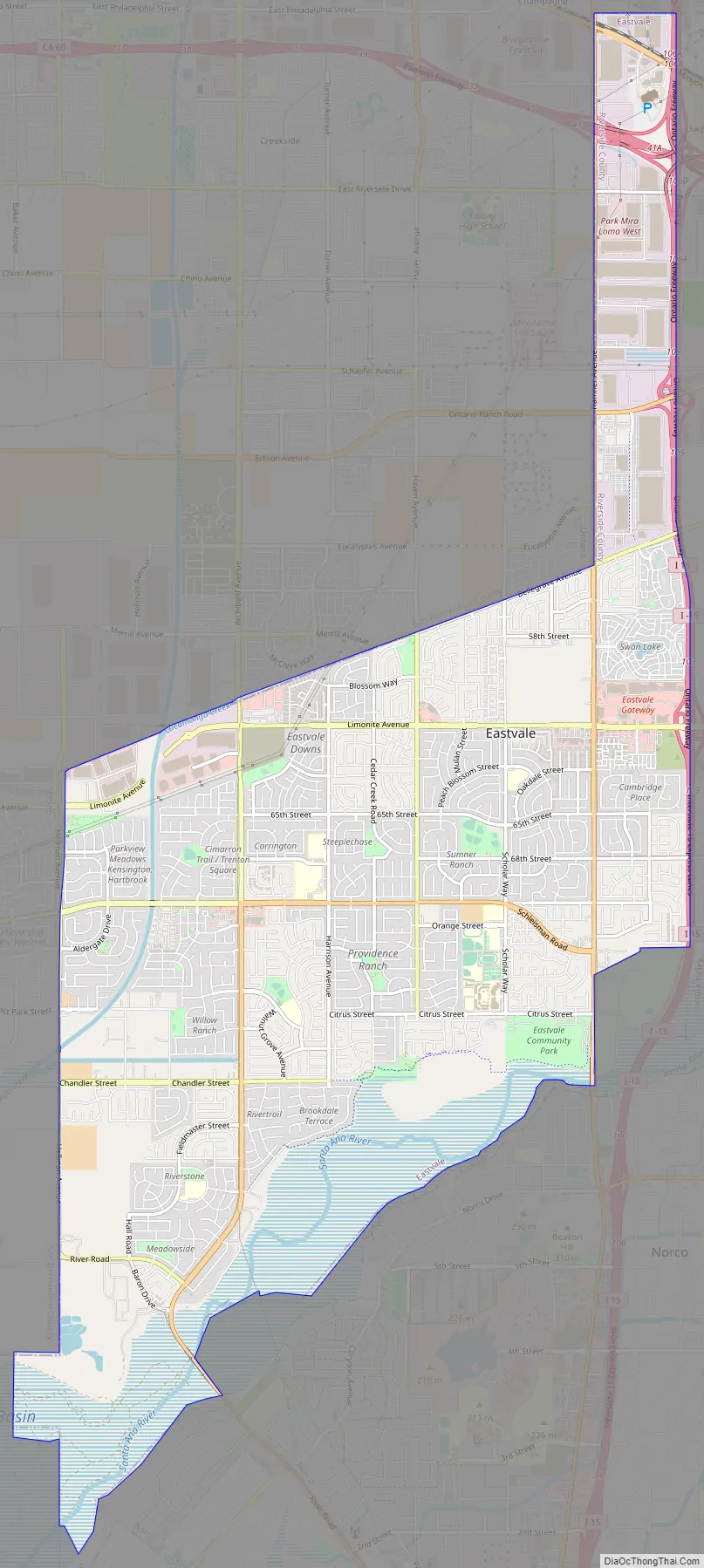
The city’s boundaries extend from Hellman Avenue to the west (the San Bernardino County line), State Route 60 to the north (also the San Bernardino County line), the Santa Ana River and Norco to the south, and Interstate 15 to the east. It is surrounded by the cities of Chino, Ontario, Jurupa Valley, Norco, and Corona.
The city is served by the highly accredited public school system – the Corona Norco Unified School District. According to the 2020 United States Census, Eastvale has a median household income at one of the top earning percentiles in the country at $119,213.
| Name: | Eastvale city |
|---|---|
| LSAD Code: | 25 |
| LSAD Description: | city (suffix) |
| State: | California |
| County: | Riverside County |
| Incorporated: | October 1, 2010 |
| Elevation: | 627 ft (191 m) |
| Total Area: | 13.11 sq mi (33.97 km²) |
| Land Area: | 12.67 sq mi (32.82 km²) |
| Water Area: | 0.44 sq mi (1.14 km²) 0.35% |
| Total Population: | 69,757 |
| Population Density: | 5,062.50/sq mi (1,954.59/km²) |
| ZIP code: | 91752, 92880 |
| Area code: | 909, 951 |
| FIPS code: | 0621230 |
| Website: | www.eastvaleca.gov |
Online Interactive Map
Click on ![]() to view map in "full screen" mode.
to view map in "full screen" mode.
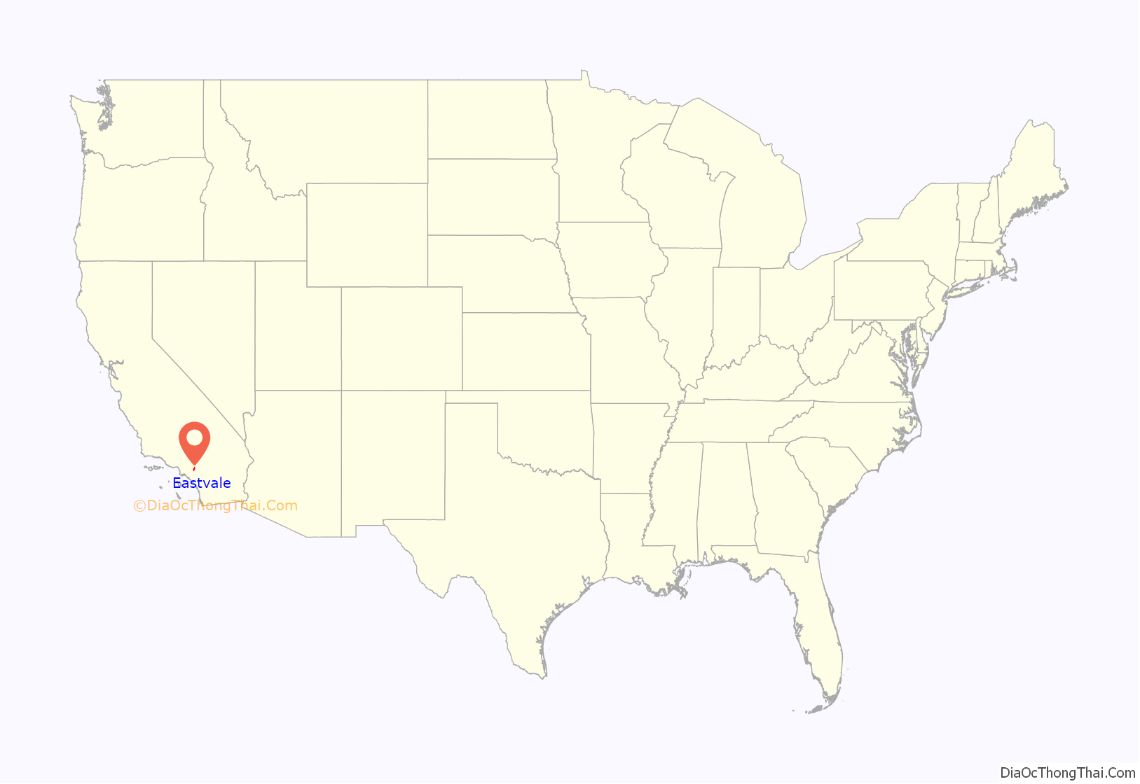
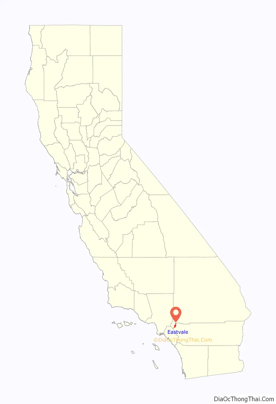
Eastvale location map. Where is Eastvale city?
History
Recorded history of land in the far western side of present-day Riverside County and north of the Santa Ana River begins in 1838, when Mexican Governor Juan Alvarado, of the Alta California territory, granted Rancho Jurupa (some 48 square miles) to Juan Bandini. The city of Eastvale now occupies approximately the westernmost one-quarter of former Rancho Jurupa land grant. The Mexican–American War between the United States and Mexico ended in 1848 with the Treaty of Guadalupe Hidalgo, by which Mexico ceded Alta California and much other Southwestern land to the US. Two years later, on September 9, 1850, California became a U.S. state.
For 65 years, between 1889 and 1954, the Fuller family owned about 6 square miles of ranch land on the north side of the Santa Ana River. Almost half of present-day Eastvale, between Schleisman Road and the river, was included within the Fuller ranch’s boundaries.
Eastvale, often spelled with two words as “East Vale” in early days, was an elementary school district in Riverside County for more than 50 years, from County formation in 1893 until 1947 when the district was merged with Corona and Norco schools.
Recent history
Once a rural area, Eastvale was predominantly dairy farms and agricultural until the late 1990s. At that time, the area started to suburbanize to accommodate the influx of people coming from Orange and Los Angeles counties seeking more affordable housing.
Incorporation effort
Eastvale was one of several unincorporated areas of Riverside County that had strong community support for city incorporation. The passage of AB 1602 in the mid-2000s, a state bill that adds funds from vehicle license fees, made it easier for unincorporated areas to attain cityhood. In 2008, the communities of Menifee, Sun City and Quail Valley merged and incorporated as the City of Menifee. The law also brought renewed interest in incorporation efforts for Mira Loma and Jurupa Valley (Mira Loma, Pedley, Glen Avon, Sunnyslope, and Rubidoux).
The community of Eastvale actively attempted to incorporate from the mid-2000s through 2010. The incorporation effort was being led by the Eastvale Incorporation Committee. Other groups were also proponents of Eastvale cityhood, such as the Yes on Eastvale Cityhood Committee.
The Eastvale Incorporation Committee successfully gathered enough signatures to qualify on the June 8, 2010. “Measure A” was placed on the ballot deciding incorporation. “Measure B” would decide how the city council would be elected: at large, by district, or from district. Measure A passed with 65.8% of voters approving incorporation. Eastvale officially incorporated on October 1, 2010. Voters also decided that the city council would be elected at large. Eastvale’s first city council members were Ike Bootsma, Jeff DeGrandpre, Kelly Howell, Adam Rush, and Ric Welch. The council selected Adam Rush as Eastvale’s first mayor.
Eastvale Road Map
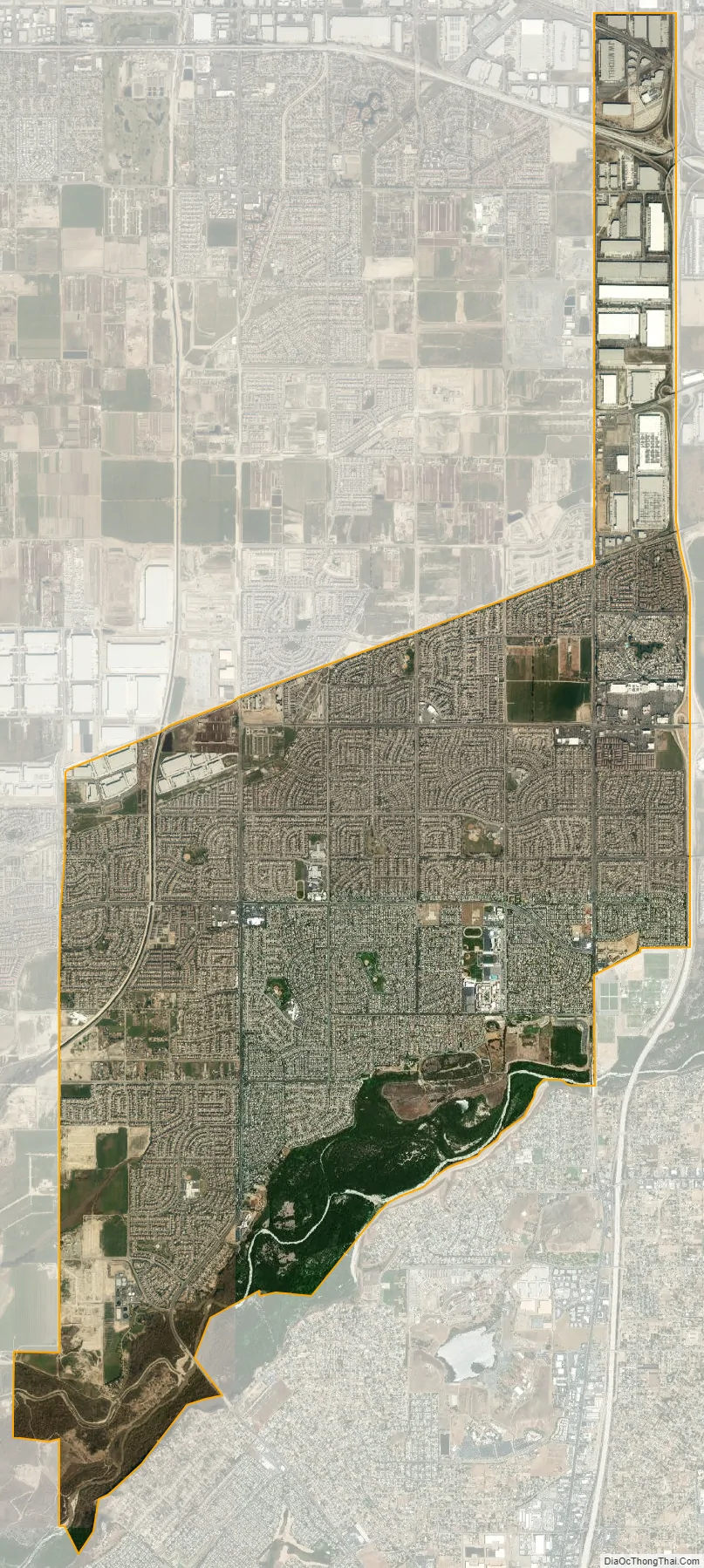
Eastvale city Satellite Map
Geography
The Los Angeles County line is approximately 8 miles northwest of Eastvale, and the Orange County line is approximately 5 miles to the southwest. The proximity of these two heavily commercialized counties, and the fact that Eastvale is roughly squared between Interstate 15 and State Routes 91, 60, and 71, has made Eastvale popular for those who commute to these counties for employment, making Eastvale a commuter town.
According to the Eastvale area plan, Eastvale has a total area of 13.1 square miles (33.9 km), of which 12.5 square miles (32.3 km) is land and 0.6 square miles (1.6 km), or 4.76%, is water.
According to the United States Census Bureau, the former census-designated place of Eastvale covered an area of 11.4 square miles (29.6 km), 99.65% of it land, and 0.35% of it water.
Eastvale has two postal ZIP codes, 92880 and 91752, which often use mailing addresses of Corona and Mira Loma, respectively.
Most of Eastvale, like most of western Riverside County, has the telephone area code of 951. However, according to the California Public Utilities Commission, because the 951 area code was split along telephone service areas and not strictly along county boundaries, some Eastvale residents still retain the older 909 area code.
See also
Map of California State and its subdivision:- Alameda
- Alpine
- Amador
- Butte
- Calaveras
- Colusa
- Contra Costa
- Del Norte
- El Dorado
- Fresno
- Glenn
- Humboldt
- Imperial
- Inyo
- Kern
- Kings
- Lake
- Lassen
- Los Angeles
- Madera
- Marin
- Mariposa
- Mendocino
- Merced
- Modoc
- Mono
- Monterey
- Napa
- Nevada
- Orange
- Placer
- Plumas
- Riverside
- Sacramento
- San Benito
- San Bernardino
- San Diego
- San Francisco
- San Joaquin
- San Luis Obispo
- San Mateo
- Santa Barbara
- Santa Clara
- Santa Cruz
- Shasta
- Sierra
- Siskiyou
- Solano
- Sonoma
- Stanislaus
- Sutter
- Tehama
- Trinity
- Tulare
- Tuolumne
- Ventura
- Yolo
- Yuba
- Alabama
- Alaska
- Arizona
- Arkansas
- California
- Colorado
- Connecticut
- Delaware
- District of Columbia
- Florida
- Georgia
- Hawaii
- Idaho
- Illinois
- Indiana
- Iowa
- Kansas
- Kentucky
- Louisiana
- Maine
- Maryland
- Massachusetts
- Michigan
- Minnesota
- Mississippi
- Missouri
- Montana
- Nebraska
- Nevada
- New Hampshire
- New Jersey
- New Mexico
- New York
- North Carolina
- North Dakota
- Ohio
- Oklahoma
- Oregon
- Pennsylvania
- Rhode Island
- South Carolina
- South Dakota
- Tennessee
- Texas
- Utah
- Vermont
- Virginia
- Washington
- West Virginia
- Wisconsin
- Wyoming


