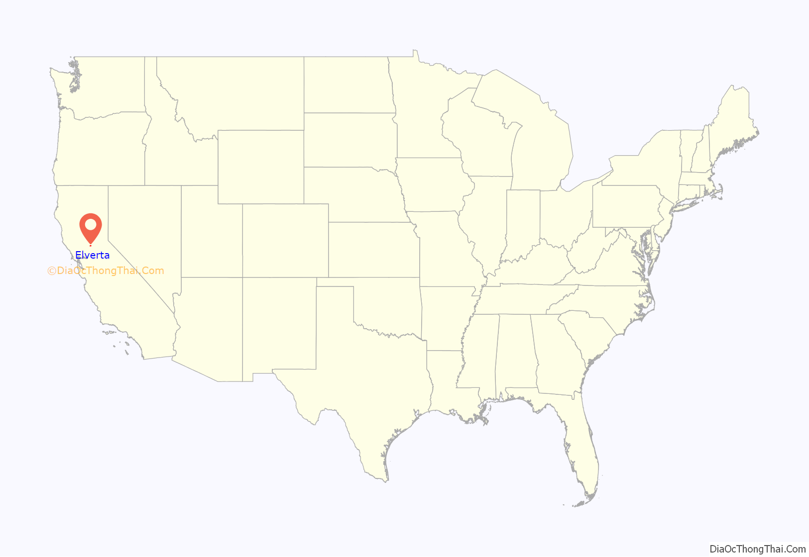
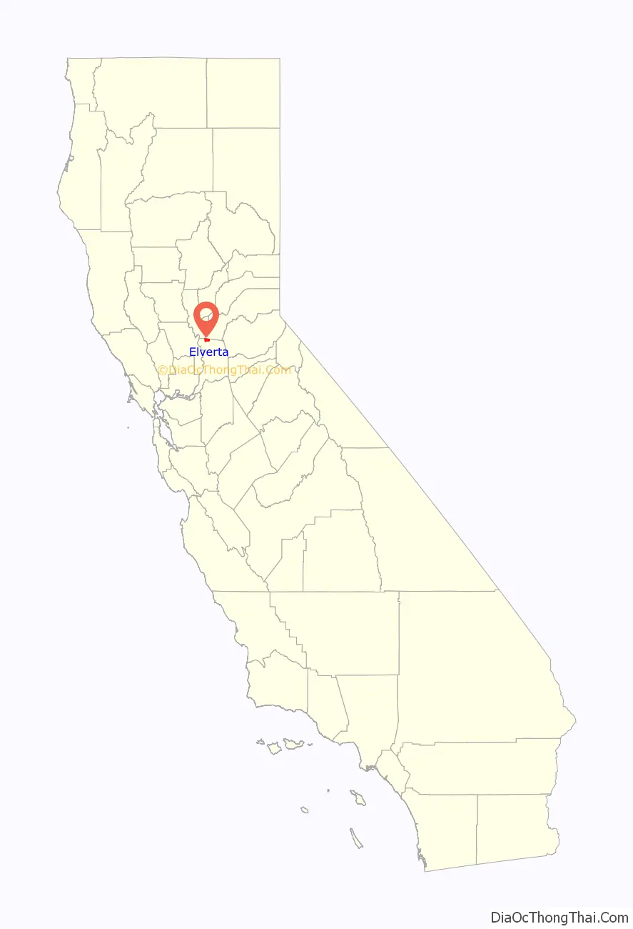
Elverta is a census-designated place in Sacramento County, California. It is part of the Sacramento metropolitan area, which includes Sacramento (the state capital and county seat), Arden-Arcade, and Roseville. It is about 20 miles (32 km) from Sacramento, 2.5 miles (4.0 km) from Rio Linda, 6 miles (9.7 km) from Roseville, and 8.0 miles (12.9 km) from Antelope. The population was 5,492 as of the 2010 census.
The ZIP code is 95626, which it shares with other areas of Sacramento County as well as parts of Placer and Sutter counties.
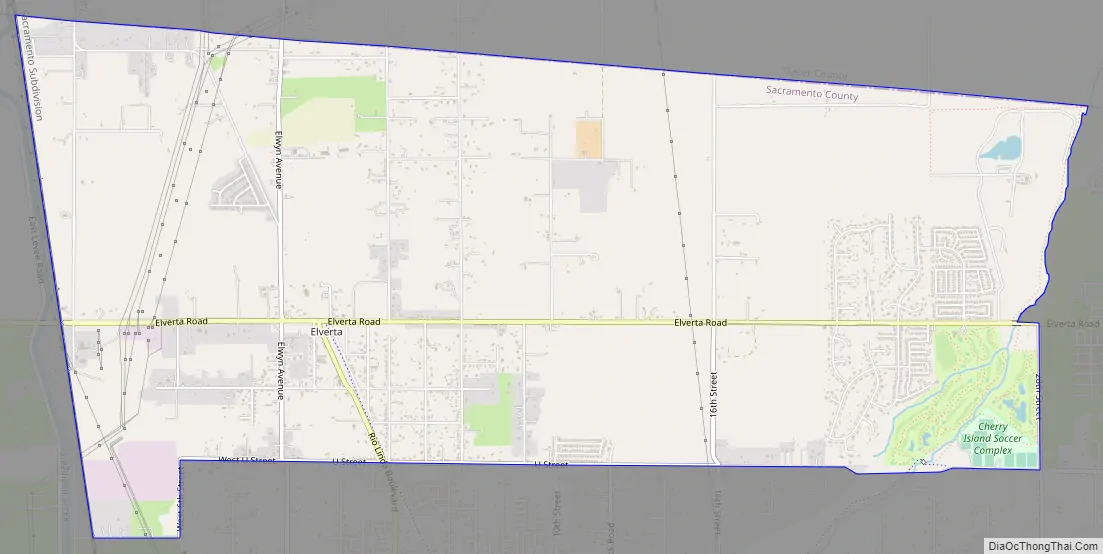
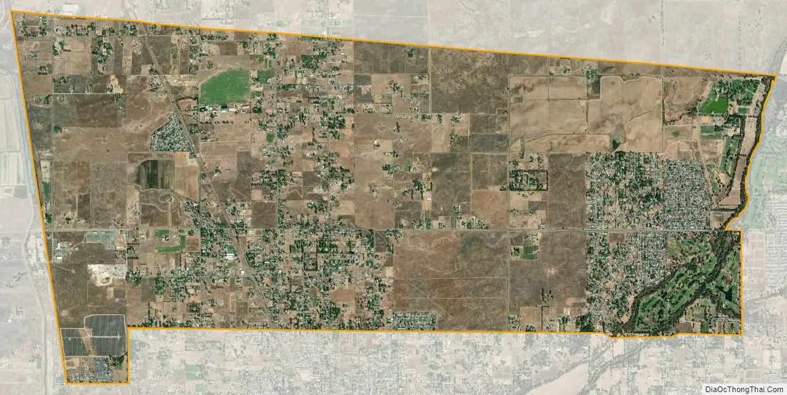
The community has very few hills, and no major bodies of water.
| Name: | Elverta CDP |
|---|---|
| LSAD Code: | 57 |
| LSAD Description: | CDP (suffix) |
| State: | California |
| County: | Sacramento County |
| Elevation: | 52 ft (16 m) |
| Total Area: | 8.842 sq mi (22.90 km²) |
| Land Area: | 8.842 sq mi (22.90 km²) |
| Water Area: | 0 sq mi (0 km²) 0% |
| Total Population: | 5,492 |
| Population Density: | 620/sq mi (240/km²) |
| ZIP code: | 95626 |
| Area code: | 916, 279 |
| FIPS code: | 0622524 |
Online Interactive Map
Click on ![]() to view map in "full screen" mode.
to view map in "full screen" mode.
Elverta location map. Where is Elverta CDP?
History
The unincorporated community was named for Elverta Dike, whose husband donated property to a local church. The Elverta/Rio Linda community is located on part of the Rancho Del Paso Mexican land grant of 1844. In 1910, a Fruit Land Company of Minneapolis acquired 12,000 acres (49 km) of the Grant and in 1912 the area was subdivided. It also runs to the Rio Linda Bike Path.
Elverta Road Map
Elverta city Satellite Map
Geography
Elverta is located at 38°42′50″N 121°27′46″W / 38.71389°N 121.46278°W / 38.71389; -121.46278 (38.7137910, -121.4627326).
According to the United States Census Bureau, the unincorporated community has a total area of 8.842 square miles (22.90 km).
Climate
According to the Köppen Climate Classification system, Elverta has a warm-summer Mediterranean climate, abbreviated “Csa” on climate maps.
See also
Map of California State and its subdivision:- Alameda
- Alpine
- Amador
- Butte
- Calaveras
- Colusa
- Contra Costa
- Del Norte
- El Dorado
- Fresno
- Glenn
- Humboldt
- Imperial
- Inyo
- Kern
- Kings
- Lake
- Lassen
- Los Angeles
- Madera
- Marin
- Mariposa
- Mendocino
- Merced
- Modoc
- Mono
- Monterey
- Napa
- Nevada
- Orange
- Placer
- Plumas
- Riverside
- Sacramento
- San Benito
- San Bernardino
- San Diego
- San Francisco
- San Joaquin
- San Luis Obispo
- San Mateo
- Santa Barbara
- Santa Clara
- Santa Cruz
- Shasta
- Sierra
- Siskiyou
- Solano
- Sonoma
- Stanislaus
- Sutter
- Tehama
- Trinity
- Tulare
- Tuolumne
- Ventura
- Yolo
- Yuba
- Alabama
- Alaska
- Arizona
- Arkansas
- California
- Colorado
- Connecticut
- Delaware
- District of Columbia
- Florida
- Georgia
- Hawaii
- Idaho
- Illinois
- Indiana
- Iowa
- Kansas
- Kentucky
- Louisiana
- Maine
- Maryland
- Massachusetts
- Michigan
- Minnesota
- Mississippi
- Missouri
- Montana
- Nebraska
- Nevada
- New Hampshire
- New Jersey
- New Mexico
- New York
- North Carolina
- North Dakota
- Ohio
- Oklahoma
- Oregon
- Pennsylvania
- Rhode Island
- South Carolina
- South Dakota
- Tennessee
- Texas
- Utah
- Vermont
- Virginia
- Washington
- West Virginia
- Wisconsin
- Wyoming


