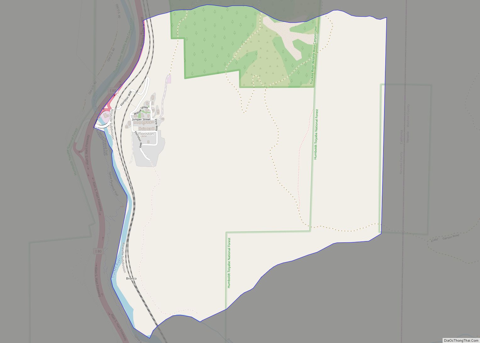
Floriston is an unincorporated community and census-designated place in Nevada County, California. It is situated at an elevation of 5,400 ft (1,600 m) above sea level. Floriston is located on the Truckee River, 10 miles (16.1 km) east-northeast of Truckee. Formerly an important railroad stop and mill town, Floriston survives to this day as a small residential community. The population was 73 at the 2010 census.
| Name: | Floriston CDP |
|---|---|
| LSAD Code: | 57 |
| LSAD Description: | CDP (suffix) |
| State: | California |
| County: | Nevada County |
| Elevation: | 5,400 ft (1,600 m) |
| Total Area: | 0.950 sq mi (2.461 km²) |
| Land Area: | 0.950 sq mi (2.461 km²) |
| Water Area: | 0 sq mi (0 km²) 0% |
| Total Population: | 73 |
| Population Density: | 77/sq mi (30/km²) |
| FIPS code: | 0624526 |
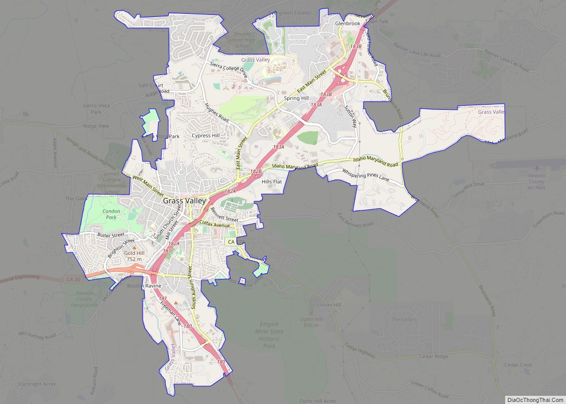
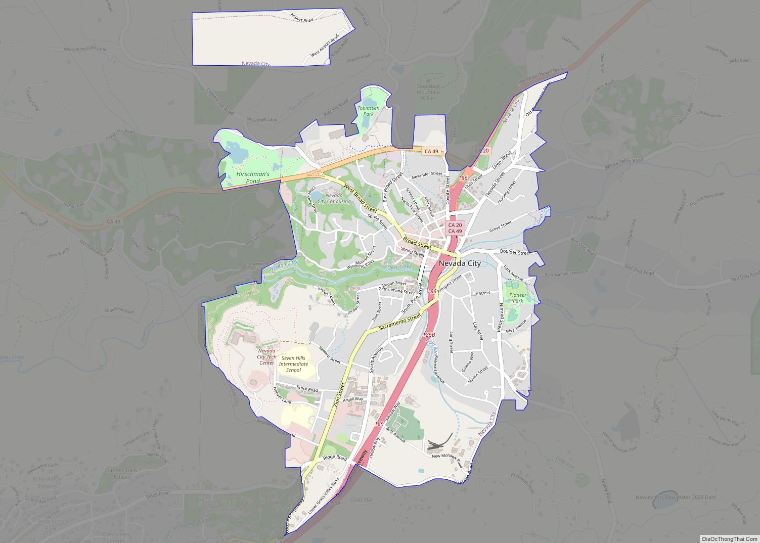
Online Interactive Map
Click on ![]() to view map in "full screen" mode.
to view map in "full screen" mode.
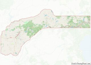
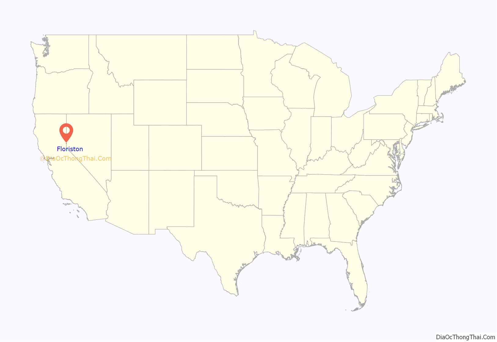
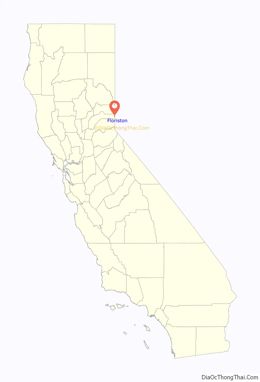
Floriston location map. Where is Floriston CDP?
History
The railroad station was established in the 1870s with the name of Bronco after the name of the creek a mile to the south. The Floriston post office opened in 1891.
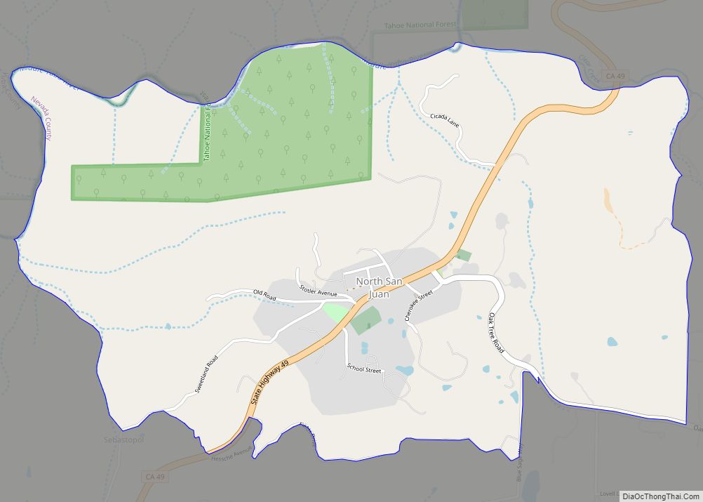
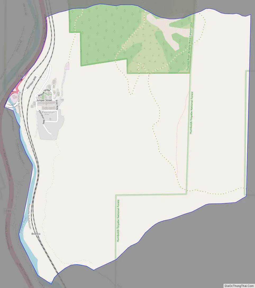
Floriston Road Map
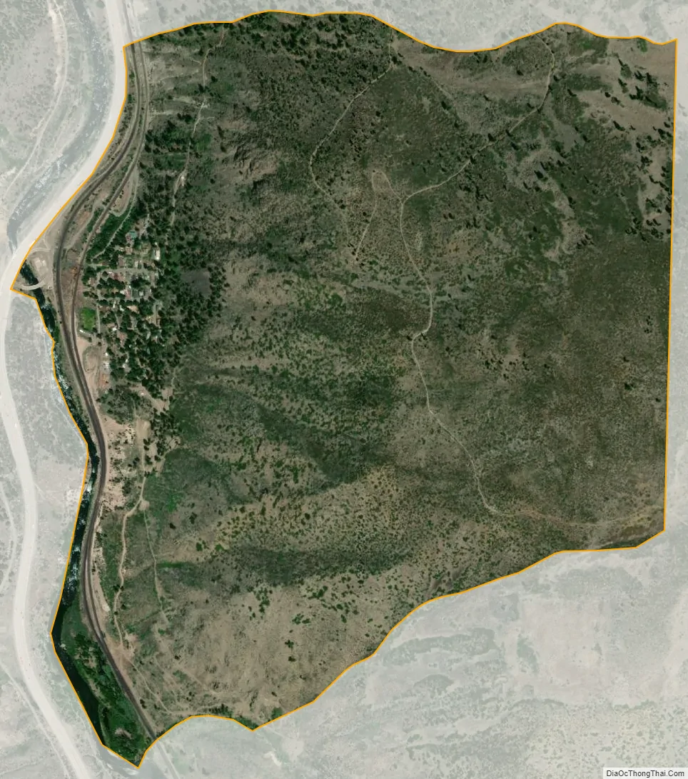
Floriston city Satellite Map
Geography
Floriston is located east of Truckee in the canyon of the Truckee River, a short distance north of the bend where it turns north from its previous eastward course. The community is located on a small gently sloped area on the east bank of the river next to Interstate 80, which crosses the river nearby. Steep canyon walls thousands of feet high rise up from the river on both sides.
Climate
Floriston has a dry-summer continental climate (Köppen Dsb) with a moderate amount of precipitation, much of it falling as snow in the wintertime. Diurnal temperature variation is large, with average highs above freezing year-round, and quite cold nighttime temperatures even in midsummer. The community, deep in a canyon on the eastern slope of the Sierra Nevada, experiences a moderate rain shadow effect due to the Sierra crest 20 miles (32 km) to the west. However, this rain shadow is much less pronounced than that of the lower terrain to the east. As a result, Floriston is located in a transition zone between the lush forests of the Sierra and the desert valleys to the east.
See also
Map of California State and its subdivision:- Alameda
- Alpine
- Amador
- Butte
- Calaveras
- Colusa
- Contra Costa
- Del Norte
- El Dorado
- Fresno
- Glenn
- Humboldt
- Imperial
- Inyo
- Kern
- Kings
- Lake
- Lassen
- Los Angeles
- Madera
- Marin
- Mariposa
- Mendocino
- Merced
- Modoc
- Mono
- Monterey
- Napa
- Nevada
- Orange
- Placer
- Plumas
- Riverside
- Sacramento
- San Benito
- San Bernardino
- San Diego
- San Francisco
- San Joaquin
- San Luis Obispo
- San Mateo
- Santa Barbara
- Santa Clara
- Santa Cruz
- Shasta
- Sierra
- Siskiyou
- Solano
- Sonoma
- Stanislaus
- Sutter
- Tehama
- Trinity
- Tulare
- Tuolumne
- Ventura
- Yolo
- Yuba
- Alabama
- Alaska
- Arizona
- Arkansas
- California
- Colorado
- Connecticut
- Delaware
- District of Columbia
- Florida
- Georgia
- Hawaii
- Idaho
- Illinois
- Indiana
- Iowa
- Kansas
- Kentucky
- Louisiana
- Maine
- Maryland
- Massachusetts
- Michigan
- Minnesota
- Mississippi
- Missouri
- Montana
- Nebraska
- Nevada
- New Hampshire
- New Jersey
- New Mexico
- New York
- North Carolina
- North Dakota
- Ohio
- Oklahoma
- Oregon
- Pennsylvania
- Rhode Island
- South Carolina
- South Dakota
- Tennessee
- Texas
- Utah
- Vermont
- Virginia
- Washington
- West Virginia
- Wisconsin
- Wyoming