Forestville is a census-designated place (CDP) in Sonoma County, California, United States. It was settled during the late 1860s and was originally spelled Forrestville after one of its founders. The spelling long ago became standardized with one “r”. The population was 3,293 at the 2010 census, an increase of nearly 1,000 since the 2000 census.
By 1900, the community was known for attracting writers and artists and had a bohemian reputation. The small town has a limited number of businesses.
| Name: | Forestville CDP |
|---|---|
| LSAD Code: | 57 |
| LSAD Description: | CDP (suffix) |
| State: | California |
| County: | Sonoma County |
| Elevation: | 171 ft (52 m) |
| Total Area: | 5.257 sq mi (13.615 km²) |
| Land Area: | 5.257 sq mi (13.615 km²) |
| Water Area: | 0 sq mi (0 km²) 0% |
| Total Population: | 3,293 |
| Population Density: | 630/sq mi (240/km²) |
| ZIP code: | 95436 |
| Area code: | 707 |
| FIPS code: | 0624960 |
| GNISfeature ID: | 1658564 |
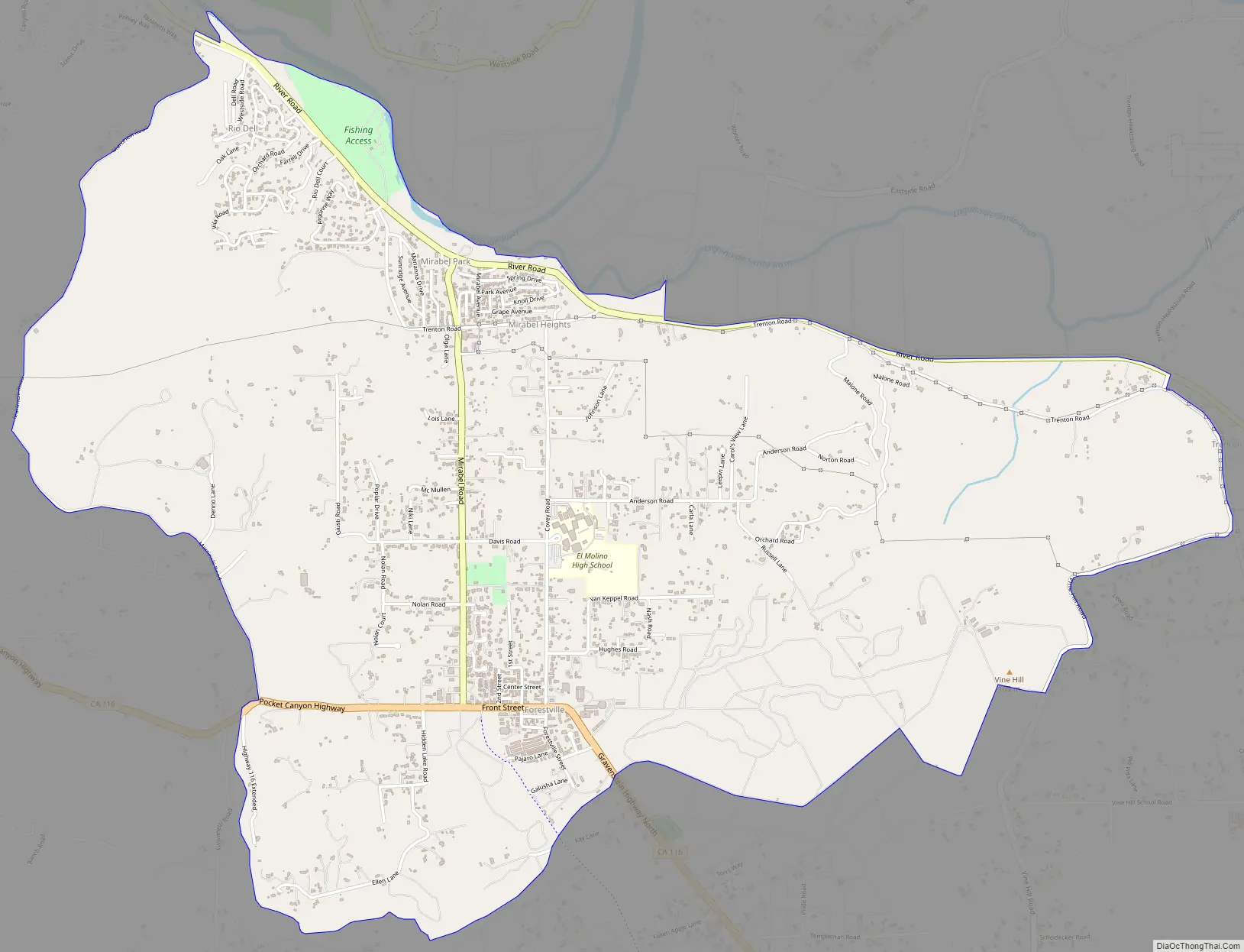
Online Interactive Map
Click on ![]() to view map in "full screen" mode.
to view map in "full screen" mode.
Forestville location map. Where is Forestville CDP?


History
Forestville’s unofficial motto is “Forestville, The Good Life.” This phrase appears on license plate holders sold at the local hardware store. The major road through town is Front Street for the length of the town, a distance of about three blocks, between Covey Road and Mirabel Road. It has been made part of Highway 116. The “downtown” blocks were first developed during the 1870s and 1880s. A fire destroyed many of the older structures, and existing buildings date mostly to the early 20th century. According to Sonoma State University professor Jonah Raskin, Forestville “was a gathering place for bohemians and writers and artists, circa 1900.”
Today businesses in the town consist of one gas station, one bar, one hardware store, a grocery store, two convenience markets, a pharmacy, several churches, a number of restaurants, a post office, an assortment of small businesses, a fire station operated by a volunteer fire department, a volunteer-run Youth Park, and three ATMs. The annual Forestville Youth Park Parade is held each June as a fund-raising event. It is associated with two days of music, bingo, and carnival rides in the Youth Park. Food and handicrafts booths are staffed by local vendors and non-profit organizations.
A number of bed and breakfast inns and wineries have been developed along the Russian River and to the east.
Forestville Road Map
Forestville city Satellite Map

Geography
Forestville is located in central Sonoma County, about 60 miles (97 km) north of San Francisco. According to the United States Census Bureau, the CDP has a total area of 5.3 square miles (14 km), all of it land. Near Forestville is the confluence of the Laguna de Santa Rosa and Mark West Creek with the Russian River. South of Forestville are found the endangered Pitkin Marsh lily and White sedge. To the north are the Russian River, Steelhead Beach Park, and Mount Jackson; to the west are the Redwood forests; and to the East and South are many rolling hills on which are planted wine grape vineyards and apple orchards.
See also
Map of California State and its subdivision:- Alameda
- Alpine
- Amador
- Butte
- Calaveras
- Colusa
- Contra Costa
- Del Norte
- El Dorado
- Fresno
- Glenn
- Humboldt
- Imperial
- Inyo
- Kern
- Kings
- Lake
- Lassen
- Los Angeles
- Madera
- Marin
- Mariposa
- Mendocino
- Merced
- Modoc
- Mono
- Monterey
- Napa
- Nevada
- Orange
- Placer
- Plumas
- Riverside
- Sacramento
- San Benito
- San Bernardino
- San Diego
- San Francisco
- San Joaquin
- San Luis Obispo
- San Mateo
- Santa Barbara
- Santa Clara
- Santa Cruz
- Shasta
- Sierra
- Siskiyou
- Solano
- Sonoma
- Stanislaus
- Sutter
- Tehama
- Trinity
- Tulare
- Tuolumne
- Ventura
- Yolo
- Yuba
- Alabama
- Alaska
- Arizona
- Arkansas
- California
- Colorado
- Connecticut
- Delaware
- District of Columbia
- Florida
- Georgia
- Hawaii
- Idaho
- Illinois
- Indiana
- Iowa
- Kansas
- Kentucky
- Louisiana
- Maine
- Maryland
- Massachusetts
- Michigan
- Minnesota
- Mississippi
- Missouri
- Montana
- Nebraska
- Nevada
- New Hampshire
- New Jersey
- New Mexico
- New York
- North Carolina
- North Dakota
- Ohio
- Oklahoma
- Oregon
- Pennsylvania
- Rhode Island
- South Carolina
- South Dakota
- Tennessee
- Texas
- Utah
- Vermont
- Virginia
- Washington
- West Virginia
- Wisconsin
- Wyoming


