Gardena is a city located in the South Bay region of Los Angeles County, California, United States. The population was 58,829 at the 2010 census, up from 57,746 at the 2000 census. Until 2014, the US census cited the City of Gardena as the place with the highest percentage of Japanese Americans in California. Gardena’s Japanese American population contributes to the South Bay region of Los Angeles being home to the largest concentration of Japanese companies within the mainland United States.
| Name: | Gardena city |
|---|---|
| LSAD Code: | 25 |
| LSAD Description: | city (suffix) |
| State: | California |
| County: | Los Angeles County |
| Incorporated: | September 11, 1930 |
| Elevation: | 49 ft (15 m) |
| Total Area: | 5.86 sq mi (15.19 km²) |
| Land Area: | 5.83 sq mi (15.10 km²) |
| Water Area: | 0.04 sq mi (0.09 km²) 0.61% |
| Total Population: | 58,829 |
| Population Density: | 10,178.25/sq mi (3,929.74/km²) |
| FIPS code: | 0628168 |
| Website: | www.cityofgardena.org |
Online Interactive Map
Click on ![]() to view map in "full screen" mode.
to view map in "full screen" mode.
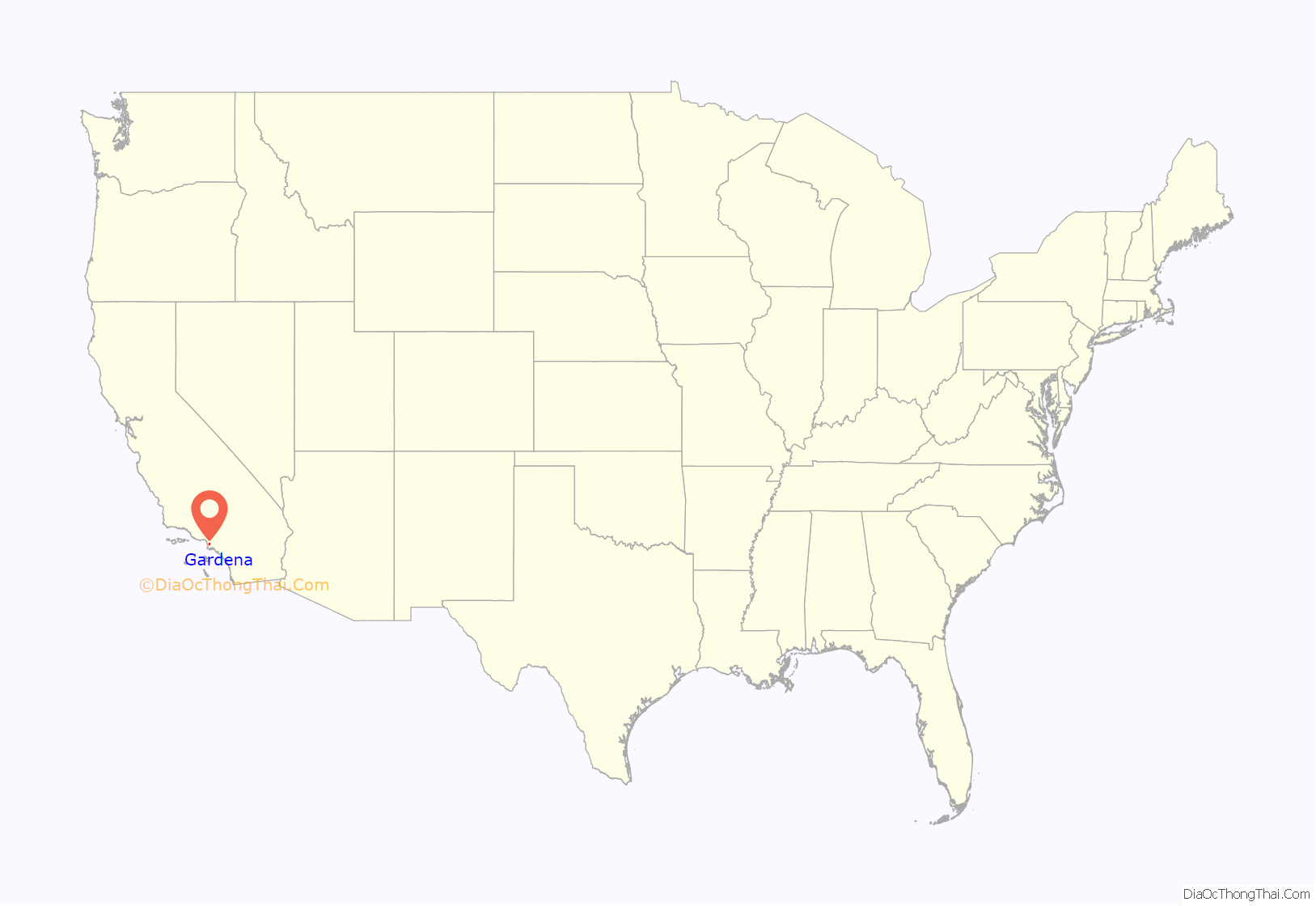
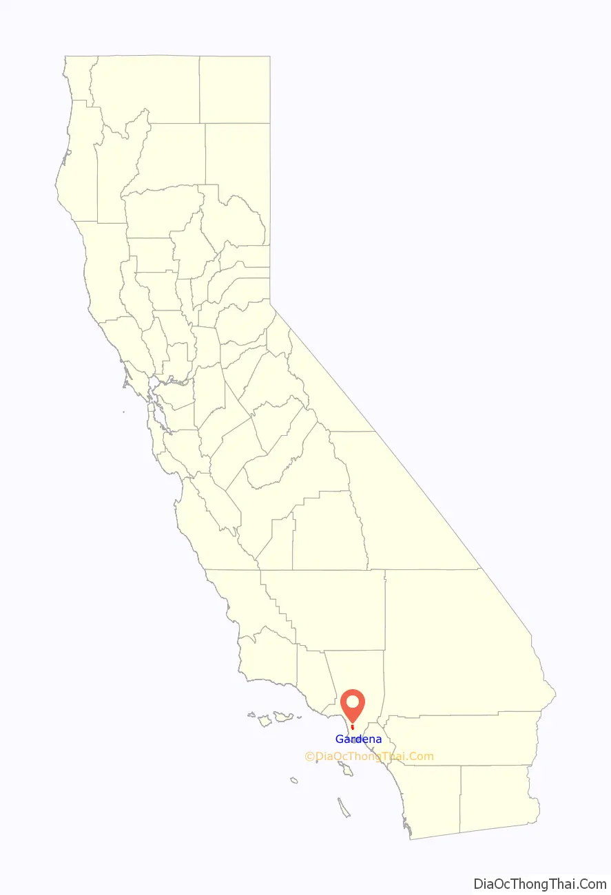
Gardena location map. Where is Gardena city?
History
Based on archaeological findings, the Tongva people hunted and fished in the area of today’s Gardena. The Tongva Indians — also known as Gabrielino Indians — are probably descendants of those who crossed from Asia to North America around 10,000 years ago.
In 1784, three years after the foundation of Los Angeles, Juan Jose Dominguez (1736–1809), a Spanish soldier who arrived in San Diego, California in 1769 with Fernando Rivera y Moncada, in recognition of his military service, received the roughly 43,000-acre (170 km) Spanish land grant, the Rancho San Pedro. Part of this land contained what became known as Gardena Valley. After the American Civil War veterans bought parts of the land, and soon ranchers and farmers followed suit. Union Army Major General William Starke Rosecrans in 1869 bought 16,000 acres (65 km). The “Rosecrans Rancho” was bordered by what later was Florence Avenue on the north, Redondo Beach Boulevard on the south, Central Avenue on the east, and Arlington Avenue on the west. The Rosecrans property was subdivided and sold in the early 1870s. One of those became the 650-acre (2.6 km) Amestoy Ranch. Gardena proper began in 1887 when the Pomeroy & Harrison real estate developers subdivided the ranch, anticipating the coming of the Los Angeles and Redondo Railway. Civil War veteran Spencer Roane Thorpe is credited with starting the first settlement in Gardena in 1887. Railroads put Gardena on the map following a real estate boom in the Los Angeles area in the 1880s.
Some believe the city was named for its reputation for being the only “green spot” in the dry season between Los Angeles and the sea. Because of its acres of berries, the city was dubbed “Berryland”. The Strawberry Day Festival and Parade was held each May. The berry industry suffered at the time of World War I as other crops were supported by the war economy.
Japanese Americans settled in Gardena throughout its history. The only way Gardena could protect itself from a heavy county tax imposed on a planned project at a park site was to incorporate. The City of Gardena became incorporated on September 11, 1930.
From 1936 to 1980, Gardena held a local monopoly on legal cardrooms, the taxes from which accounted for nearly a third of its annual budget. As this Los Angeles suburb grew, many Japanese American families moved into the new tract homes being built.
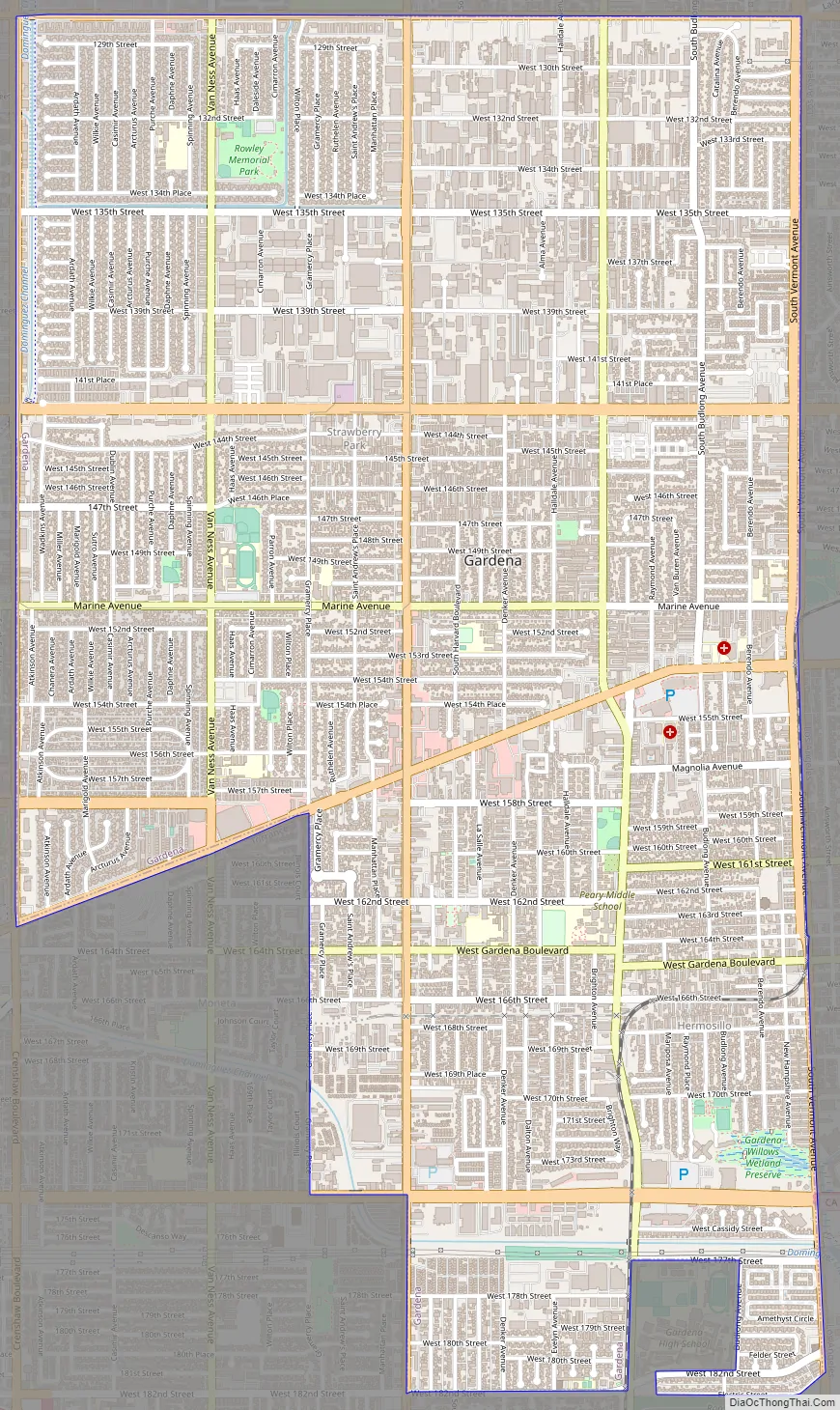
Gardena Road Map
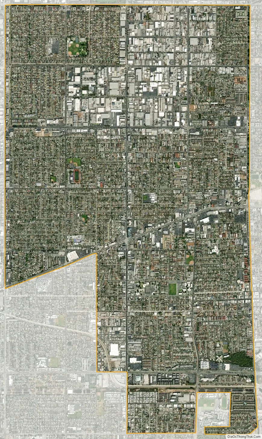
Gardena city Satellite Map
Geography
According to the United States Census Bureau, the city has a total area of 5.9 square miles (15 km), over 99% of which is land. A 9.4-acre (3.8 ha) wetland preserve, the Gardena Willows Wetland Preserve, is located at the southeast corner of Gardena. This is a naturally occurring marshland where water seeps above-ground all year round. It hosts several species of trees and other vegetation.
Gardena is bordered by the unincorporated community of Athens on the north, the Los Angeles neighborhood of Harbor Gateway on the east and south, Torrance on the southwest, Alondra Park on the west, and Hawthorne on the northwest.
Neighborhoods in Gardena include:
- Hermosillo
- Moneta
- Strawberry Park
See also
Map of California State and its subdivision:- Alameda
- Alpine
- Amador
- Butte
- Calaveras
- Colusa
- Contra Costa
- Del Norte
- El Dorado
- Fresno
- Glenn
- Humboldt
- Imperial
- Inyo
- Kern
- Kings
- Lake
- Lassen
- Los Angeles
- Madera
- Marin
- Mariposa
- Mendocino
- Merced
- Modoc
- Mono
- Monterey
- Napa
- Nevada
- Orange
- Placer
- Plumas
- Riverside
- Sacramento
- San Benito
- San Bernardino
- San Diego
- San Francisco
- San Joaquin
- San Luis Obispo
- San Mateo
- Santa Barbara
- Santa Clara
- Santa Cruz
- Shasta
- Sierra
- Siskiyou
- Solano
- Sonoma
- Stanislaus
- Sutter
- Tehama
- Trinity
- Tulare
- Tuolumne
- Ventura
- Yolo
- Yuba
- Alabama
- Alaska
- Arizona
- Arkansas
- California
- Colorado
- Connecticut
- Delaware
- District of Columbia
- Florida
- Georgia
- Hawaii
- Idaho
- Illinois
- Indiana
- Iowa
- Kansas
- Kentucky
- Louisiana
- Maine
- Maryland
- Massachusetts
- Michigan
- Minnesota
- Mississippi
- Missouri
- Montana
- Nebraska
- Nevada
- New Hampshire
- New Jersey
- New Mexico
- New York
- North Carolina
- North Dakota
- Ohio
- Oklahoma
- Oregon
- Pennsylvania
- Rhode Island
- South Carolina
- South Dakota
- Tennessee
- Texas
- Utah
- Vermont
- Virginia
- Washington
- West Virginia
- Wisconsin
- Wyoming


