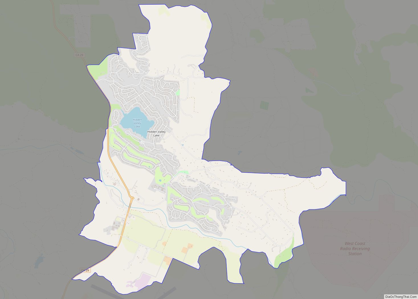
Hidden Valley Lake is a census-designated place (CDP) and gated subdivision in Lake County, California, United States. The population was 6,235 at the 2020 census, up from 5,579 at the 2010 census. Today, it is a CID (Common Interest Development) known as Hidden Valley Lake Association (HVLA).
| Name: | Hidden Valley Lake CDP |
|---|---|
| LSAD Code: | 57 |
| LSAD Description: | CDP (suffix) |
| State: | California |
| County: | Lake County |
| Elevation: | 1,191 ft (363 m) |
| Total Area: | 9.888 sq mi (25.609 km²) |
| Land Area: | 9.734 sq mi (25.211 km²) |
| Water Area: | 0.154 sq mi (0.398 km²) 1.55% |
| Total Population: | 6,235 |
| Population Density: | 630/sq mi (240/km²) |
| ZIP code: | 95467 |
| Area code: | 707 |
| FIPS code: | 0633549 |
| Website: | hvla.com |
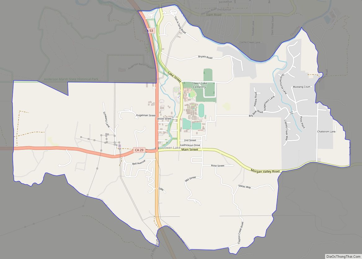
Online Interactive Map
Click on ![]() to view map in "full screen" mode.
to view map in "full screen" mode.
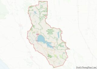
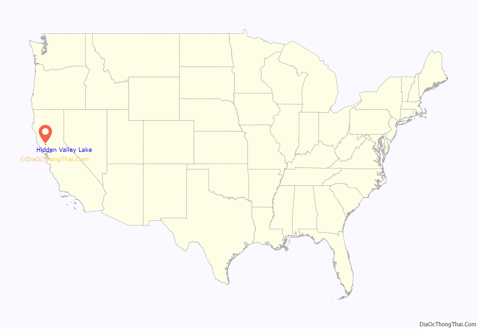
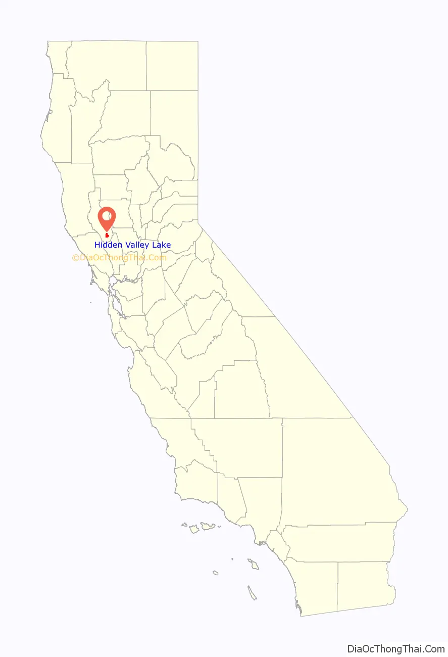
Hidden Valley Lake location map. Where is Hidden Valley Lake CDP?
History
In October 2014, The State Water Resources Control Board ordered the Hidden Valley Lake Community Services District to stop allowing new service connections to its water system due to concerns that, under current drought conditions, the district did not have enough water to meet future demands. The district, with about 2,500 connections, is a junior water rights holder in the Sacramento River and San Joaquin River watersheds. November 2020 the water moratorium was lifted and new water rights are currently available through the District, but at a much higher price point.
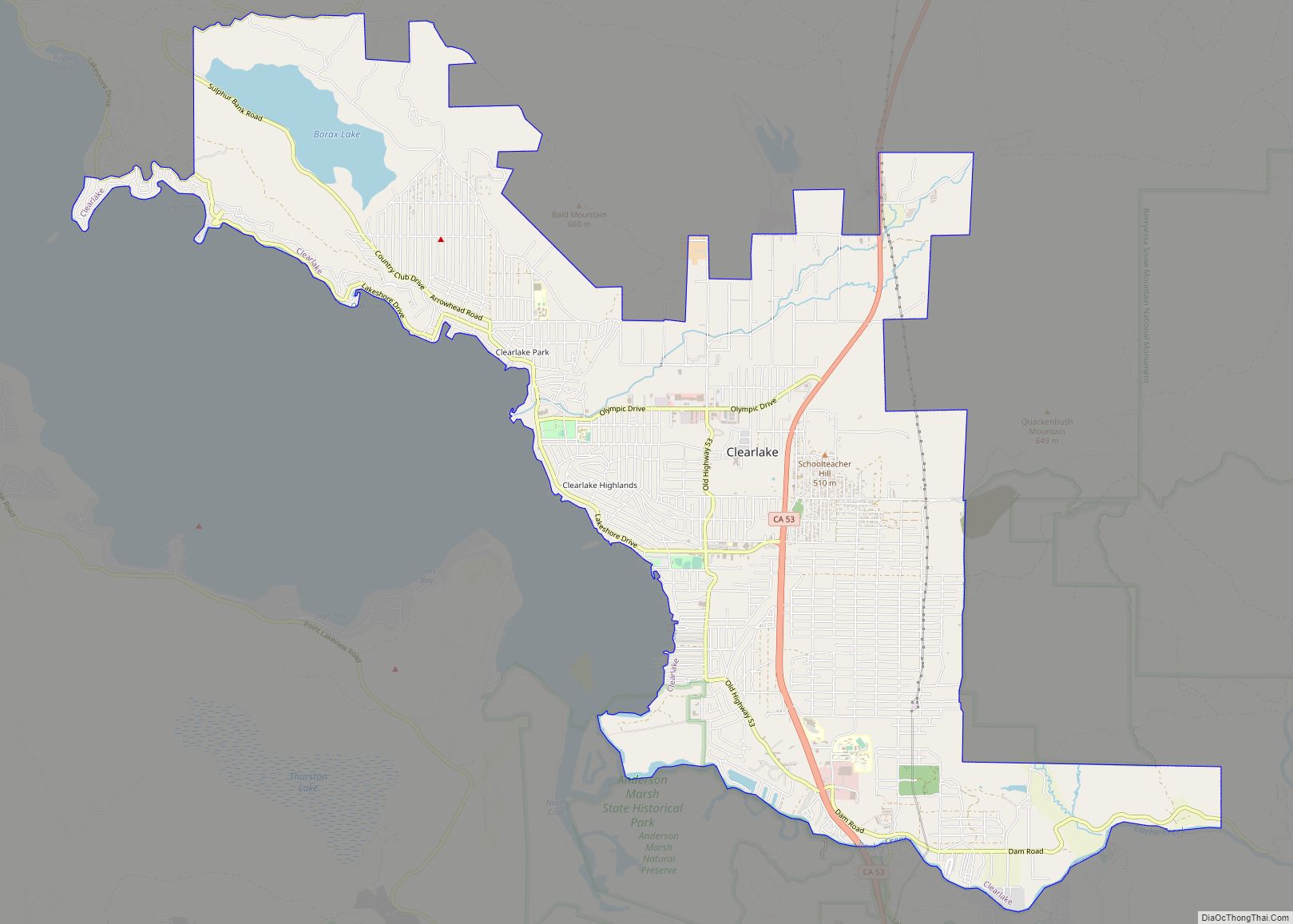
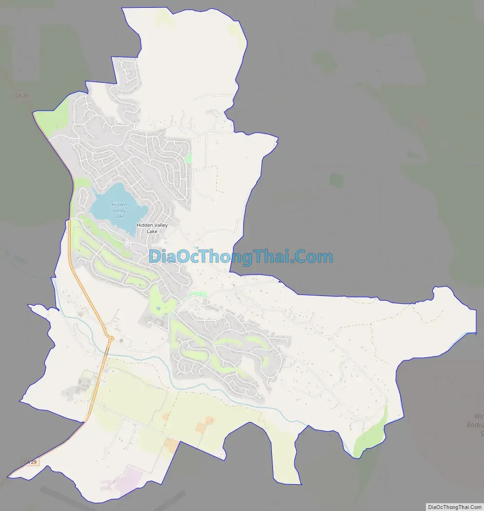
Hidden Valley Lake Road Map
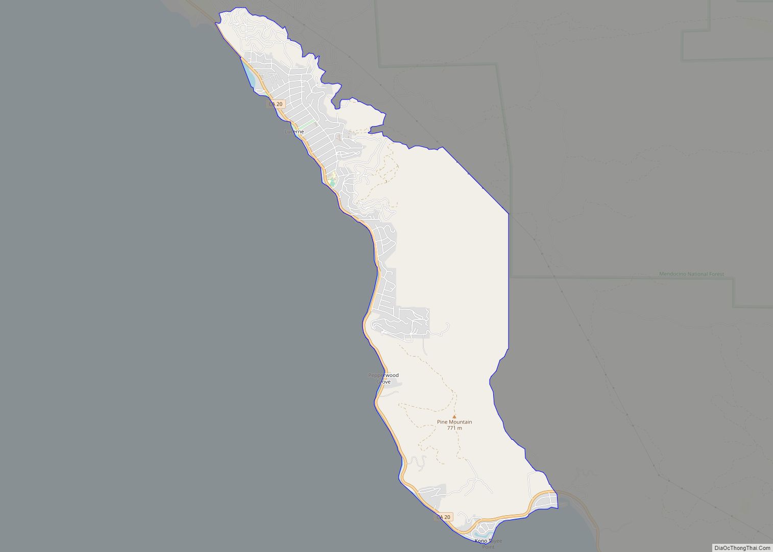
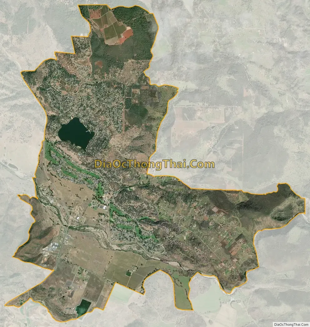
Hidden Valley Lake city Satellite Map
Geography
According to the United States Census Bureau, the CDP has a total area of 9.9 square miles (26 km), of which, 9.7 square miles (25 km) of it is land and 0.2 square miles (0.52 km) of it (1.55%) is water. In the west of the town, California State Route 29 runs through the town limits.
See also
Map of California State and its subdivision:- Alameda
- Alpine
- Amador
- Butte
- Calaveras
- Colusa
- Contra Costa
- Del Norte
- El Dorado
- Fresno
- Glenn
- Humboldt
- Imperial
- Inyo
- Kern
- Kings
- Lake
- Lassen
- Los Angeles
- Madera
- Marin
- Mariposa
- Mendocino
- Merced
- Modoc
- Mono
- Monterey
- Napa
- Nevada
- Orange
- Placer
- Plumas
- Riverside
- Sacramento
- San Benito
- San Bernardino
- San Diego
- San Francisco
- San Joaquin
- San Luis Obispo
- San Mateo
- Santa Barbara
- Santa Clara
- Santa Cruz
- Shasta
- Sierra
- Siskiyou
- Solano
- Sonoma
- Stanislaus
- Sutter
- Tehama
- Trinity
- Tulare
- Tuolumne
- Ventura
- Yolo
- Yuba
- Alabama
- Alaska
- Arizona
- Arkansas
- California
- Colorado
- Connecticut
- Delaware
- District of Columbia
- Florida
- Georgia
- Hawaii
- Idaho
- Illinois
- Indiana
- Iowa
- Kansas
- Kentucky
- Louisiana
- Maine
- Maryland
- Massachusetts
- Michigan
- Minnesota
- Mississippi
- Missouri
- Montana
- Nebraska
- Nevada
- New Hampshire
- New Jersey
- New Mexico
- New York
- North Carolina
- North Dakota
- Ohio
- Oklahoma
- Oregon
- Pennsylvania
- Rhode Island
- South Carolina
- South Dakota
- Tennessee
- Texas
- Utah
- Vermont
- Virginia
- Washington
- West Virginia
- Wisconsin
- Wyoming