Highgrove is a census-designated place (CDP) and an unincorporated community in Riverside County, California, United States. The population was 3,988 at the 2010 census, up from 3,445 at the 2000 census. The latest 2020 census shows 7,515 total population, an 88.4% increase from last 2010 census, which makes it the fastest-growing location in entire Riverside County.
The city of Riverside, California has plans to annex Highgrove in the near future. Currently at Spring Mountain Ranch community, Avalon, Cambria, and Sonoma (all opening by February 2022) are the three, newest largest master-planned communities being built at the Highgrove eastside area. Soon, Compass and Pinnacle at Summit Canyon by PulteGroup, at the south-east corner-end of Highgrove on the higher-elevation foothill, will open in 2023. These are the only known, brand-new homes currently available for sale, closer to Downtown Riverside and University of California, Riverside campus. In addition, 846 new urban-style townhomes by Lennar, plus its first new retail store in the area, will begin construction in 2023, next to the elementary school.
This community publishes its own newsletter, Highgrove Happenings, each month, since 1994.
| Name: | Highgrove CDP |
|---|---|
| LSAD Code: | 57 |
| LSAD Description: | CDP (suffix) |
| State: | California |
| County: | Riverside County |
| Elevation: | 951 ft (290 m) |
| Total Area: | 3.219 sq mi (8.336 km²) |
| Land Area: | 3.219 sq mi (8.336 km²) |
| Water Area: | 0 sq mi (0 km²) 0% |
| Total Population: | 7,166 |
| Population Density: | 2,200/sq mi (860/km²) |
| ZIP code: | 92507 |
| Area code: | 951 |
| FIPS code: | 0633574 |
| GNISfeature ID: | 1652721 |
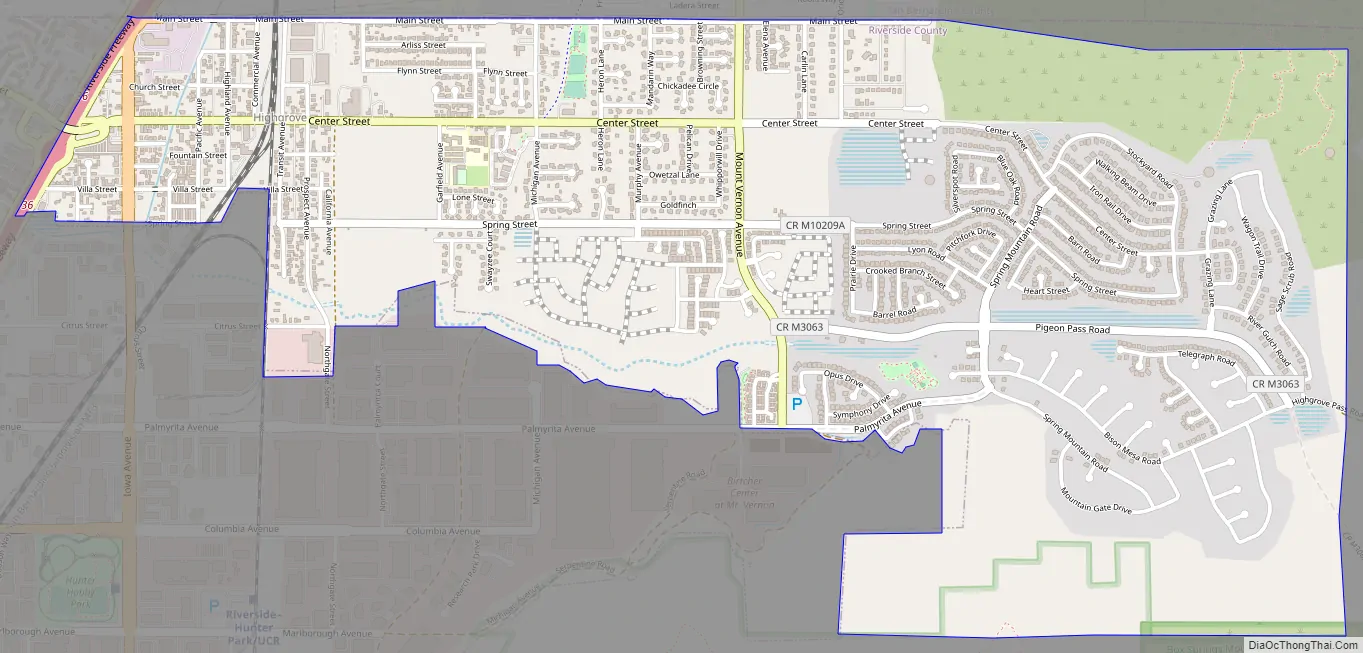
Online Interactive Map
Click on ![]() to view map in "full screen" mode.
to view map in "full screen" mode.
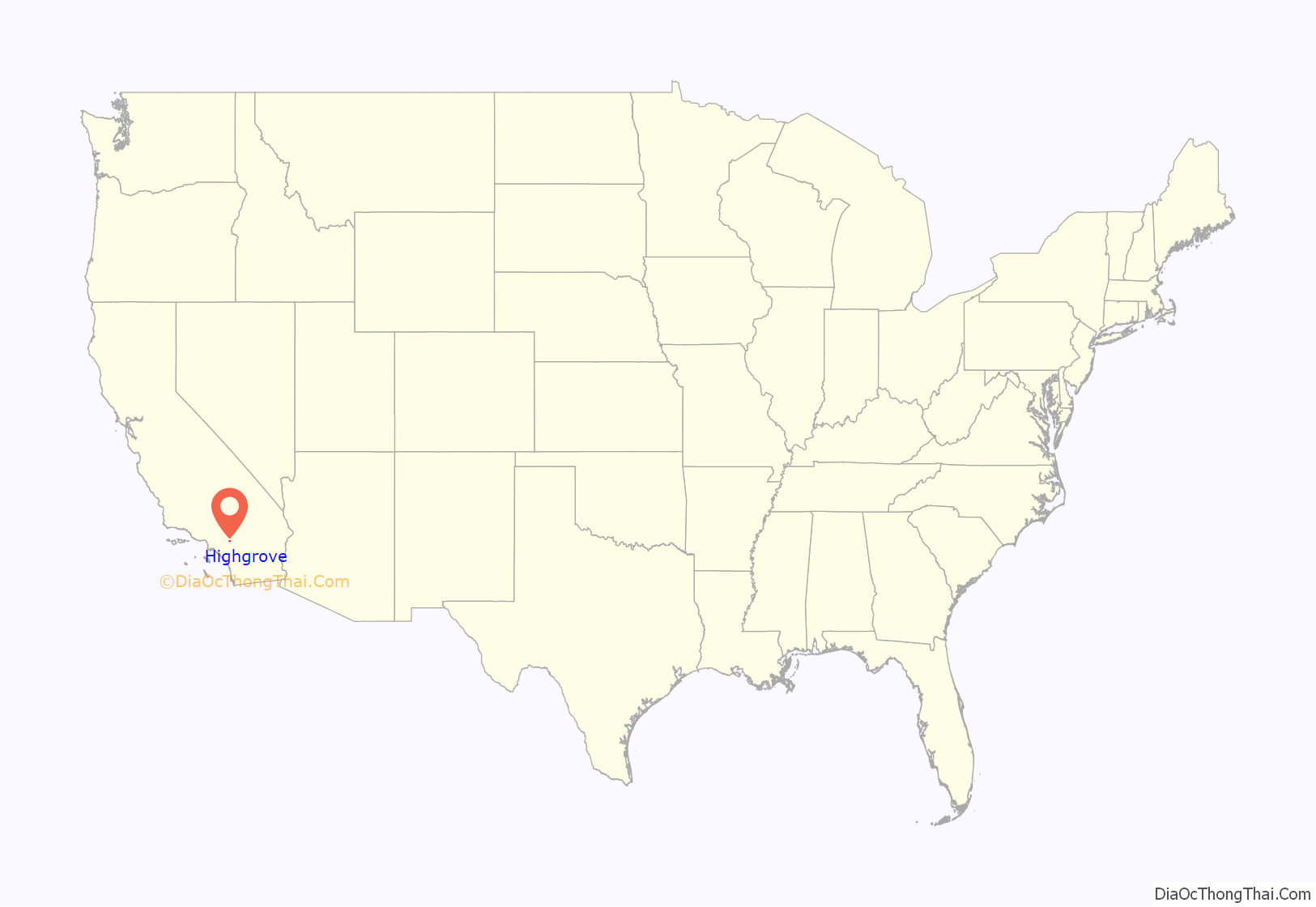
Highgrove location map. Where is Highgrove CDP?

History
Highgrove was founded in 1886, originally called East Riverside, but in 1897 during a naming contest, it was renamed to Highgrove, after not getting it confused with the city of Riverside. Citrus-farm growers have occupied Highgrove area since beginning of history, with its superior fresh-wind conditions from the west, blowing into east of a cove-shape like terrain, making it one the most valuable places in Inland Empire for citrus-farming by generations of farmers. Due to the stronger wind conditions that can easily move air out, a landfill dumping ground was opened in 1947 for discarded farm waste. Originally, it operated as a fire-burn dump during the 1950s, until 1960 when there was a concern of heavy-smog in southern California.
In 1970, the Highgrove Agricultural Preserve conservation was formed in order to support the growing number of orange trees from farmers. More diverse of citrus fruits were being grown for the packing houses in Riverside. However, farming output could only peaked by the mid-1980s. More competition on fruit prices had increased daily from new farming businesses in the Central California region. Highgrove’s another biggest threat was its rising land-value and water cost for the groves by the end of 1980s, due to its close-proximity to downtown Riverside, which made farm crops more unprofitable. By 1990, the preserve contract was not renewed, citing increases of population density, housing shortage, traffic jam, and smog near Riverside. Citrus (mostly orange) trees were gradually phased out and torn down completely by the year 2000.
The Highgrove sanitary landfill closed permanently in 1998, after 51 years of operation. Since the 2018 inspection yearly report, no methane output has been detected in any of the designated area. Today, new construction homes occupy near front of it, across Pigeon Pass Road. The citrus industry declined in the area as more agricultural areas were replaced by new subdivisions. In 2007, Spring Mountain Ranch master-planned community was originally conceived by RWR Homes, but construction halted due to the 2008 recession, and now KB Home, in 2014, will be completing this long-awaited project today, with no HOA fee as its main selling point. Other builders included are D.R. Horton, Lennar, and PulteGroup with some HOA fee.
Highgrove Road Map
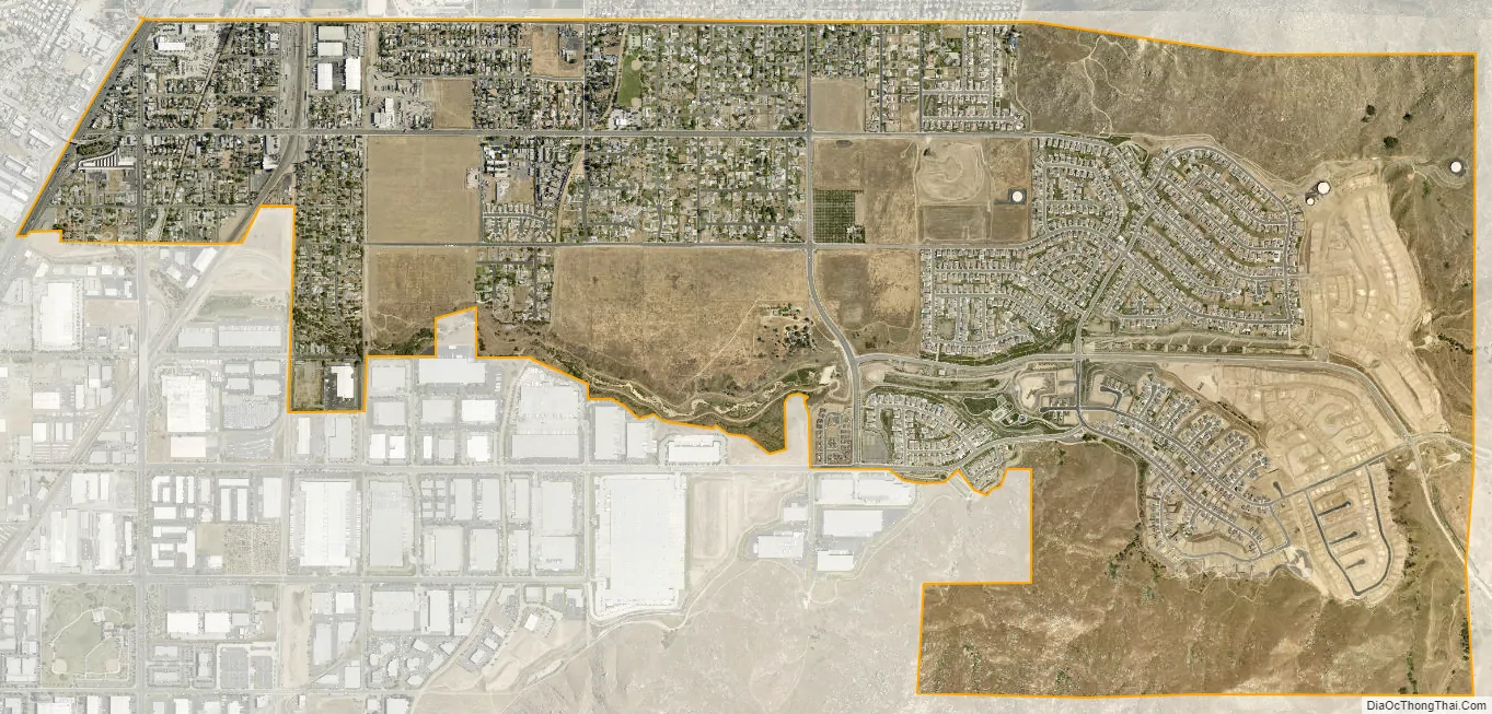
Highgrove city Satellite Map
Geography
Highgrove is located at 34°00′55″N 117°19′51″W / 34.015253°N 117.330926°W / 34.015253; -117.330926. Highgrove is between the city of Riverside and Grand Terrace. It is located east of Interstate 215 and north of the University of California, Riverside campus.
According to the United States Census Bureau, the CDP has a total area of 3.2 square miles (8.3 km), all of it land.
The highest-elevation point in Highgrove with homes built is up to 1,420 feet at the eastside.
See also
Map of California State and its subdivision:- Alameda
- Alpine
- Amador
- Butte
- Calaveras
- Colusa
- Contra Costa
- Del Norte
- El Dorado
- Fresno
- Glenn
- Humboldt
- Imperial
- Inyo
- Kern
- Kings
- Lake
- Lassen
- Los Angeles
- Madera
- Marin
- Mariposa
- Mendocino
- Merced
- Modoc
- Mono
- Monterey
- Napa
- Nevada
- Orange
- Placer
- Plumas
- Riverside
- Sacramento
- San Benito
- San Bernardino
- San Diego
- San Francisco
- San Joaquin
- San Luis Obispo
- San Mateo
- Santa Barbara
- Santa Clara
- Santa Cruz
- Shasta
- Sierra
- Siskiyou
- Solano
- Sonoma
- Stanislaus
- Sutter
- Tehama
- Trinity
- Tulare
- Tuolumne
- Ventura
- Yolo
- Yuba
- Alabama
- Alaska
- Arizona
- Arkansas
- California
- Colorado
- Connecticut
- Delaware
- District of Columbia
- Florida
- Georgia
- Hawaii
- Idaho
- Illinois
- Indiana
- Iowa
- Kansas
- Kentucky
- Louisiana
- Maine
- Maryland
- Massachusetts
- Michigan
- Minnesota
- Mississippi
- Missouri
- Montana
- Nebraska
- Nevada
- New Hampshire
- New Jersey
- New Mexico
- New York
- North Carolina
- North Dakota
- Ohio
- Oklahoma
- Oregon
- Pennsylvania
- Rhode Island
- South Carolina
- South Dakota
- Tennessee
- Texas
- Utah
- Vermont
- Virginia
- Washington
- West Virginia
- Wisconsin
- Wyoming


